Who: Just me!
What: Backpacking
When: 8/4/19-8/8/19
Where: Ansel Adams Wilderness + Yosemite NP, native land of the Me-Wuk and Numu
Mileage: 43 miles (24.5 on trail + 18.5 xc)
Elevation gain/loss: +10,500ft/-9,800ft
More photos: here
CalTopo: here
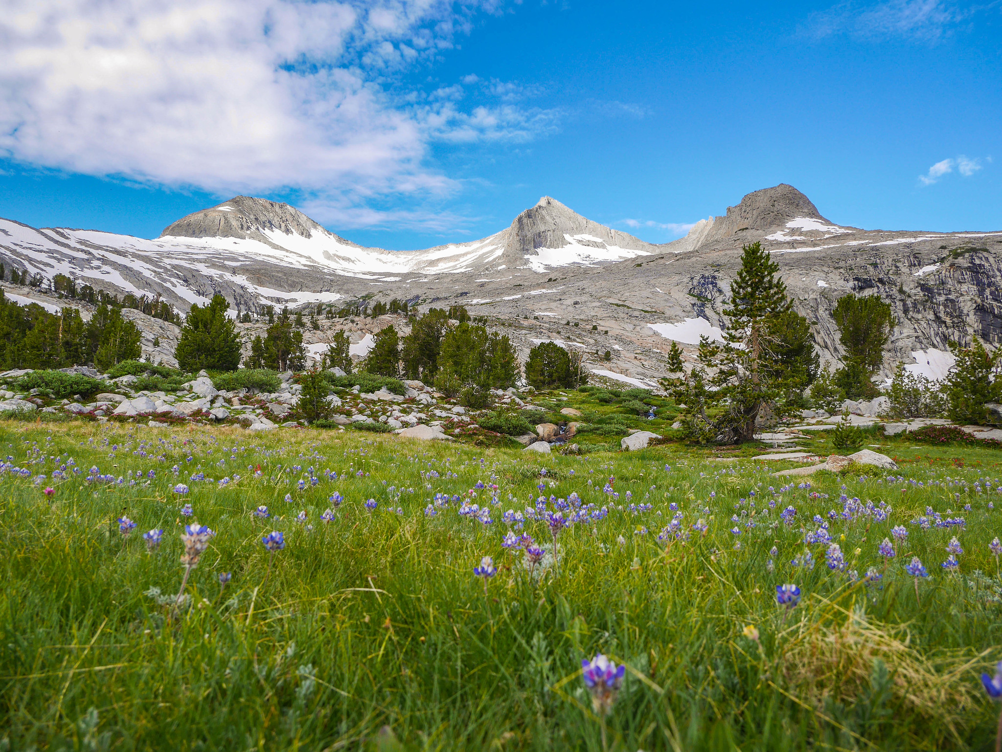
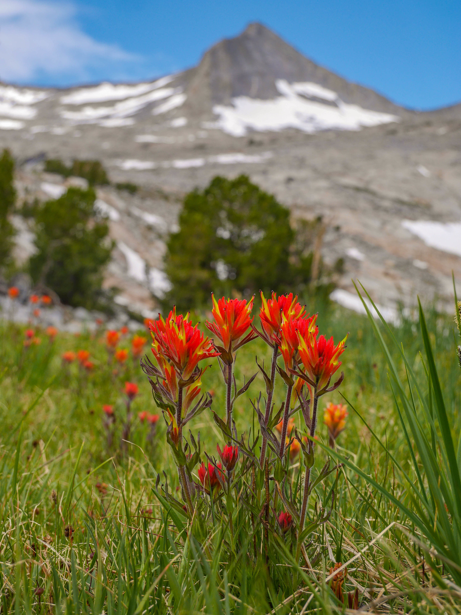
Ansel Adams Wilderness near Mammoth and Tuolumne Meadows in Yosemite are some of the most beautiful—and popular—areas in the Sierra. There’s so much beauty that can be seen with relatively little effort and the JMT runs right through there, so many of the lakes have camping restrictions or become little villages of tents every night. The on-trail lakes, that is. I found solitude in this area by taking a mostly cross-country route, and speak to any other humans for 3 days. In fact, the only other person I saw was from a distance—a kayaker on Ireland Lake.
Day 0
Transportation logistics
I drove from Oakland to Yosemite, dropping my car on the side of the road not too far from the store in Tuolumne Meadows. I caught YARTS bus down to Mammoth and camped for the night at New Shady Rest campground.
Day 1
Agnew Meadows to Nydiver Lakes via Shadow Creek
6mi +1,550ft/-700ft on trail, plus 1mi +1,200ft/-0ft xc
I was a bit lazy getting going this morning but managed to make it out of the campground to stick my thumb out to hitch a ride from town. After about ten minutes or so, I was picked up by pretty much the type of ride I’ve come to expect hitching around the eastern Sierra… a kinda beat pickup driven by a friendly but shirtless middle aged man. He drove me up to the main lodge area where I rode the bus down to Agnew Meadows and started my hike.
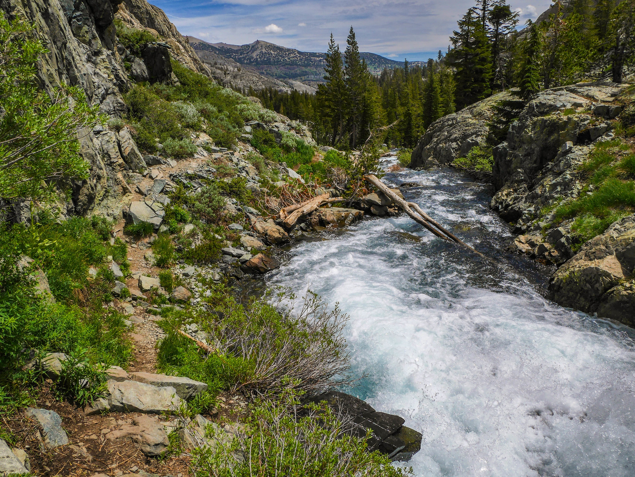
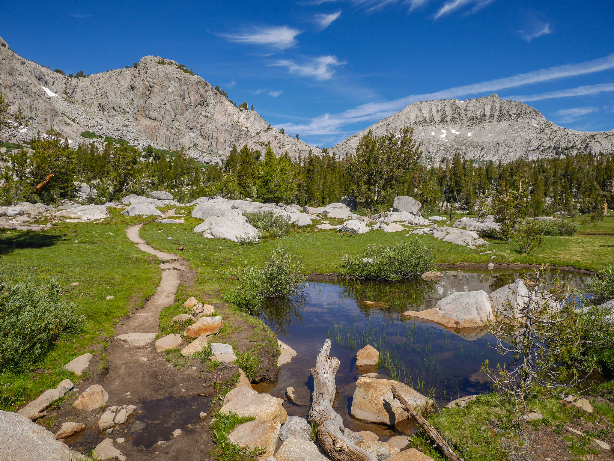
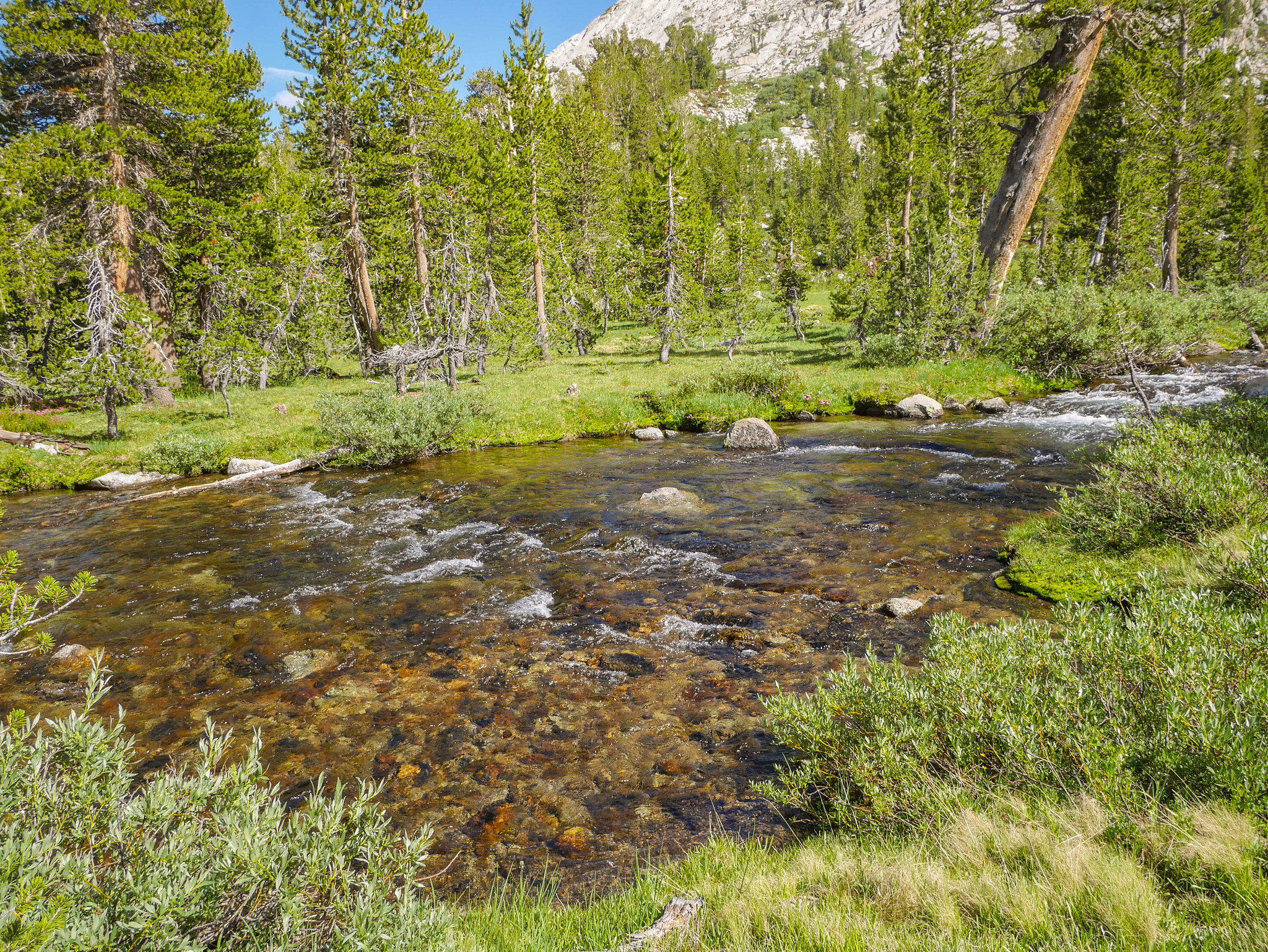
I hiked along the river trail in the warm sun and soon was turning up Shadow Creek towards the Ediza Lake area, which opened up some nice views back towards Mammoth.
The hike up Shadow Creek was mellow and the sound of the cascades was soothing. I was excited to be returning to this area for the first time in a few years. I just adore this part of the Sierra. It’s been a bit overused in recent years but my mostly cross country route would ameliorate many of the issues associated with overuse.
I arrived at Shadow Lake and stopped for a snack break with this view of Ritter and Banner. I’d be hiking around the right side, then up to Nydiver lakes.

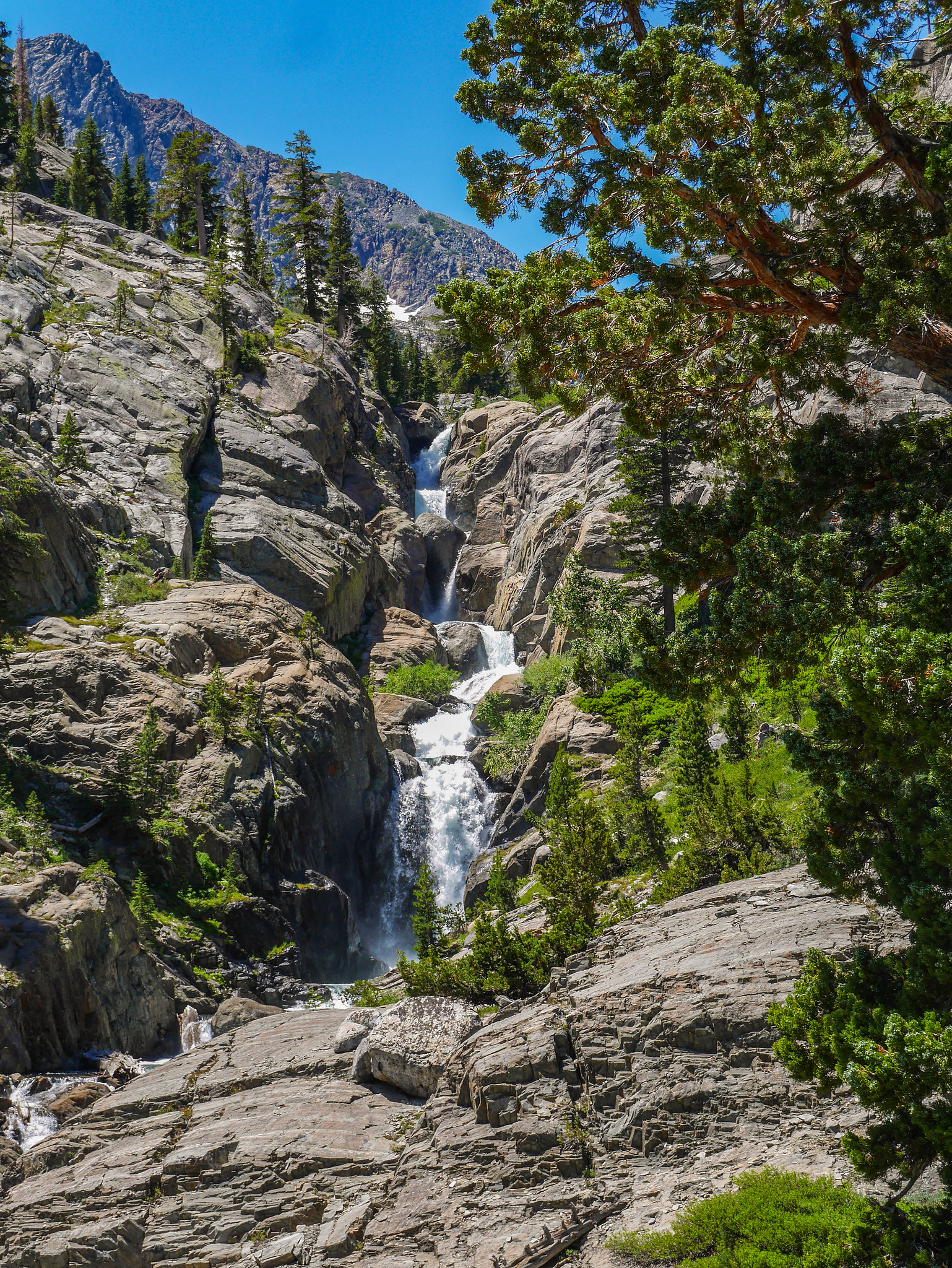
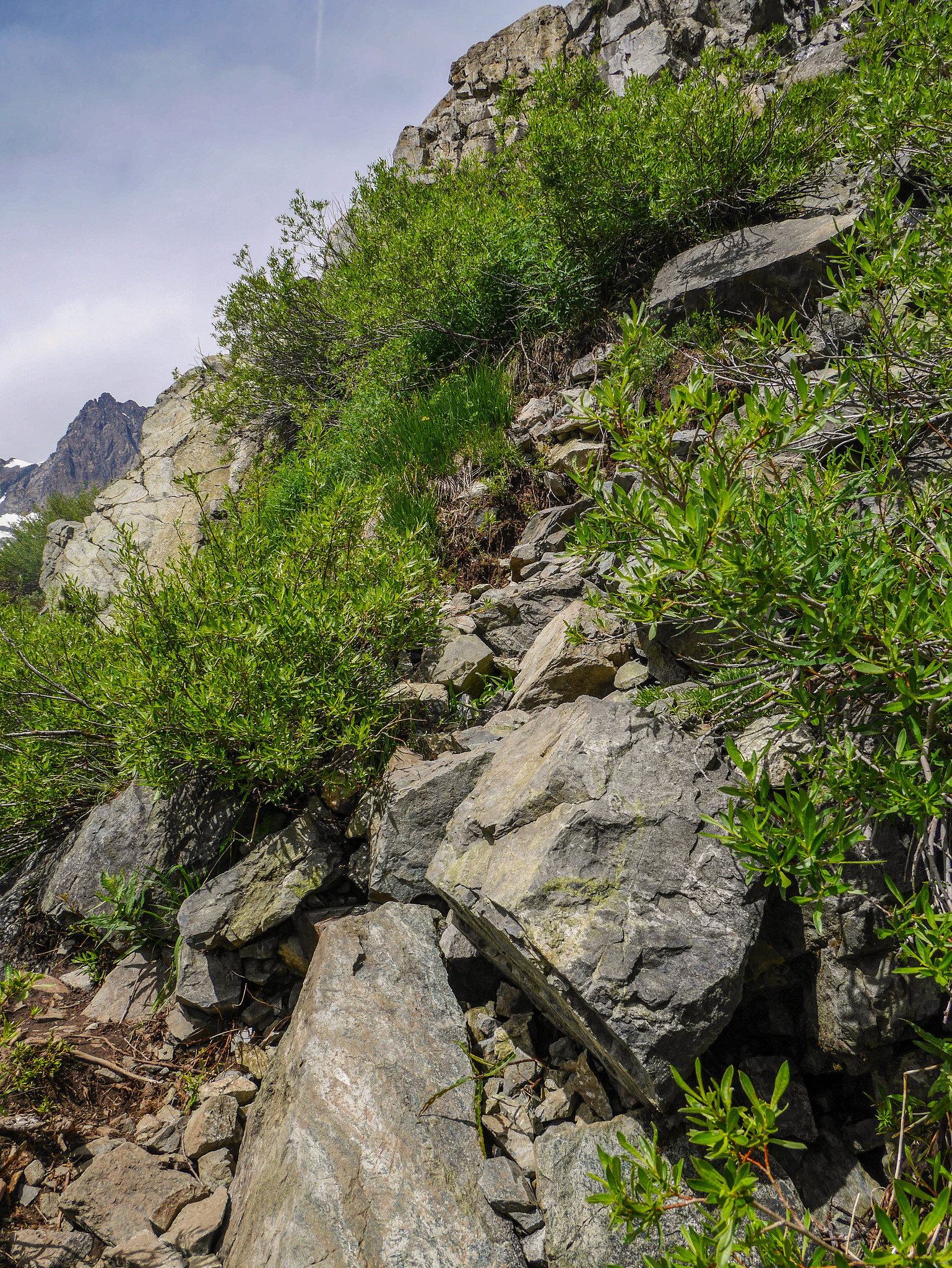
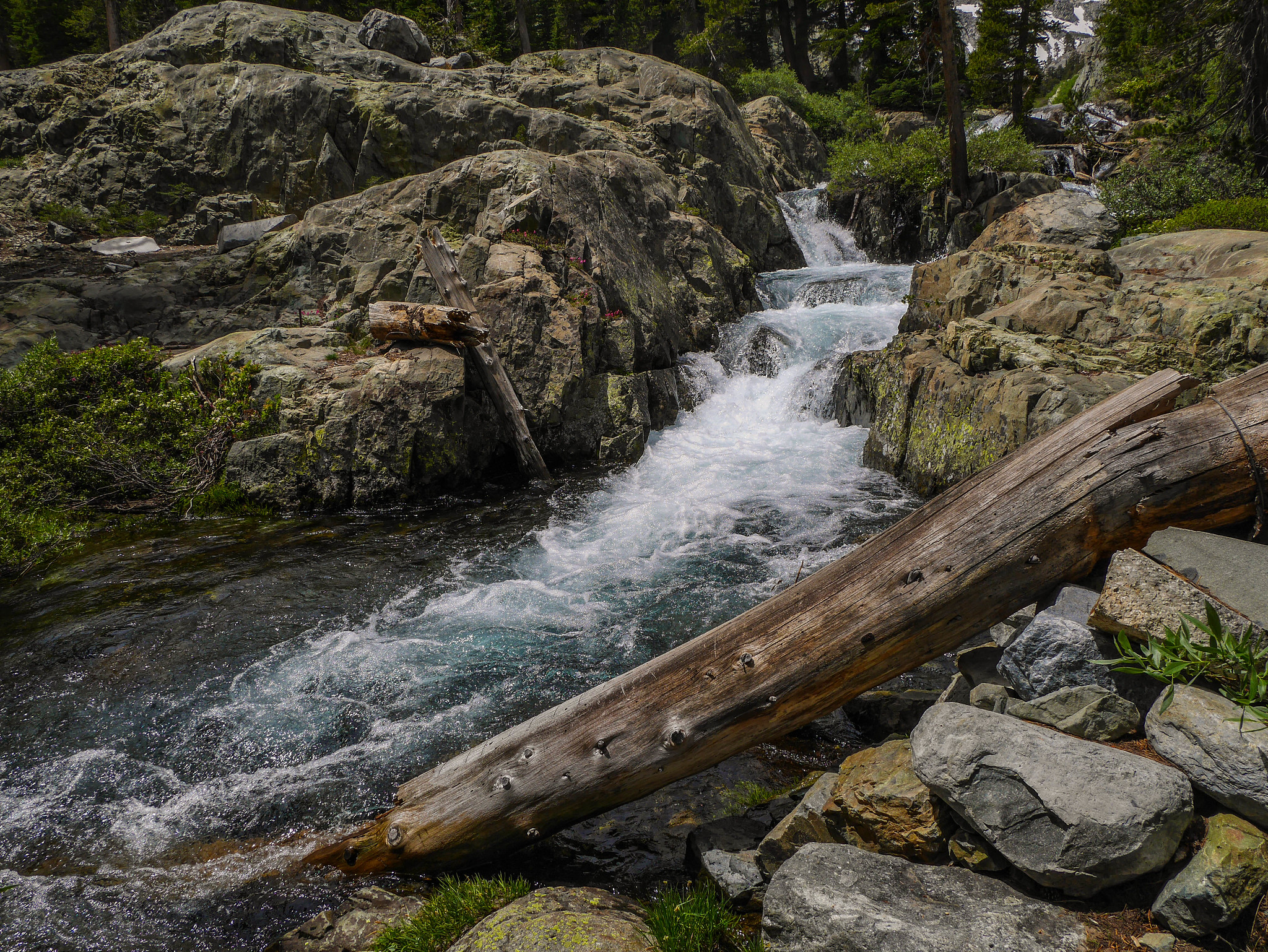
I left the trail between Shadow and Ediza at the spot that I roughly remembered coming down a few years back. There’s an old use trail here that leads up to the lowest of the Nydiver lakes. It’s easy to spot if you’re paying attention. About halfway up there is a magical cave, with a waterfall in the background and the views of the Volcanic Ridge from the bench above are quite nice indeed.

Last time I was here fire smoke choked this view, so I was glad to see it.


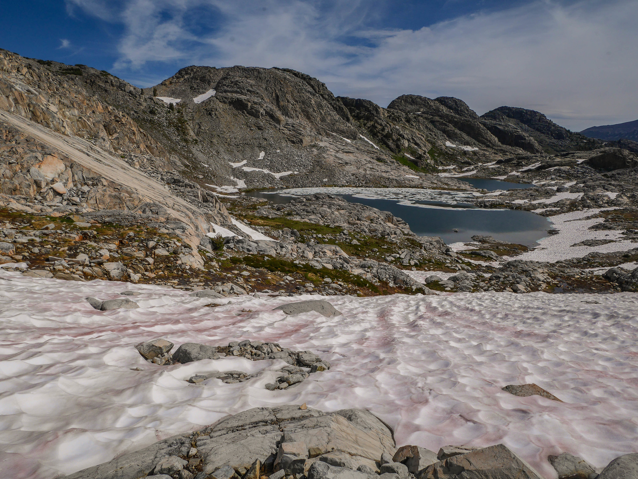
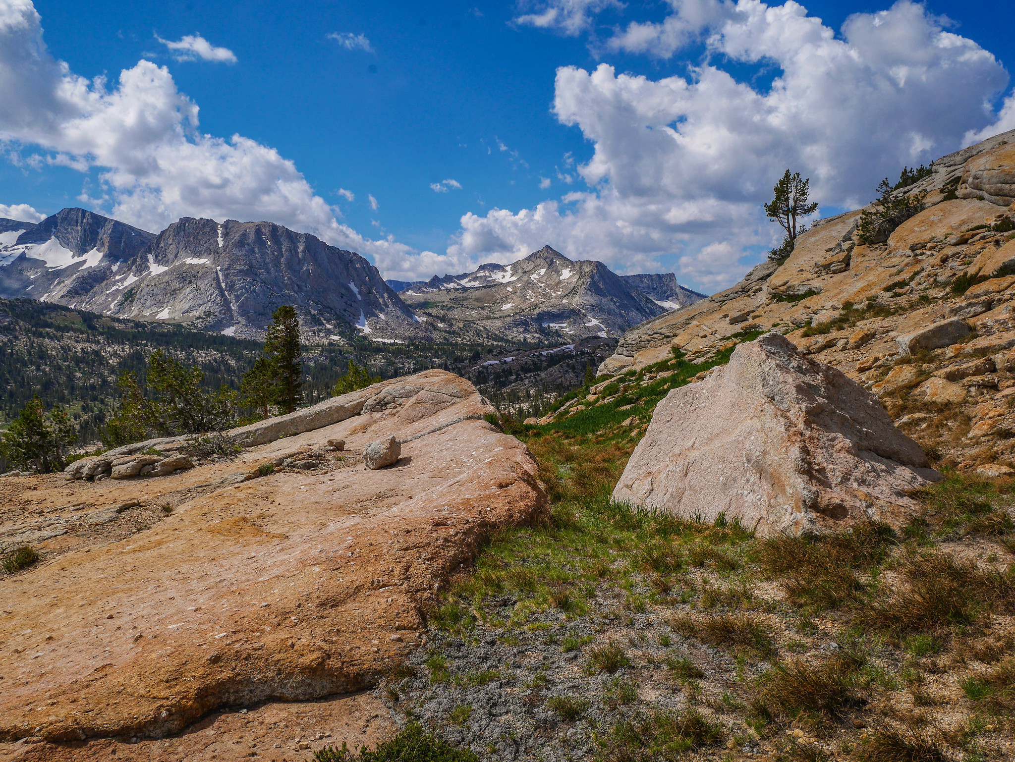
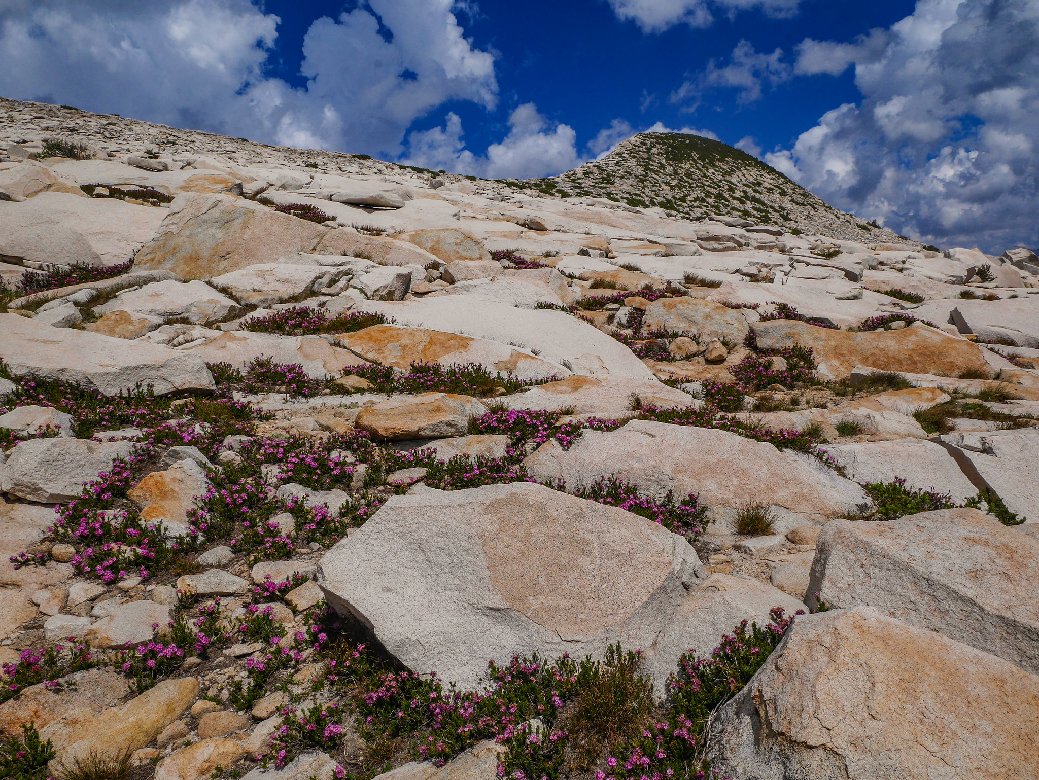
The most difficult part of this route is the last bit to the lowest Nydiver lake. You can see its outlet cascading in the middle left of this photo. I ascended along the grassy rocks just to the right of the snowfield. There were a few class 3 moves, but nothing too scary or difficult.


And when you get to the top, it’s this. T_T
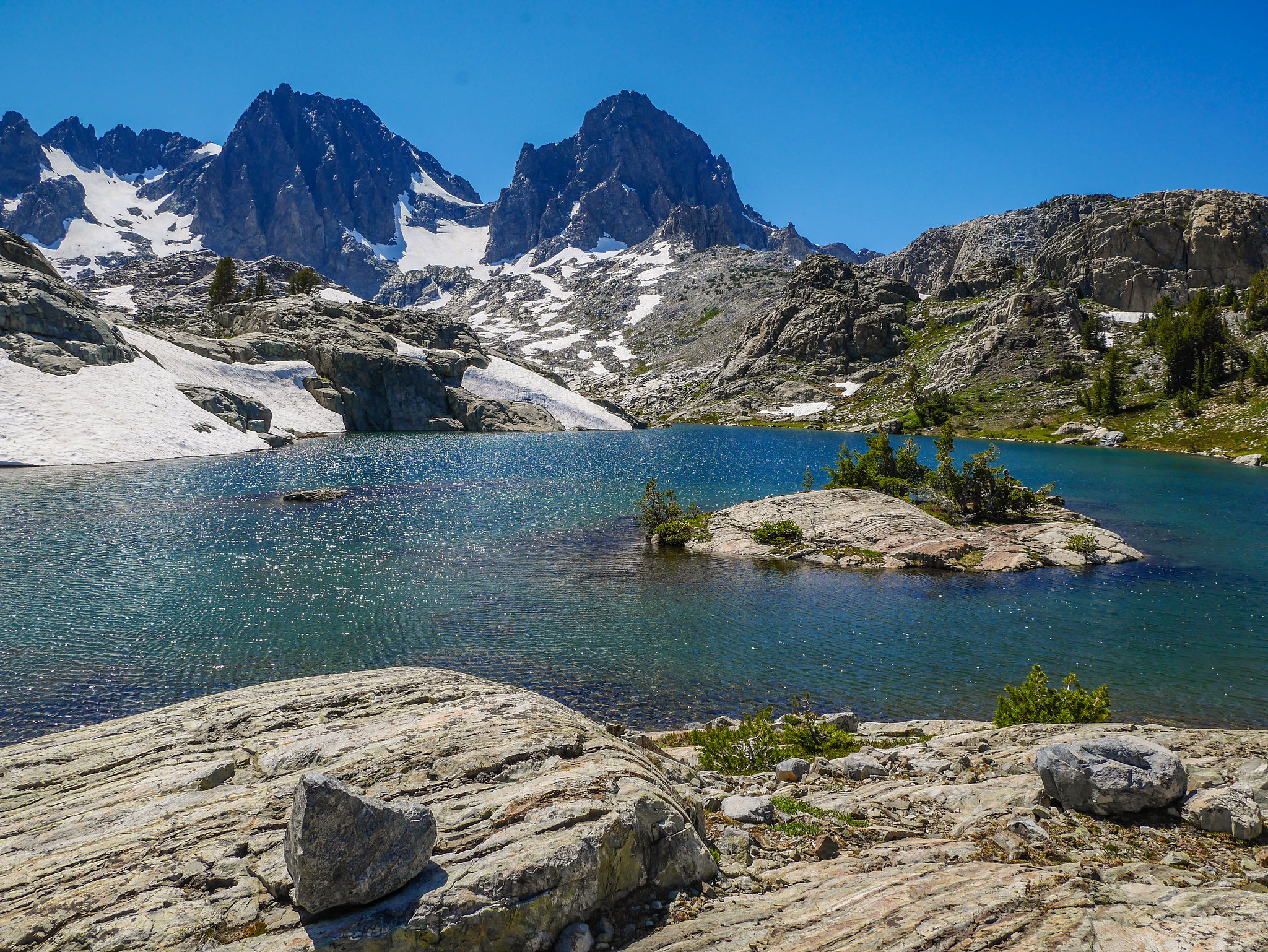
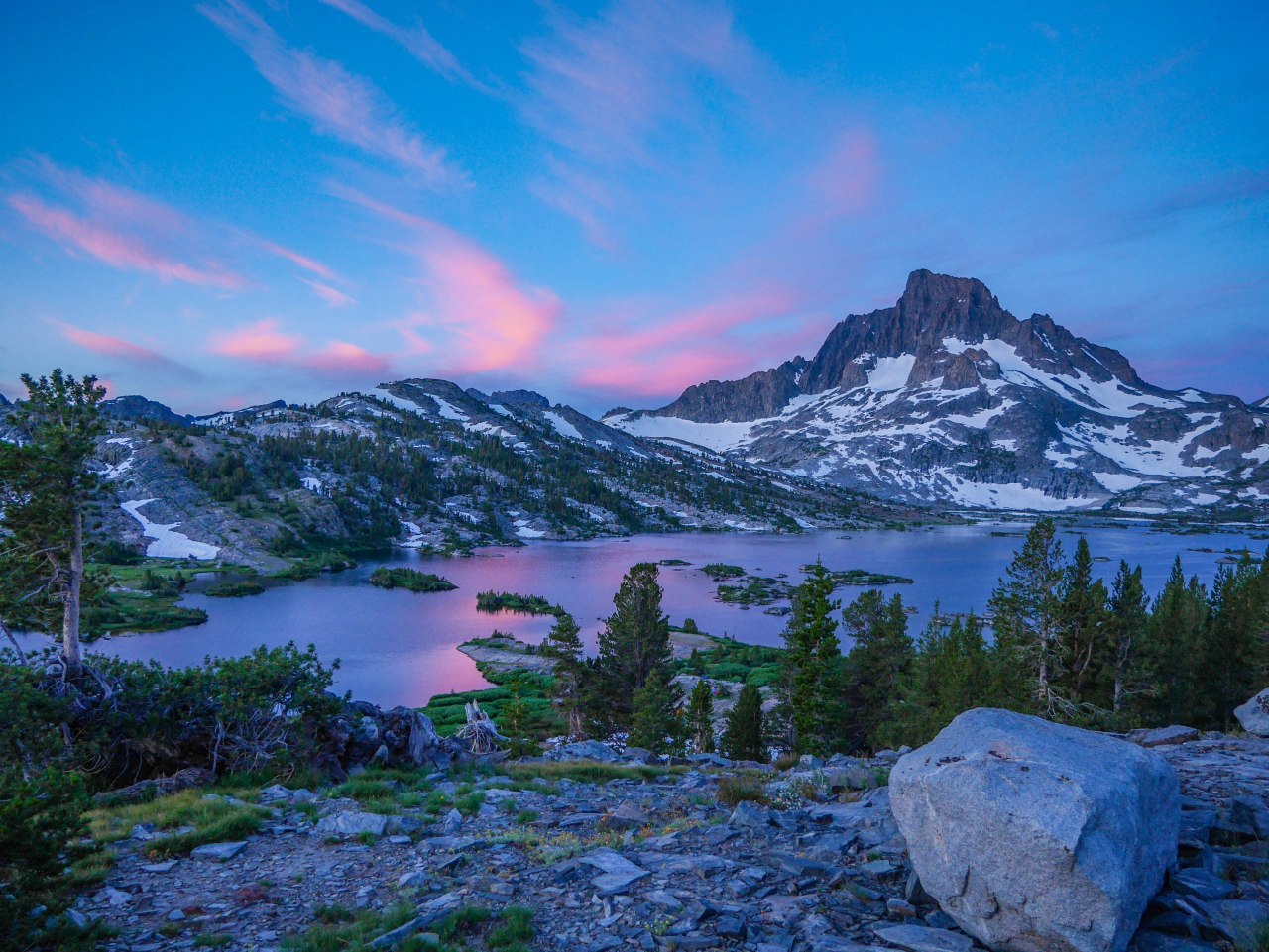
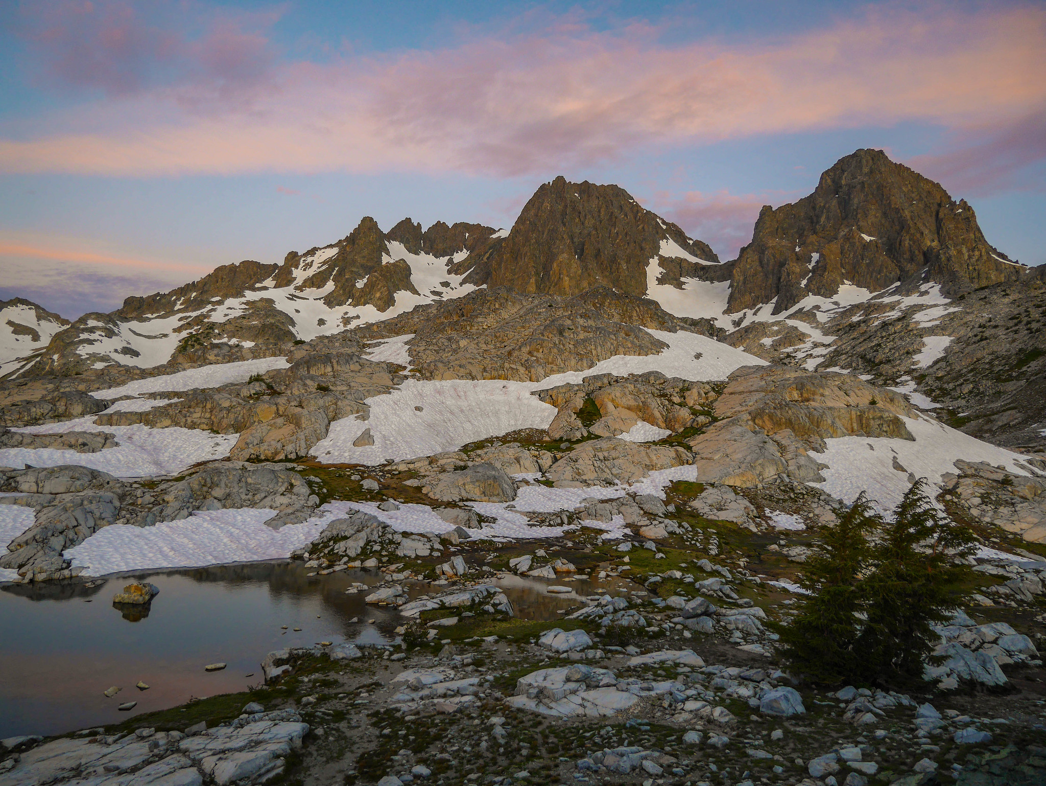
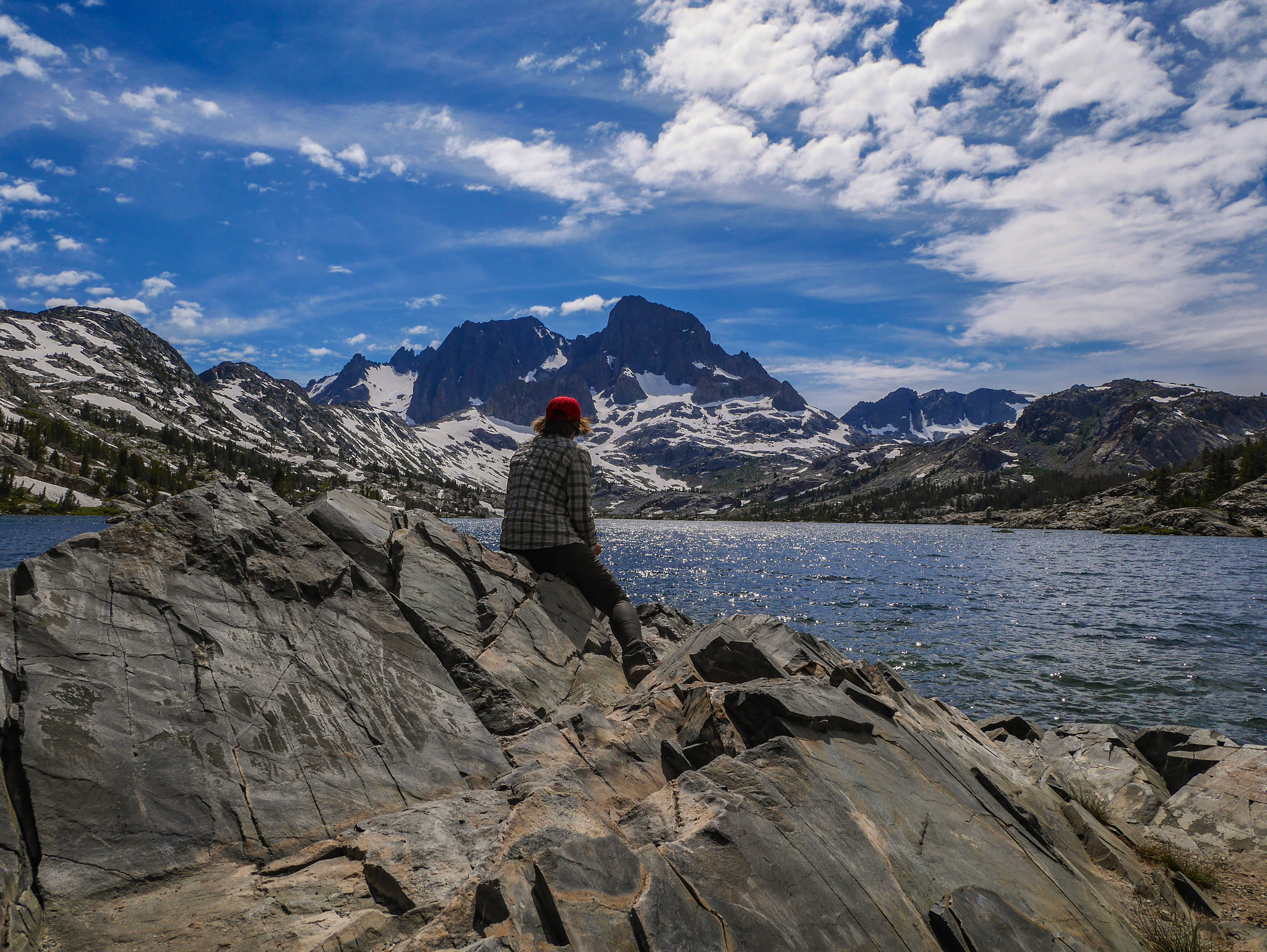
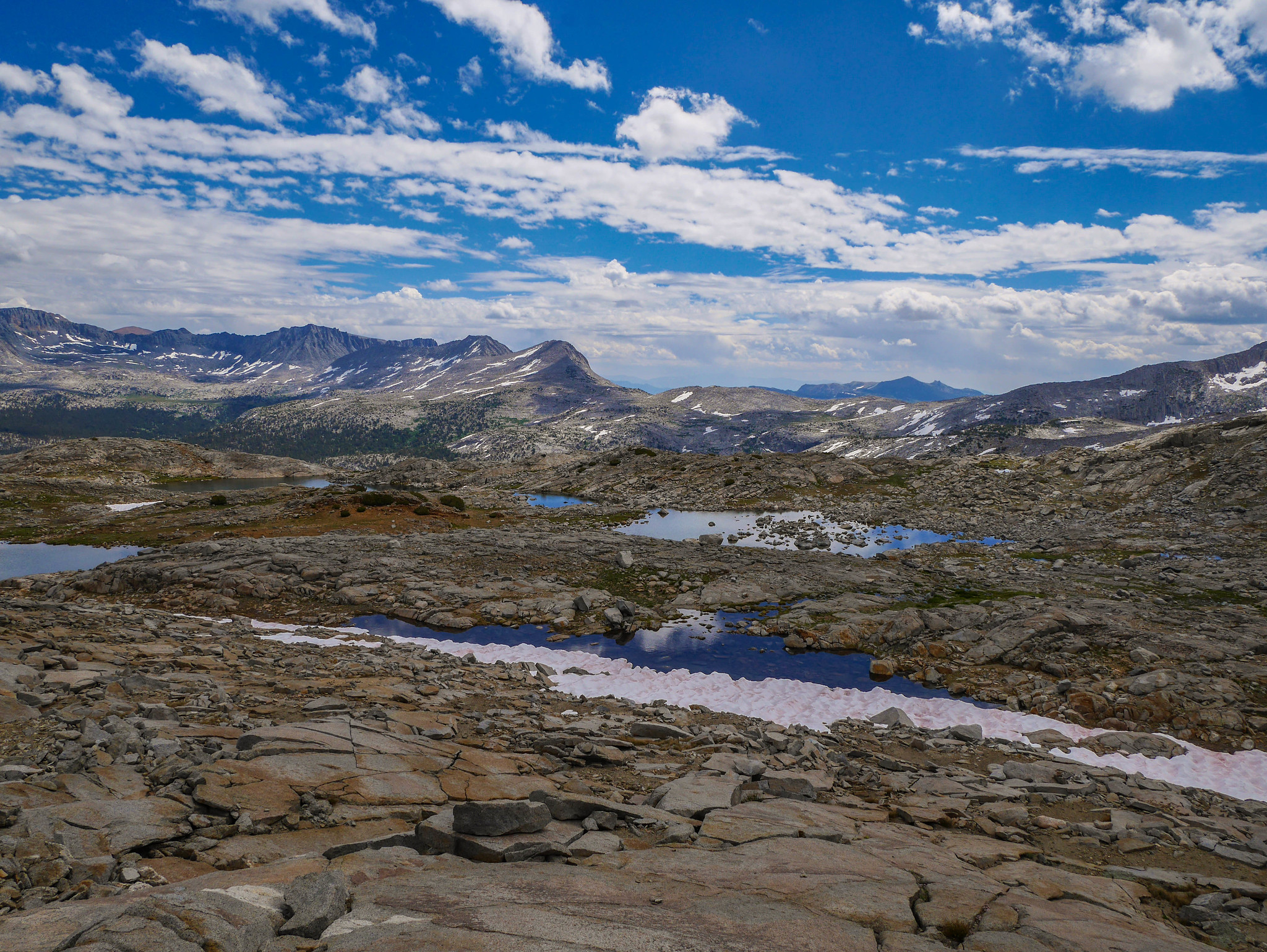
I continued around to the ridge between the Nydiver Lakes and Ediza, looking for a spot to camp. I was greeted with this view of the Minarets and Ediza. Iceberg Lake is tucked back in there, too, and you can see its frozen surface if you squint real good.
I found what might be the best campsite on the planet earth, and puttered around marveling at just.. well.. everything. Look at where I get to sleep. L O O K

I got water and set up for dinner, with a view.

I tried to capture the magic of this place as best I could with my camera. Here’s a more zoomed in shot of Iceberg Lake, with Cecile in the empty space hanging above it. You can really see how treacherous that infamous snowfield along its eastern shore is—in fact someone died descending from Cecile to Iceberg a few days before I camped with this view, but I didn’t know that at the time.


Day 2
Nydiver Lakes to Thousand Island via Ediza + JMT
7mi +2,100ft/-1,200ft, plus 3.5mi +300ft/-1,500ft xc
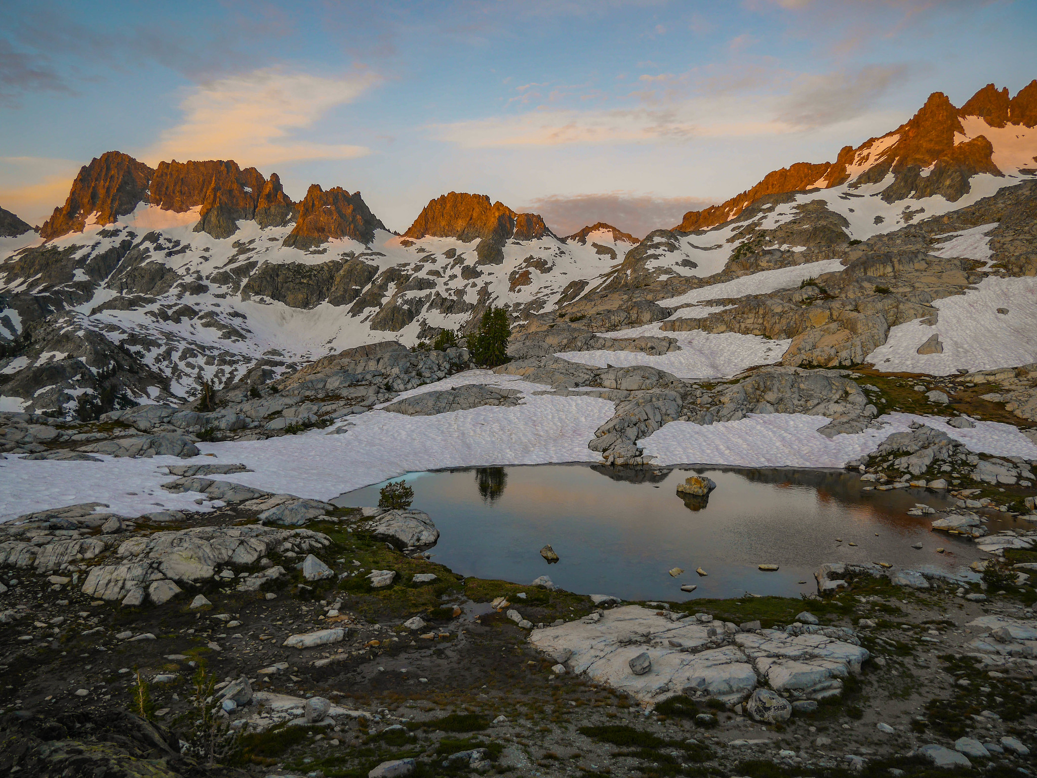
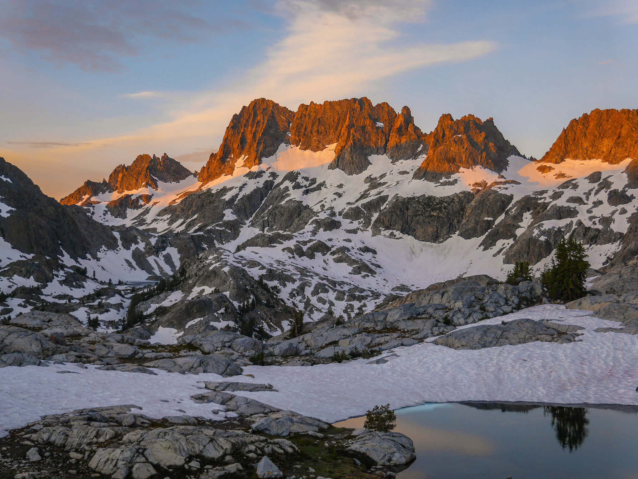
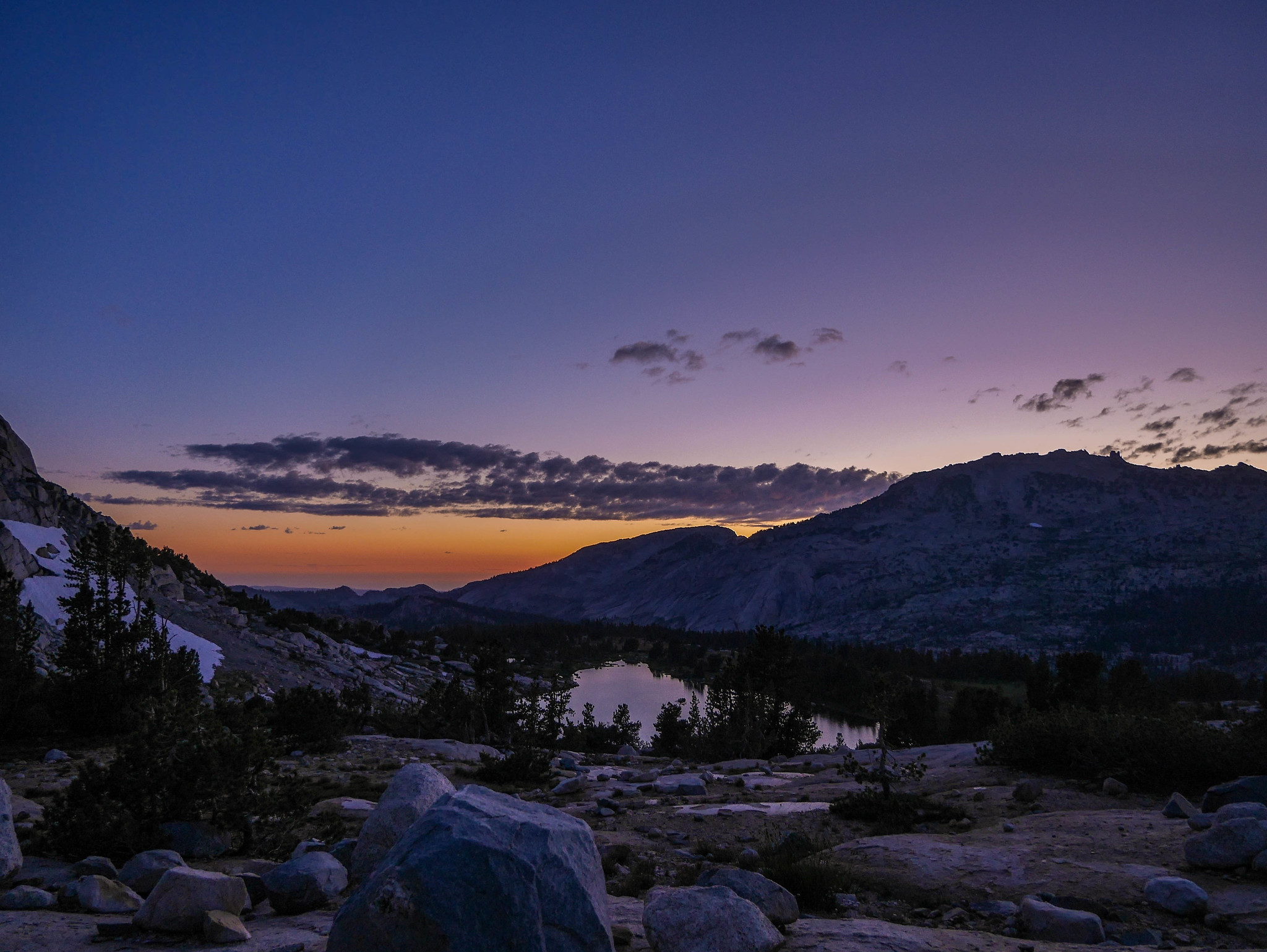
I woke early to an ethereal and ephemeral sunrise of cotton candy clouds over Ritter and Banner. The lingering snowpack is just like jewelry on these gorgeous babes.

The sunrise. My god. The rays creeped up from the east, setting the granite aglow inch by inch from the top down. I might have cried a little.


After a good breakfast of coffee, oatmeal, and crying about how we don’t deserve this Earth, I headed around the south side of the upper Nydiver lakes towards Ritter and Banner, and looked up at Whitebark Pass (the low point on the ridgeline below) and thought about how I dragged an ex on his first time backpacking trip over there back in 2013. Oops. I just wanted to show him the beauty of this place, ok?


As I got closer, I got a good view of Whitebark Pass.
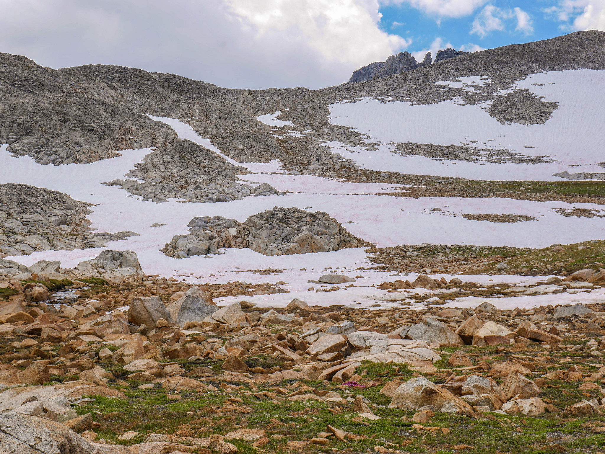
I continued on roughly southeast around the upper most of the Nydiver Lakes, looking to climb over a saddle and then find the use trail that people use to climb Ritter, which would lead me down to Ediza. The going was a bit slow with the snow, but the scenery and solitude made up for it.
I did find myself backtracking here and there in a worrisome mood, trying to figure out where to cross the saddle, since the snowpack had created quite a few hazardous tarns that I needed to make my way around. Breaking through the snow into one of these would be Not Fun, at best.

Eventually I picked my way through and made it down into the valley below Ritter. I descended mostly on snow until I ran out of it, and then picked up a use trail alongside the snowmelt stream feeding into Ediza.

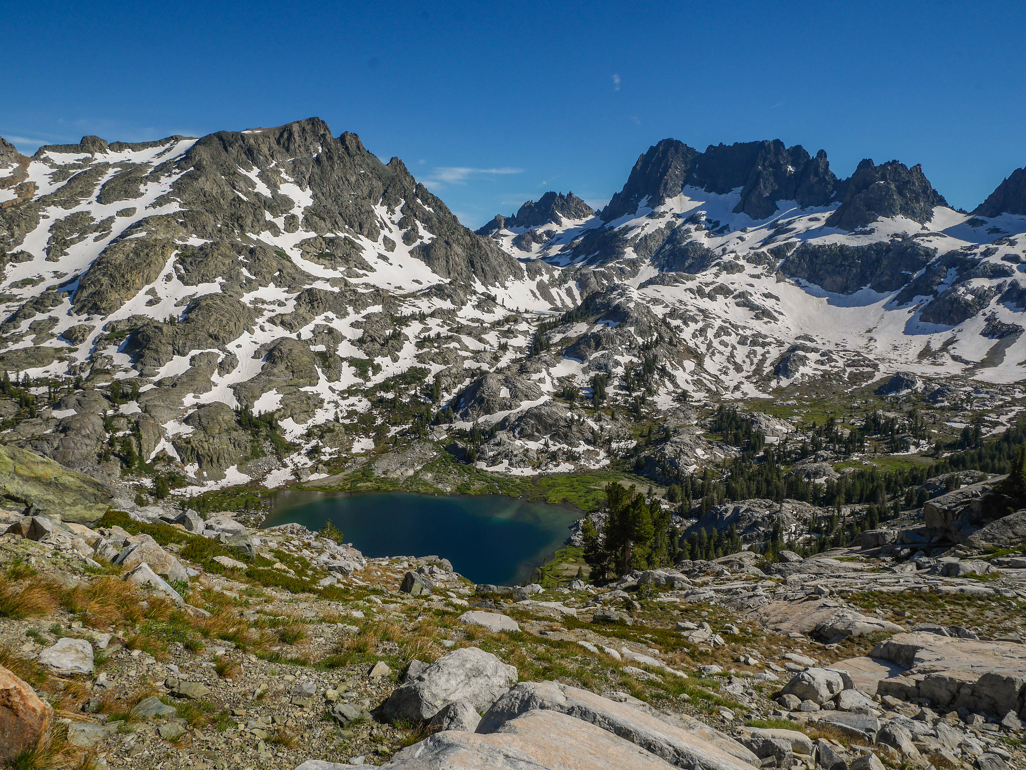
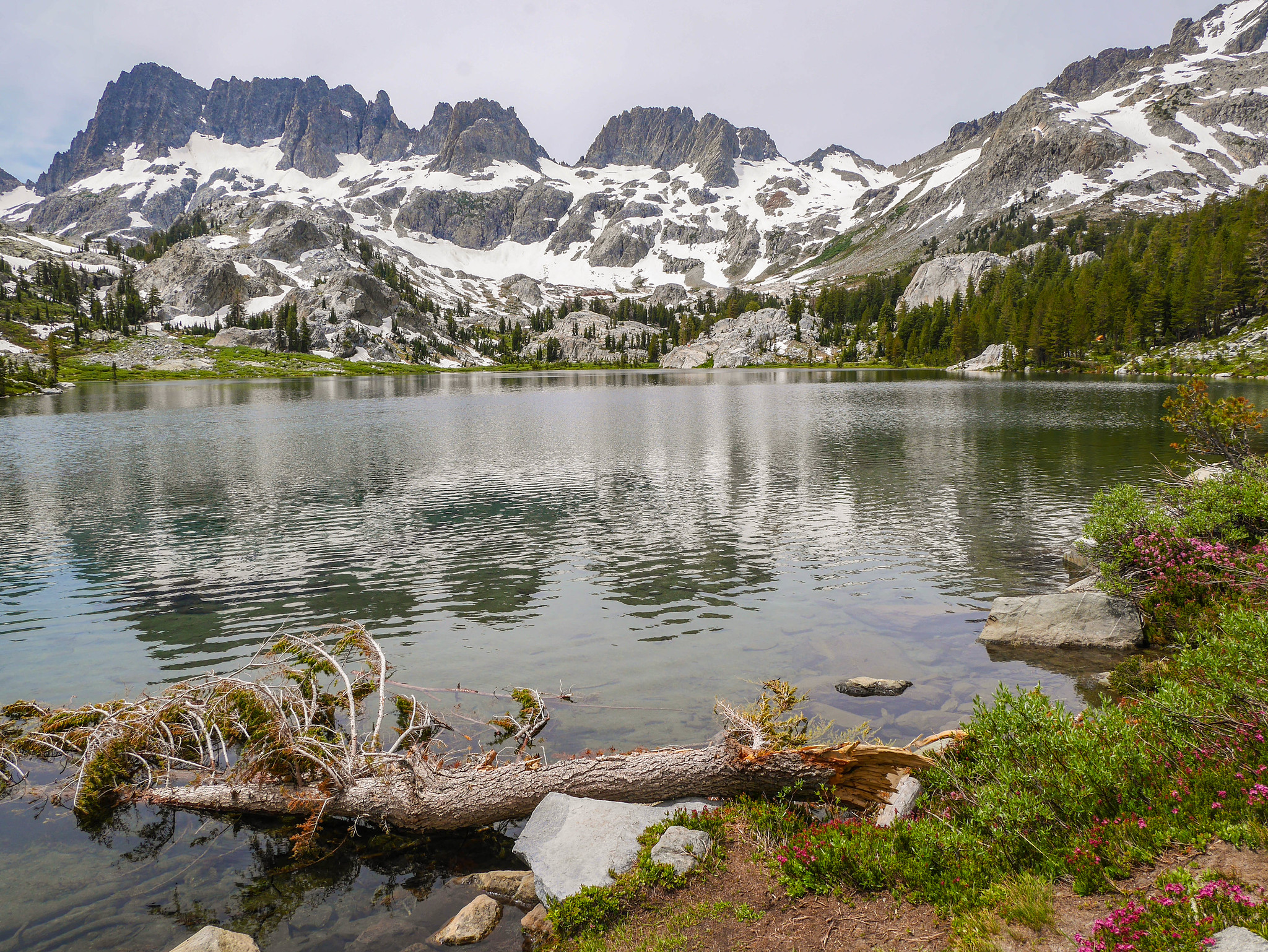
I had a little break at Ediza. I guess I get why this is a favorite, a highlight lake.
The usual crossing of Ediza’s outlet in the valley below was washed away, so the route to get down this year is along the north rather than south side of the outlet stream. It’s just a use trail, and definitely involved some scrambling.

I continued down and eventually met up with the JMT, where I turned to head back up towards Garnet Lake.

It was your usual idyllic Sierra scene: hanging meadows, granite, distant peaks.

Descending to Garnet Lake gave me a view up towards the north side of Whitebark Pass. I had considered going that way when planning this trip, and looking at it from this side I was glad that I hadn’t. It’s not too steep, but the half-melted snow atop the loose and large talus would be tedious. Plus, going the long way round I got to hike that part of the JMT between Shadow and Thousand Island, that I hadn’t hiked yet.

I had lunch (and awkward timed selfies) along Garnet Lake’s east shore.
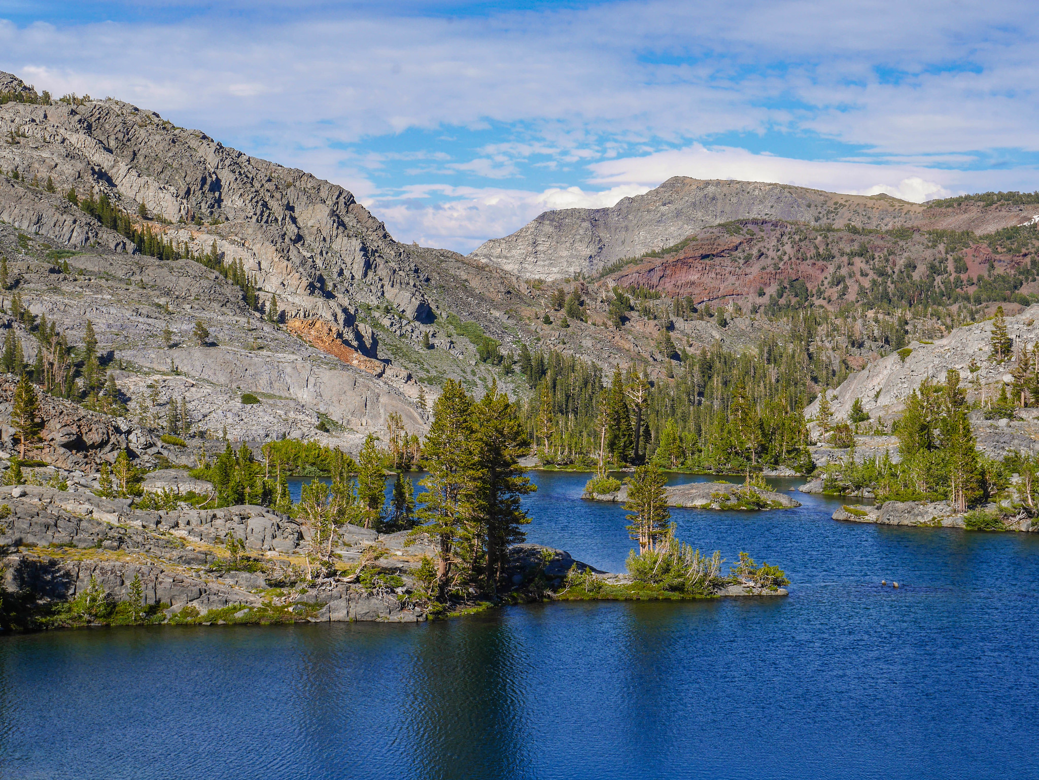
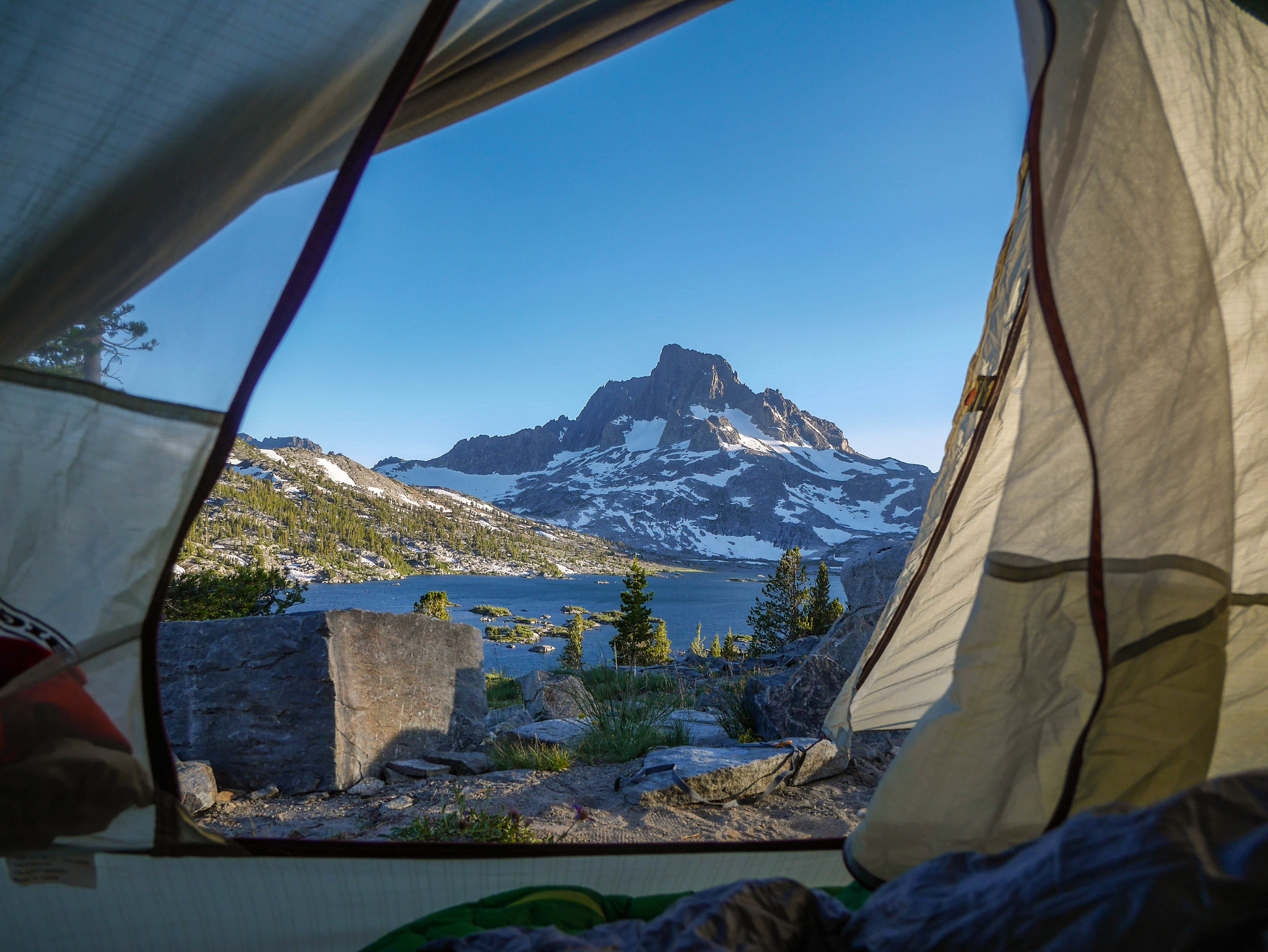
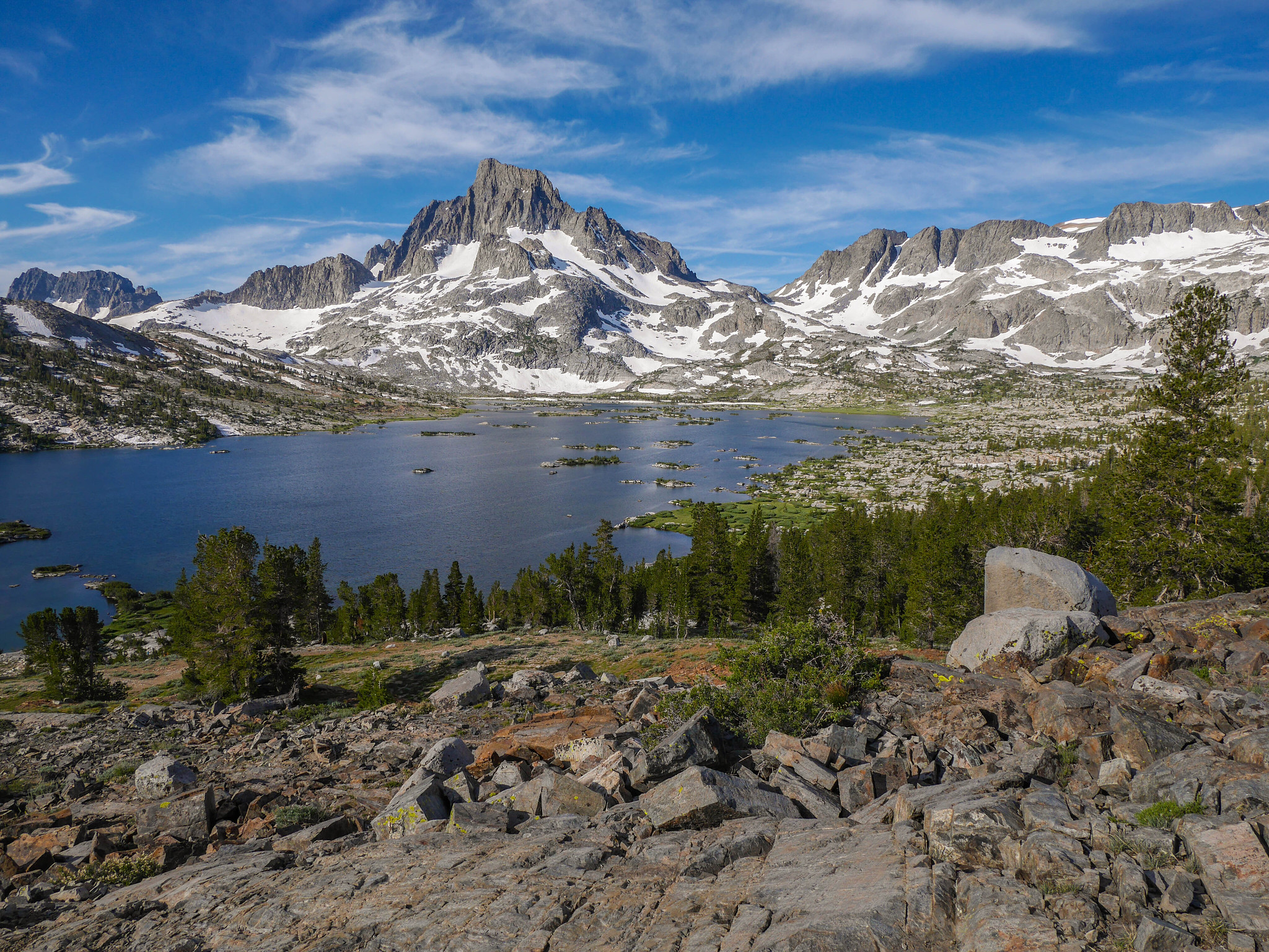
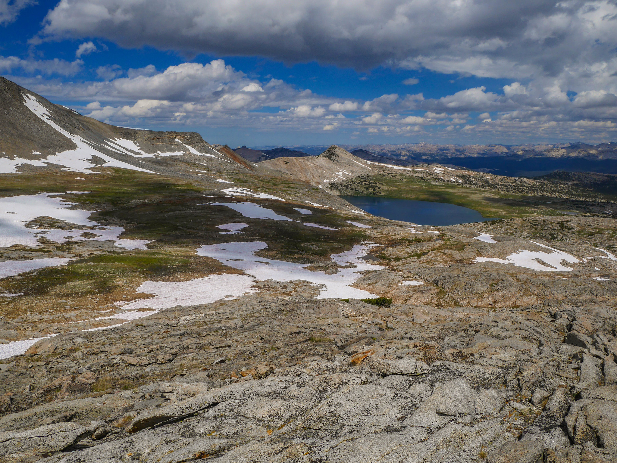
And soon enough it was time to continue on hiking past Ruby and Emerald Lakes and towards Thousand Island Lake, where I would camp for the night. I knew I was in for a crowd at Thousand Island, so I wanted to arrive at a reasonable hour to try to find a decent spot far enough from the ukulele crowd.

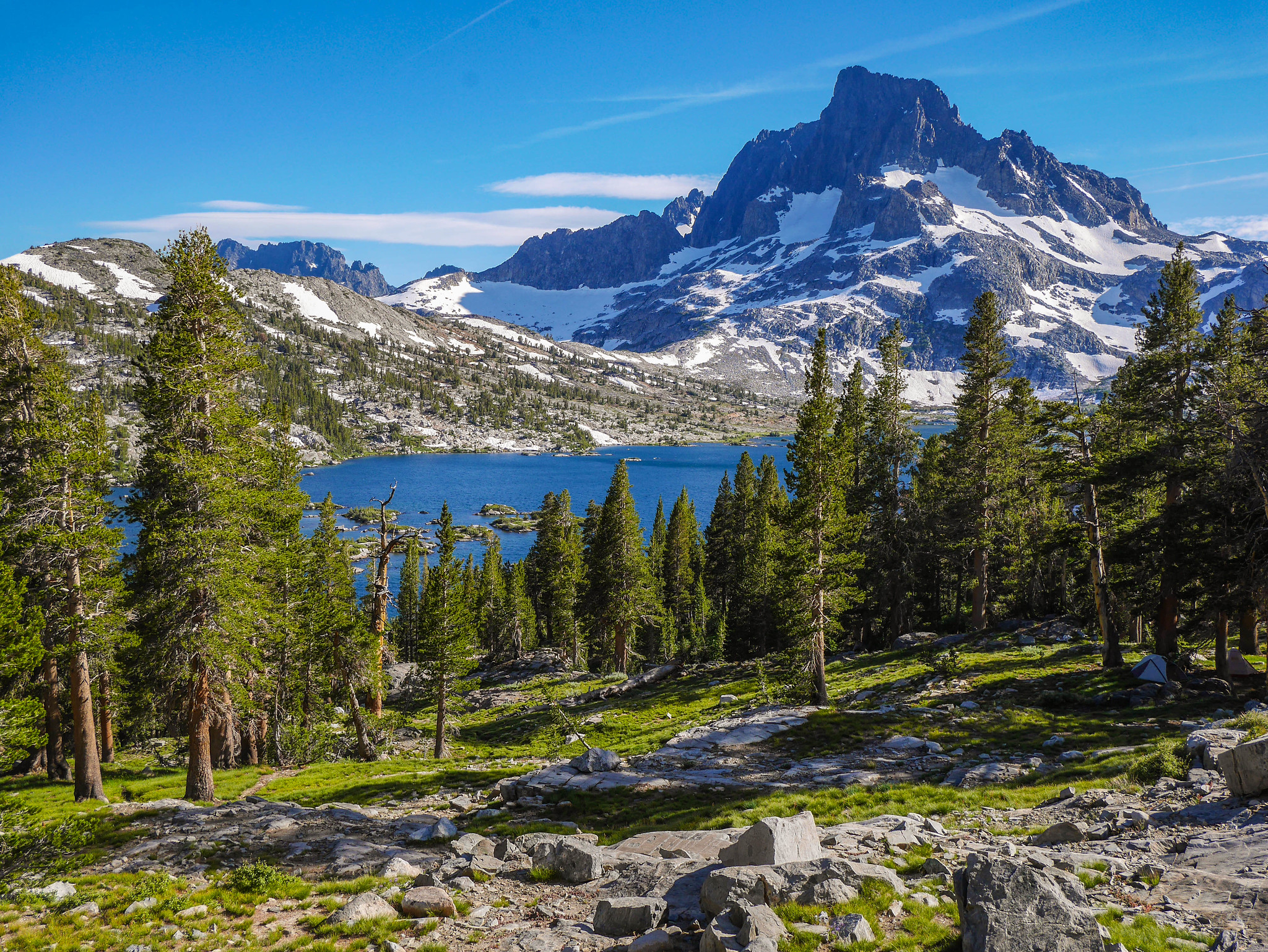
The view of Banner from the outlet of Thousand Island is just like.. the platonic ideal of a mountain. Look at it. Look.

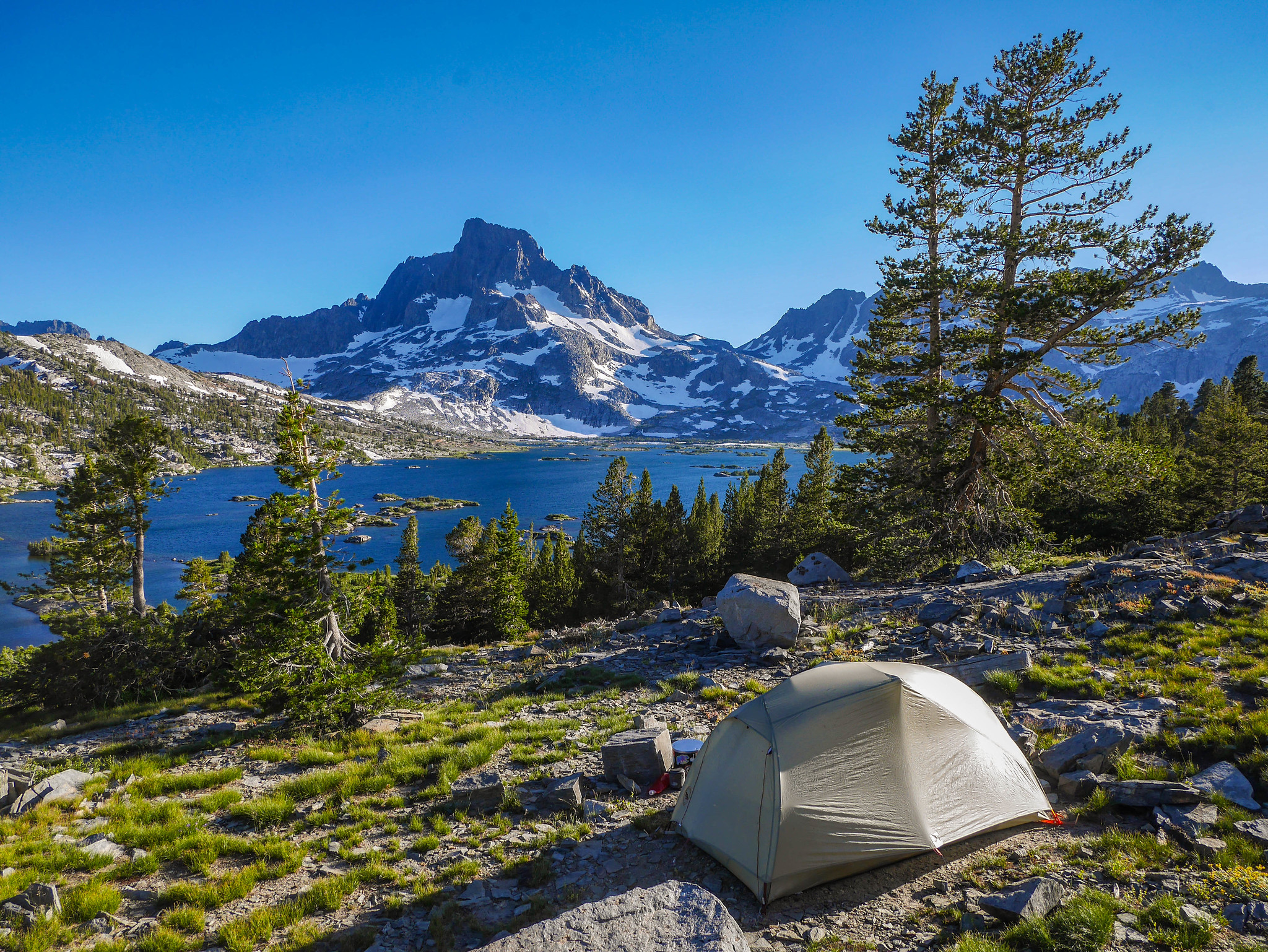
I climbed a bit higher towards Thousand Island Pass and found myself a perch atop a ledge above Hostel Thousand Island. It was stupid pretty.
Day 3
Thousand Island to McClure Creek
7mi +1,800ft/-1,500ft, plus 1.5mi +300ft/-100ft xc
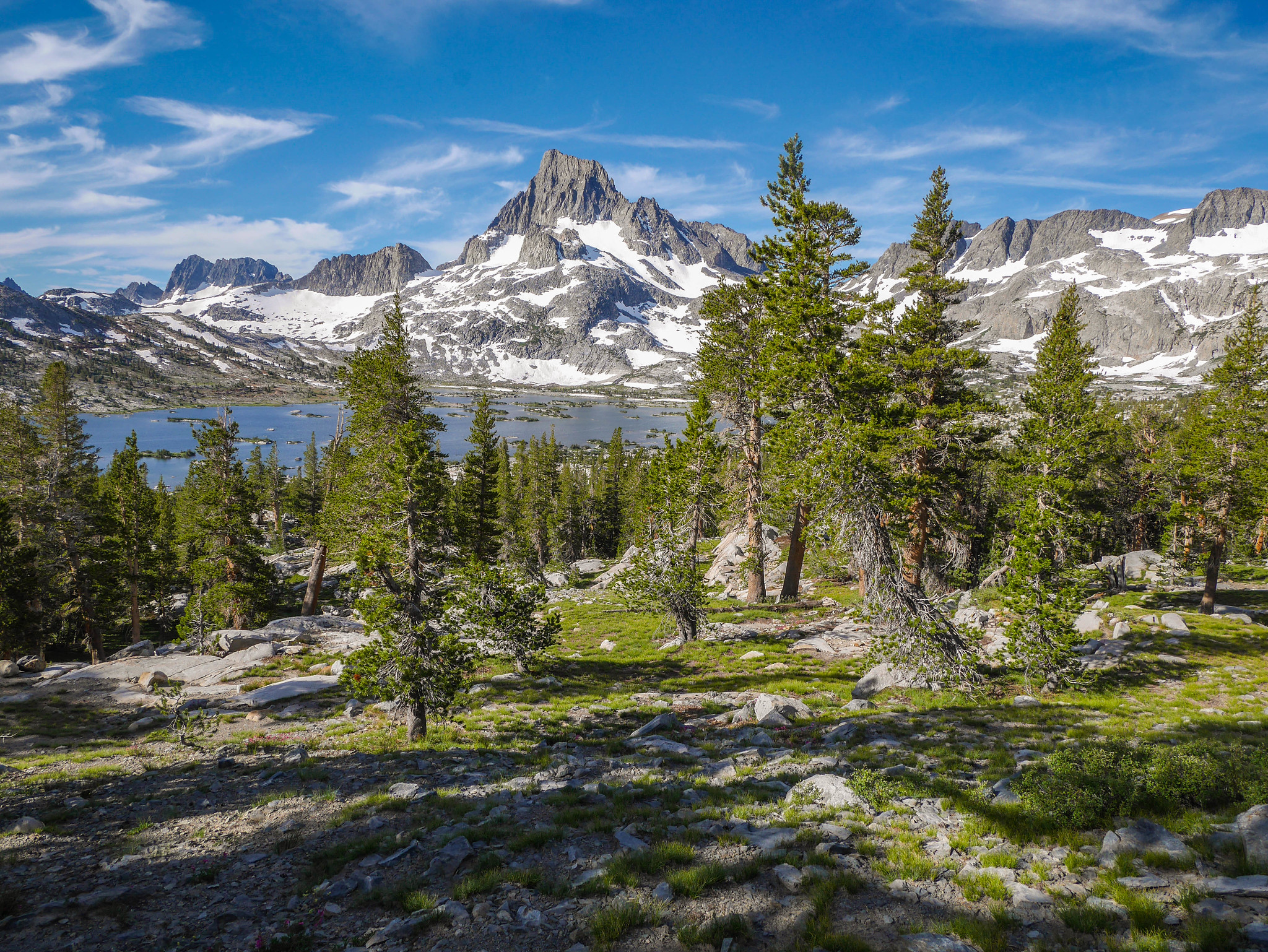
I got up early to tell this mountain to fuck off. I mean, come on. It’s just a little bit ostentatious, don’t you think?
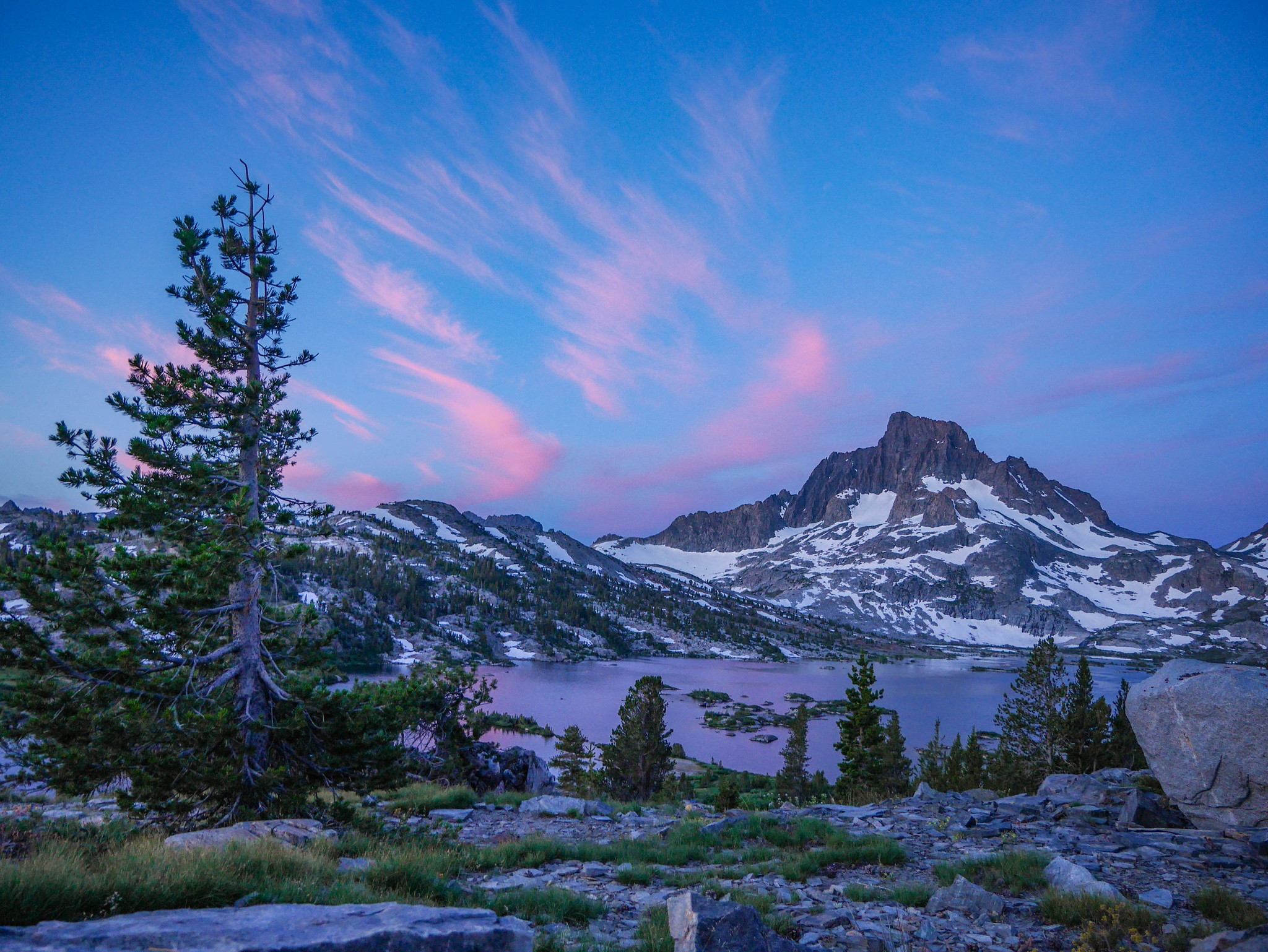
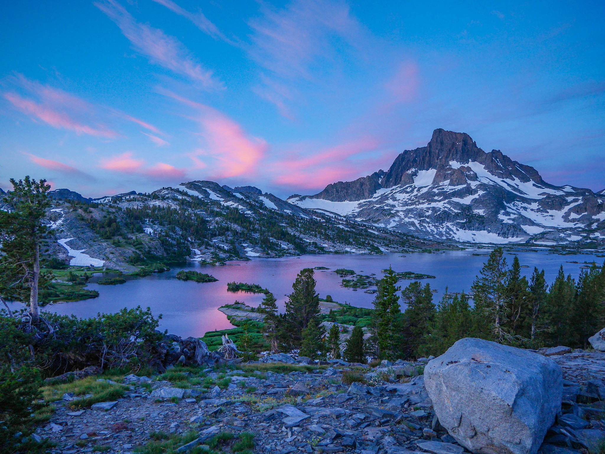
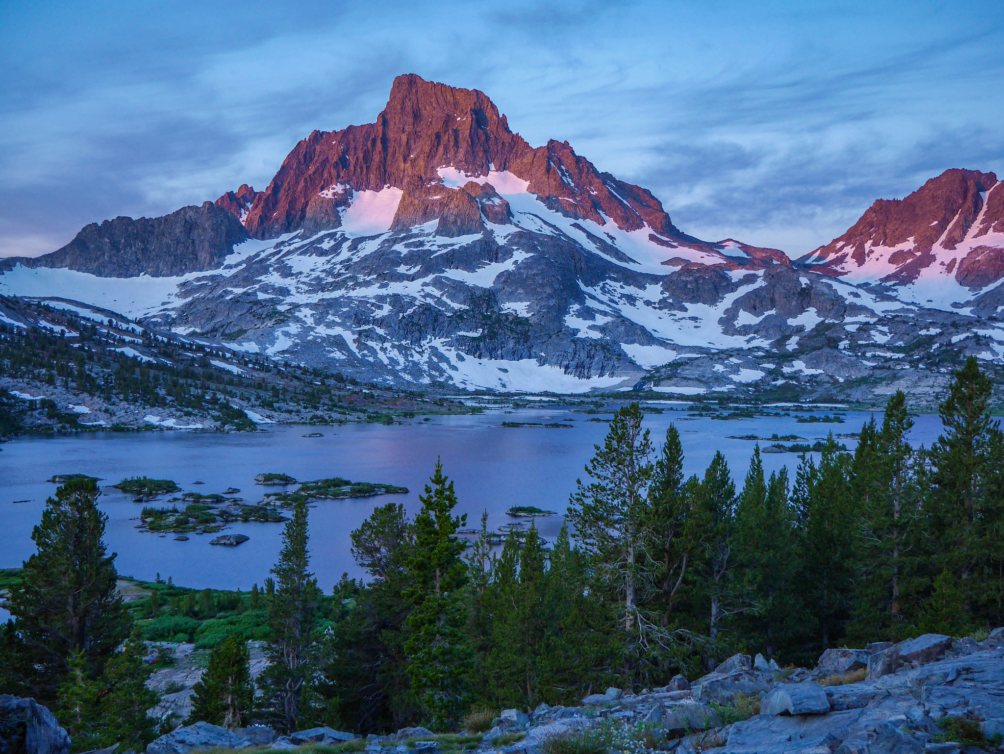
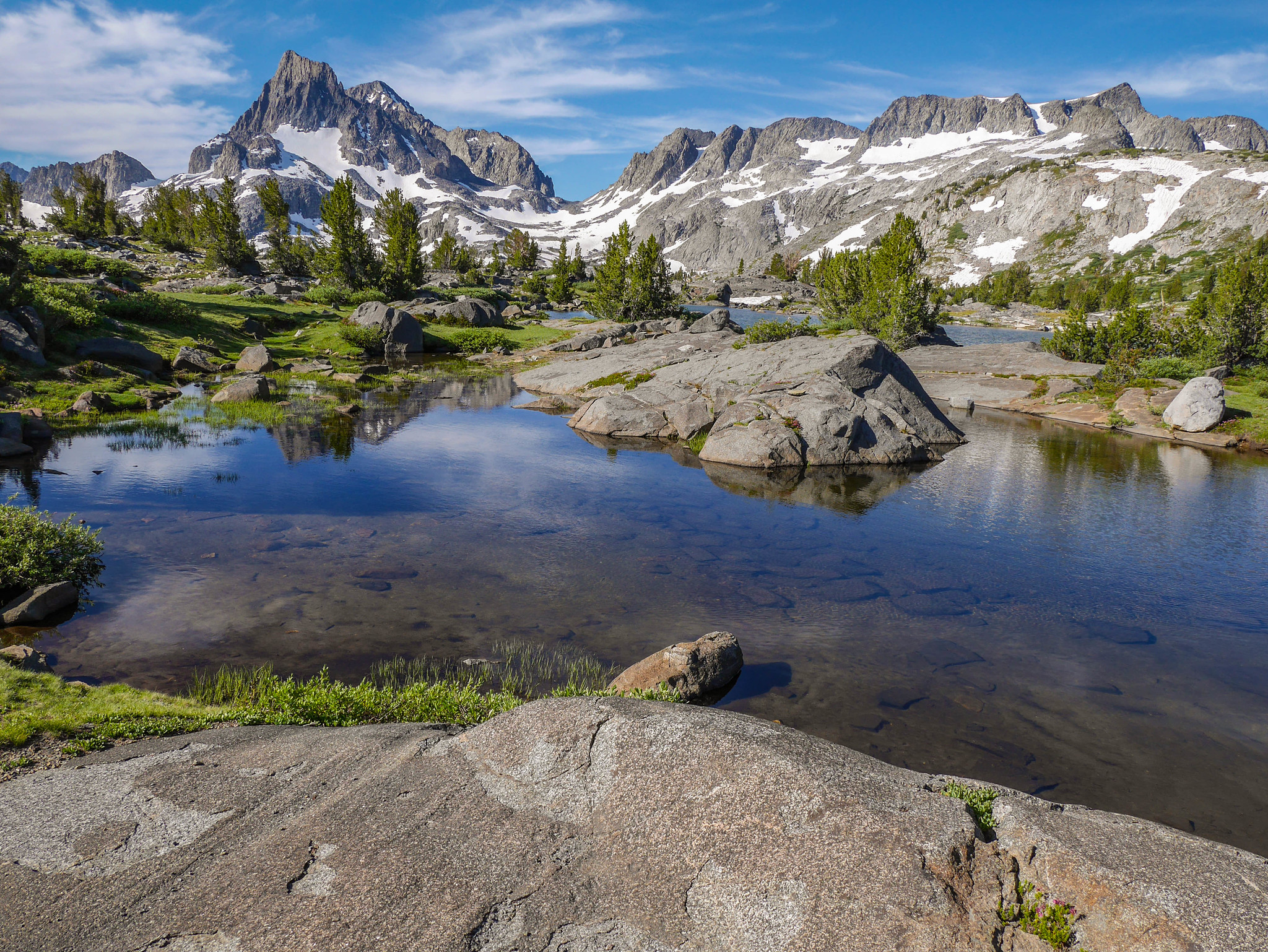
And no worries if you didn’t manage to wake up for sunrise, because it’s just as gorgeous at literally any time of day. I packed up camp and started climbing towards Thousand Island and then Donahue Passes. My goal for the day was to cross Donahue into Yosemite on the JMT and then leave the trail for a cross country section up McClure Creek.

The route up gives more ridiculously gorgeous perspectives on Banner, and now Ritter in the background.
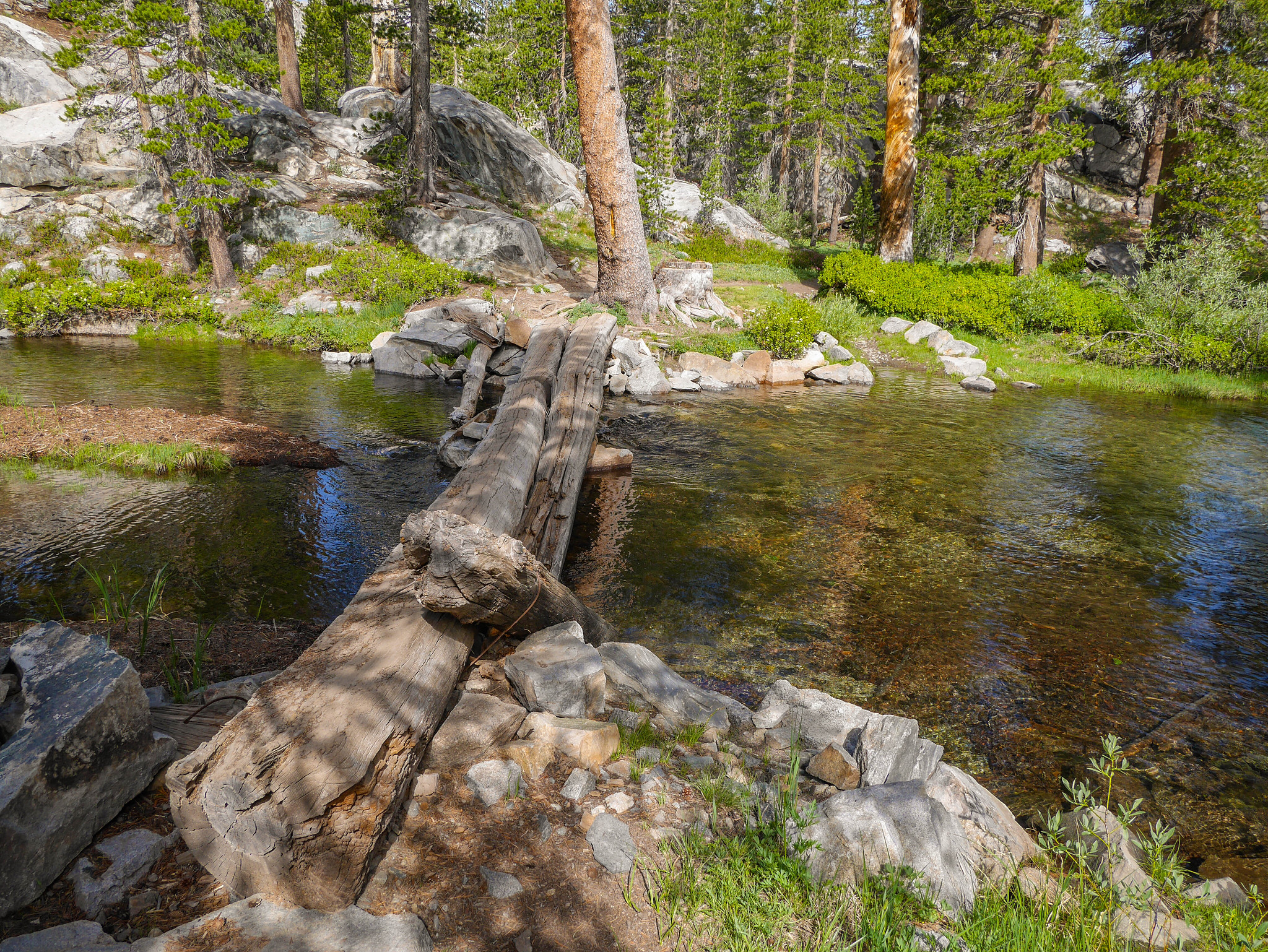
There were a few log crossings, nothing too crazy. It’s the JMT after all.


Ascending towards Donahue Pass, the trail is somewhat deceptive… it appears closer than it is, though there’s not too much elevation to ascend, it still takes a bit of time to reach the top. Once there, you go down. Wow! Imagine that. I’ll spare you the details since this is the JMT, a literal hiker highway.


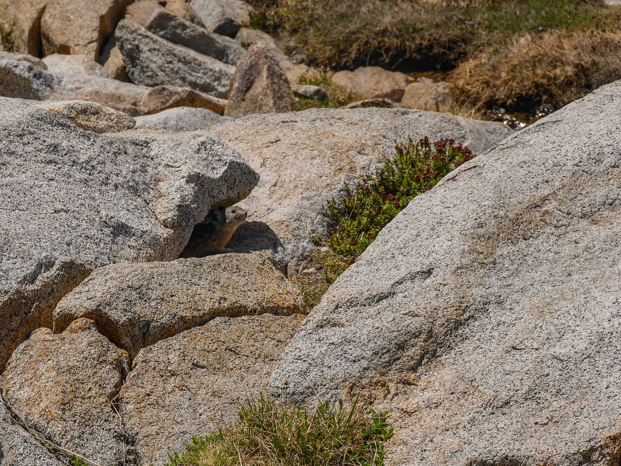
On the descent I did spot one kindred spirit, doin’ a li’l chirp chirp from under his rock perch. Hey pika!
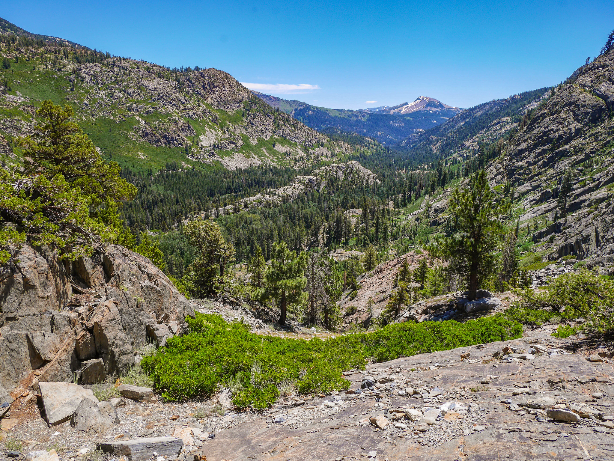
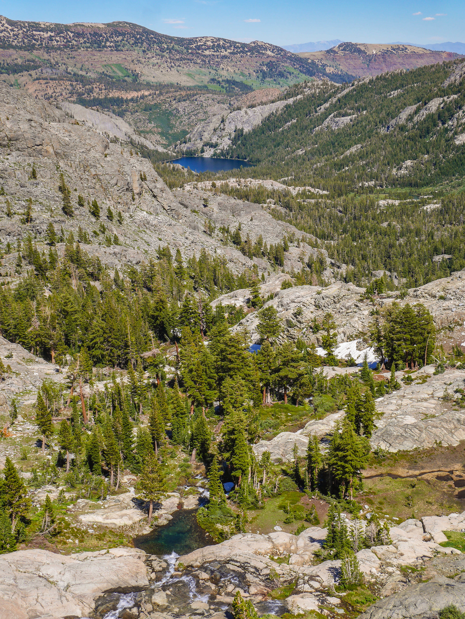
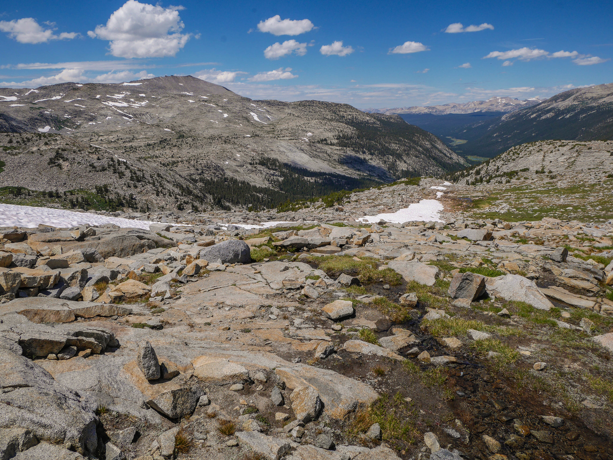
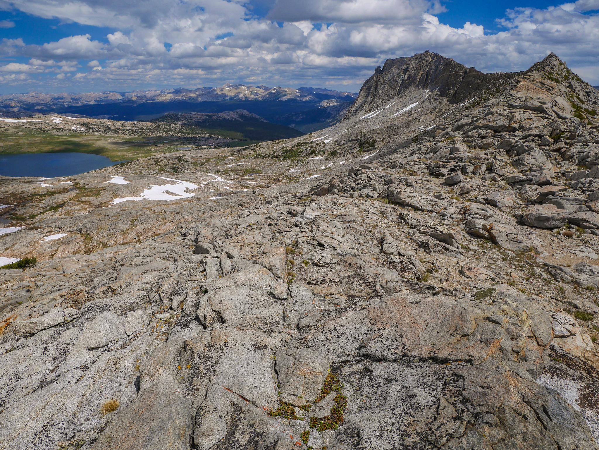
As the JMT descends down Lyell Canyon, you get amazing views up into the high country.


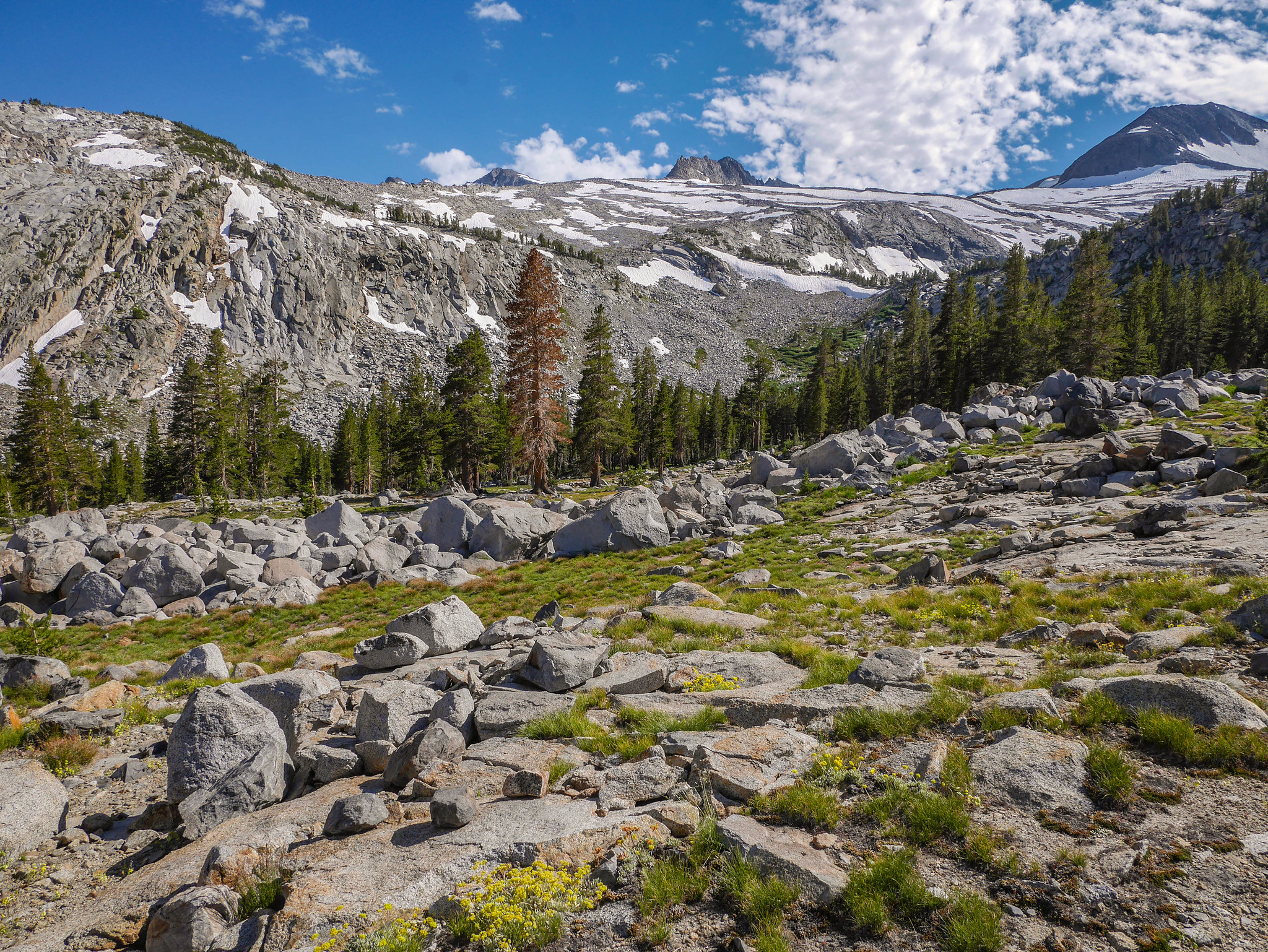
I followed the JMT along a shoulder and then cut southwest before reaching Maclure Creek.

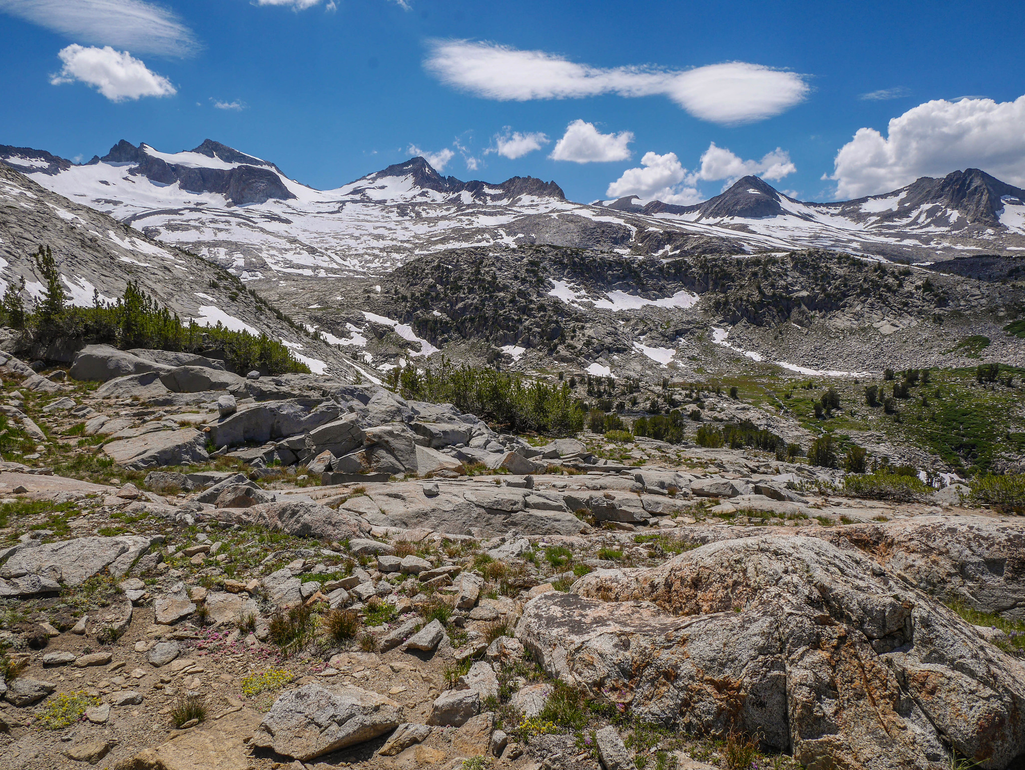
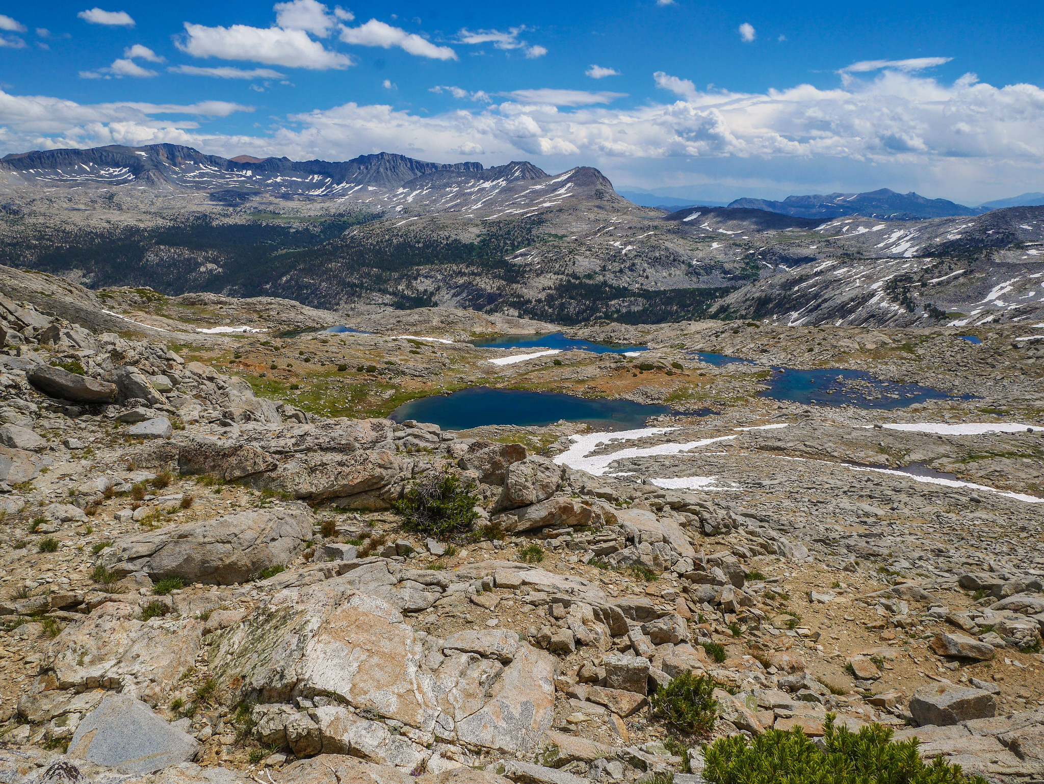
The cross country terrain was easy until I arrived at the large talus field, which looked rather annoying but was not too terrible after all.


Midway through the talus I had magnificent views down Lyell Canyon.

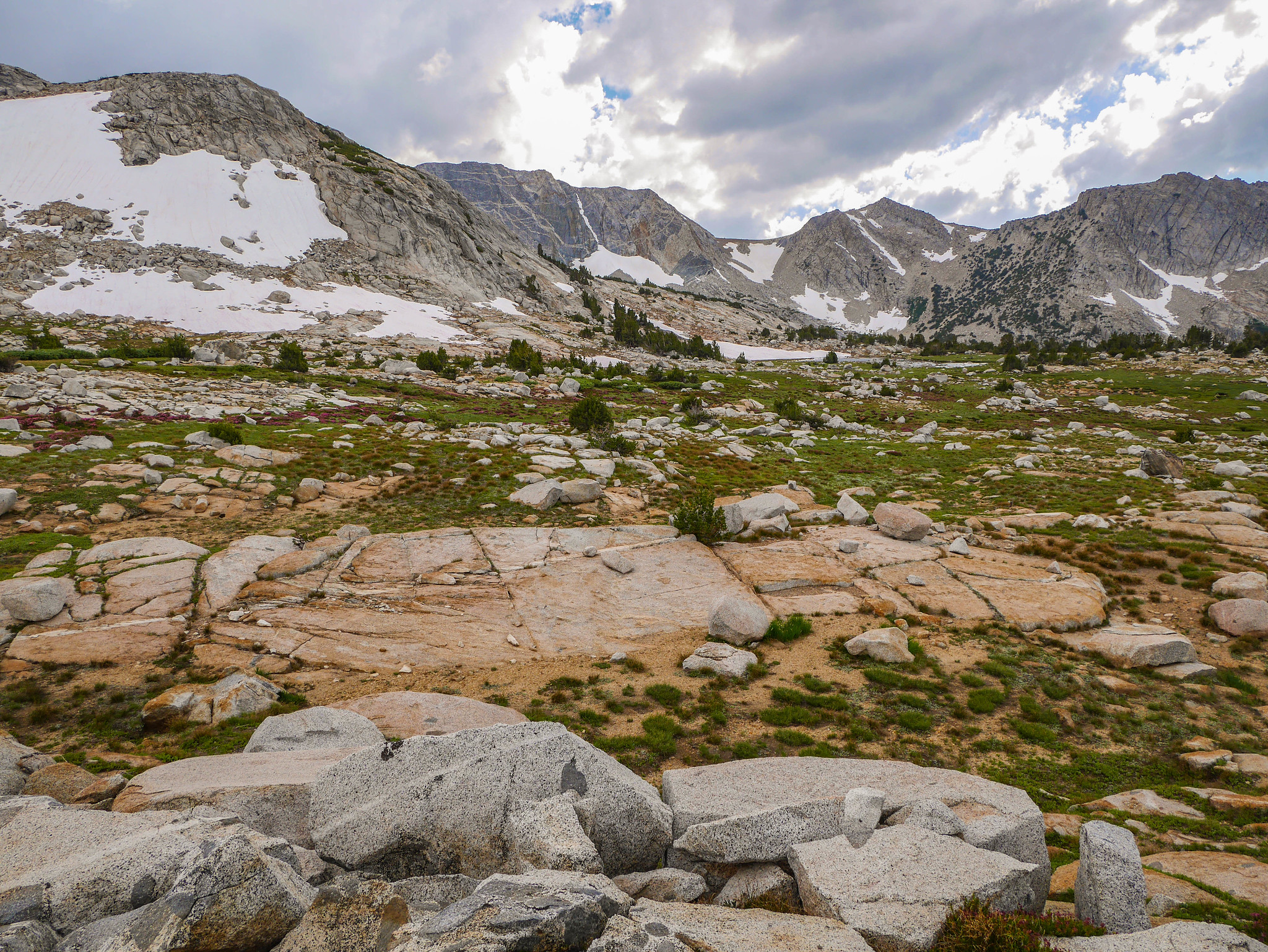
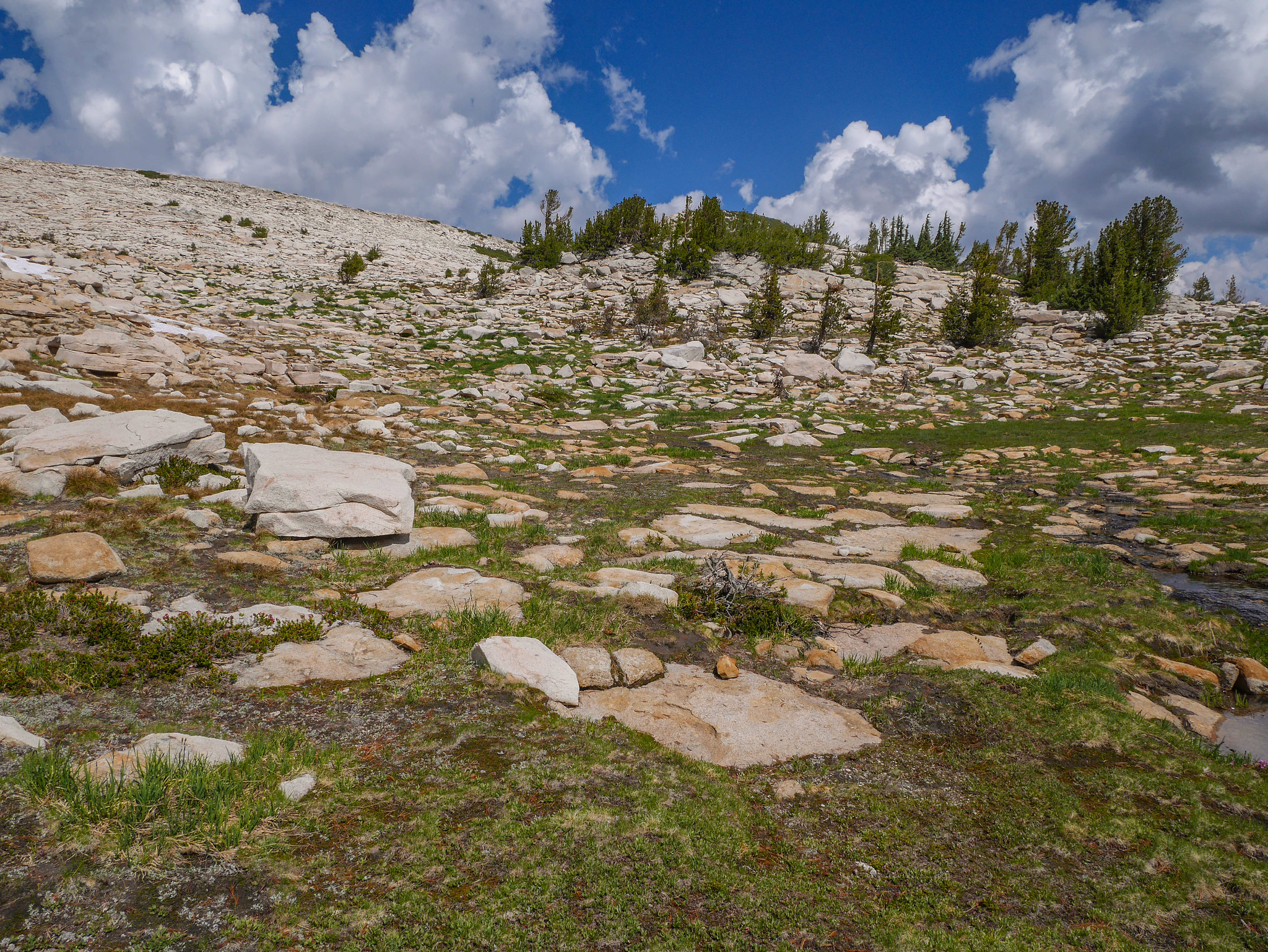
After the talus, there was some gentle valley walking, a stream crossing (of Maclure Creek), and then some really chill hillside walking to reach the bench where I planned to camp.

Climbing up the other side of the creek, views began to open up. I love the way snow accents the granite.

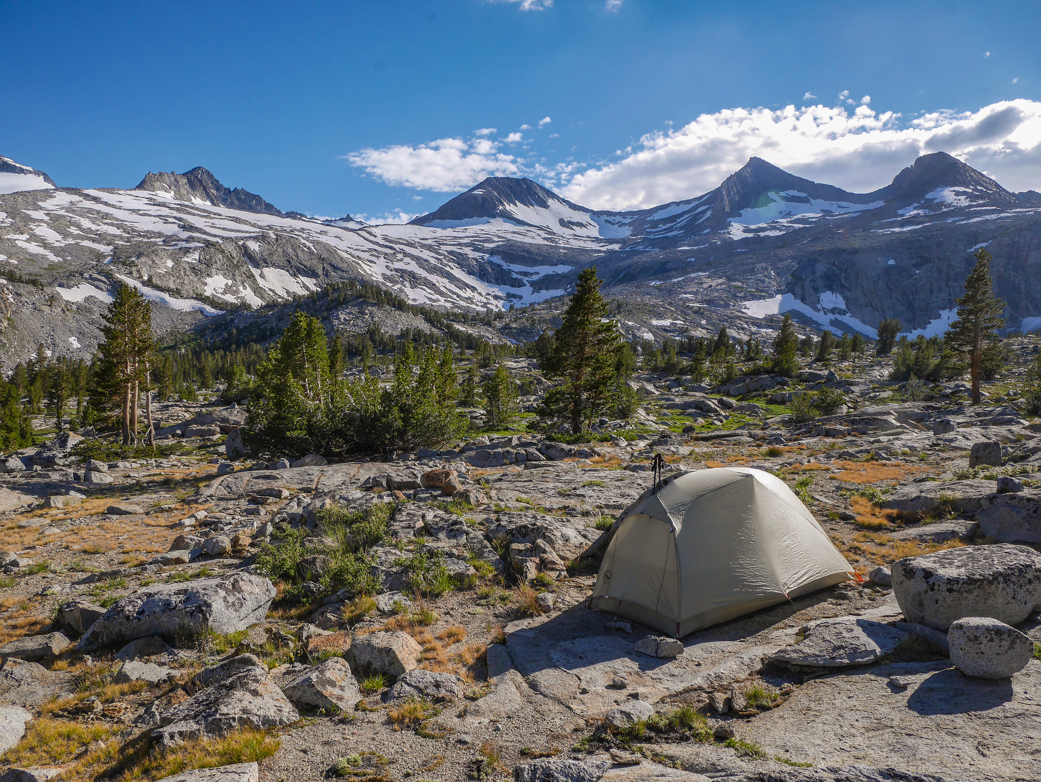
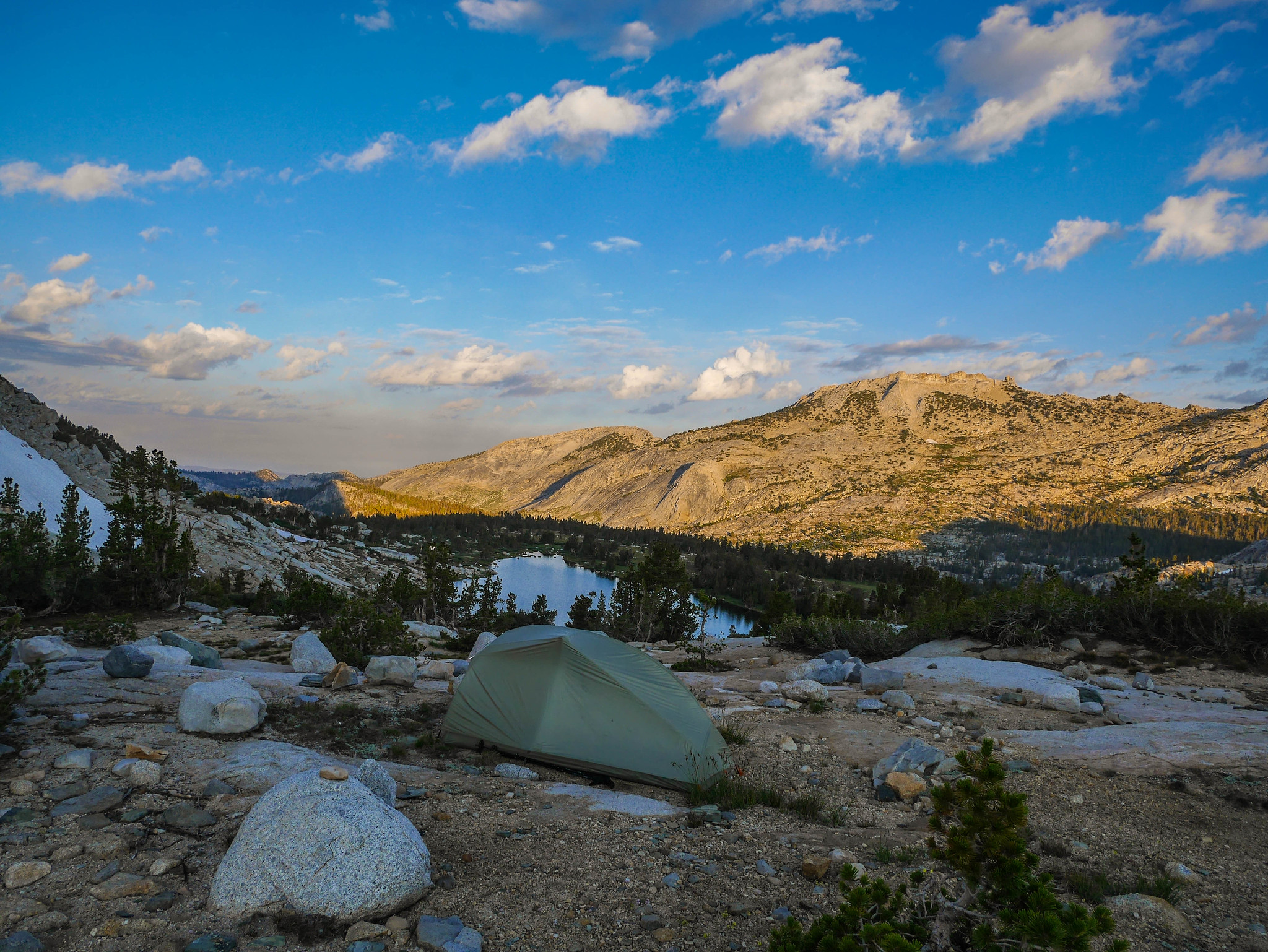
Once atop the bench, I had my choice of idyllic campsites. I chose to head all the way back to the northeastern most tarn so that I could get a view both across Lyell Canyon and also back up towards Maclure and Lyell.

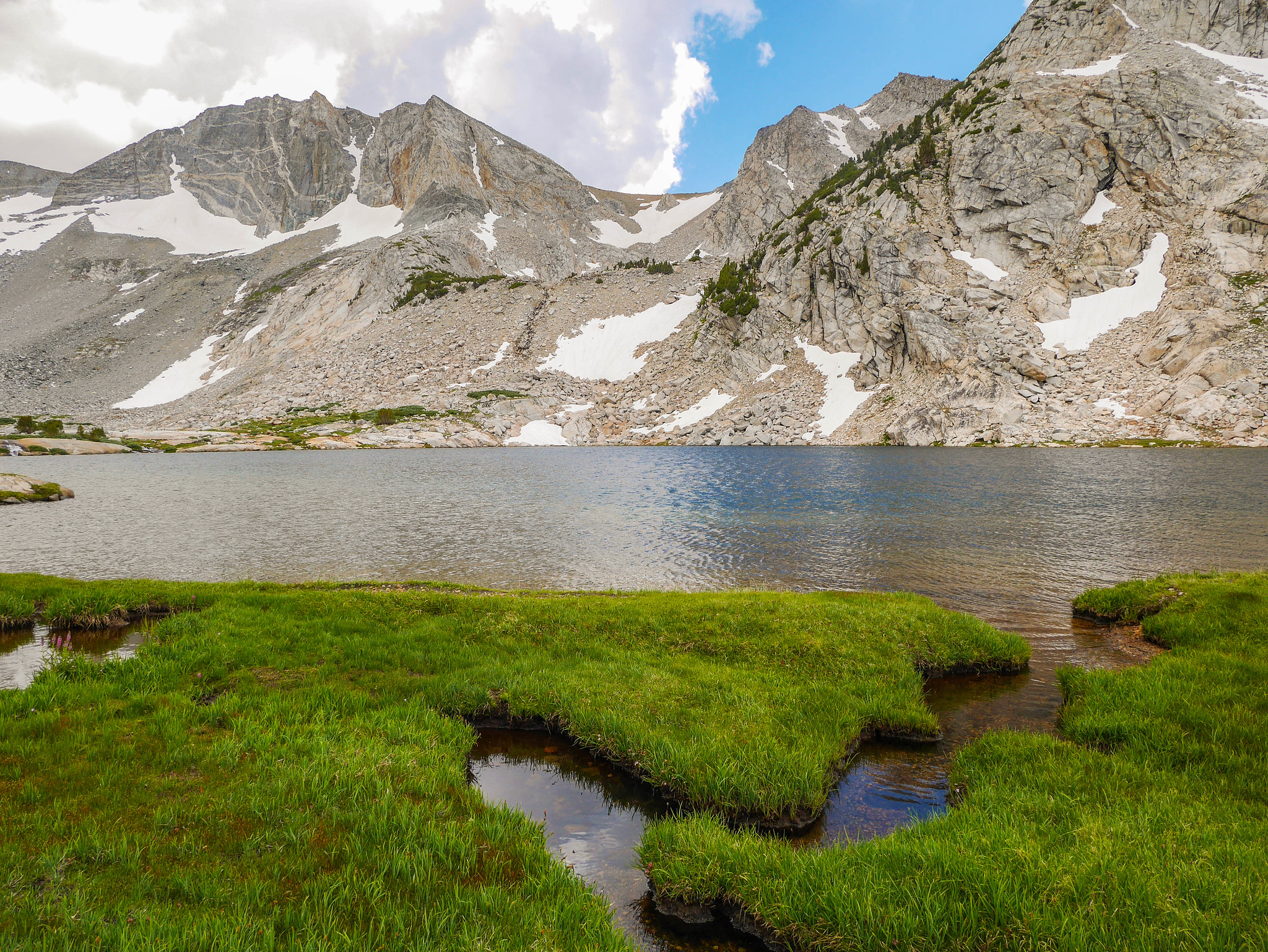
After making my little home for the night, I headed to a tarn nearby for a swim and some water gathering. I came across some mountain lion poo. Perfect for easing the ol’ solo cross-country anxiety. Yep. Just what I wanted to see.

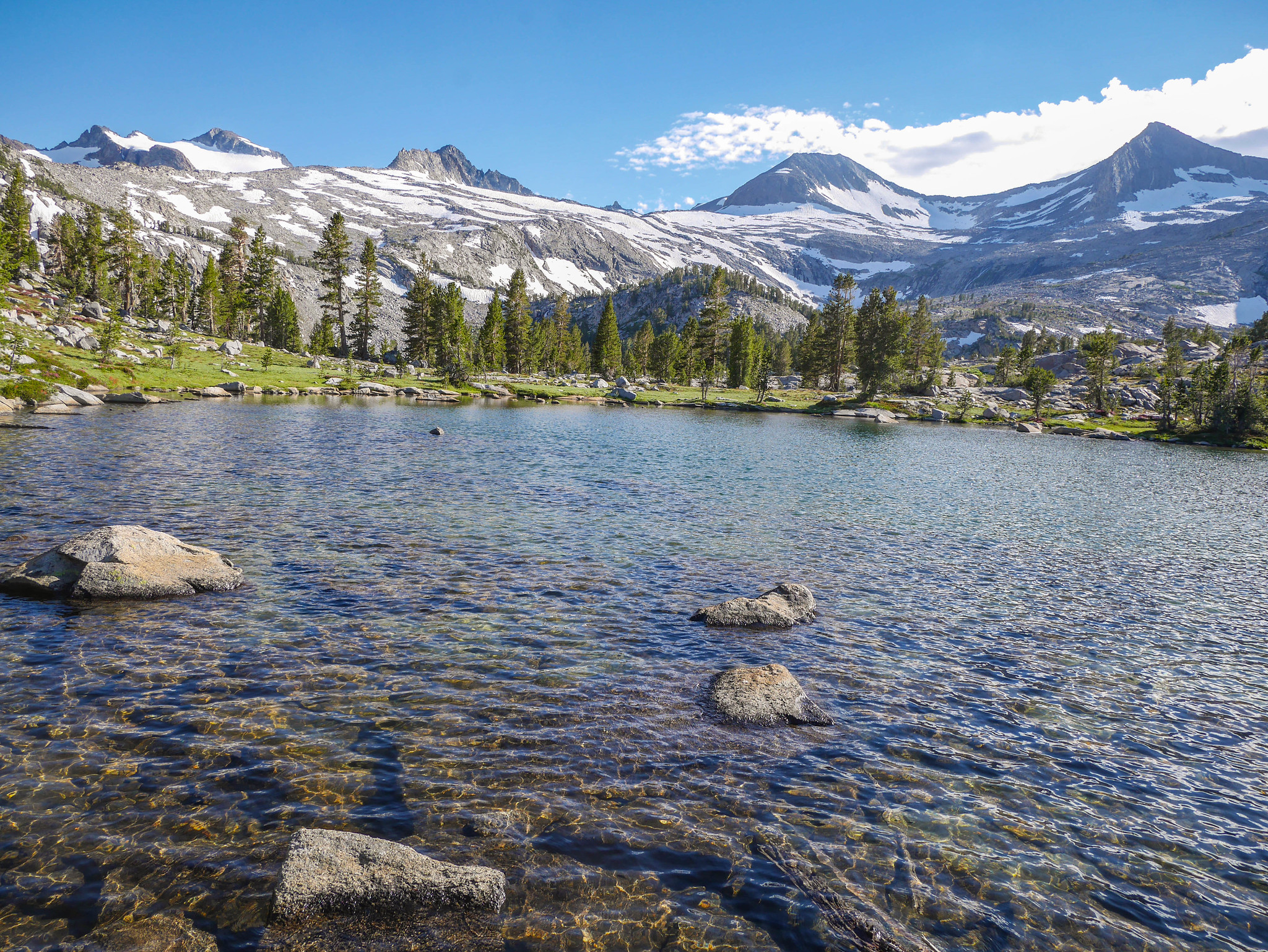
But well worth it for this as my private little lake. I swam, then warmed myself on some rocks, filled up my water and returned to camp for dinner and rest.
Day 4
McClure Creek to Townsley Lake
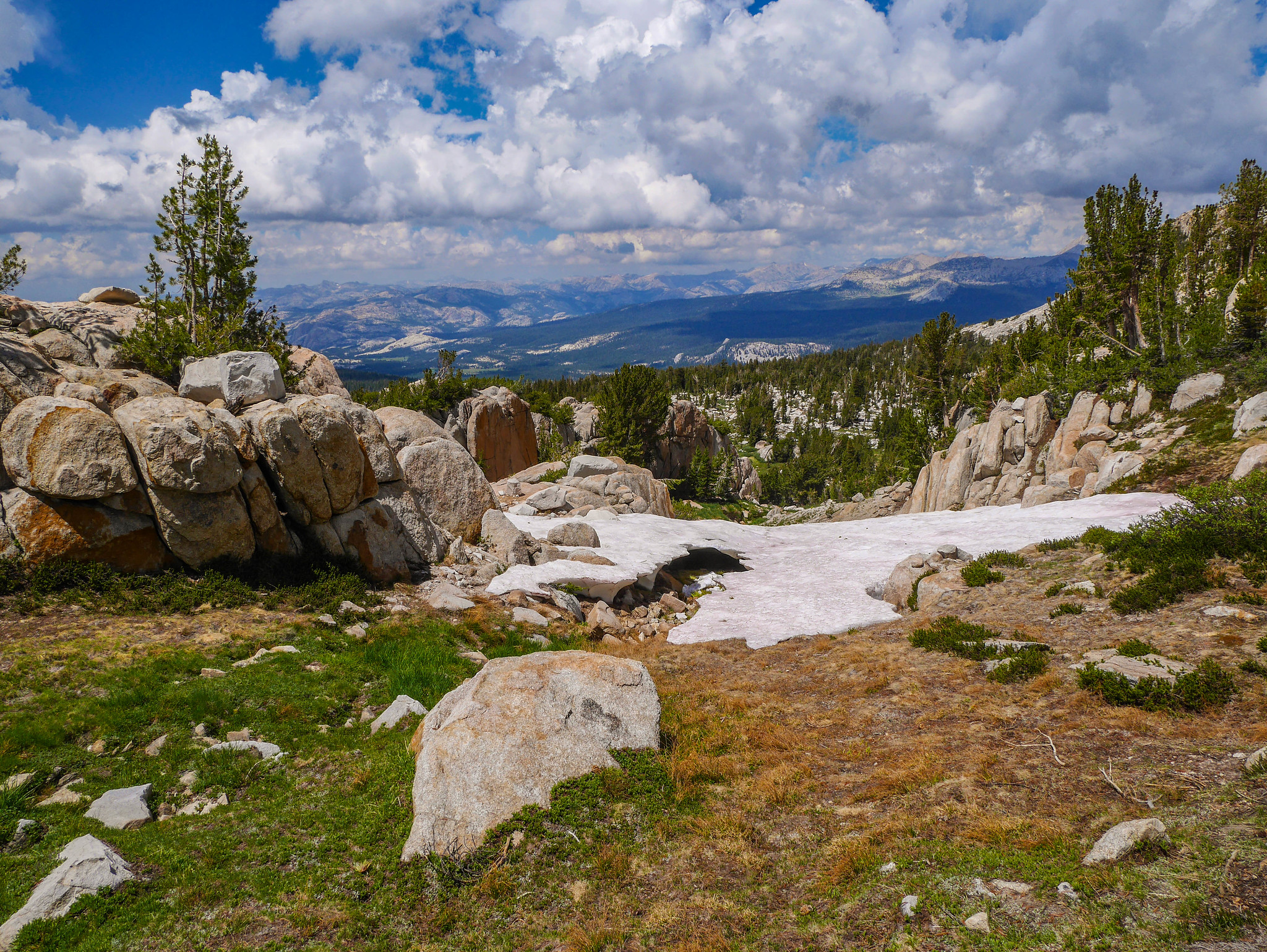
7.5mi +1,700ft/-1,700ft xc
I made myself crawl out of my tent early enough to catch some of that eastern Sierra sunrise alpenglow. It’s generally worth it close to the crest since the height of the mountains plus the severe drop to the Owens Valley means that the sun’s rays flow through lots of atmosphere before painting the granite peaks.

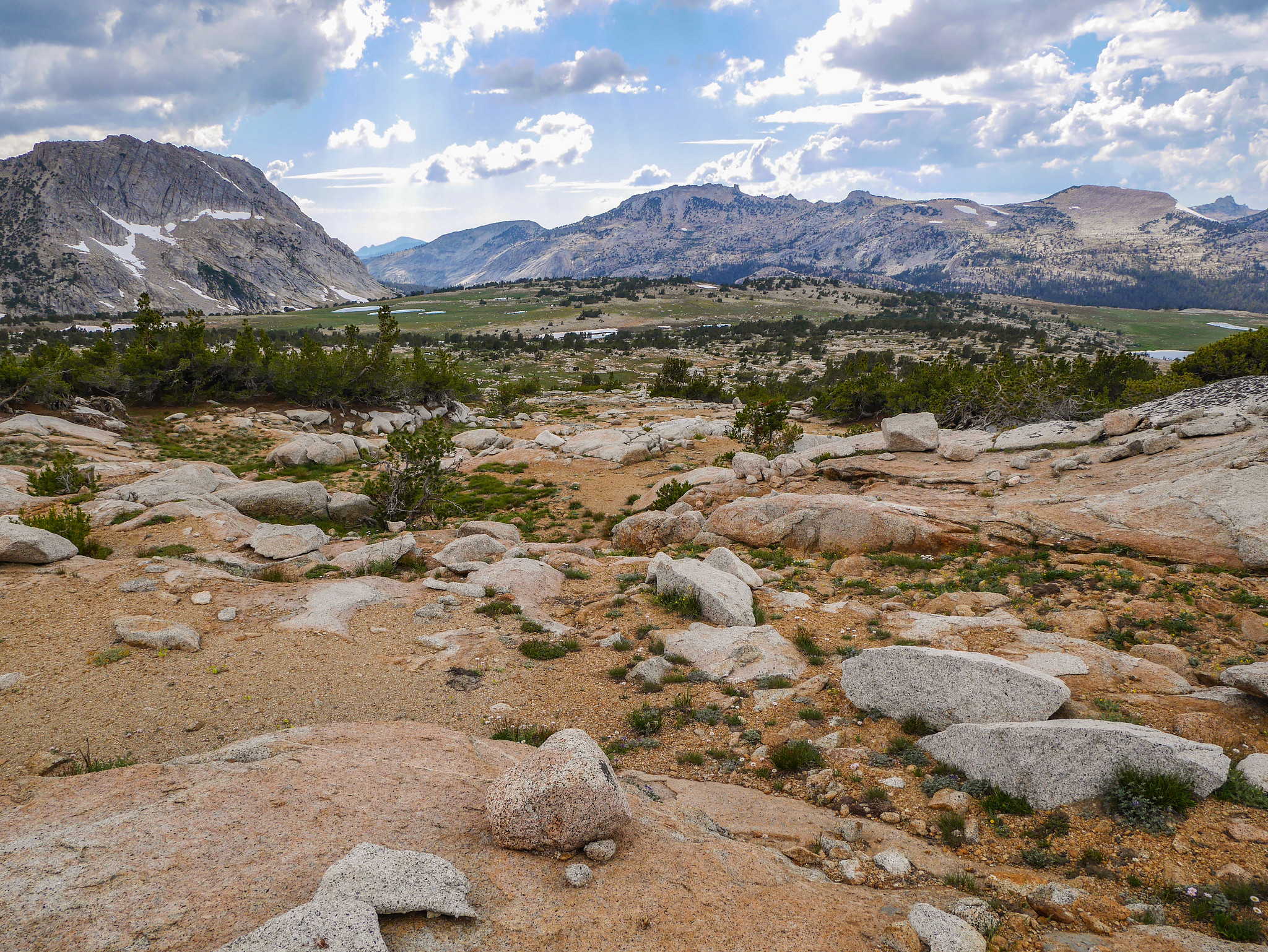
The cool thing about backpacking by yourself is you can set your own schedule and go back to bed for a bit after the alpenglow ritual. I started back towards Lyell across easy granite slabs, avoiding meadows so as to minimize my impact on the plants.


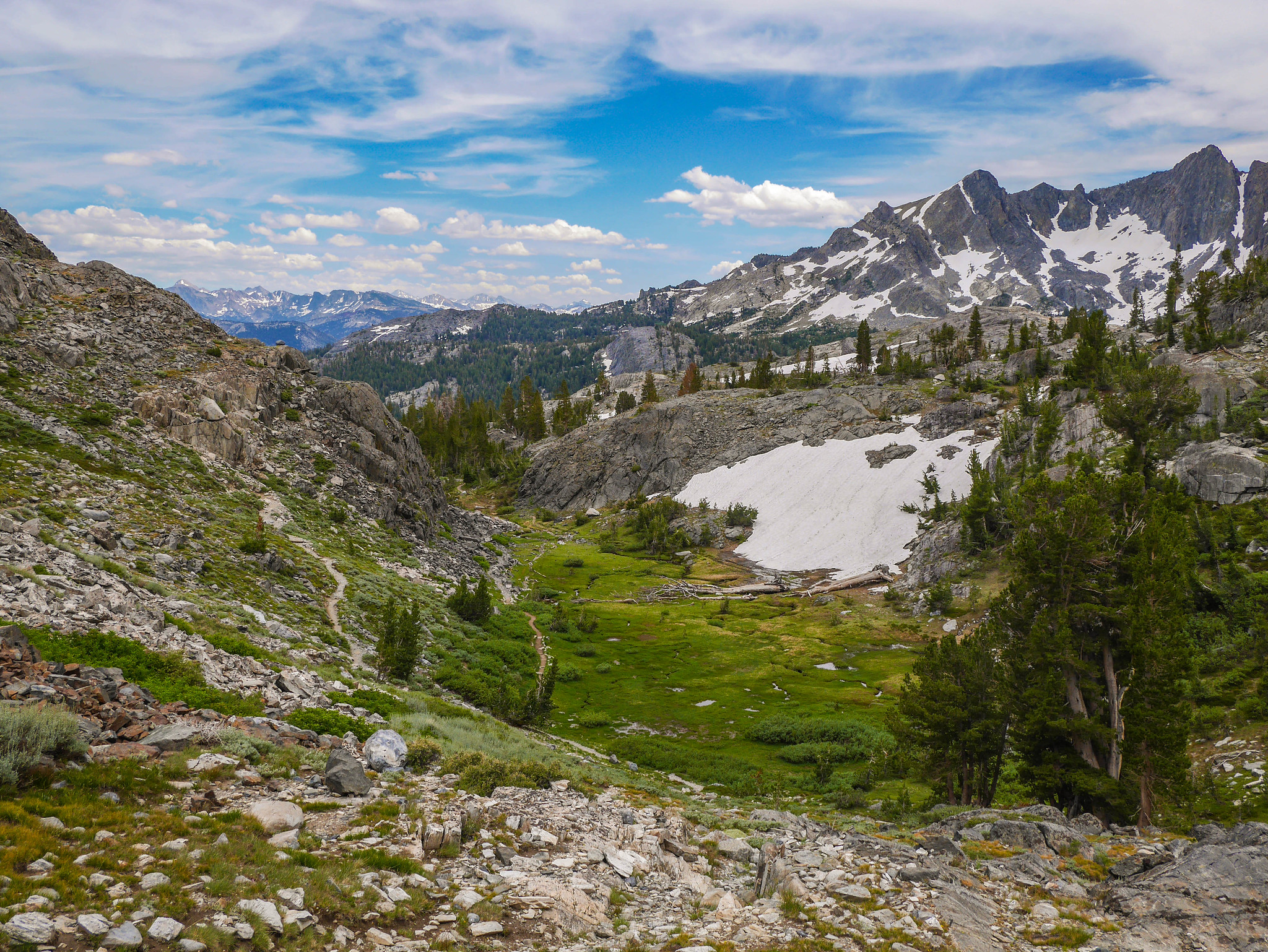
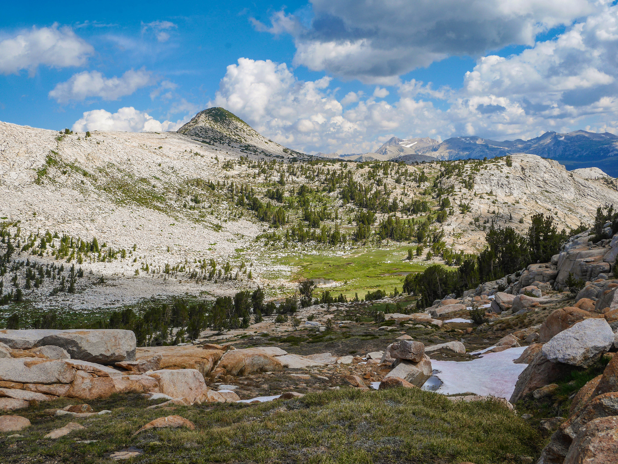
My plan was to walk up the granite ramps, first to the left and then to the right, up to the wide saddle, where I’d find some tarns to navigate around before reaching the pass south of Ameila Earheart Peak.

I walked up granite slabs from near the trees on the right, diagonally up to the left, where I tried to connect with some grassy ramps I’d heard would bring me back up to the right above the steep cliff face.


I got a little tangled in a maze of ramps, but spotted this young buck along the way.

Soon enough I found the grassy ramps I was looking for.

And I followed them all the way up.

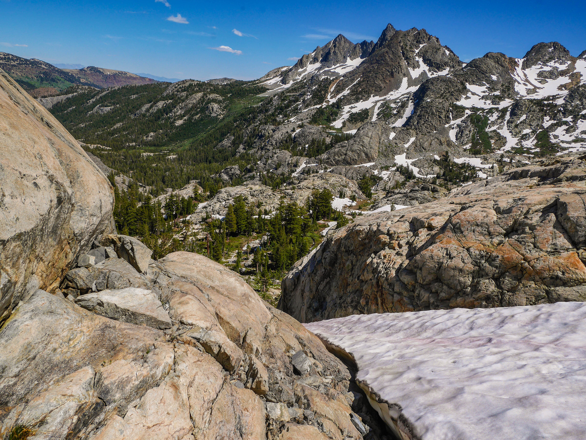
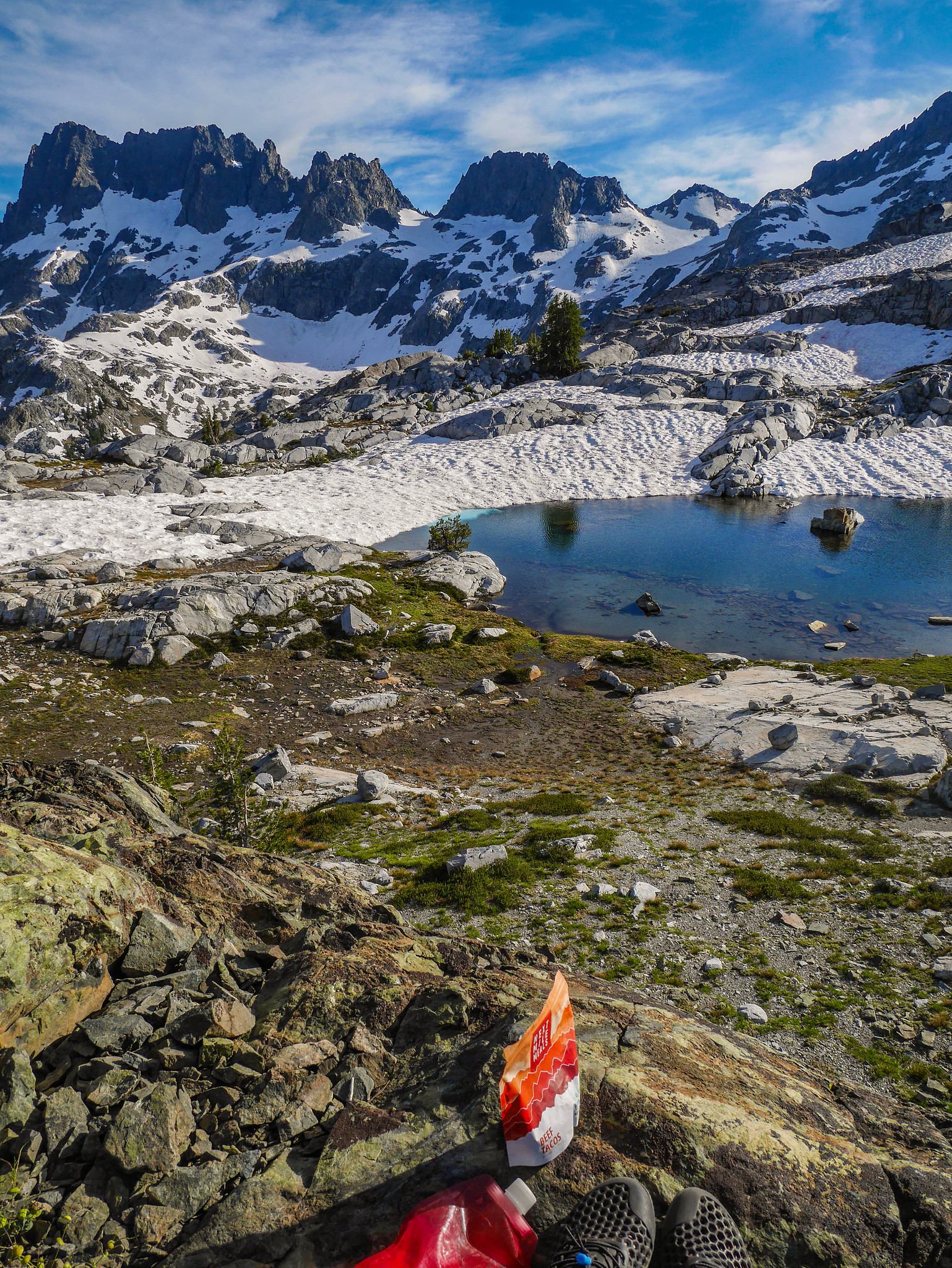
I took a short snack break and surveyed the next part of my route. I went across between the tarns and then crossed the snowfield in a narrower, less steep part. Then it was chunky slab walking all the way to the ridge.


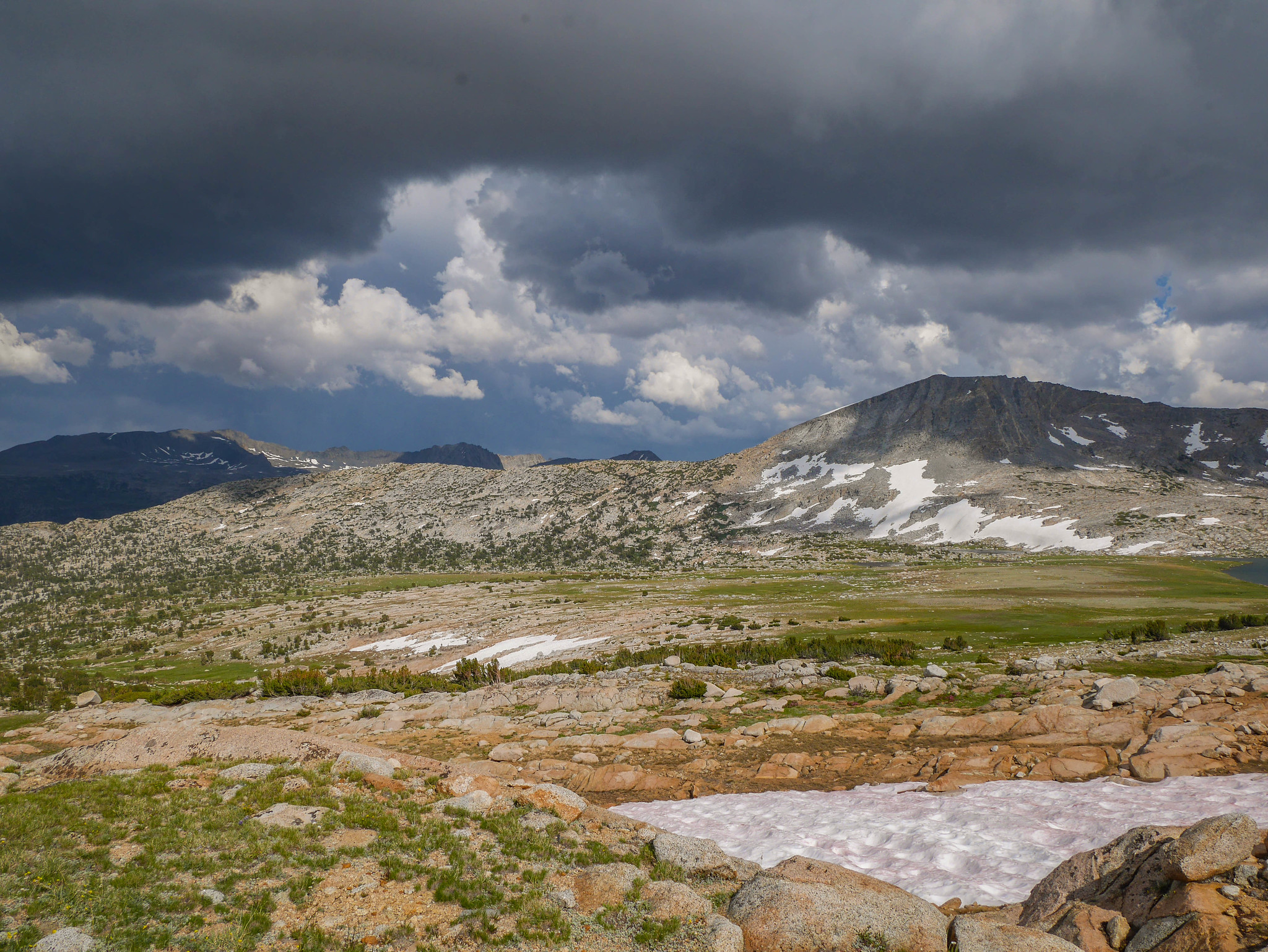
The arrival of more clouds did make for an interesting texture to the sky, but they also signaled afternoon thunderstorms. Although the views up there were absolutely spectacular, I didn’t linger atop the pass long before picking my way down towards Ireland Lake.

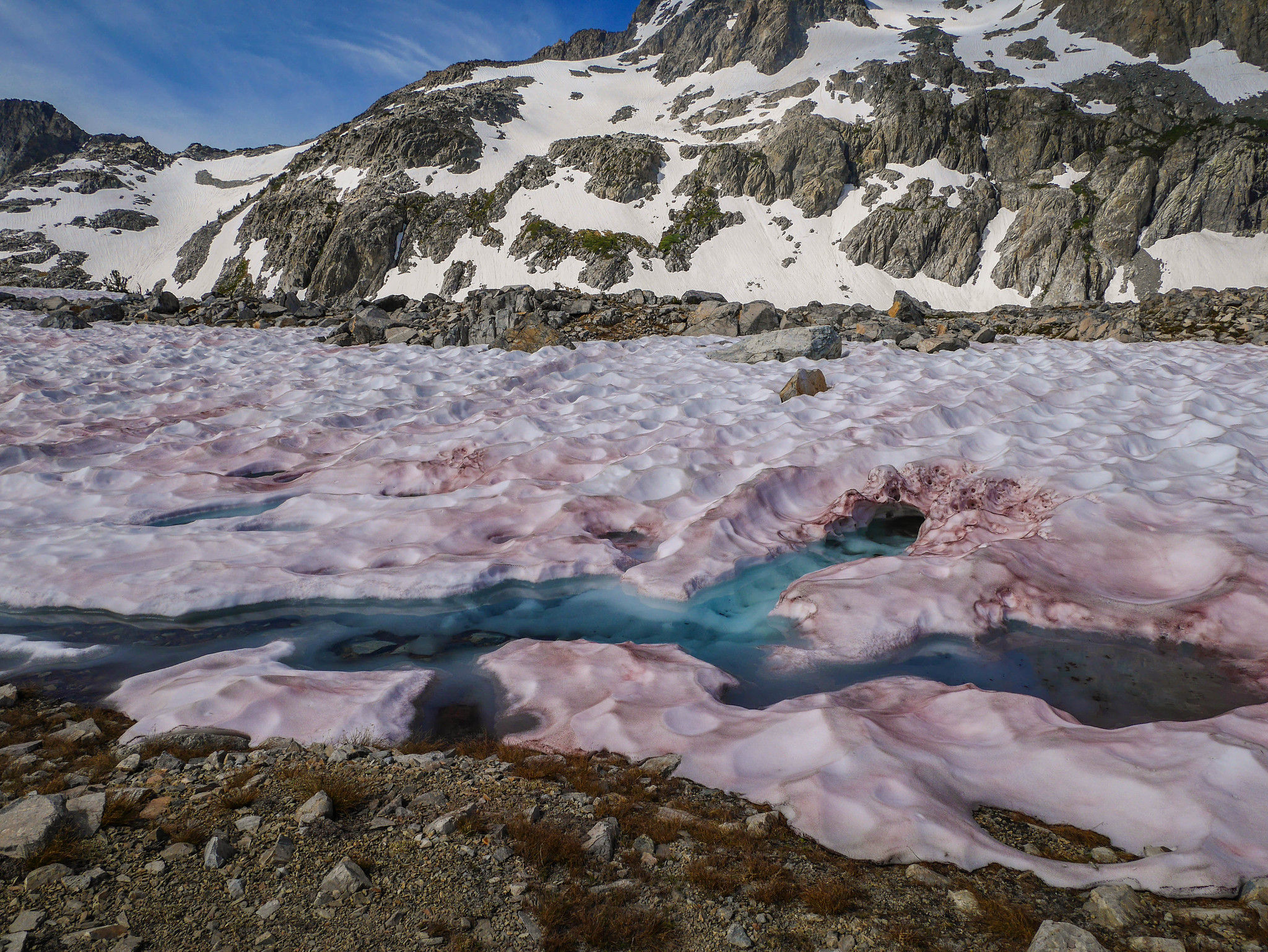
This had been a big snow year, and you know what they say about big snow years—big sun cups. Some of these were as deep as my thighs.

Looking back towards the ridge from where I’d come. I picked my way between snowfields until I was down in the flats and I couldn’t avoid them.
The terrain in here was a little convoluted and required some micro routefinding to get down to Ireland Lake. I don’t remember exactly where I went, but I do remember that I had to backtrack a couple times after arriving at something too steep or too filled with snow.


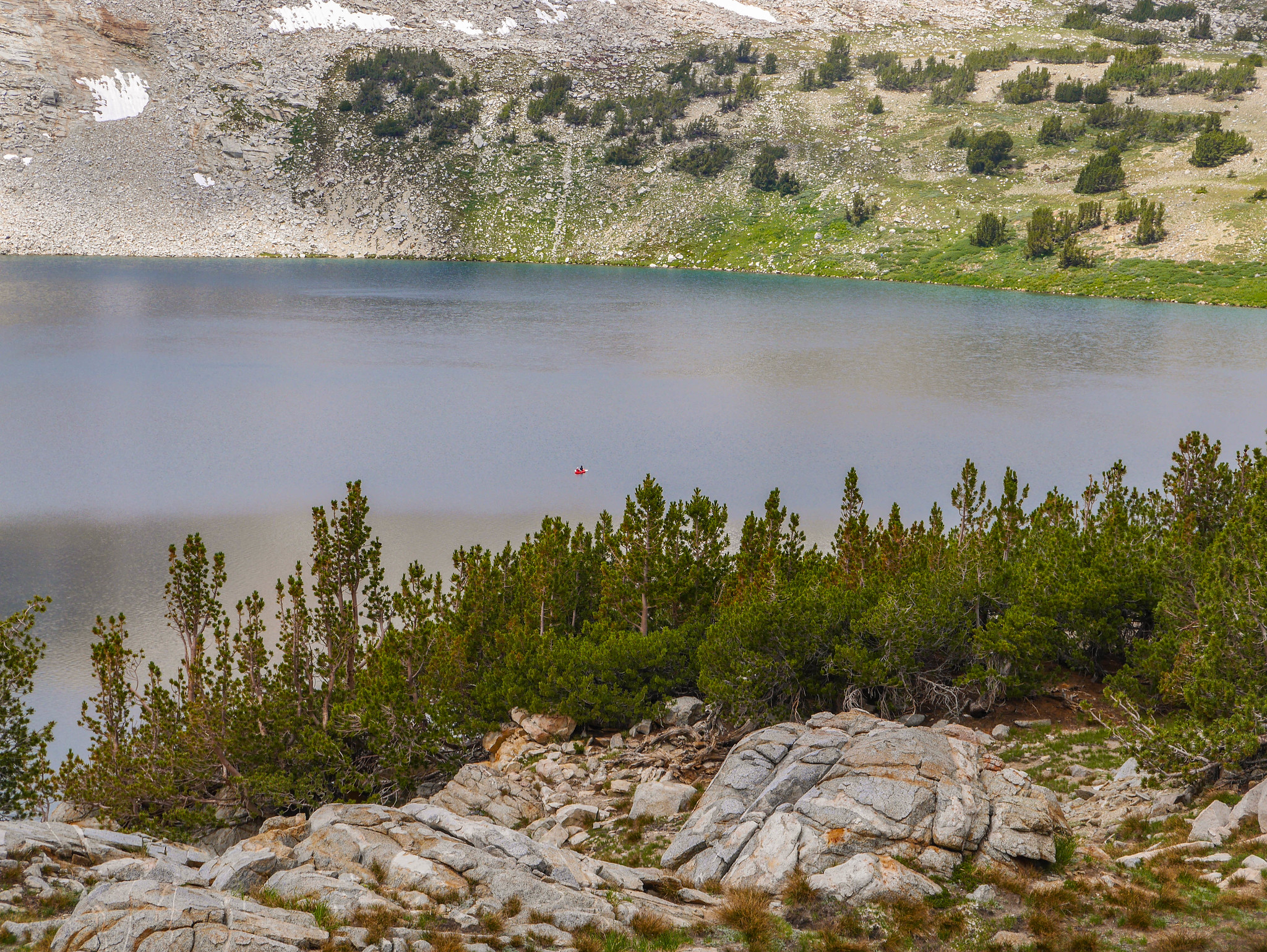
From my vantage point high above Ireland Lake I spotted a kayaker! Now that’s dedication. Hiking in a kayak. Wow.

Once down at the lake, I crossed its outlet stream and then had another little break. I hemmed and hawed about what to do, with the clouds building. My next destination was over a little saddle just north of Peak 11,480, a shortcut avoiding the trail that would get me to Fletcher Lake. But my did it look barren up there. Not really a great place to be if the weather decided to get grumbly.

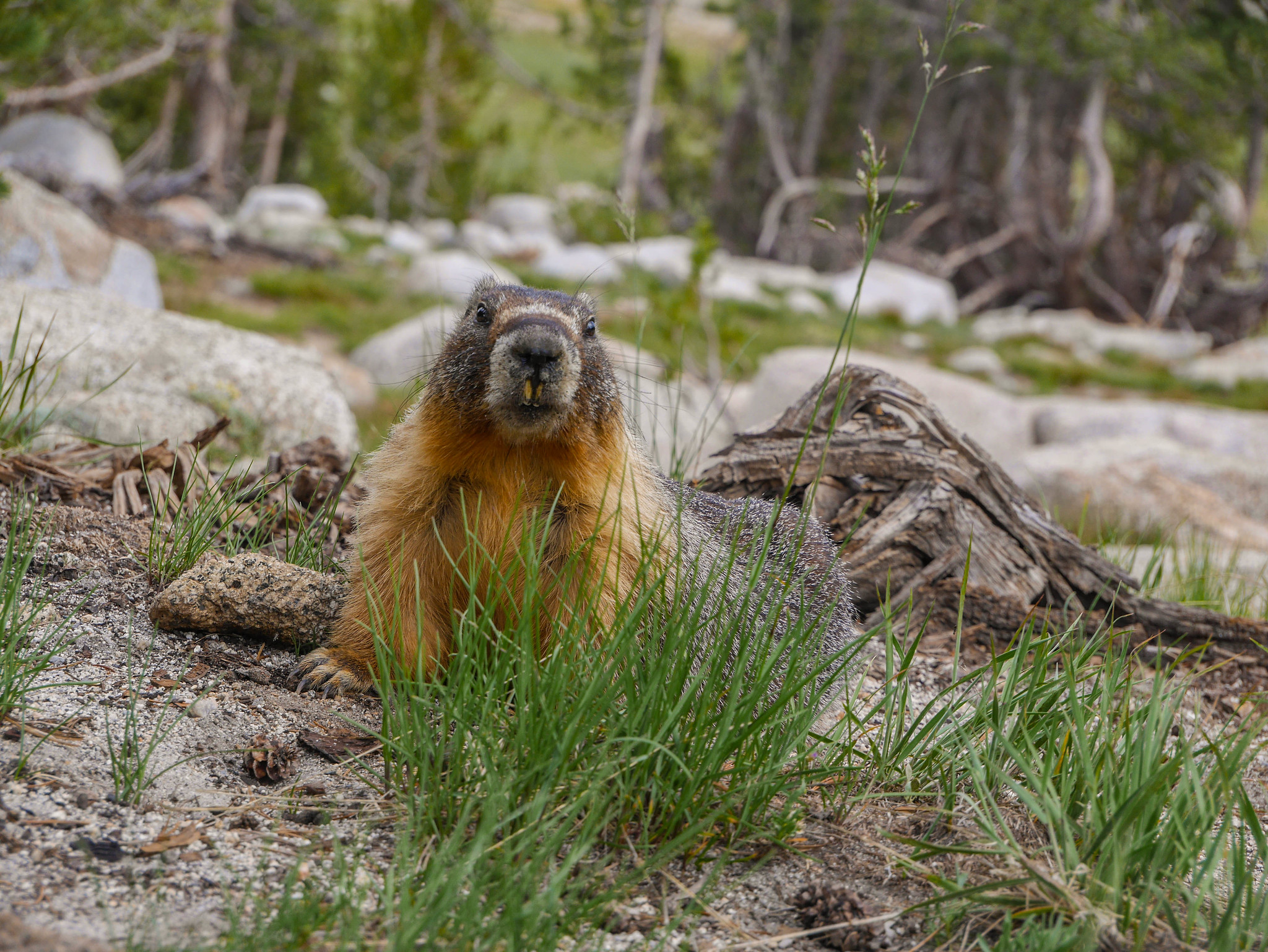
I headed partway over there anyway, into some low scrubby trees and pitched my tent. I ate Reeses Pieces and chatted with a marmot while I waited to see what the storm would do.
It did this, so I was glad for my caution.
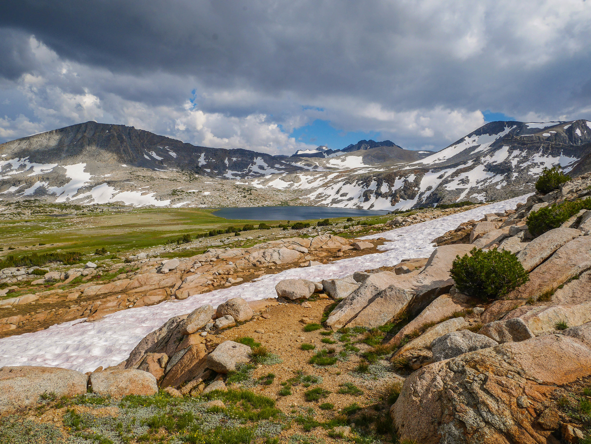
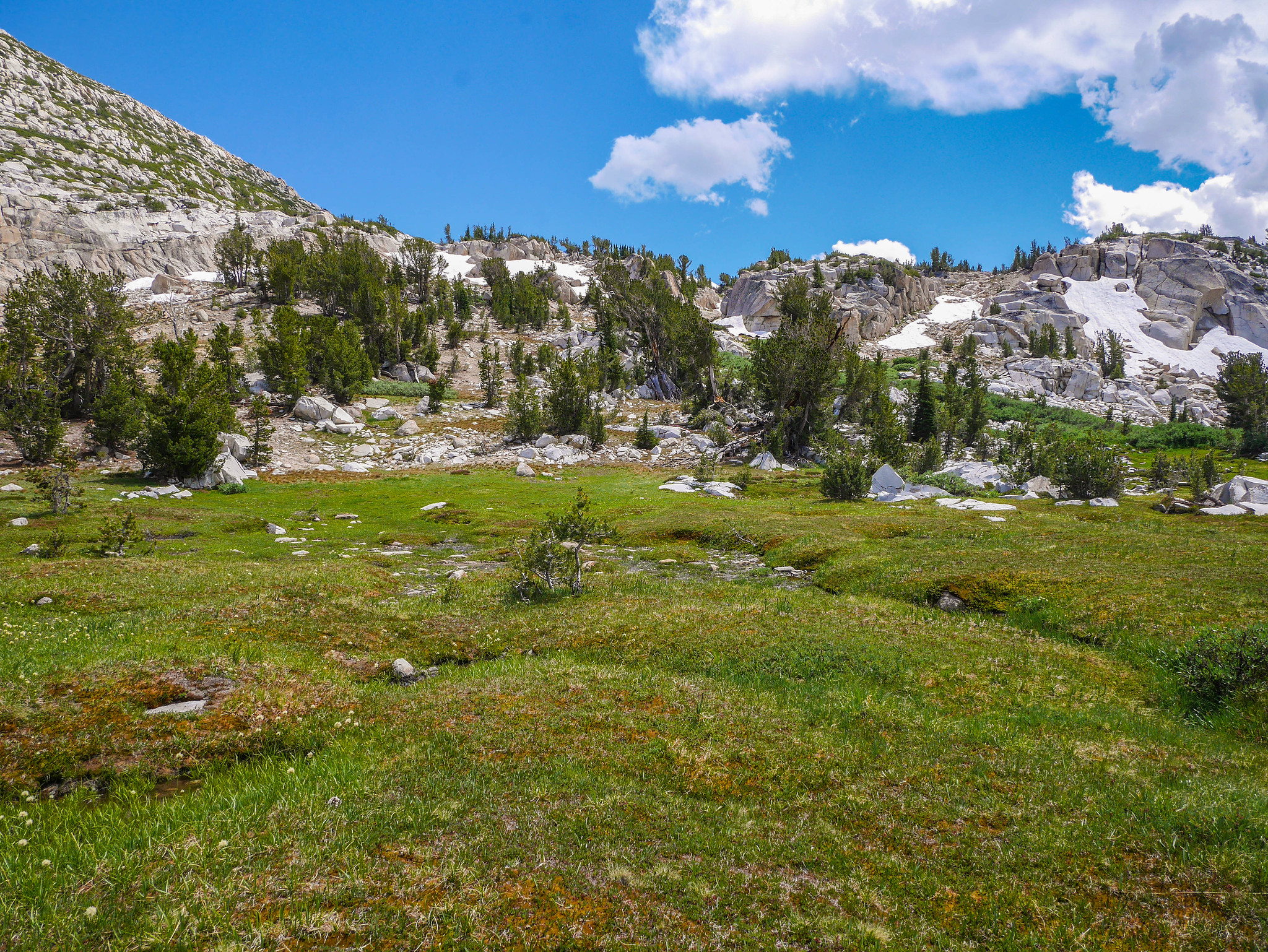
But, as is often the case in the Sierra, it blew on through after throwing some lightning at the peaks to my south and thoroughly soaking the meadow near Ireland Lake. In the after-storm clear, I climbed over the ridge and down the other side through magical hanging meadows. There was a bit of hmmm where should I cross this wide pond-y creek, but before long I was bootskiing down loose sandy gravel to Townsley Lake.


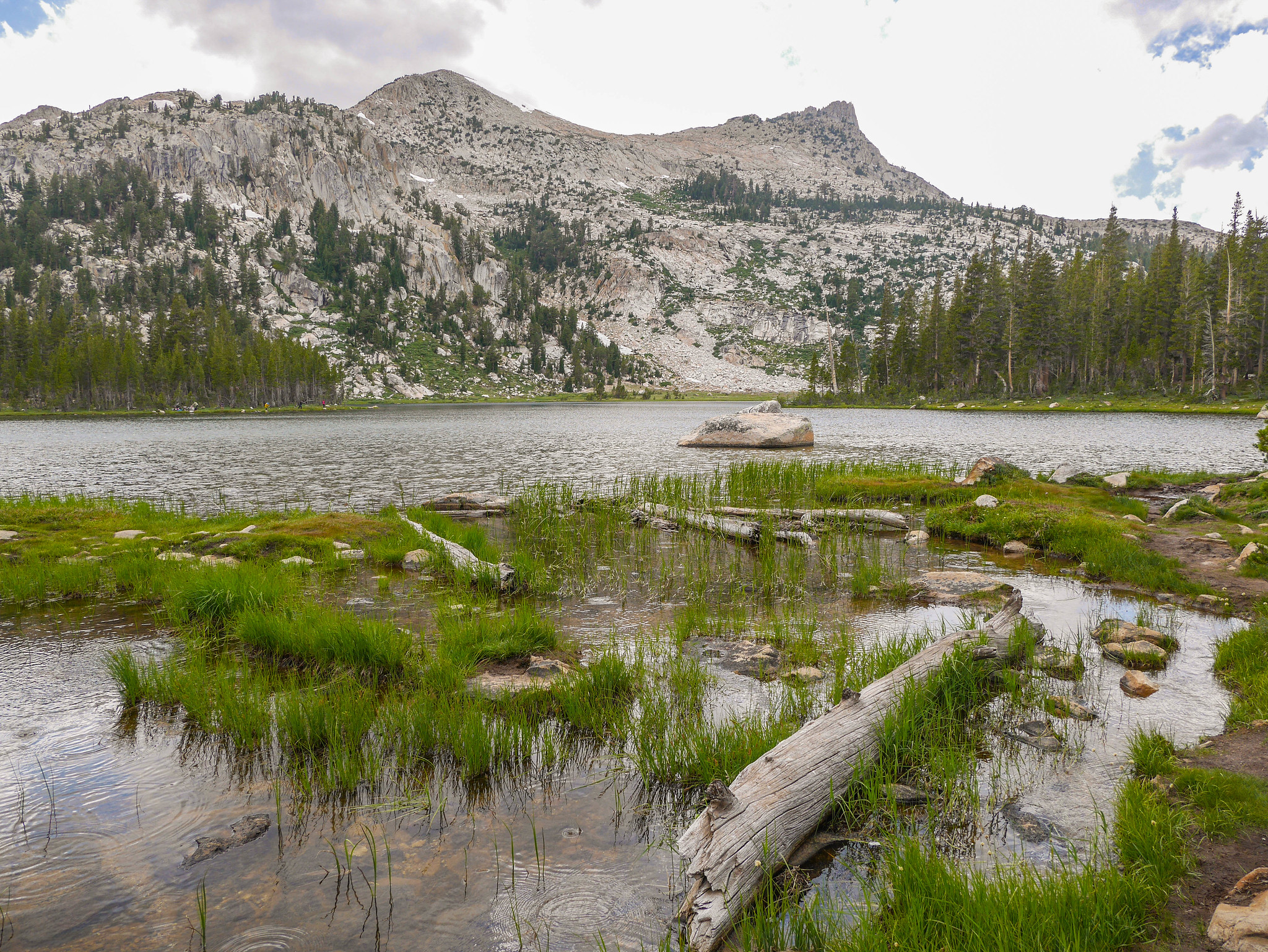
Camping down at Fletcher Lake isn’t allowed, so I snagged this nice little ledge spot to call home for the night. I ate dinner as the sun sunk behind the ridge southwest of Rafferty Peak and bathed my little home in all its warm glory.


Day 5
Townsley Lake to Tuolumne via Johnson Peak + Elizabeth Lake
4.5mi +500ft/-1,300ft, plus 5mi +1,100ft/-1,800ft xc
I woke to a few scattered clouds, had breakfast, and headed down to catch the JMT near Fletcher Lake. The plan was to hike north just over Tuolumne Pass—barely a pass though I guess the trail does go up and then down—and then leave the JMG and hike up the shoulder of Rafferty to a small hanging valley before crossing over the ridge south of Johnson Peak.


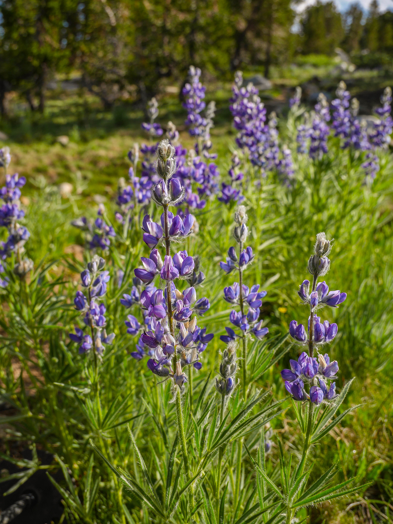

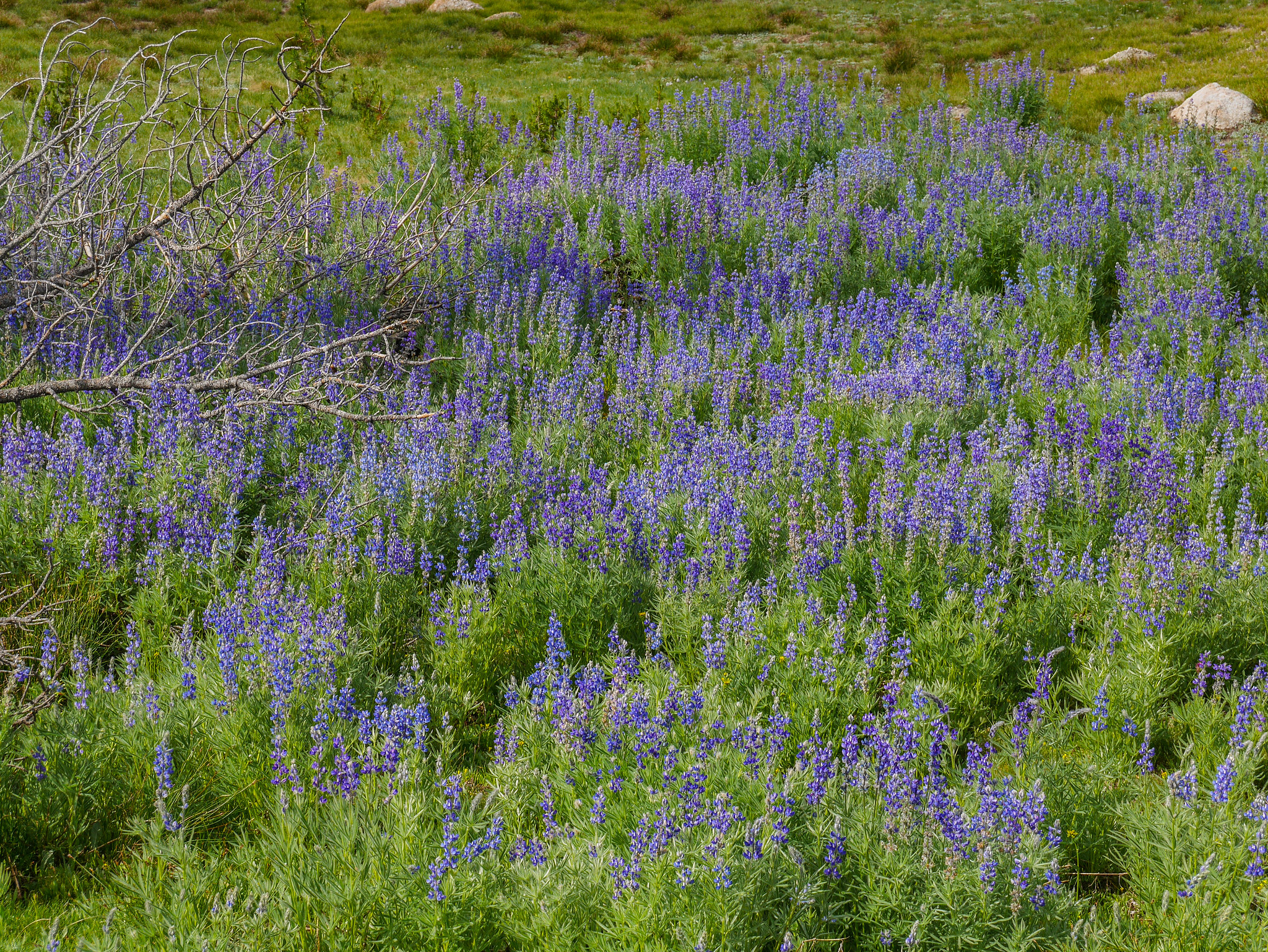
I got a little distracted and side tracked by acres of thigh high lupine.


As I climbed a helicopter was making trips back and forth to Vogelsang, perhaps bringing supplies for a trail crew. I don’t know. It didn’t seem like a rescue operation, though.

I continued to climb up grass and ledges, though I was going perpendicular to their flow so the going was somewhat annoying walking up and down when the spot in front of me was too tall to hoist myself up.


The views back towards Vogelsang got better and better as I climbed.
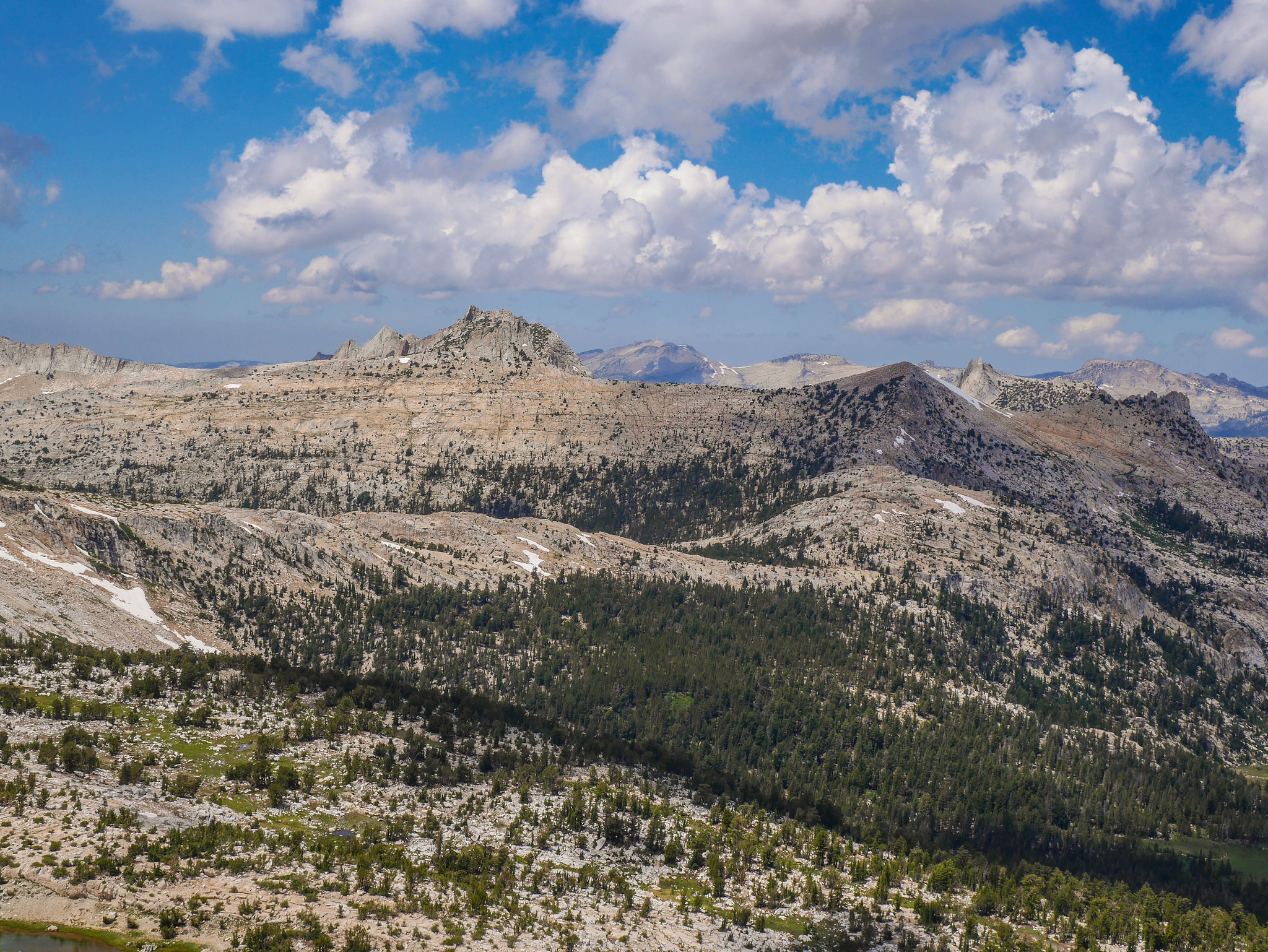
And then I crested the ridge and saw this absolutely spectacular little hanging valley. This would be an amazing place to camp in the future. I continued on, down relatively easy grassy gullies and across the meadow towards the trees in the distance. I would climb through them, then up to the left to reach the ridge.
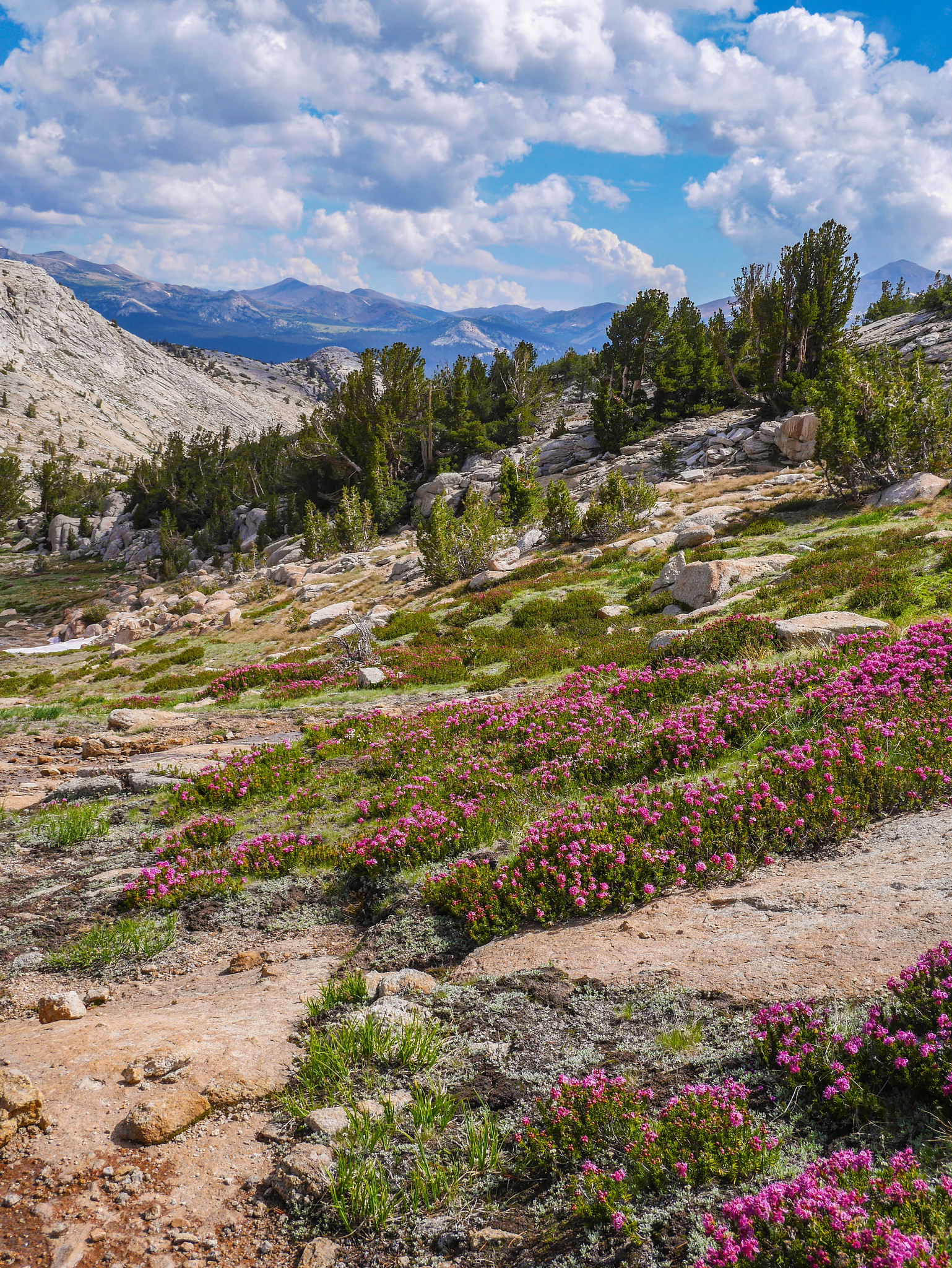
The broken granite slabs below Johnson Peak were knit through with heather in full bloom.

At the saddle I ditched my pack, bringing just a bit of water and a snack to climb the Class 2 route up to Johnson Peak, a few hundred feet above me to the north.

The view from the top is like a who’s who of Yosemite—you can see just about every famous Tuolumne area peak since you’re standing atop one of the lesser-known ones. There’s Rafferty, Vogelsang, Fletcher, Florence Lyell, Maclure…
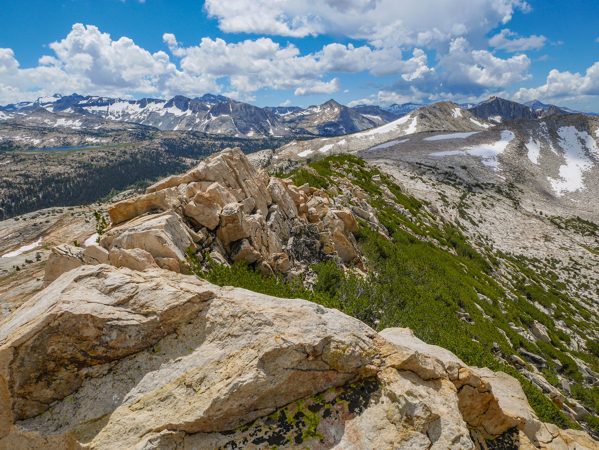
Kuna, Blacktop, Donahue…

Ragged, White, Conness…
Unicorn, Cathedral, Cockscomb…
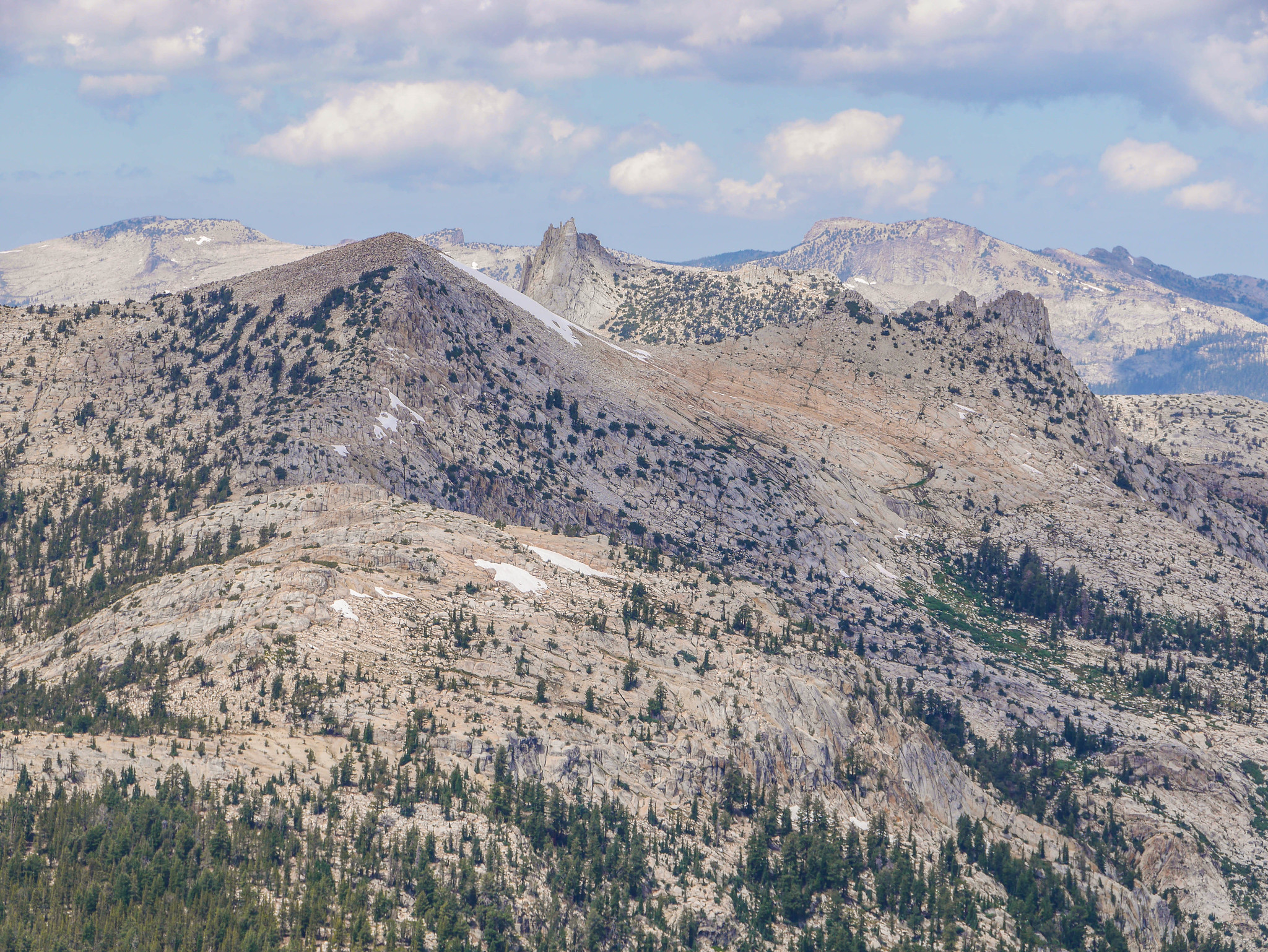

The Matthes Crest and just… wow.


After opening and closing my mouth a bunch both to express awe and also to eat snacks, I started scrambling back down. I went a slightly different and more annoying way. There were trees choking large boulders and I definitely got myself in some awkward positions.


I grabbed my pack and walked down easy granite slabs to the west, then down past some incredibly endearing tarns.


I used the tarns outlet streams as a handrail and followed ramps down into the forest. I knew that if I kept not too far from the creek, it would take me down to Elizabeth Lake where I could pick up the trail down to Tuolumne.

I saw a tree with a butt.

And a weird bloody smear on a rock.

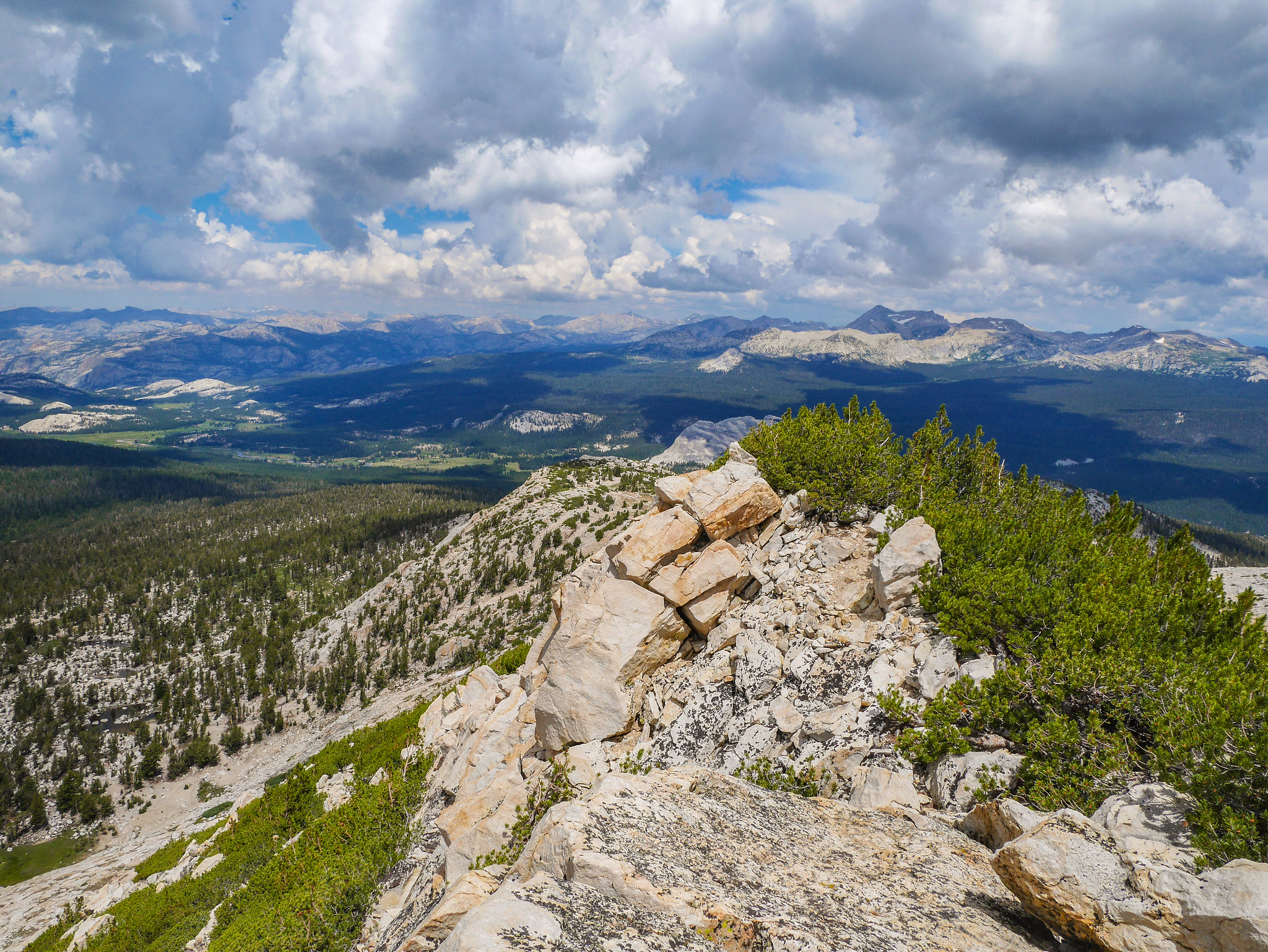
And then a lake. And LOTS of people for the first time since the kayaker on Ireland Lake.
Look at how huge this trail is! I hoofed it on back and made it to the Tuolumne Meadows Store around 1pm for lunch and a relaxing adult beverage before returning to my car for the journey home.

Want to do this trip yourself? You’ll need an Inyo National Forest Wilderness permit for Shadow Creek. If you want to skip the Nydiver Lakes portion, you could alternatively use any of the other trails heading north from Agnew Meadows. The Mount Ritter and Vogelsang USGS Quads will be helpful. You might also want to pick up the National Geographic Trails Illustrated Yosemite SE Ansel Adams Wilderness (#309) map.

I love your photo of Banner Peak from your camp above Thousand Island Lake. I also love that area on the ridge between Nydiver and Ediza Lake with the view of the Minarets above Iceburg Lake. Very interesting x-country route beyond Donahue Pass. Awesome trip! Thanks for sharing.
Lovely commentary and some very nice photographs. I’ve climbed Ritter and Lyell with a German Shepherd, although on different trips. I’ve also walked from Agnew Meadow to Yosemite with a Shepherd, almost passing a ranger in the sandy braids of the Lyell Fork of the Tuolumne. Just over the top of Donahue Pass is a killer camping area, right near a gentle section of the stream, which was terrific for swimming and floating… You really didn’t need that tent, at least not everywhere. In those days, I was carrying a Nikon, now a 4 x 5″ view camera. I have a short folding ladder, I can immediately see how I would have used it for several of your perspectives on, otherwise, flat terrain. We should talk. I publish in L.A. You did the beauty of the region justice; it was a thrill to reminisce through your eyes. Thank you.
Wonderful! I’ll be in this area in September, 2023. I’ve been there three times before over the last 30 years? Your story and photos were inspiring!