
Who: Just me!
What: Backpacking
When: 6/17/14-6/19/14
Where: Kings Canyon National Park
Mileage: 13 miles on trail, 7 miles cross-country
Elevation gain/loss: +4300ft/-4300ft
More photos: here
This was the second trip of my road trip encircling the Sierra and my third solo trip ever. I was really excited to explore Dusy Basin, hoping to find some solitude and fantastic scenery. I was not disappointed! I had considered heading over Knapsack Pass and down into Palisade Basin for the second night, but after a brutal talus slog with a full pack (due to a poor route choice), I decided to stay in Lower Dusy Basin for the second night. Two nights is not nearly enough time to explore this gorgeous basin. The cross-country travel is easy, with landmarks everywhere and little to no underbrush to worry about. It’s a great place to explore if you’re interested in getting accustomed to off-trail travel!
Day 1
Bishop Pass Trailhead to Upper Dusy Basin
6 miles on trail, 1 mile cross-country, +2300ft/-600ft
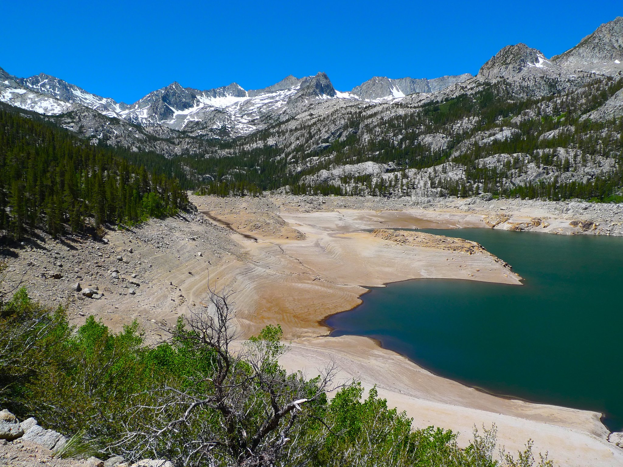
After getting a late start due to sleeping in after my talk at Harvey Mudd on Monday, I was greeted with this incredibly depressing view of South Lake. So dry, so sad.
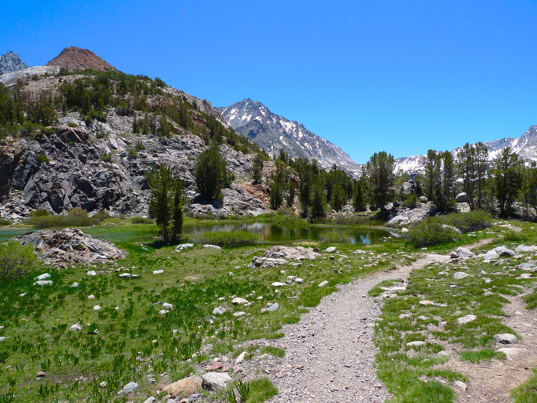
But quickly enough the trail climbs (onward and upward!) away from South Lake, a bit steeply at first, heading towards Long Lake, passing Chocolate Peak on the way.
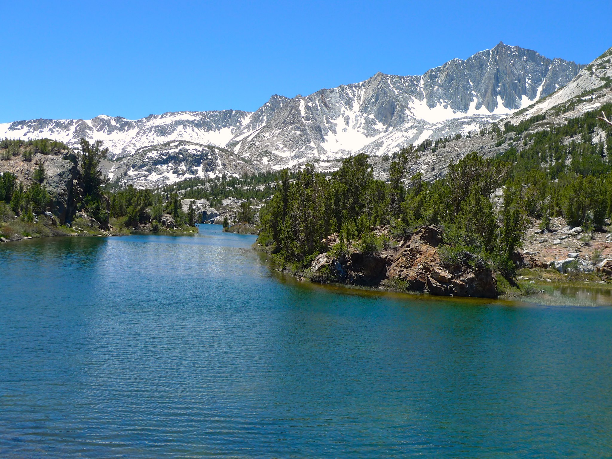
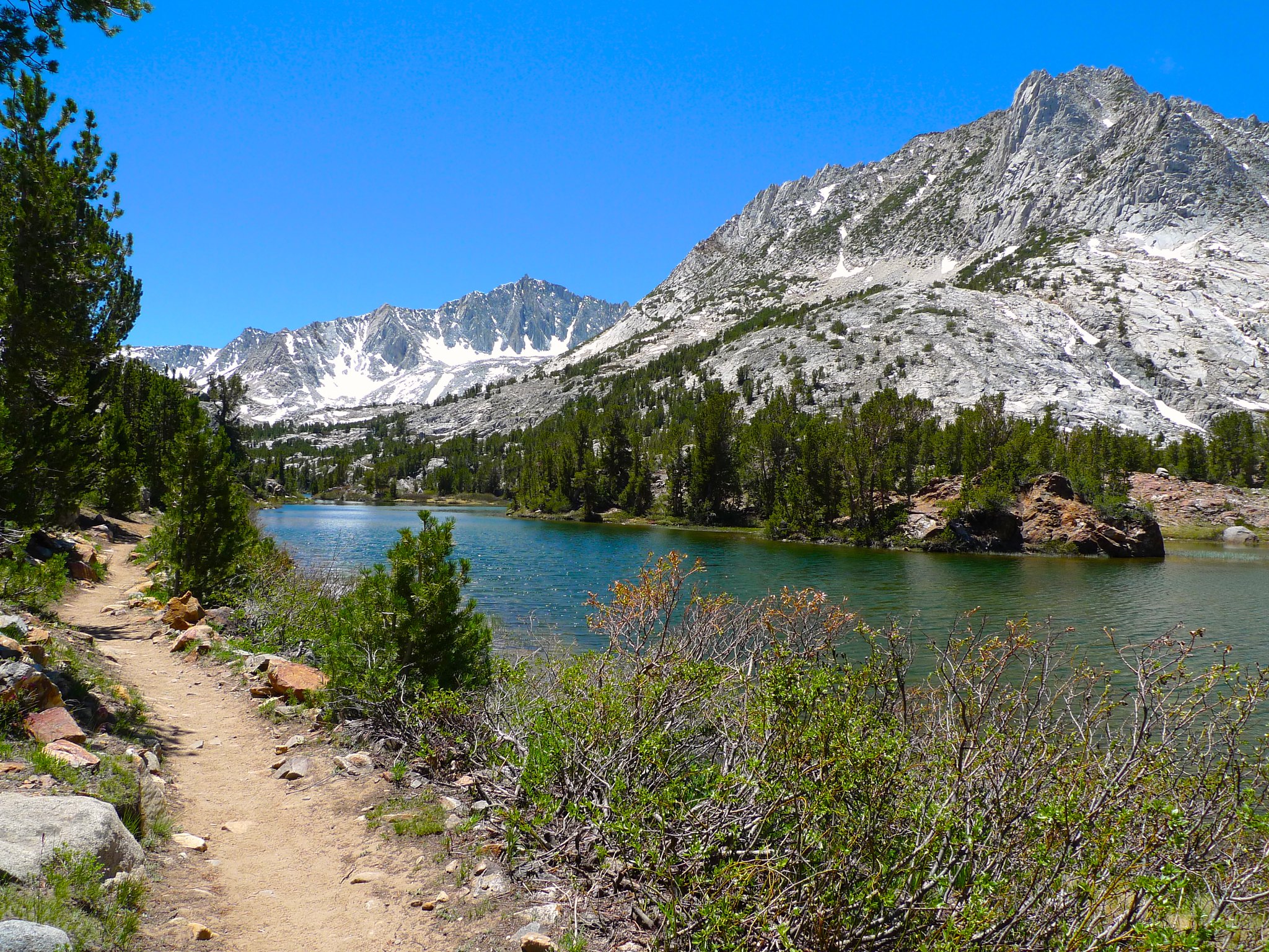
Upon reaching Long Lake, the trail mellows out and hugs its shore.
Soon, the trail begins to climb again out of the basin around Long Lake and up towards Saddlerock and Bishop Lakes. The Bishop Pass trail follows a boundary between different types of rock, making for a colorful journey.
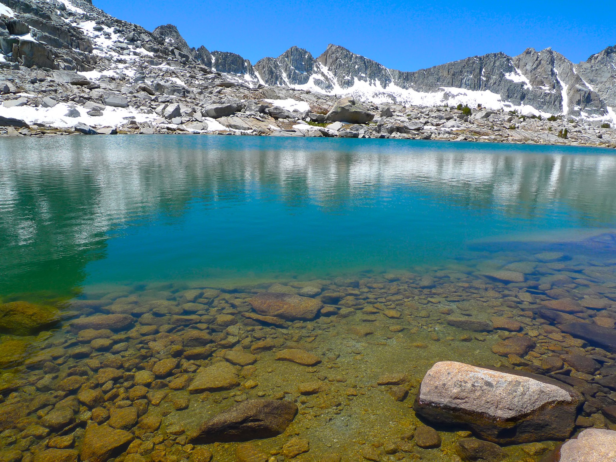
After a gentle climb, the trail reaches glacial Bishop Lake (actually a grouping of lakes). I couldn’t get enough of the glacially carved slope descending from Mount Goode into the turquoise Bishop Lake basin.
Starting the climb up to Bishop Pass in earnest, the view back down along the basin makes clear the difference in color between Bishop Lake and the lower lakes. Bishop Lake is turquoise because of rock flour deposited by the glacier that carved its basin.
I continued up the switchbacks, meeting one daunting (40 degrees, but short) snowfield before the trail flattened out. There was still a couple hundred feet to gain before Bishop Pass, but the grade was fairly easy as I passed two more snowfields.
Across the pass, I got my first teaser views of the peaks surrounding Dusy Basin. A JMT hiker on resupply was friendly enough to take a couple photos of me with this dramatic backdrop.
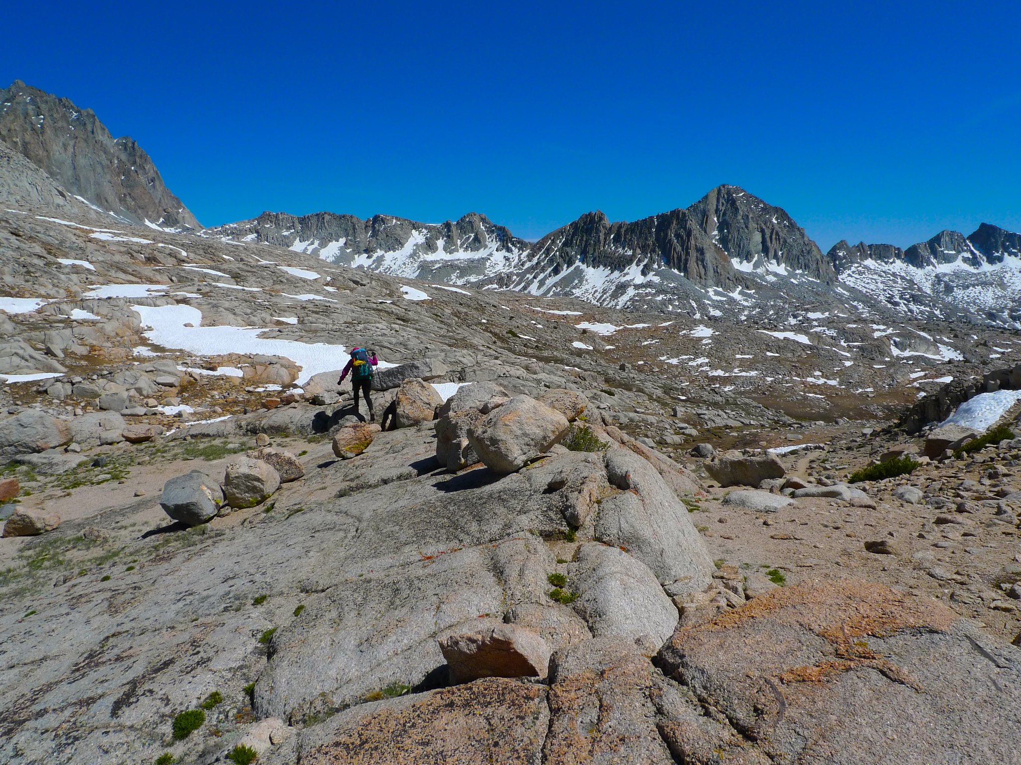
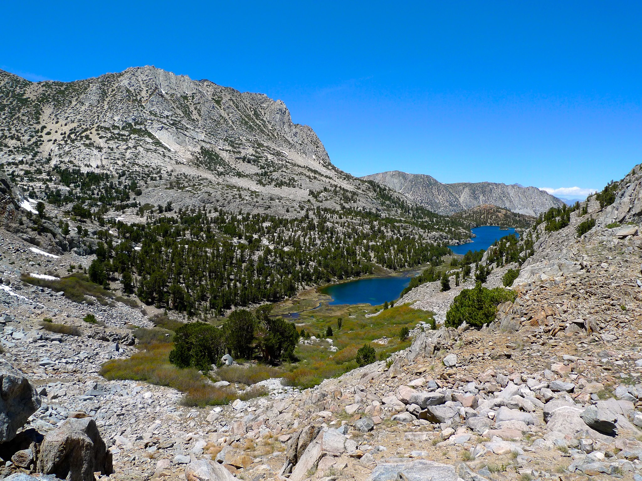
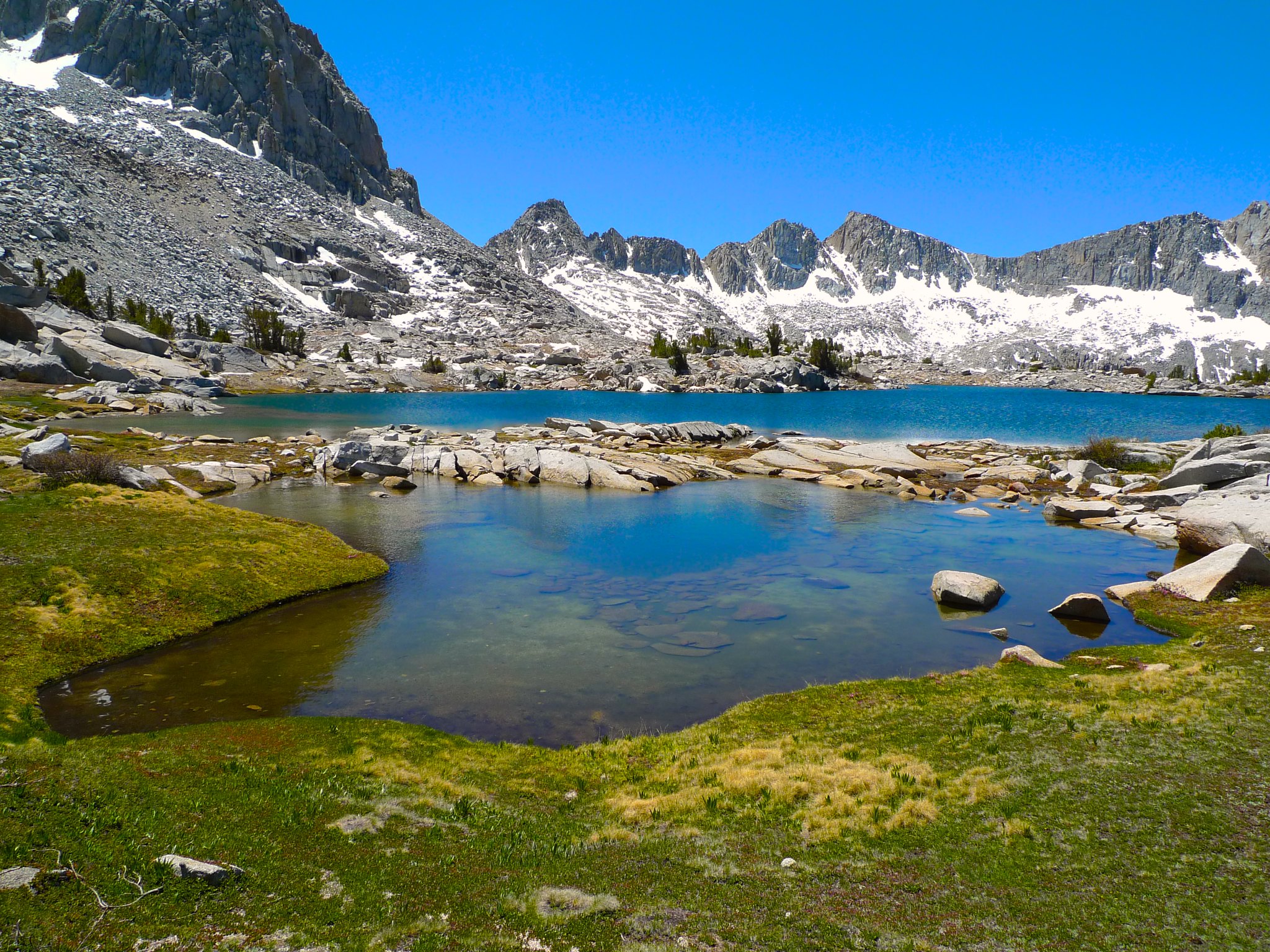
Soon, I headed off the trail and towards the northeastern most lake in Dusy Basin, where I’d make camp. The going was very easy through a flat meadowland creek drainage.
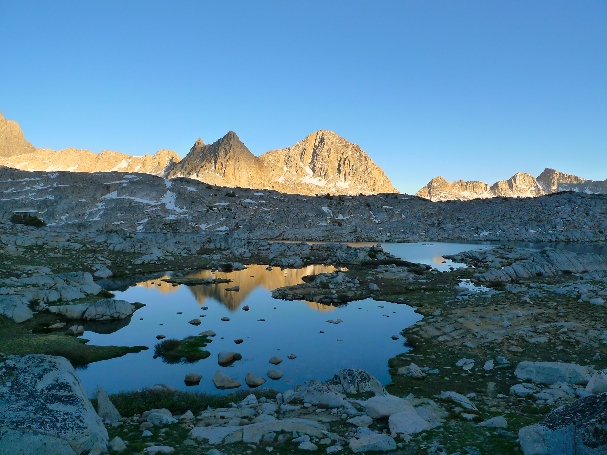
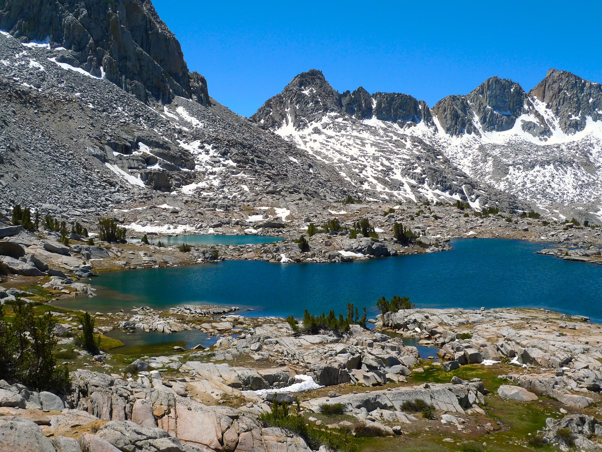
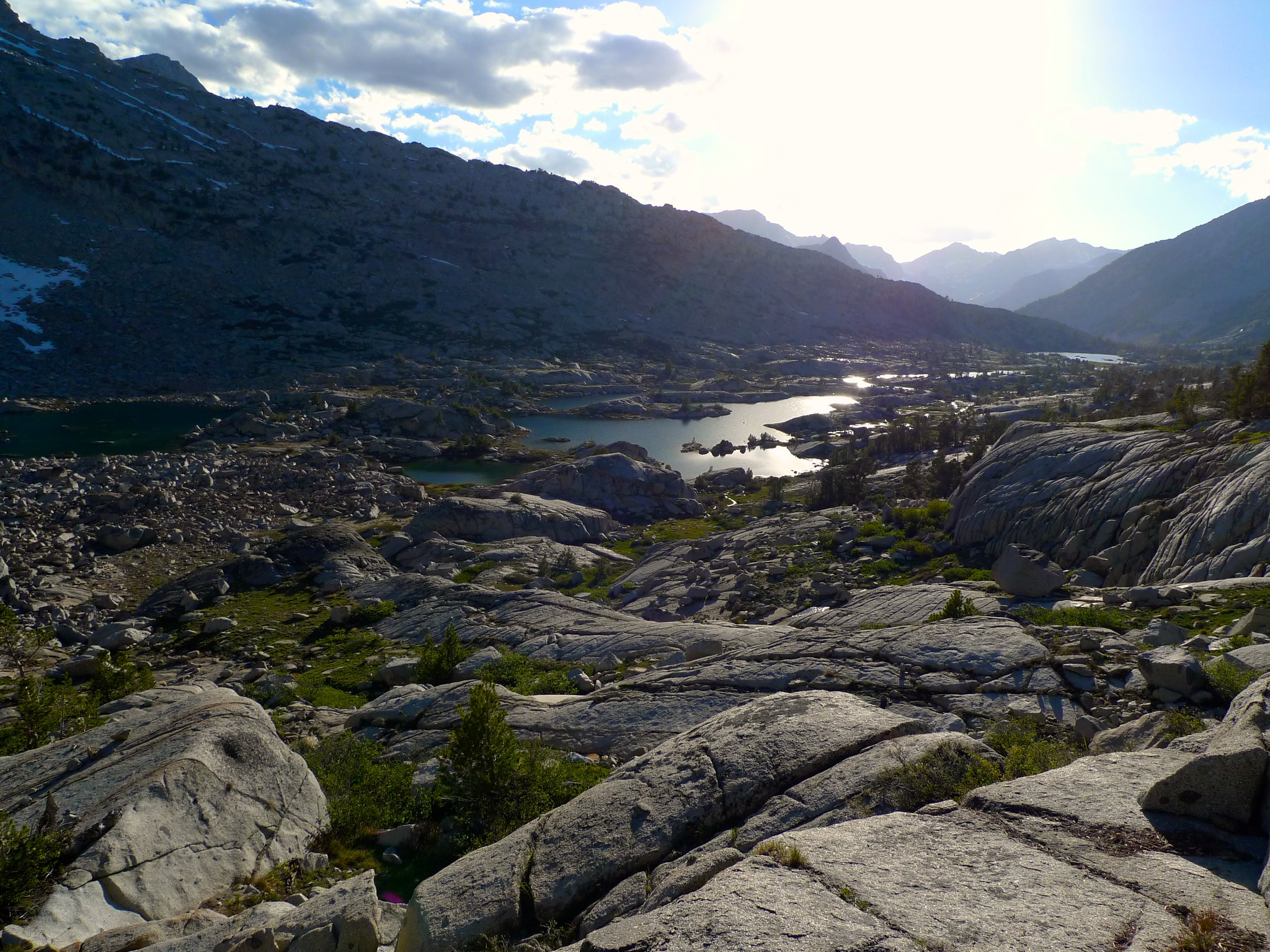
I was stunned with my first view of this lake in Dusy Basin. I’d considered camping at Lake 11388, but when I saw this view, I decided I had to stop and spend the night here.
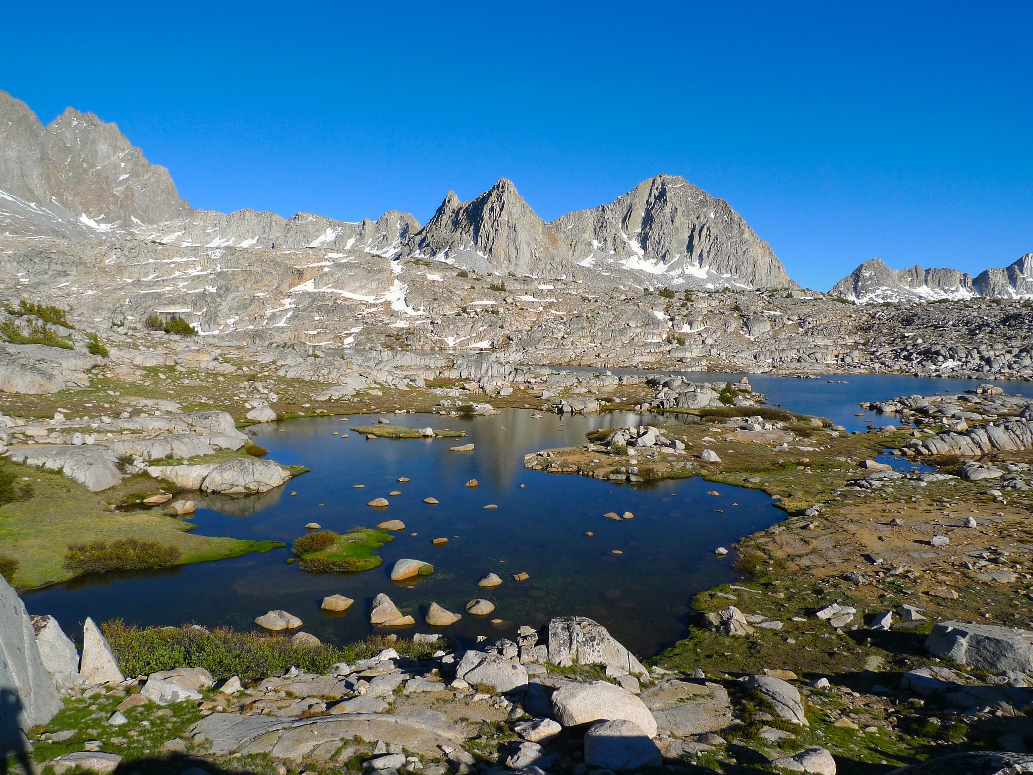
I grabbed an absolutely perfect spot to set up camp and wandered around taking pictures and soaking in the immense beauty of the basin. I was surrounded on all sides by nearly-to-over 14k peaks, amidst a rocky meadowland that I had entirely to myself.
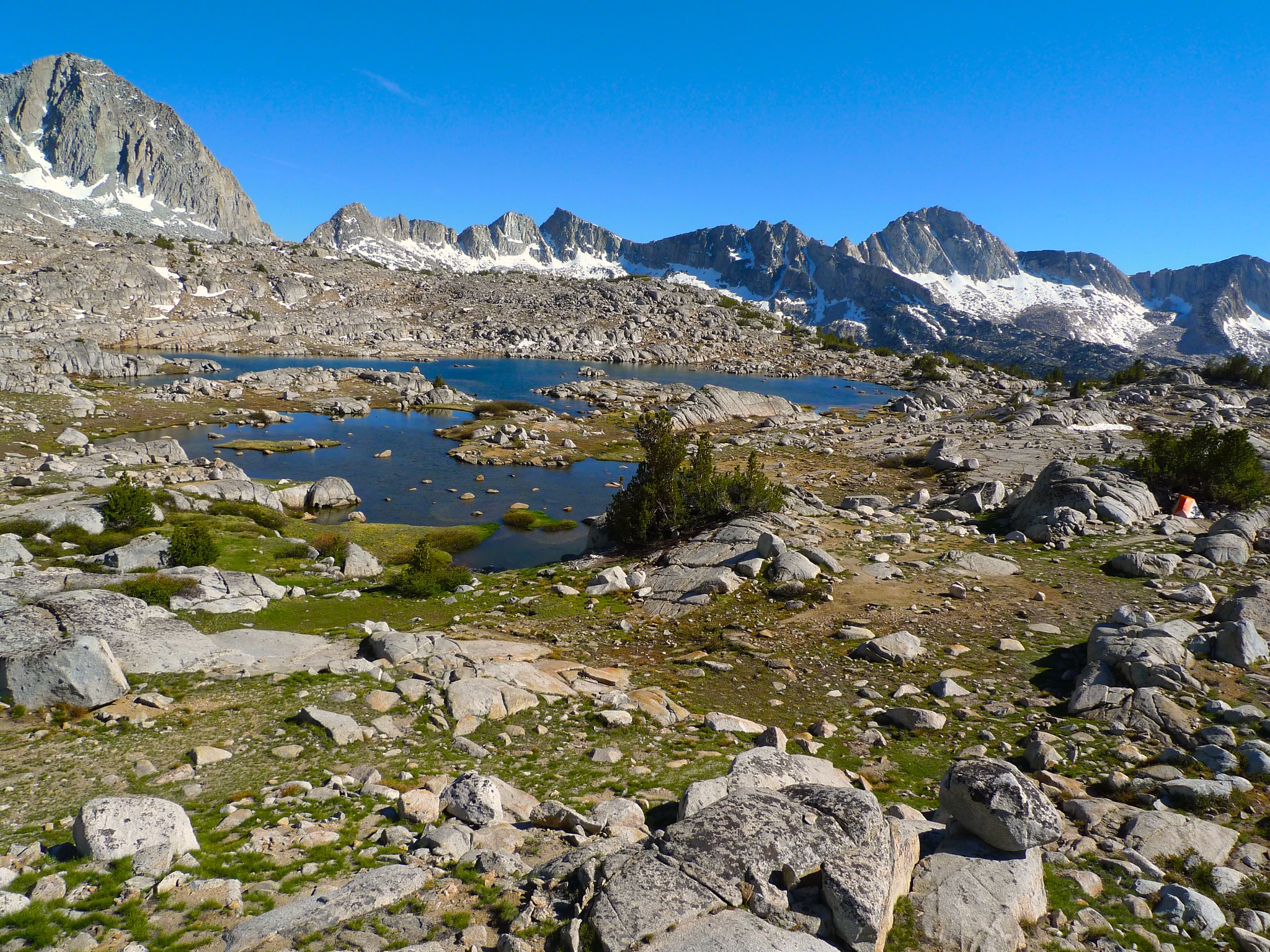

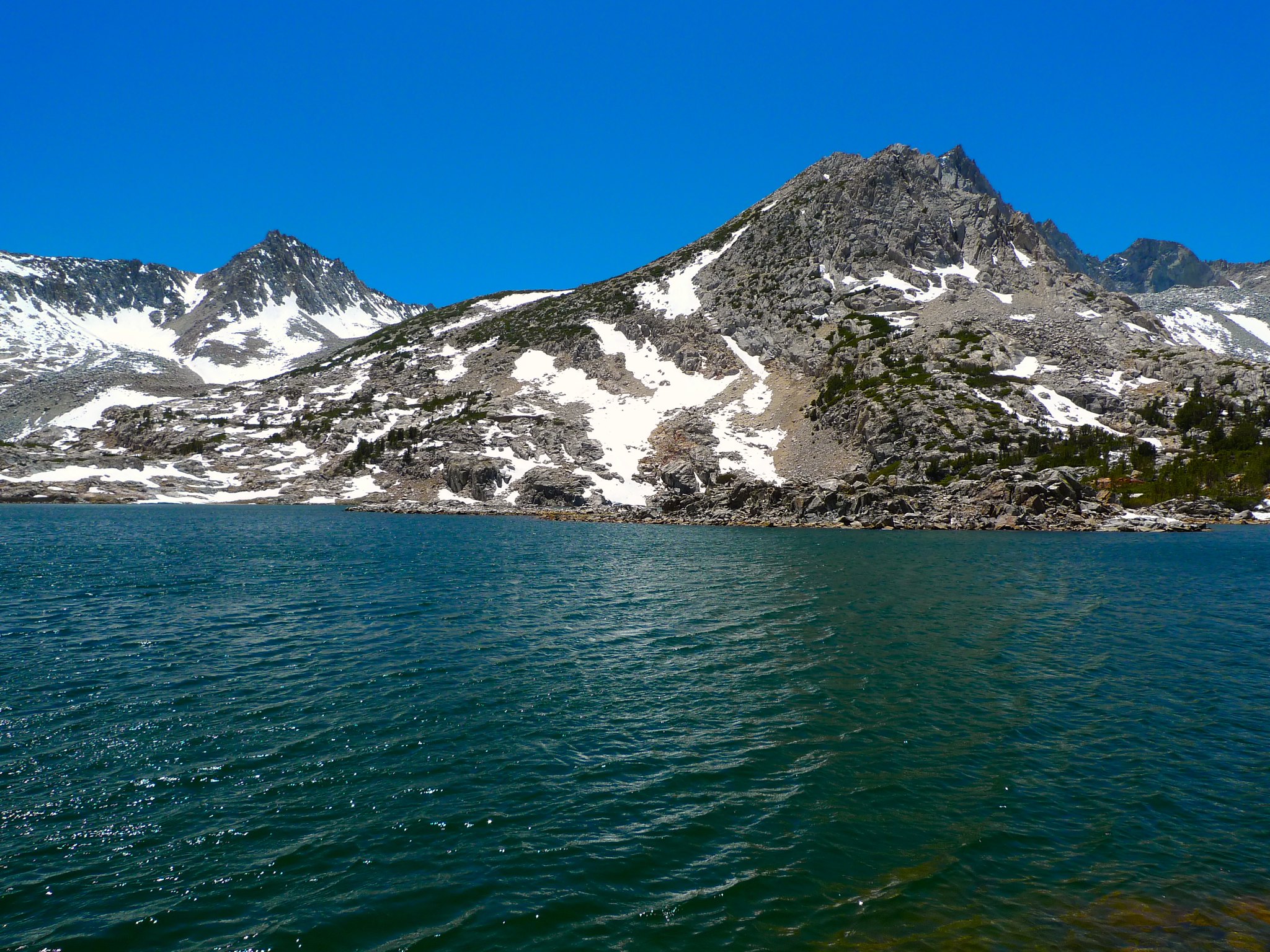
That is, until a couple walked right through my camp as I was cooking dinner. I think they were surprised to see me. I said hello and they said hi back and walked on. I heard the girl say “What do you think? Down there?” And I started to worry a bit a bit. The walked not 50 yards and dropped their packs on an illegal spot literally on top of the lake between me and it, between me and my beloved Isosceles and Columbine Peaks. On the flat spot you see right in the middle of this picture:
Well I just couldn’t handle it. With this whole basin empty, with literally dozens of perfect, secluded campsites to be had at this very lake, why on earth would they choose this one? I put my dinner on hold and walked down to where they were resting, hoping to catch them before they started unpacking gear. I politely told them that, in my exploring, I’d seen a bunch of other much better campsites where they could have privacy (rather than me looking directly down on them) and we chatted a bit. They understood and moved on. They would be the last people I’d see until I crossed back over Bishop Pass on my way out 42 hours later. I had my sense of solitude again (knowing that they were nearby, but at least not anywhere I could see, so I could suspend disbelief) and I ran around taking pictures as the sun was setting. It was glorious!

Day 2
Exploring Dusy Basin and Knapsack Pass
4 miles cross-country, +900ft/-1200ft
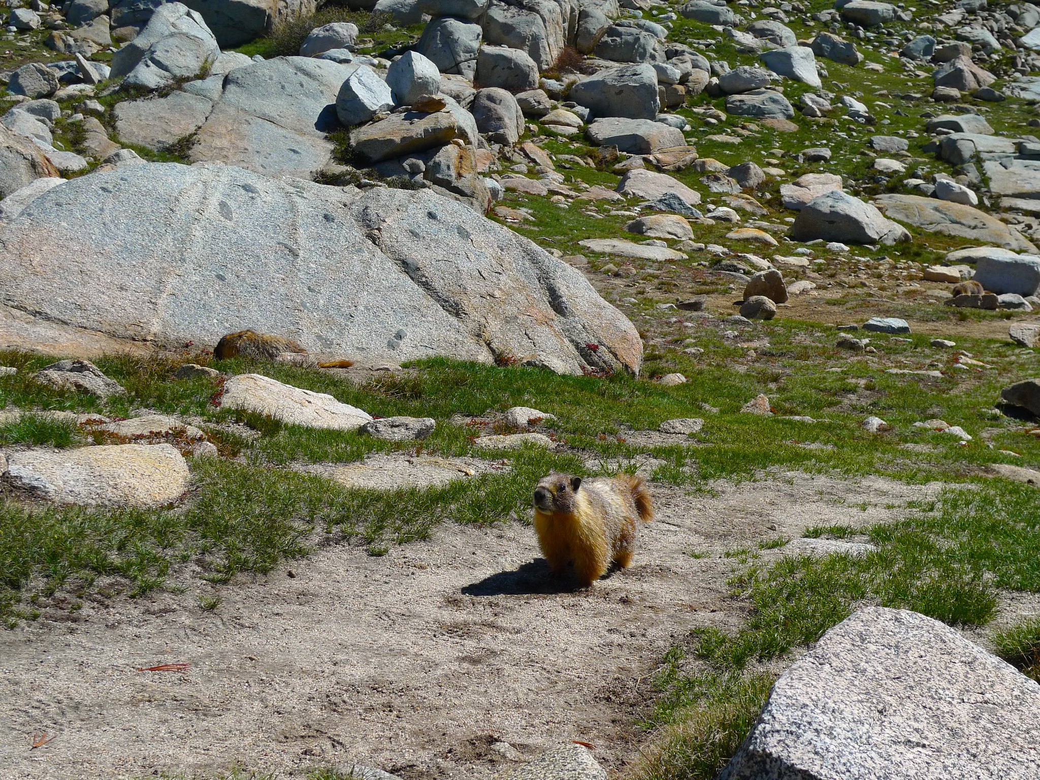
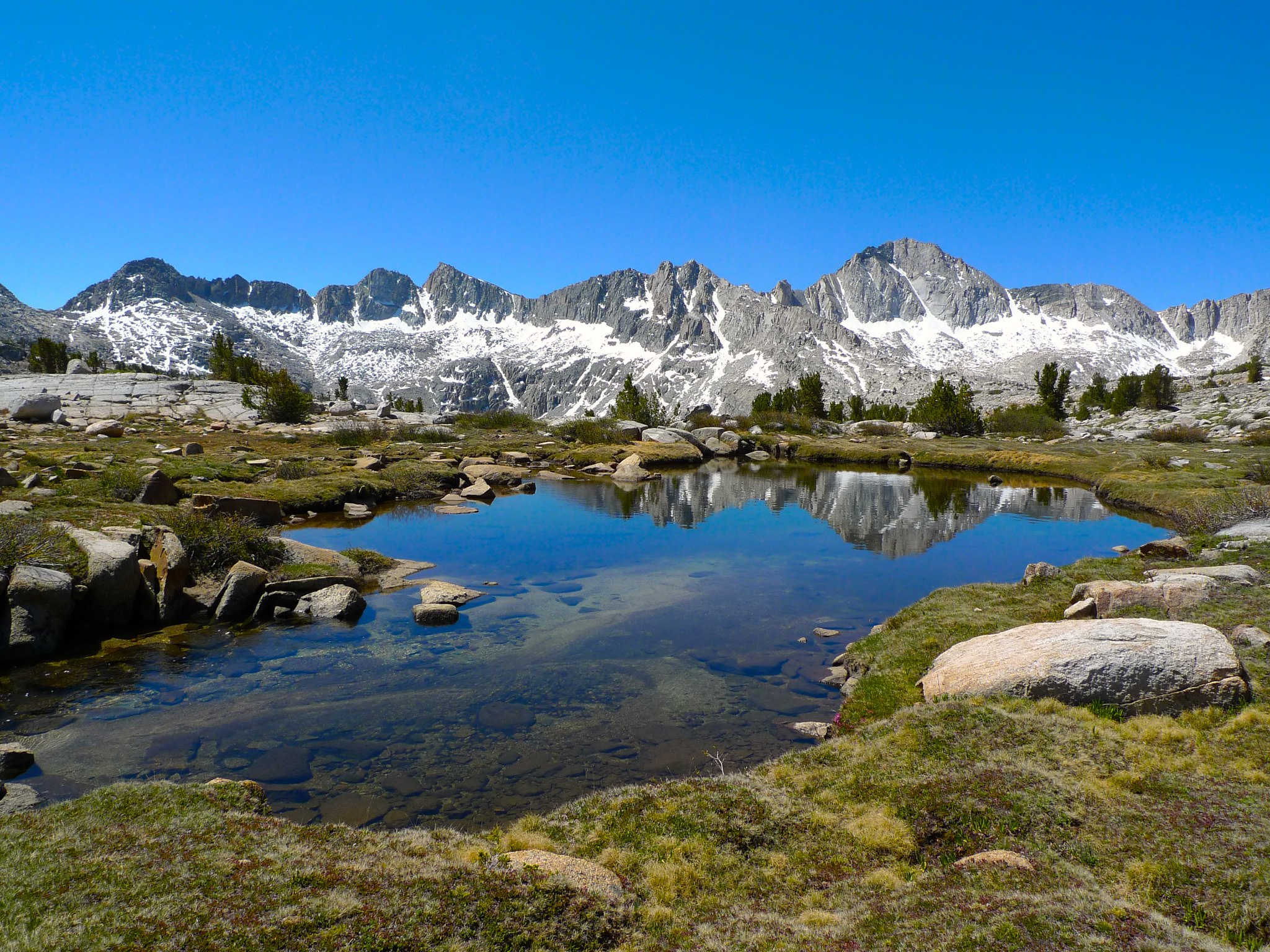
Upper Dusy Basin isn’t known for dramatic sunrises, but I peeked my head out at dawn anyway. After confirming this, I snuggled back in my bag and slept in until 8am. I had a leisurely breakfast with numerous marmots to keep me company. There are three in this picture!
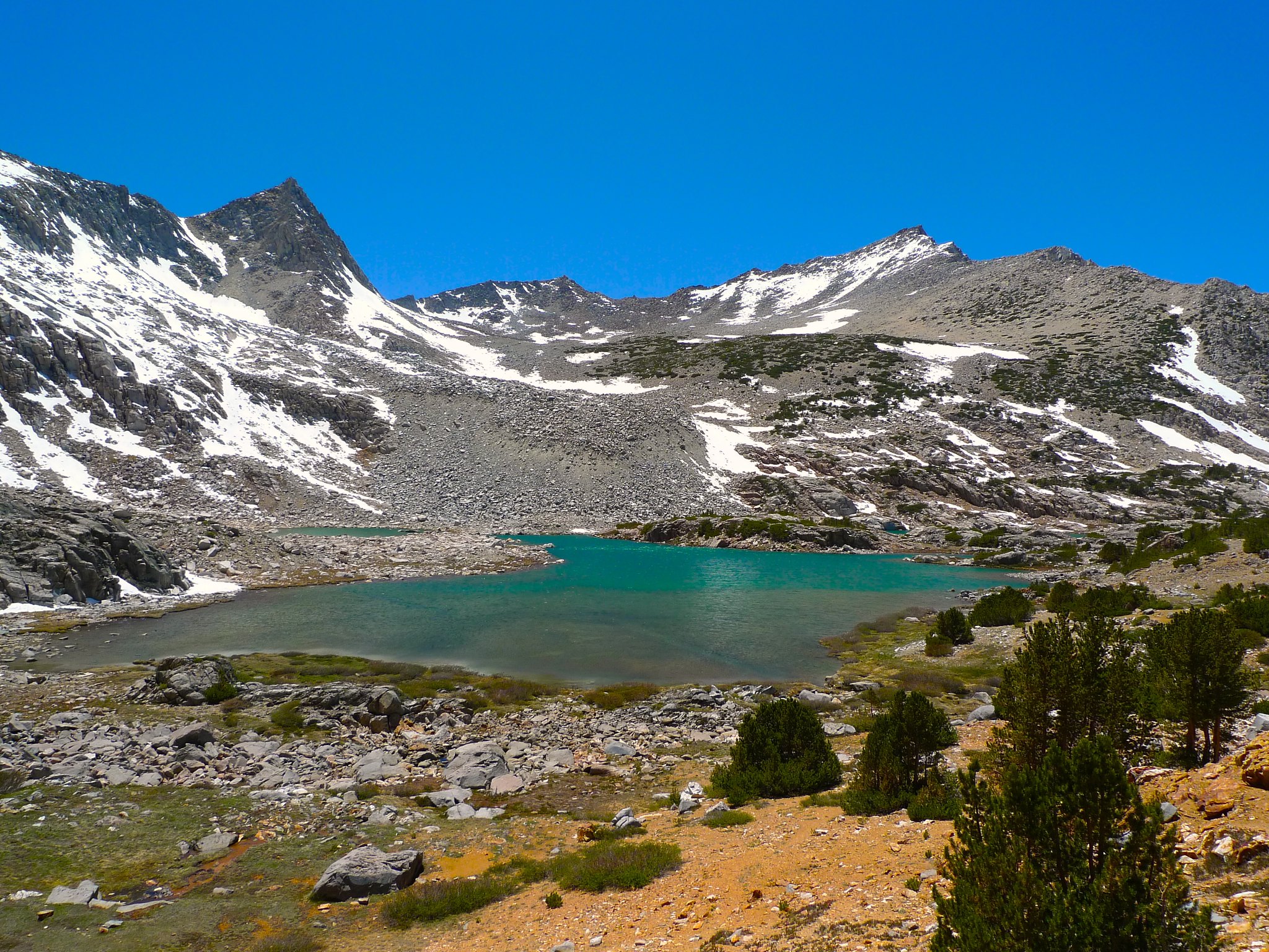
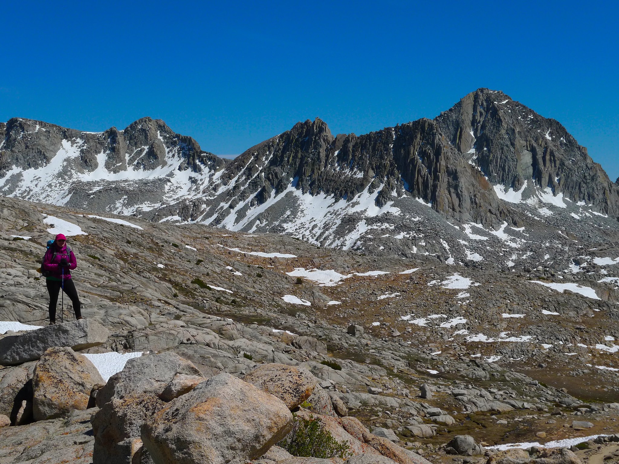
I said goodbye to my home for the night and began making my way cross-country towards Lake 11388 and then to Knapsack Pass.

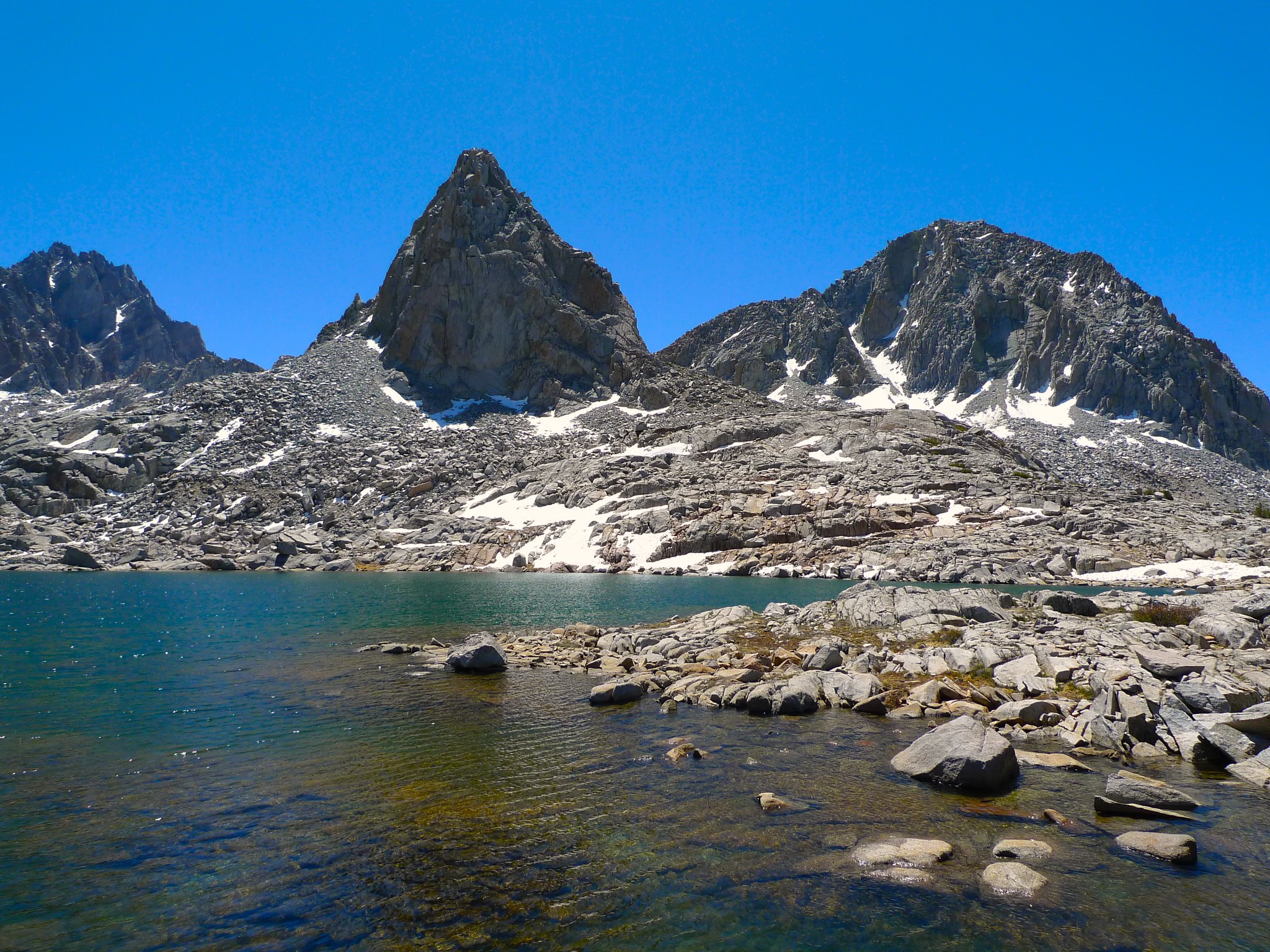
The cross-country was very easy across granite slabs with few trees or ridges obstructing views of obvious landmarks. I set myself towards Isosceles Peak and soon enough I was at Lake 11388. I’ve got to come back and camp here for the classic iconic sunset shot of Isosceles from this perspective.
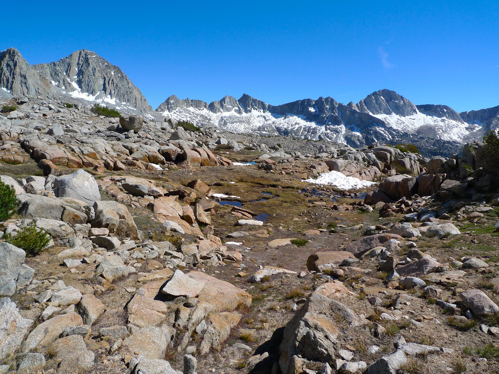
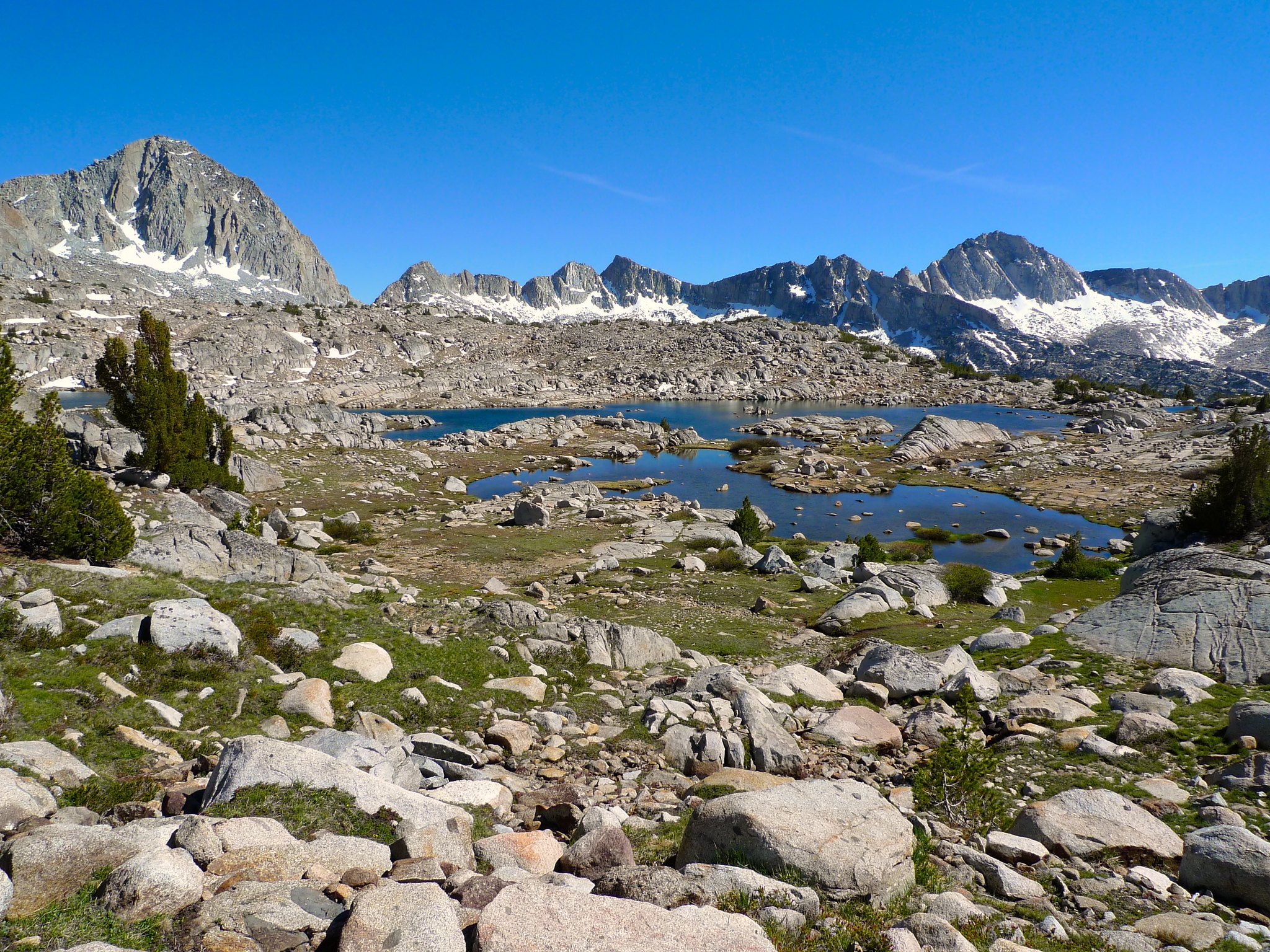
I continued on, making my way around the lakes below Lake 11388 on my way to Knapsack Pass.
After leaving the middle lakes, I made my way towards Knapsack Pass. I thought I might save myself some elevation by staying roughly at elevation rather than descending to the bottom of the pass. This ended up being a terrible idea as I was faced with car-sized boulders and tedious talus.
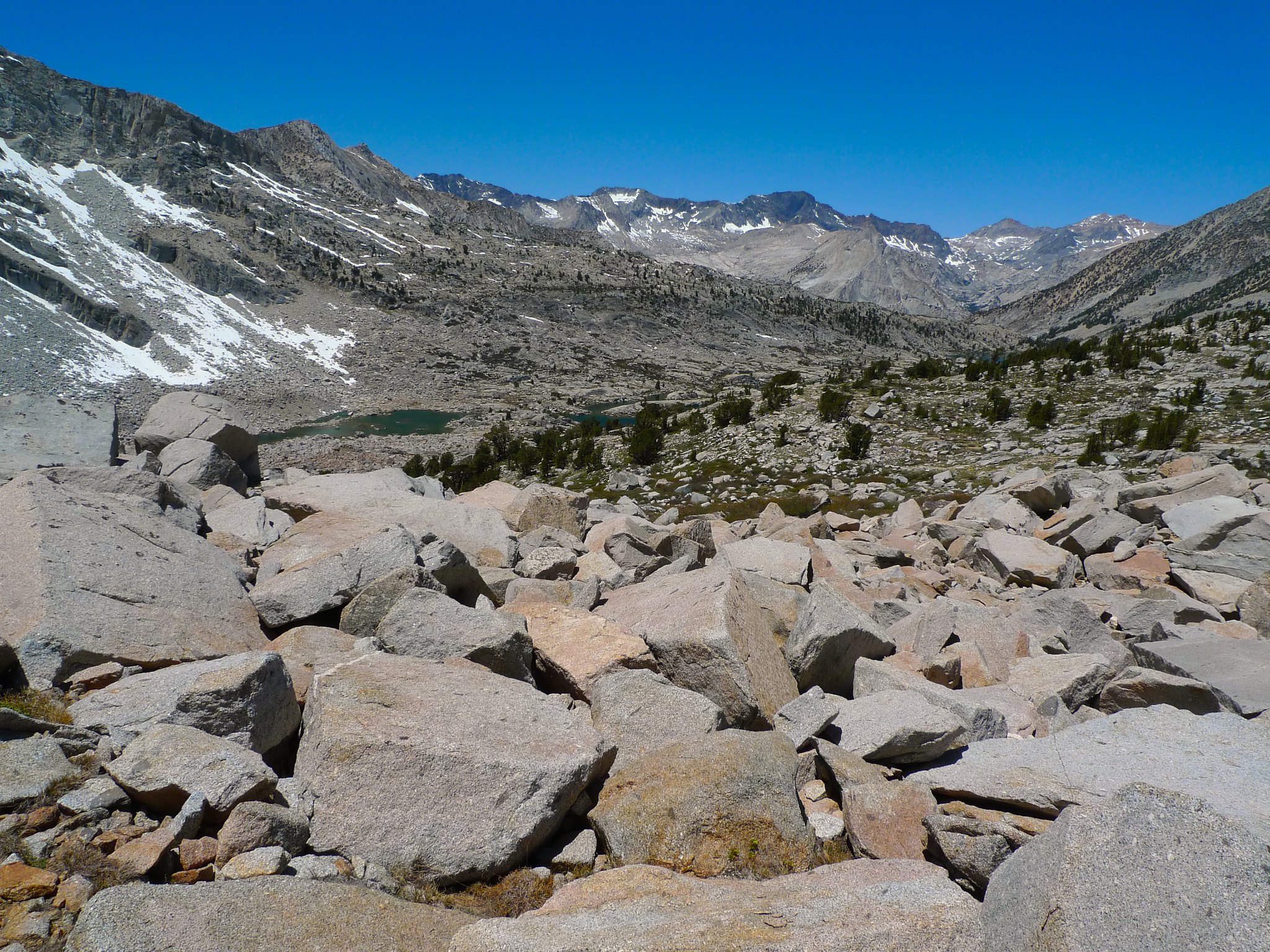
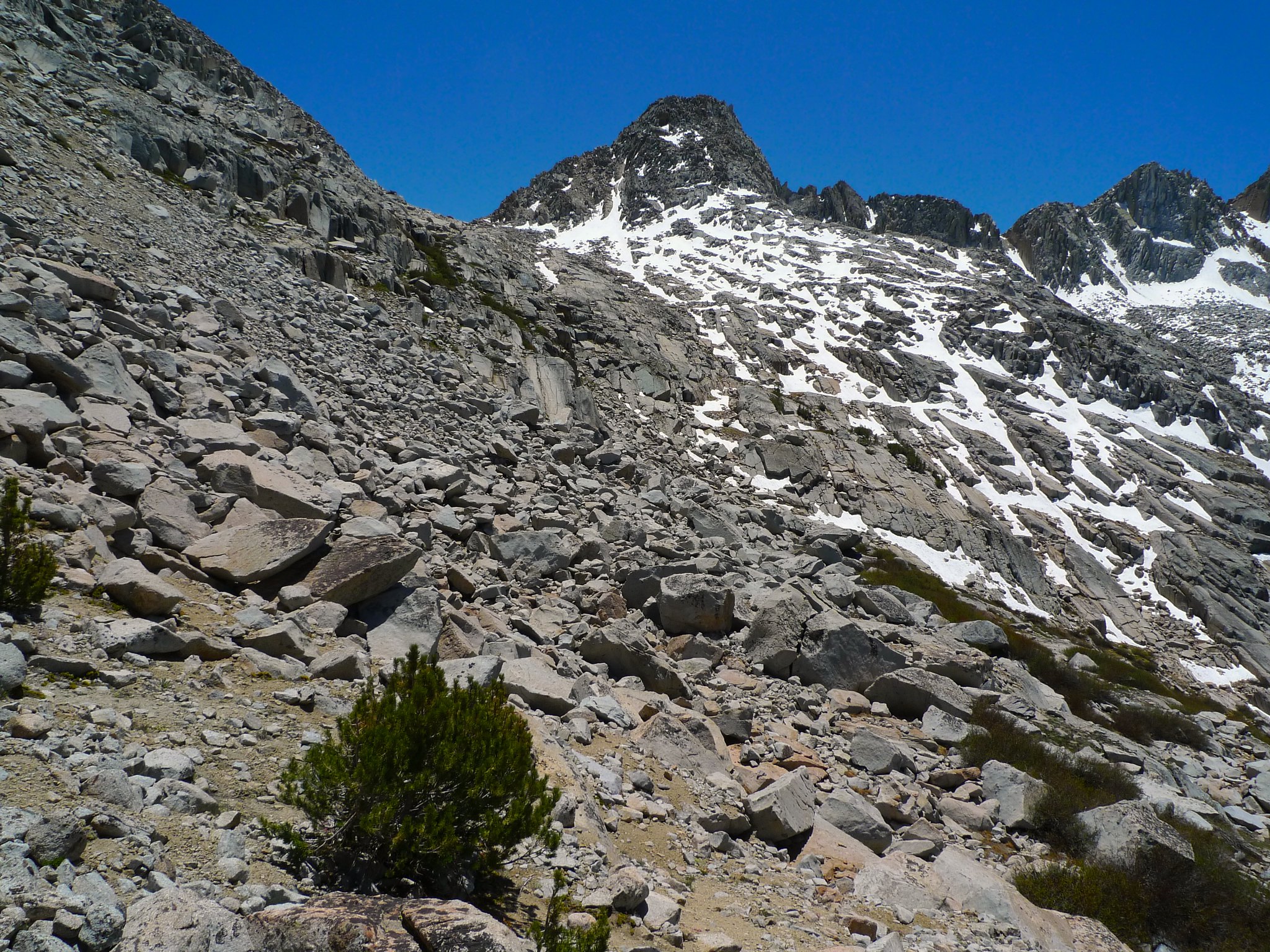
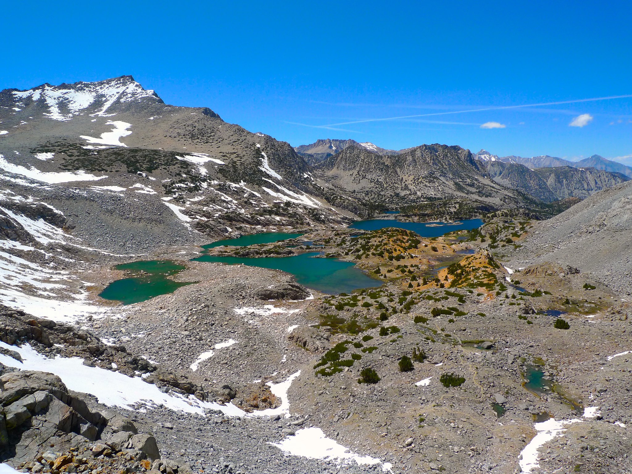
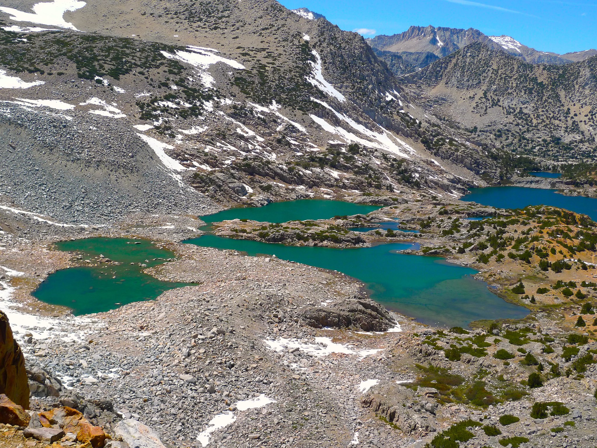
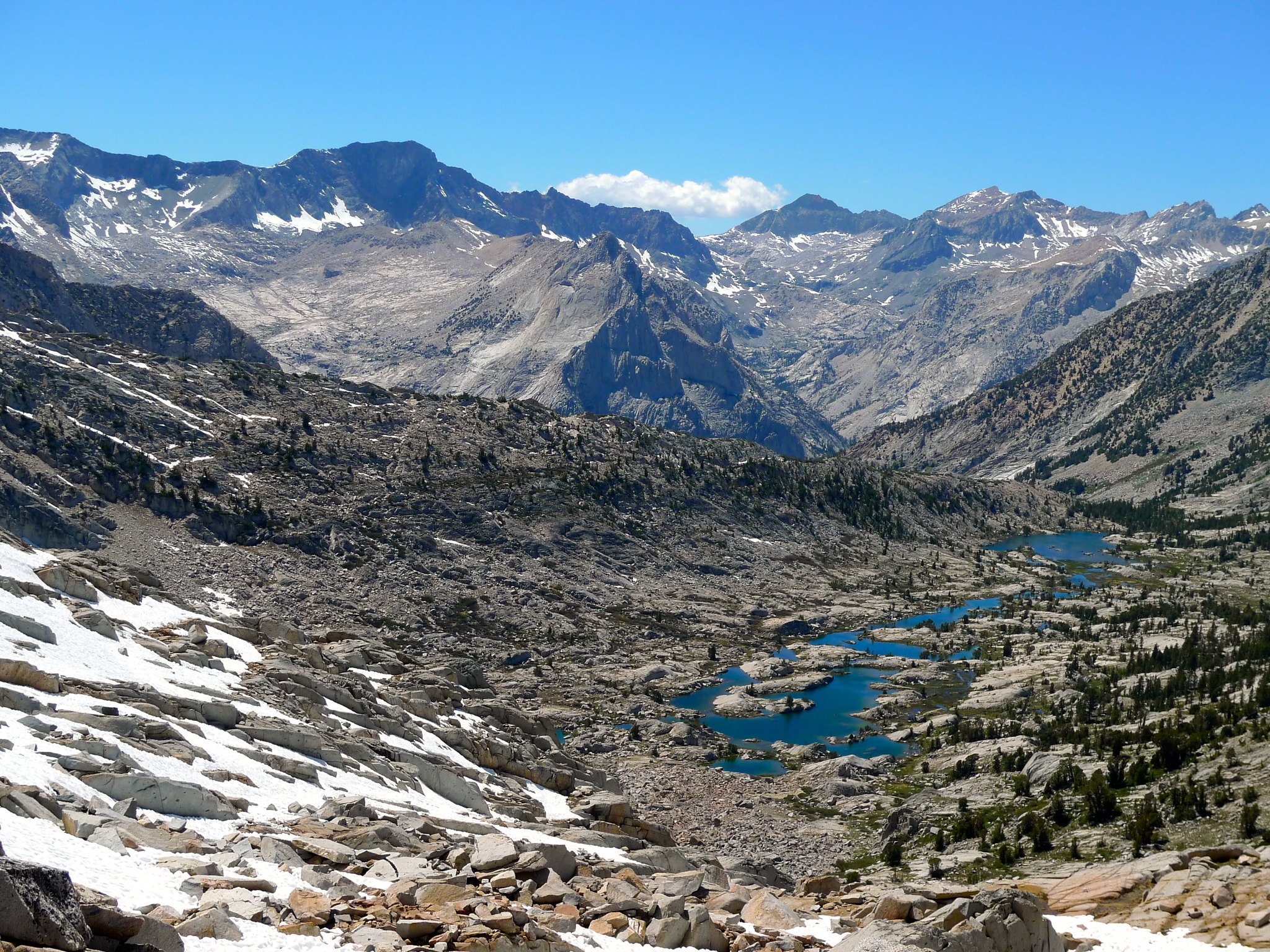
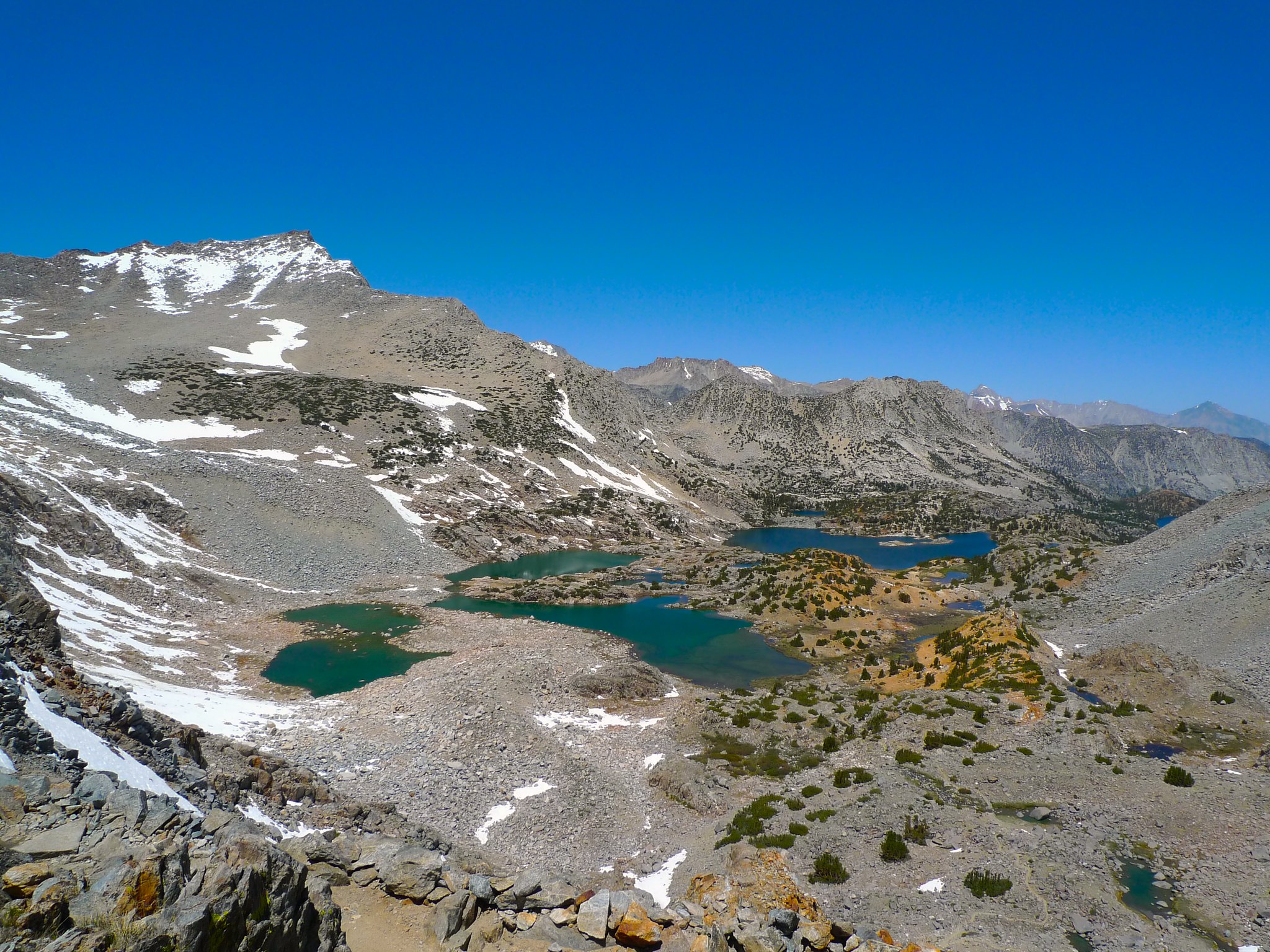
It got worse before it got better. The higher I went, the steeper it became. At least the view of Lower Dusy Basin was magnificent!
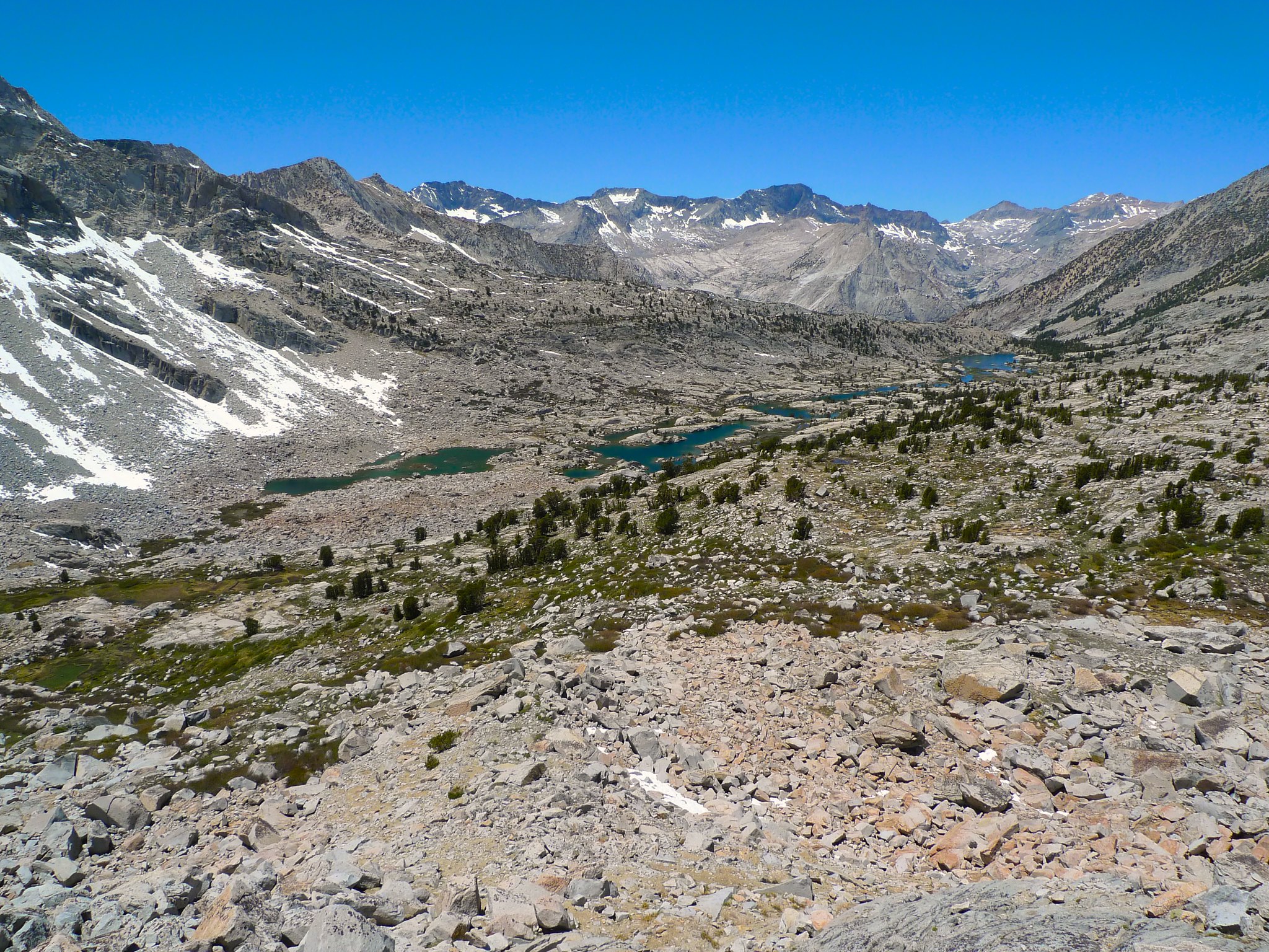
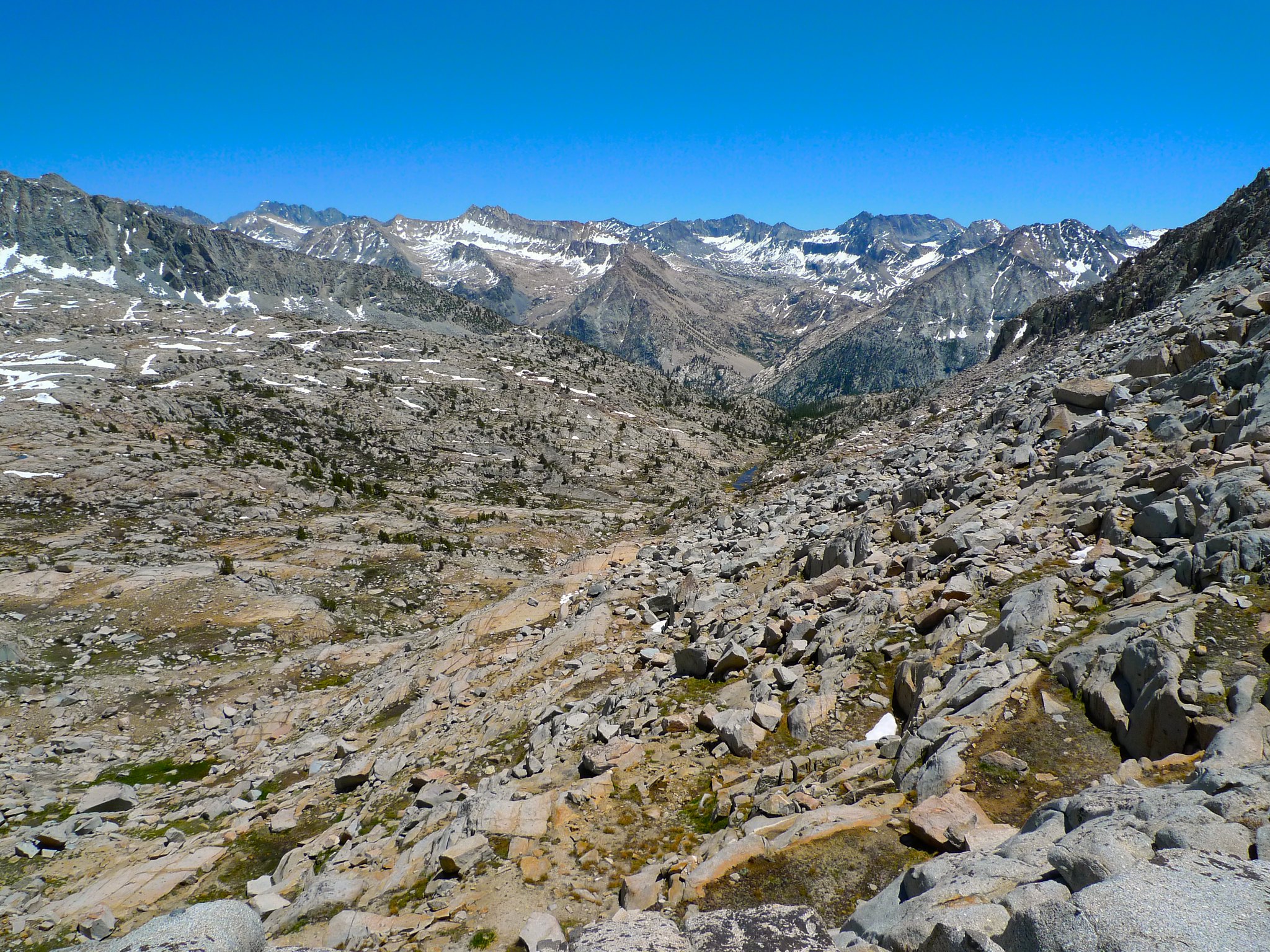
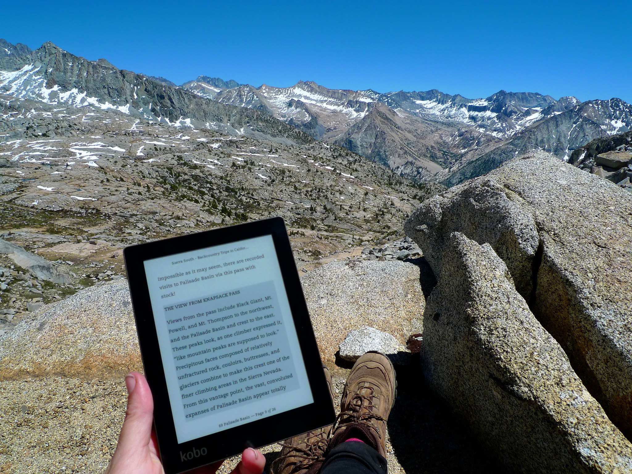
Finally, I reached the top of the pass and was rewarded with beautiful views of the Palisade Basin and across Le Conte Canyon to peaks beyond.
I did a little meta-reading about the view from Knapsack Pass.
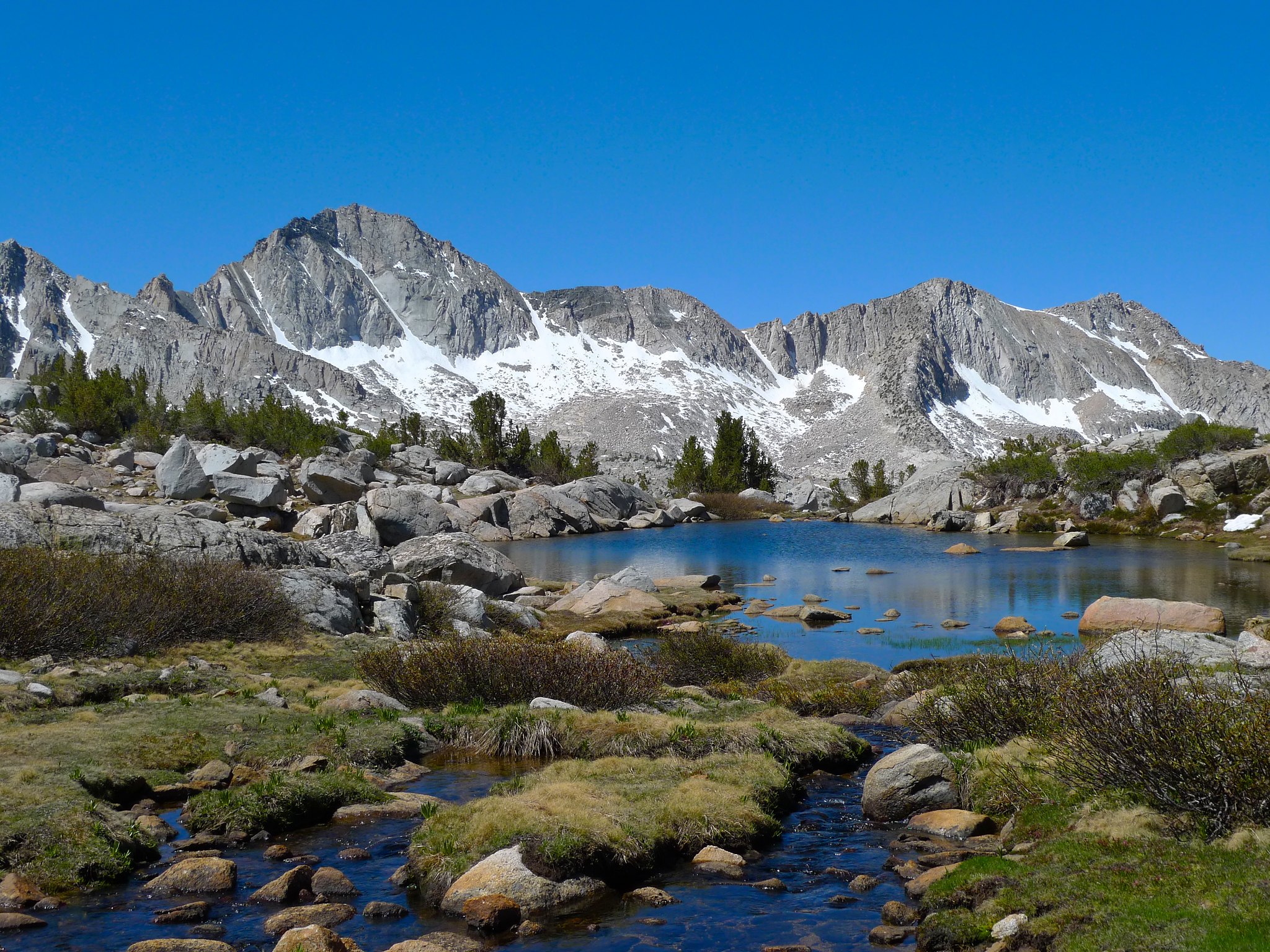
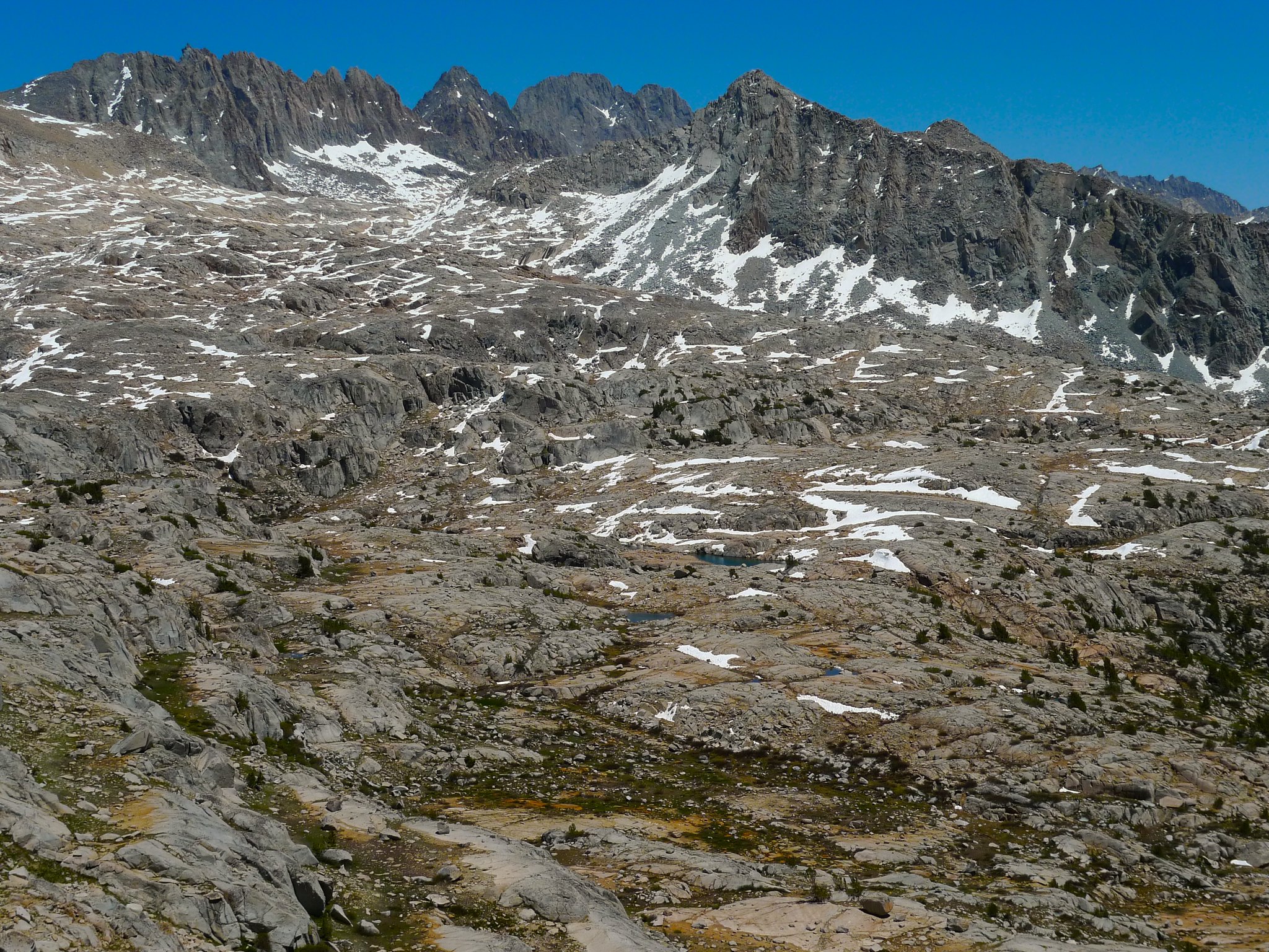
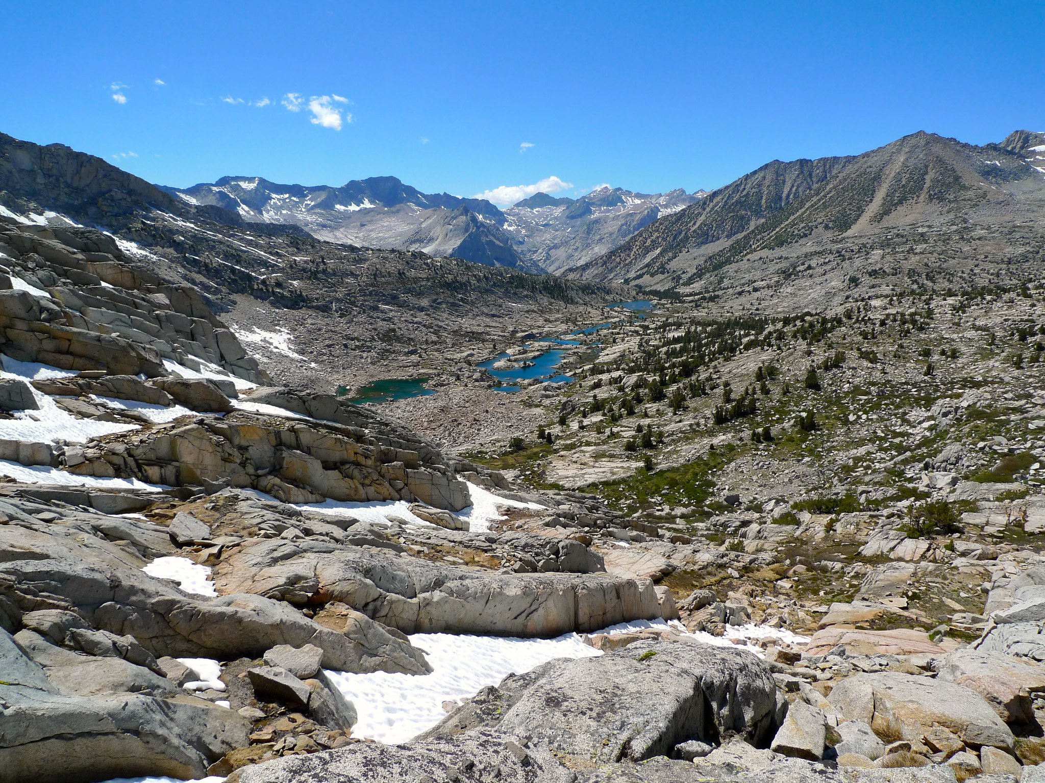
Although I’d lugged my full pack up to the top of the pass, I decided to head back down to Lower Dusy Basin for the night and save Palisade Basin for another trip. I was a bit tired from my suboptimal route up to the pass and figured my body would thank me the next day if my return trip was shorter. I found a much better route down from the pass, following granite slabs. It was made somewhat more complicated by lingering snowfields that I had to avoid (as I could hear them melting from underneath), but I made it down quickly enough, enjoying a wonderful view of all of Dusy Basin on my way.
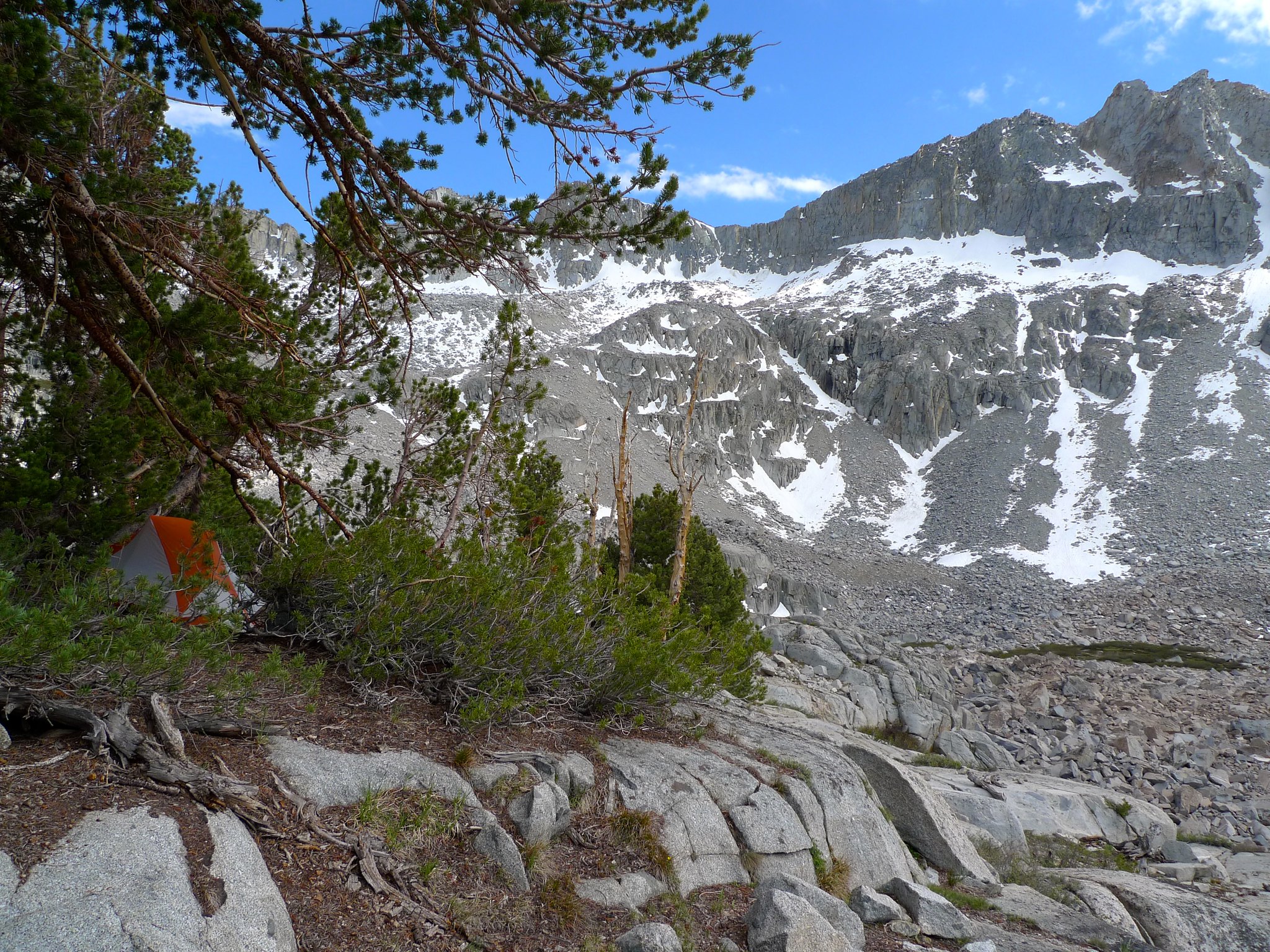
I found a nice camp spot on a shelf above the lower lakes and settled in for the evening.
Day 3
Lower Dusy Basin to Bishop Pass Trailhead
7 miles on trail, 2 miles cross-country, +1100ft/-2500ft
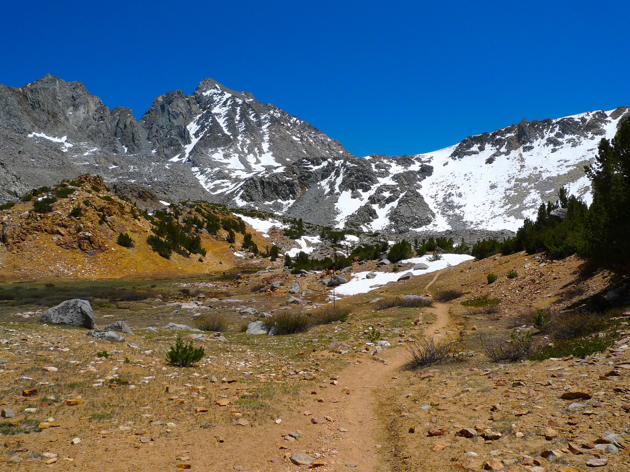
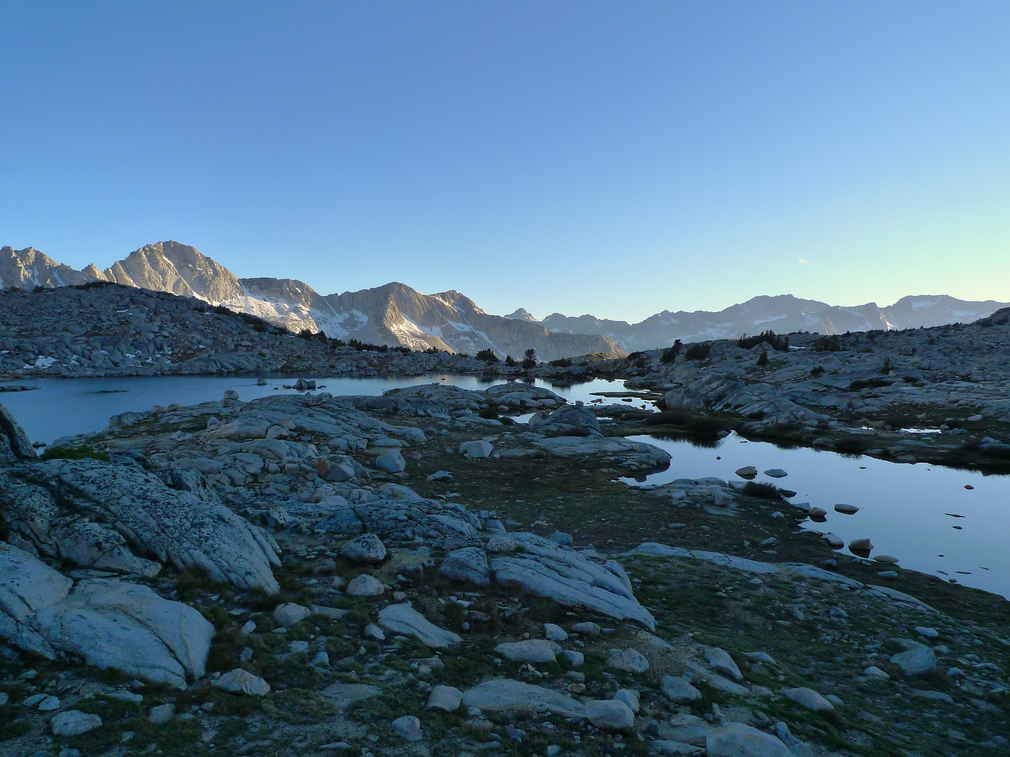
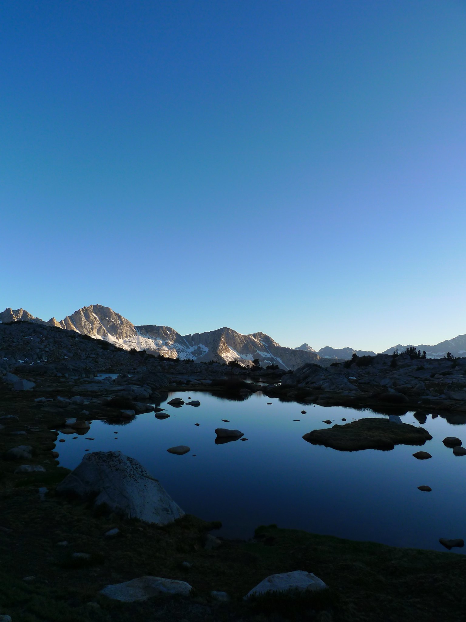
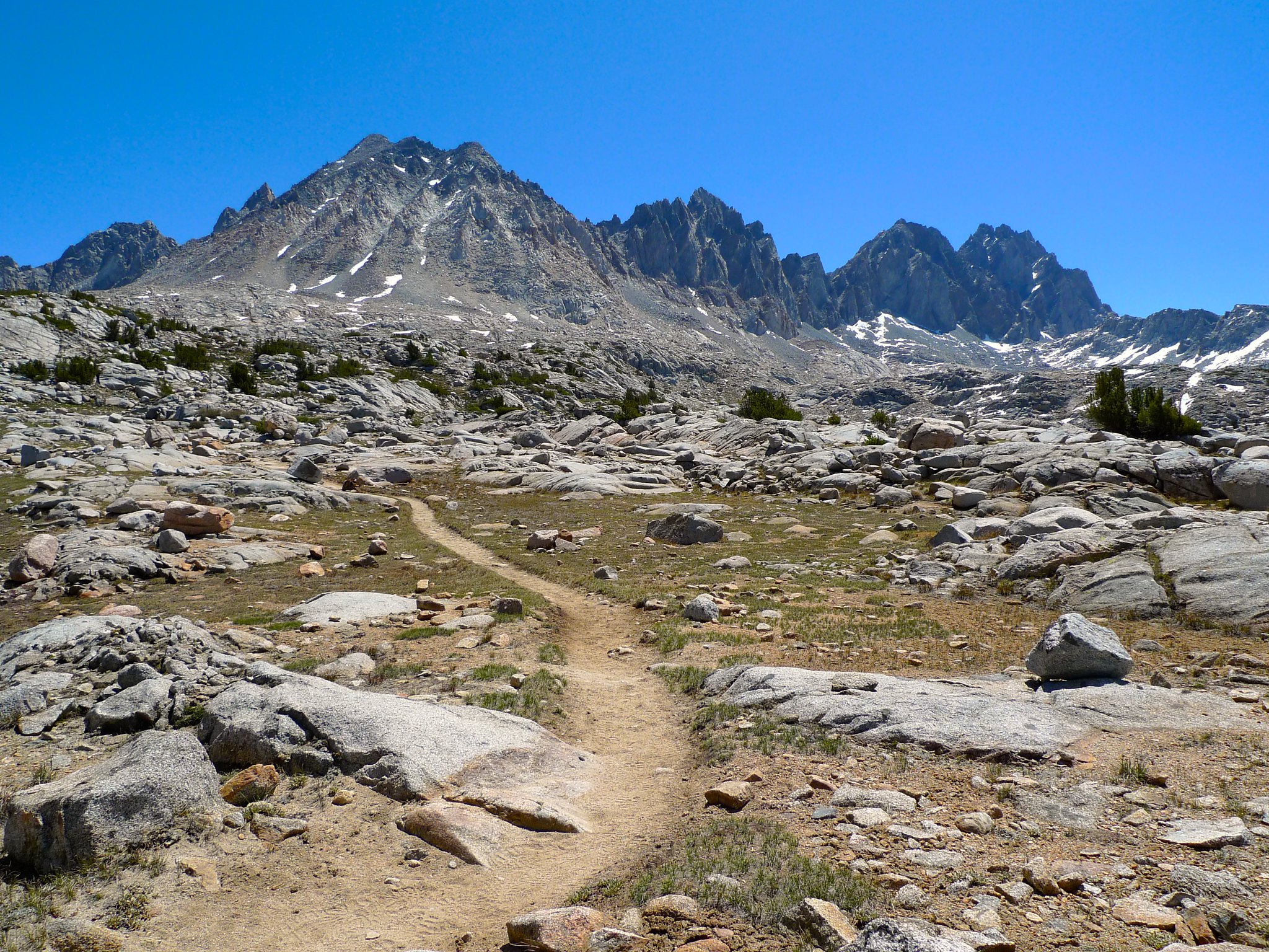
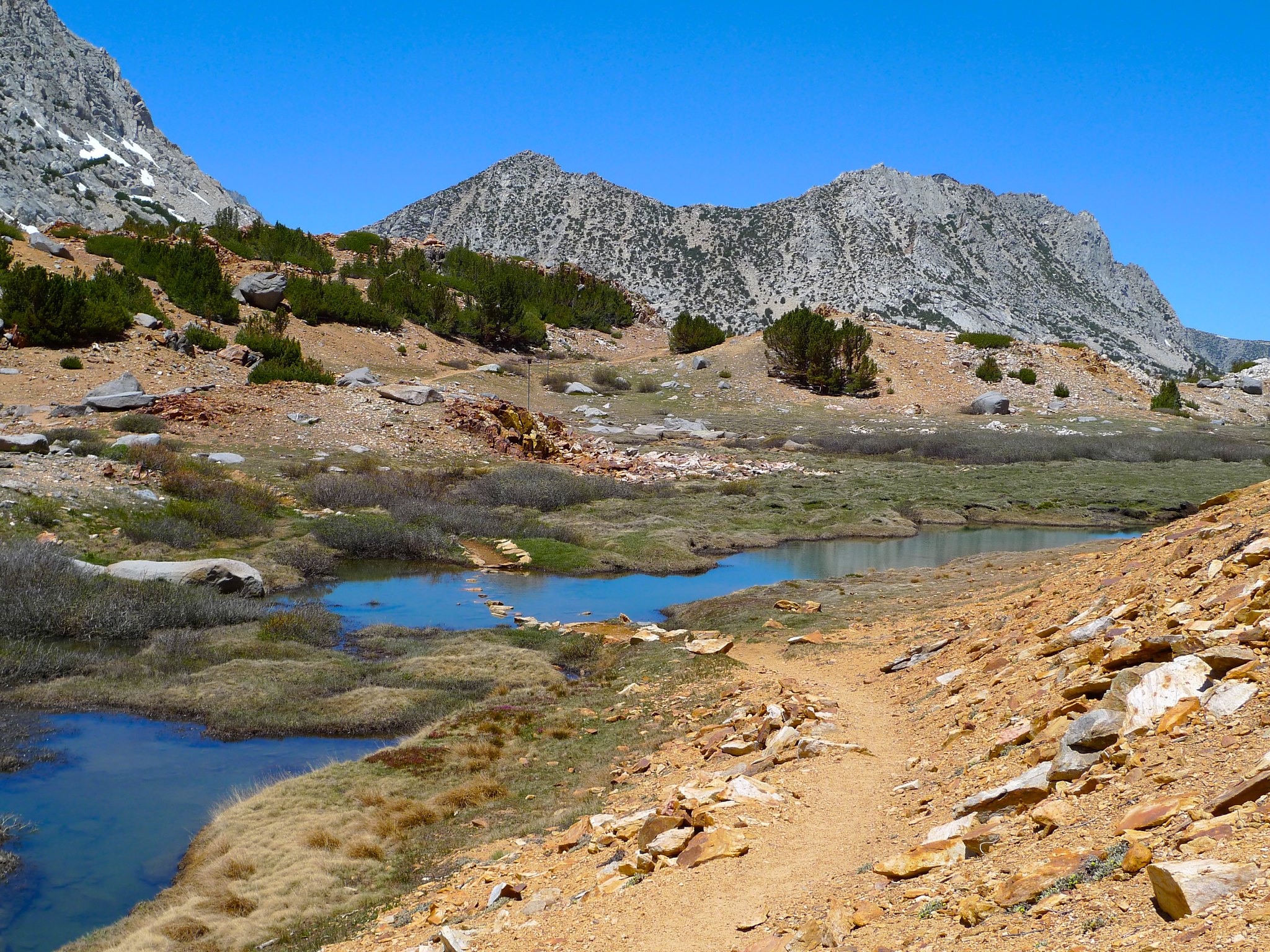
I woke to a beautiful view and set off back towards the Bishop Pass trail. The route-finding was easy again and I followed grassy ledges above the lower Dusy Basin lakes.

I came across a snow meter just before I rejoined the trail. This is a good landmark if you’re interested in making your way from the Bishop Pass trail over to Knapsack Pass.
Once back on the trail, I climbed a few hundred feet up to Bishop Pass.

And then retraced my steps back to the trailhead.

Want to do this trip yourself? A wilderness permit is required for overnight stay. Since the trailhead is in the Inyo National Forest, it is reservable online or via walk-in at the White Mountain Ranger Station. Download the USGS North Palisade and Mount Thomson quads or pick up the Tom Harrison Palisades map.

Great trip report! What book were you reading on Knapsack Pass? (I tried to zoom in, but couldn’t read the title of the book!)
I really enjoyed your trip report since I am planning to come off a section of the JMT at Bishop Pass, but didn’t know anything about Dusy Basin until recently. What map did you dues for this section (Tom Harrison Bishop Pass map set?)? Also any tips for lining up a nice campsite to capture that iconic image of Isosceles Peak? This is the first time I came across your blog, but will have read more of your adventures.
Thanks,
Tom
tom.clark1@mdlz.com
Hi Tom! I used a customized map that I printed with myTopo, but I can’t say I’d recommend doing that. It was the first time I tried and it came out pretty fuzzy. I think the Tom Harrison Palisades map would be best, or the USGS North Palisade and Mount Thomson quads.
I’m planning on passing through Dusy Basin this summer and I’m thinking of adding a little side trip to the Barrett Lakes. Your detailed trip report is just what I was looking for. Thanks! The photos are gorgeous too.
Thanks for the well written and informative trip report. Glad to hear that you were able to gently suggest other camping options to the couple that were going to camp illegally. It is a beautiful but fragile environment uo there.
Fabulous pictures that DO justice to one of the most beautiful backpacks in the Sierras. I did this and other trips 40 years ago and just started converting my slides to digitals. It was so much fun to relive some of those with your pictures. What camera did you use?