Yosemite’s Back Door: Hoover Wilderness Canyon Country

Who: Just me!
What: Backpacking
When: 7/21/20-7/26/20
Where: Hoover Wilderness + Yosemite NP, native land of the Me-Wuk and Numu
Mileage: 30mi on trail plus 9.5mi xc (plus a little 2mi peak bagging spur)
Elevation gain/loss: +9,000ft/-9,000ft
More photos: here
CalTopo: here

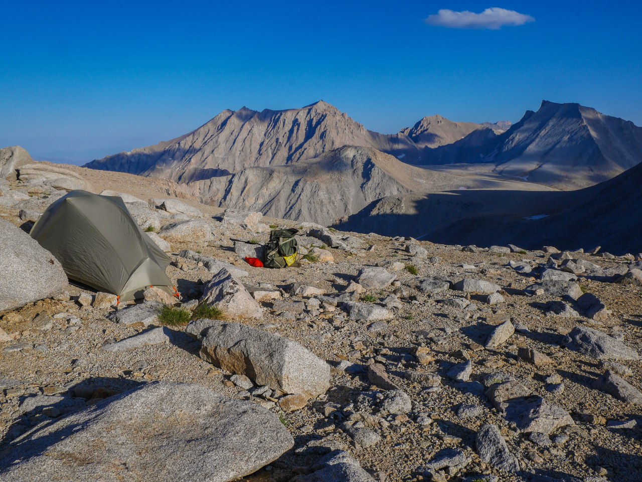
The coronavirus pandemic made 2020 quite an unusual year. I, like many people, completely changed my life around—I moved from Oakland to Tahoe. Most of the summer I spent settling in to my new area and marveling at like wow I can hike to the PCT in an hour from my front door whaaaaaaaat, but I did manage to squeeze in a couple farther flung trips. The permitting process was a mess, especially for walk-ups, but the Hoover Wilderness near Bridgeport always had high quotas and I was able to snag a permit to sneak in through Yosemite’s back door from Twin Lakes. I had some magical cross country travel, stormy weather, and a fun little peak bagging excursion.

Continue reading

Cross-country Agnew to Tuolumne via Nydiver, Maclure Creek, and Johnson Peak

Who: Just me!
What: Backpacking
When: 8/4/19-8/8/19
Where: Ansel Adams Wilderness + Yosemite NP, native land of the Me-Wuk and Numu
Mileage: 43 miles (24.5 on trail + 18.5 xc)
Elevation gain/loss: +10,500ft/-9,800ft
More photos: here
CalTopo: here

Ansel Adams Wilderness near Mammoth and Tuolumne Meadows in Yosemite are some of the most beautiful—and popular—areas in the Sierra. There’s so much beauty that can be seen with relatively little effort and the JMT runs right through there, so many of the lakes have camping restrictions or become little villages of tents every night. The on-trail lakes, that is. I found solitude in this area by taking a mostly cross-country route, and speak to any other humans for 3 days. In fact, the only other person I saw was from a distance—a kayaker on Ireland Lake.

Continue reading

Humphreys Basin and French Canyon via Piute Pass

Who: Phil and me
What: Backpacking
When: 9/2/17-9/5/17
Where: John Muir Wilderness, native land of the Monache
Mileage: 28 miles (21 on trail + 7 xc)
Elevation gain/loss: +5,300ft/-5,300ft
More photos: here
CalTopo: here

This crazy spring we’re having has me holed up writing trip reports instead of backpacking—it’s snowing in much of the Sierra this Memorial Day weekend—what even! But here we are. So, I took Phil, an avid cycle trekker, dj, and overall incredibly capable friend of mine, on his first ever backpacking trip in the John Muir Wilderness! Over Labor Day weekend in 2017, we set out from North Lake to explore Humphrey’s Basin and a pass on the Sierra High Route. We were impressed by the snowfields that still managed to linger and hinder our progress even in the first week of September of this high snow year—perhaps a sign for what’s in store for us again in 2019. Phil ripped his homemade shorts. We had a great time.

Continue reading

Merced River Canyon in Yosemite via the Mist Trail from Happy Isles

Who: Just me!
What: Backpacking
When: 5/13/19-5/14/19
Where: Yosemite National Park
Mileage: 25 miles
Elevation gain/loss: +5,350ft/-5,350ft
More photos: here
CalTopo: here

I had a good 9 days between the last day of instruction and when my final exams were scheduled, so even with a few days for review sessions and extra office hours, I still had plenty of time to head off to the woods to shake the winter off and train for more involved trips later in the summer. Typically, I head up to the Trinity Alps (1, 2) during this time, but with the big winter we’ve had here in 2019, there aren’t many great options up there around this time, so instead I headed to Yosemite. I usually try to avoid Yosemite Valley, especially in the spring, since it’s so full of people, but wow, this trip has shifted my perspective. Dare I say that I may even have become an early-season valley enthusiast? Indeed, I have, though the conditions definitely made me change my plans and I ended up splitting my trip into two pieces. This is the second part, you can read about the first part over here.

Continue reading

South Rim of Yosemite Valley via the Pohono Trail from Tunnel View to Taft Point

Who: Just me!
What: Backpacking
When: 5/12/19-5/13/19
Where: Yosemite National Park
Mileage: 10 miles
Elevation gain/loss: +4,900ft/-1,650ft
More photos: here

I had a good 9 days between the last day of instruction and when my final exams were scheduled, so even with a few days for review sessions and extra office hours, I still had plenty of time to head off to the woods to shake the winter off and train for more involved trips later in the summer. Typically, I head up to the Trinity Alps (1, 2) during this time, but with the big winter we’ve had here in 2019, there aren’t many great options up there around this time, so instead I headed to Yosemite. I usually try to avoid Yosemite Valley, especially in the spring, since it’s so full of people, but wow, this trip has shifted my perspective. Dare I say that I may even have become an early-season valley enthusiast? Indeed, I have, though the conditions definitely made me change my plans and provided copious amounts of both adventure and solitude—being the only person at Taft Point in the middle of the day when the waterfalls are raging? Yes, please! 

Continue reading

Kepler Track in Fiordland National Park, New Zealand

Who: Just me!
What: Backpacking
When: 1/1/18-1/4/18
Where: Fiordland National Park, New Zealand
Mileage: 35 miles
Elevation gain/loss: +5,200ft/-4,900ft
More photos: here

I kicked off 2018 with my first ever backpacking trip in another country! I used airline miles to snag a flight to New Zealand, which is an absolutely spectacular, unreal place to visit if you like to be outside. Fiordland National Park on the South Island is quite possibly the most stunning area in the country. There are a handful of “tracks” (trails) that New Zealand has fully developed in its Great Walks program. These have perfectly maintained trails, outhouses here and there, and even huts you can book to sleep in. Quite a change from my usual Sierra program, but it was incredible.

Continue reading

Cathedral Lakes to Yosemite Valley via Clouds Rest

Who: Me, Miles, Dominic, and Max
What: Backpacking
When: 6/9/18-6/12/18
Where: Yosemite NP
Mileage: 34 miles
Elevation gain/loss: +4,000ft/-8,650ft
More photos: here
CalTopo: here

In 2018 I vowed to introduce as many friends, acquaintances, and friends of friends as possible to backpacking, with the hope of spreading the gospel of Leave No Trace and helping it propagate. This trip was the second trip of the summer with relative newbies who I’d met through DSA, and we took a classic route in Yosemite from Tuolomne to the Valley via Cathedral Lakes and Clouds Rest. We also visited my favorite campsite on Echo Creek, where we saw a pair of bears! I am still learning how to gauge how much people who aren’t used to backpacking can do comfortably, and this trip was a learning experience for me in that vein.

Continue reading

North Lake to South Lake via Lamarck Col and Darwin Canyon

Who: Me, Jason, and Jessica
What: Backpacking
When: 7/18/18-7/23/18
Where: Inyo NF / John Muir Wilderness / Kings Canyon NP
Mileage: 36 miles (30 on trail plus 6 XC)
Elevation gain/loss: +8,700ft/-8,300ft
More photos: here
CalTopo: here

I’d been wanting to climb over Lamarck Col down Darwin Canyon to Darwin Bench for coming on a baker’s dozen years now, but wasn’t quite up to going it alone and didn’t have the right comrades until this past summer. I invited Jason, who I knew would be up for it after being a stalwart companion crossing Harrison Pass on the Circle of Solitude, and his wife Jessica. We hiked this classic trip from North Lake to South Lake amidst some wild mid-July weather, with thunderstorms every day and some of the craziest hail I’ve ever experienced, which resulted in landslides and a trapped car thwarting our car shuttle. Read on to see how we managed *not* to die!

Continue reading

Center Basin, Forester + Junction Passes Lollipop via Kearsarge

Who: Just me!
What: Backpacking
When: 8/18/18-8/23/18
Where: Inyo NF / Sequoia / Kings Canyon NP
Mileage: 52.5 miles (40.5 on trail plus 12 XC)
Elevation gain/loss: +14,800ft/-14,800ft
More photos: here
CalTopo: here

Just before the semester began, I headed out to the eastern Sierra on a 5 night trip near the JMT along Forester Pass. My goal was to see Junction Pass, which is the route the John Muir Trail took to cross the imposing east-west ridgeline that now marks the boundary between Kings Canyon and Sequoia National Parks. I wanted to hike the remnants of the old JMT, explore Center Basin, and cross over Shepherd’s and Forester Passes, two that I had seen from afar on previous trips but not been over. I accomplished all this and more on this trip, which included 2 cross-country plus 4 high trail passes in 6 days, as well as hours upon hours of solitude on the cross-country bits, plus a decent but not off-putting amount of socialization on the JMT/PCT.

Continue reading

Teton Crest Trail

Who: Me & Jesse
What: Backpacking
When: 8/17/17-8/19/17
Where: Grand Teton National Park
Mileage: 29 miles
Elevation gain/loss: +5,150ft/-8,550ft
More photos: here
CalTopo: here

My sister’s family, my parents, and I headed to the Tetons for the Great American Eclipse of 2017. The whole trip was incredible (my god, being in totality is… it’s just… wow.. maybe more on that in another post) and one of the highlights was hiking a piece of the Teton Crest Trail with my brother in law. The trail follows alongside the Teton crest just to the west, and gives hikers a seldom-seen view of the Tetons, which are much more commonly viewed from the east. We witnessed the most incredible, unbelievable wildflower blooms I’ve ever seen. Two-thousand seventeen was a banner year for wildflowers, with superblooms propagating from desert floors in the spring to mountain meadows in the summer, and I was lucky to find myself thigh deep in fields of flowers on more than one occasion, including this trip.

Continue reading