
Who: Just me!
What: Backpacking
When: 7/14/14-7/18/14
Where: Yosemite National Park
Mileage: 53 miles
Elevation gain/loss: +9,400ft/-12,700ft
More photos: here
This would be my longest solo trip so far. I was interested in trying to do a solo trip without using my car (so that I could leave it in Oakland for my partner to use), so I decided to head to Yosemite, where I could use a combination of Amtrak, YARTS, and private tour busses to get around. I had a few close calls and some delays, but all in all it worked. The trip proved to be absolutely gorgeous and I found peace and solitude in southern Yosemite. I did find myself racing intense thunderstorms on four of my days out, but the dramatic skies and beautiful granite landscapes made up for the soggy gear and afternoons spent hunkered down in my tent.
Day 0
Oakland, CA to Yosemite Valley
After a delicious brunch at Haven, I boarded the Amtrak San Joaquin around 1pm. By 4:15pm I was in Merced, where I used my credit card (!) in a vending machine (!!?) to buy flamin’ hot Cheeto’s to munch on while I waited for the 5:30pm YARTS bus. We arrived at Curry Village in Yosemite Valley at 8:30pm, about 20 minutes behind schedule. I was starving by this point, so I decided to grab dinner in Curry Village before heading over to the Backpacker’s Campground. By the time I made my way over there, it was around 10pm and the campground was dark and completely full. After circling the campground twice and feeling bad while shining my headlamp light into everyone’s camp area, I finally laid out my tent footprint and sleeping pad in a less-crowded site, shoved my gear into their bear locker as quietly as possible, and tried to get some sleep. I tried a few times to get cell service to check in with Patrick and let him know I’d arrived ok, but was unsuccessful.
Day 1
Mono Meadow Trailhead to Outlet Stream of Ottoway Lake
14 miles, +3300ft/-1400ft
I woke up around 5:30am to the sounds of the people whose camp I’d crashed scurrying around camp. I quickly apologized, explained the situation, and packed up my things and left. I walked out to the main road and managed to hitch two different rides to make it to the Wilderness Center around 6:45am. I thought the center opened at 7:30am, which should have given me plenty of time to pick up my reserved permit and make my way over to the Yosemite Lodge to take the Glacier Point Tour Bus up to my trailhead, but when I arrived at the Wilderness Center, I found 8 or so people laid out in line for JMT permits and I discovered that it didn’t open until 8am. Well, this should make things interesting!
Finally, just before 8am the rangers showed up and one of them came out and talked to the huge line of us outside. Most of the people were waiting for the 11am shot at next-day permits, but when I told the ranger I had a reserved permit and a tight schedule, he insisted that the quickest way for me to get my permit was to stay out there and listen to his spiel. So I did. And he proceeded to do the most elementary, insulting version of the “backcountry rules” that I’ve ever heard. Saying things like “How many of you are prepared to pack out your toilet paper?” *some people raise hands* “Ok well the rest of you aren’t getting permits because….” and “So food obviously has to go in the bear canister. Any thoughts on other items that have to go?” At which point I rattled off a bunch of items “sunscreen lip balm toothpaste bug spray first aid kit creams…” and he gave me the stink eye. His “short” spiel took 19 minutes and now I only had 11 minutes to get my permit and make my way to Yosemite Lodge. I ran inside and told the (very nice, efficient) ranger at the counter that I was in a hurry and had heard the guy’s speech outside and had a canister. She quickly printed my permit, we signed it, and I put the spurs on as I ran out the door. When I got to the main valley road, I stuck my thumb out at about ten cars before some nice people let me hop in the back of their pickup. I arrived at Yosemite Lodge at 8:29am and luckily there were two busses leaving that day, so I even had time to pee after picking up my ticket for the Glacier Point Tour Bus.
I’d been told on the phone beforehand that the driver wouldn’t stop to drop me off at Mono Meadow, so I’d planned to hitch down from Glacier Point once we arrived there. I figured it was worth a shot at asking the driver anyway, so I did and he was amenable. About an hour and fifteen minutes into listening to his dad jokes while still trying to get cell service to check in with Patrick, we were still going full speed as we approached Mono Meadow, so I said “Oh hey, stop at Mono Meadow?” and he slammed on the brakes. I felt bad for the bus full of day-hiking tourists as their faces were planted firmly on the seats ahead of them, but I was skipping with glee as I disembarked and grabbed my pack from under the bus, muttering “Oh gee, sorry! I just want to get off here! Byeeee!!”
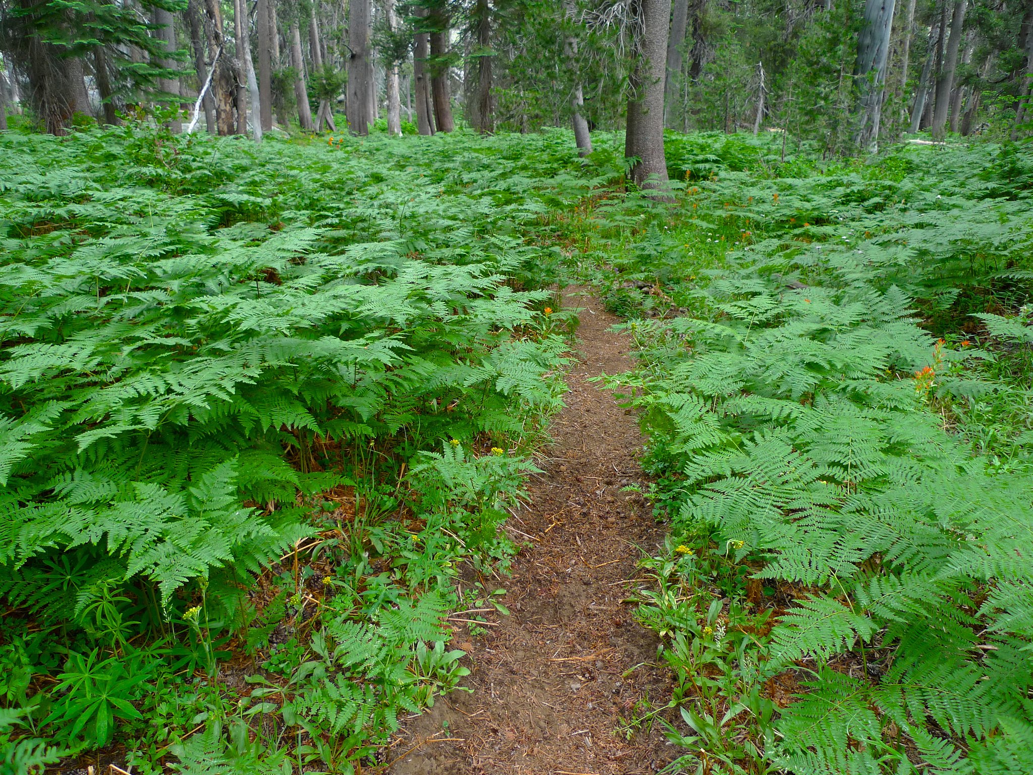
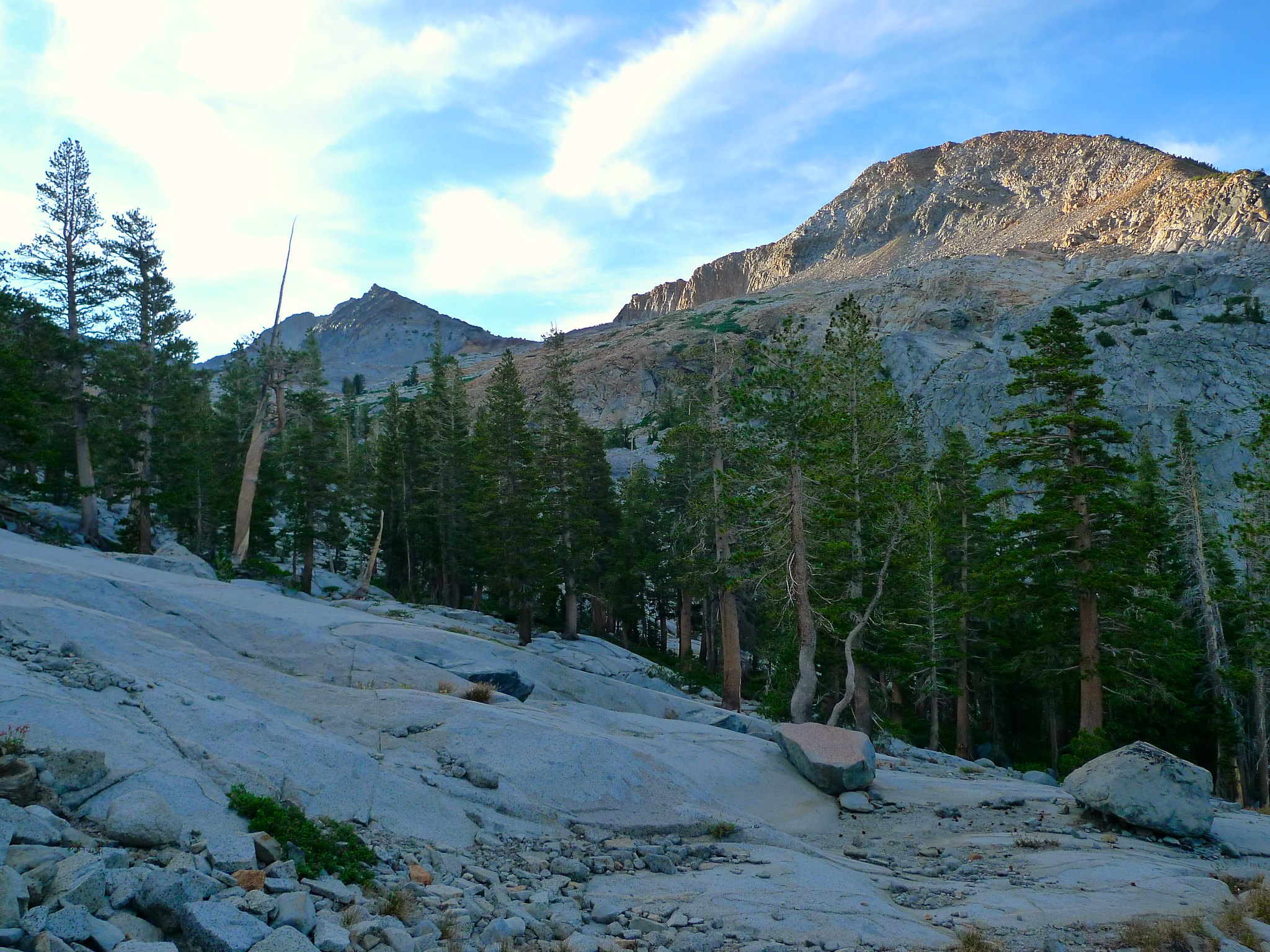
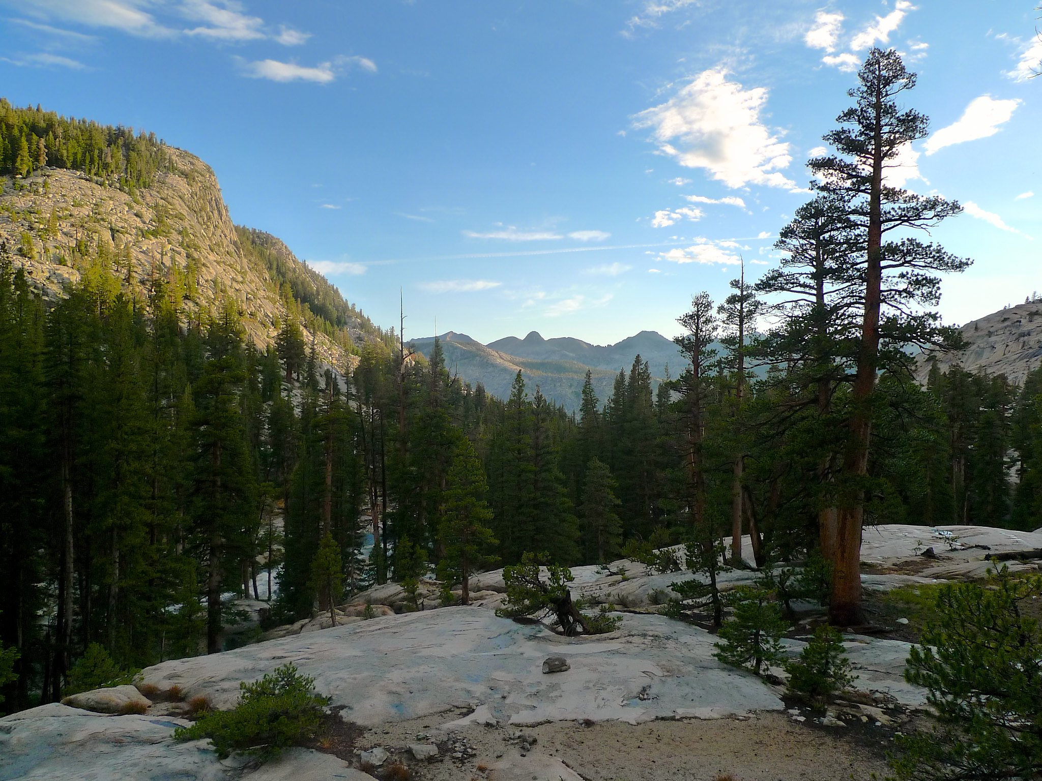
Finally I was free. I slathered up with sunscreen and headed out. I was on the trail by 10am, earlier than expected in spite of the close calls on my way up. The first mile or so was through forest as I descended towards Illilouette Creek.

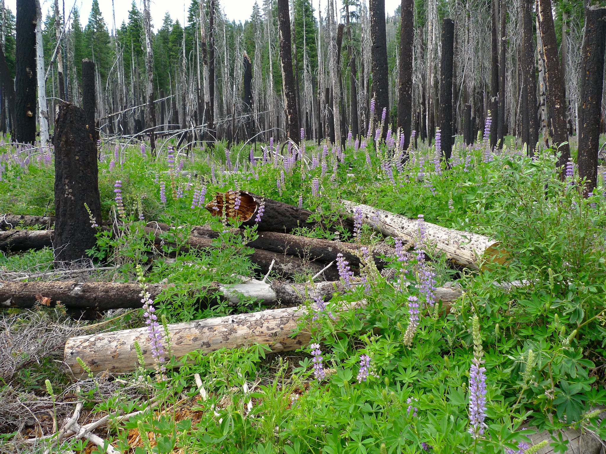
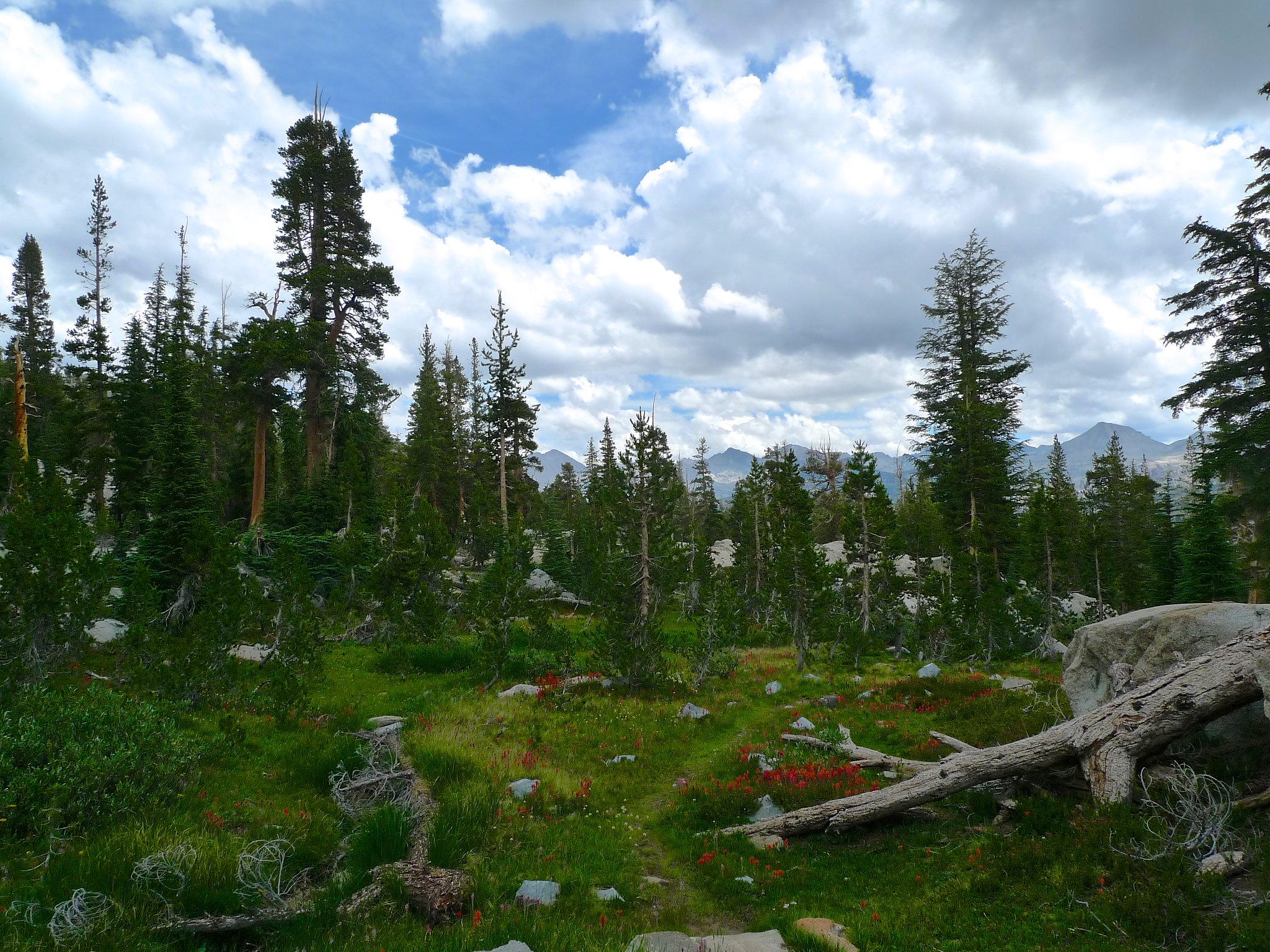
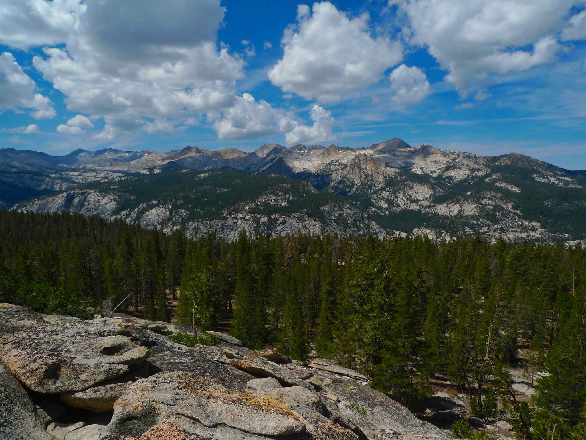
I ran into a group of six park biologists and interns studying fish populations and then a group of five park biologists studying the effects of fire on pollinators. They were the only people I’d meet on the trail until well up Illilouette Creek’s canyon, and the beautiful blooms in the fire areas made it clear why the were out! The fires of a few years ago left some wide open spaces with nice views of the granite domes Yosemite is known for.

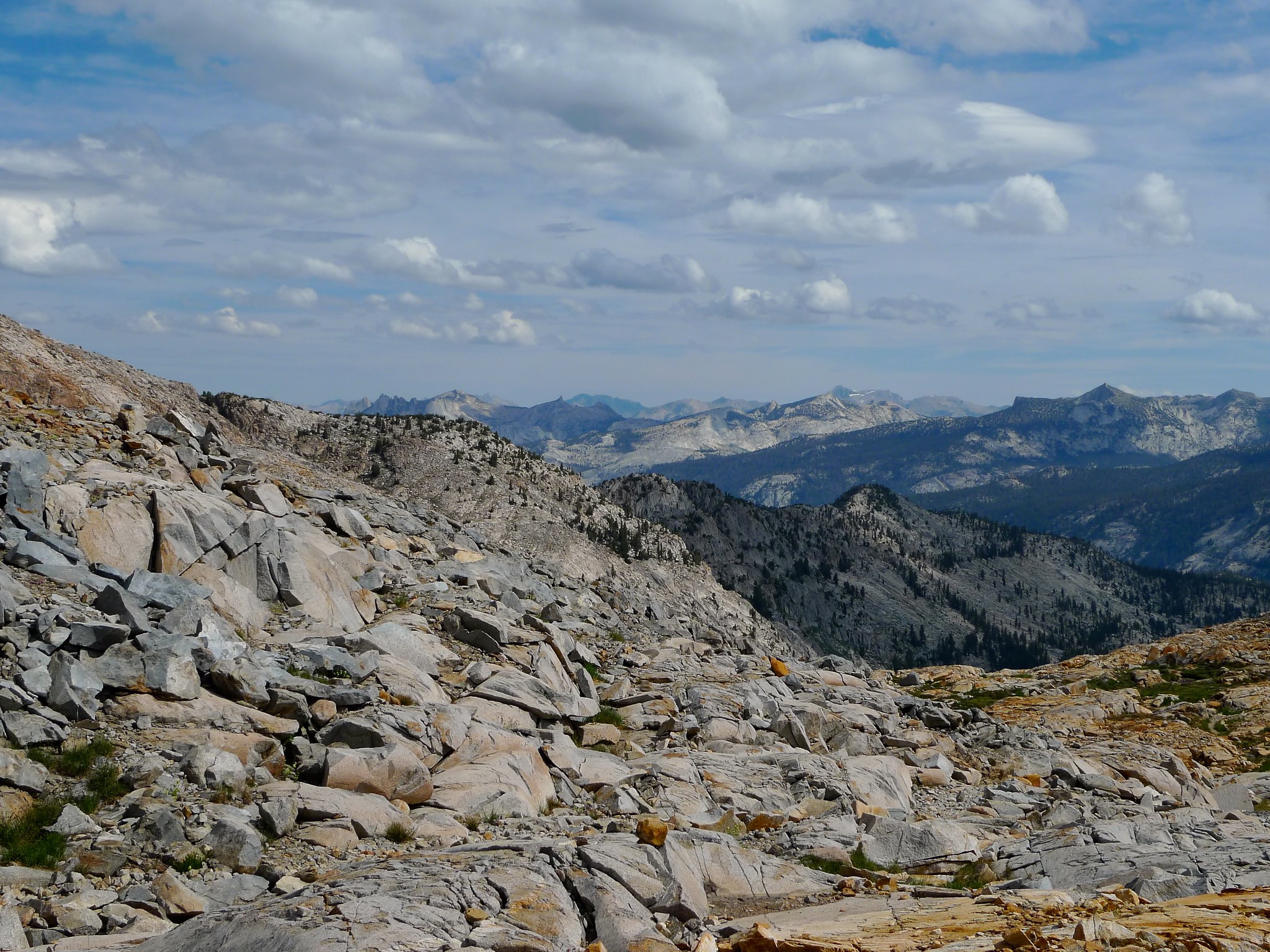
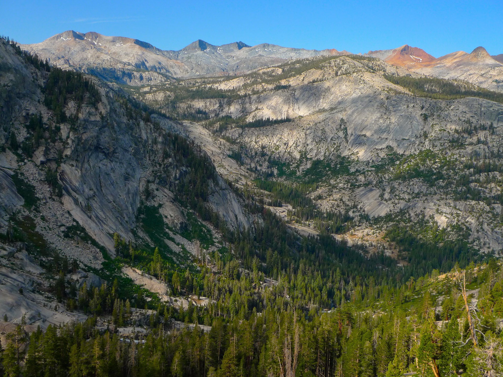
I crossed Illilouette Creek and began hiking up a sandy area before entering the forested area with peek-a-boo views of surrounding domes as I hiked higher up towards the Clark Range.
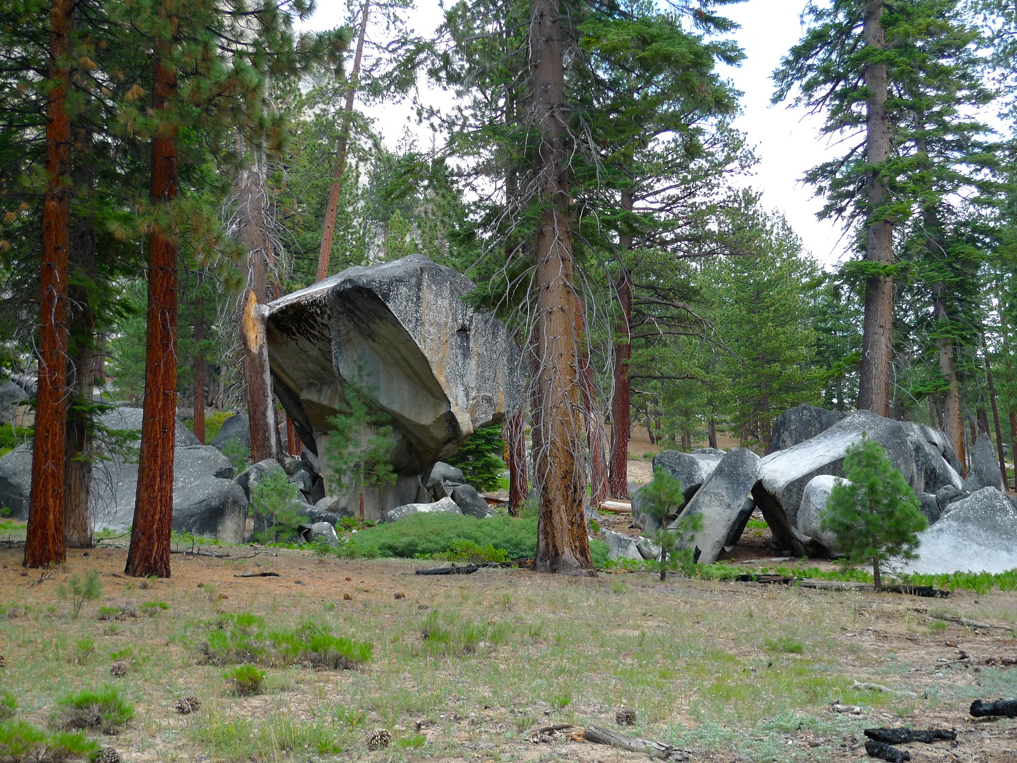
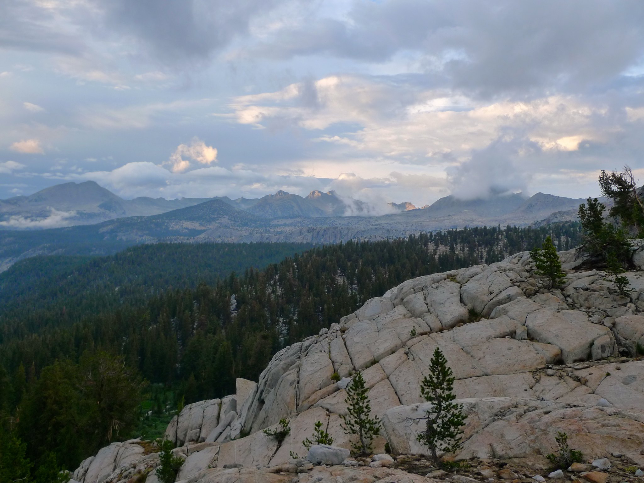
There wasn’t much to look at for many of these miles, but there were some interesting rock fall boulders, including this especially precarious group.
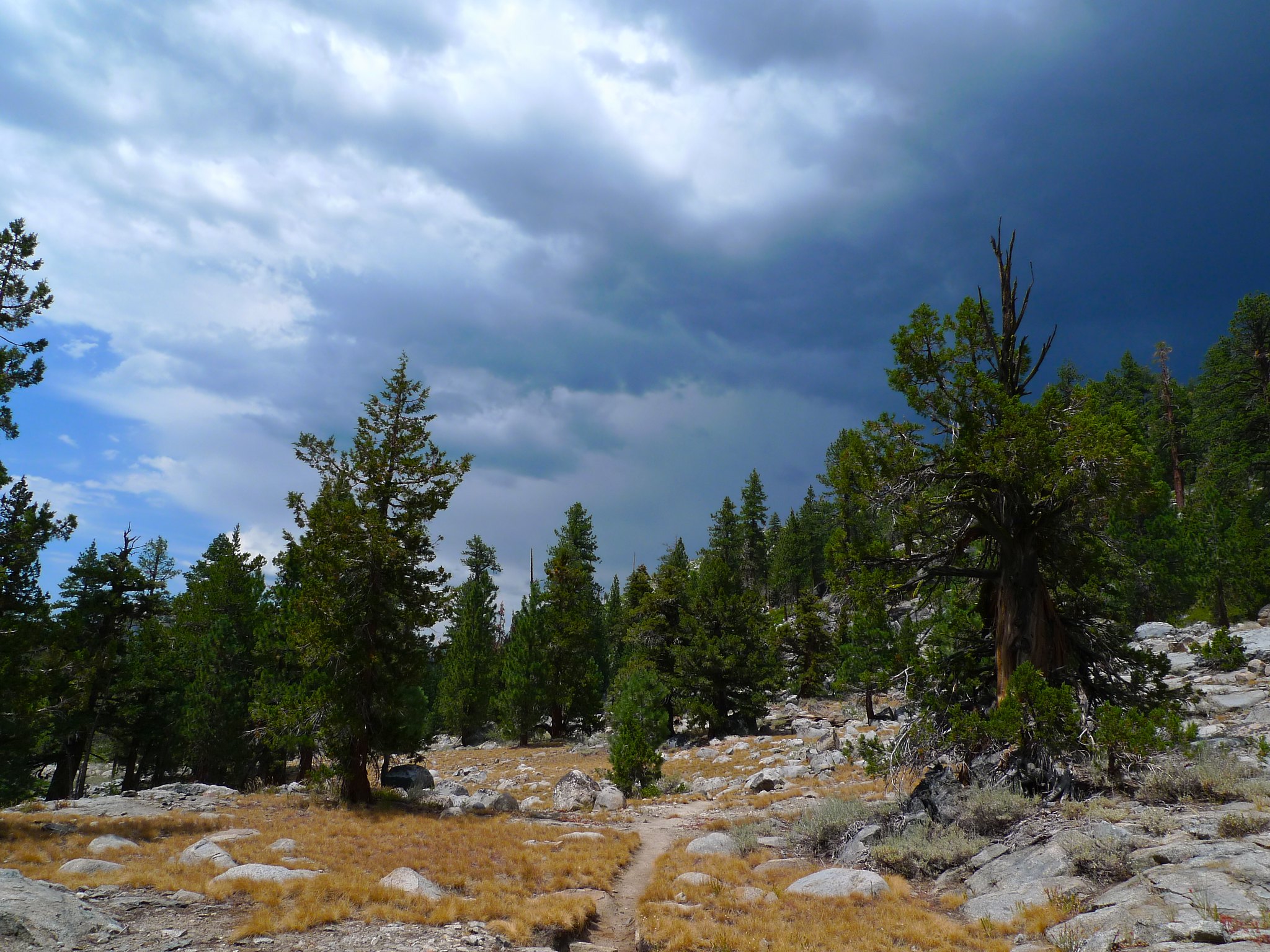
As a sign of the coming days, I found myself racing a thunderstorm in the afternoon. Knowing that I’d soon enter a much more exposed area, I elected to hunker down and nap in my tent for a few hours while this system worked its way through.
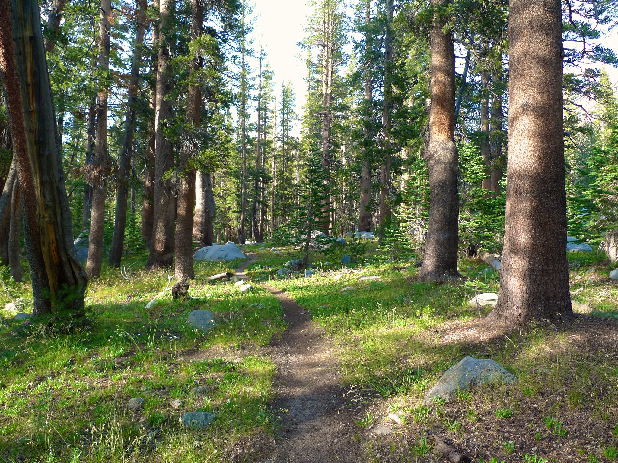
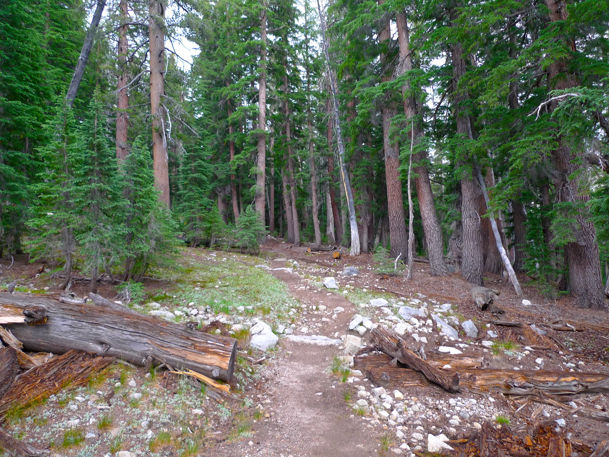
Once the threat had passed, I continued making my way up the canyon through the forest.
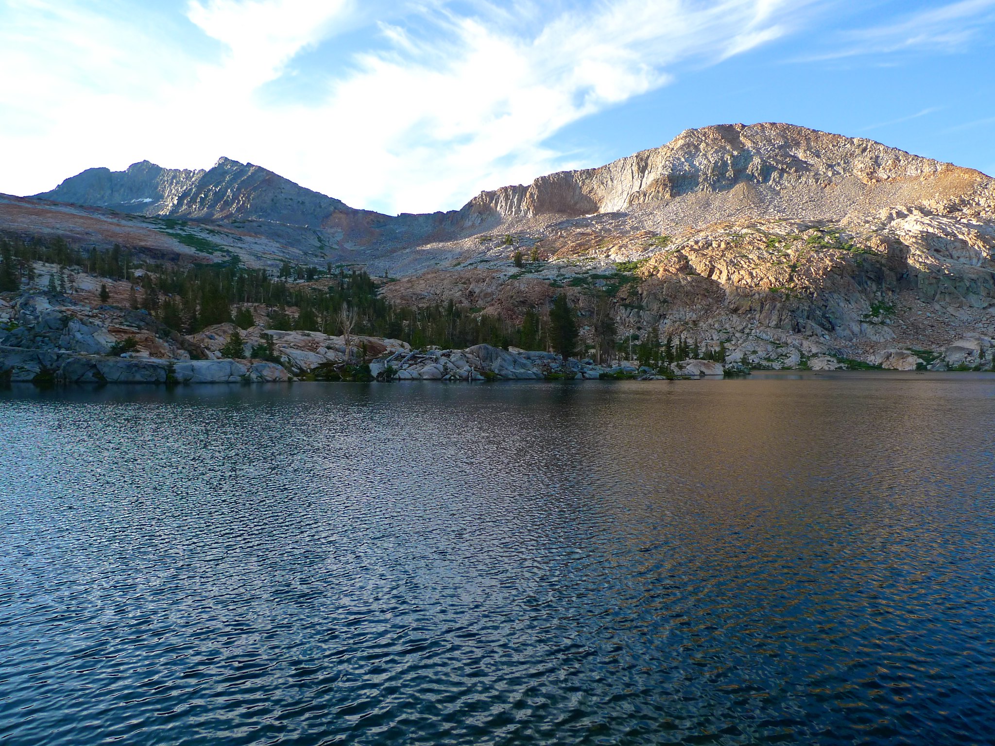
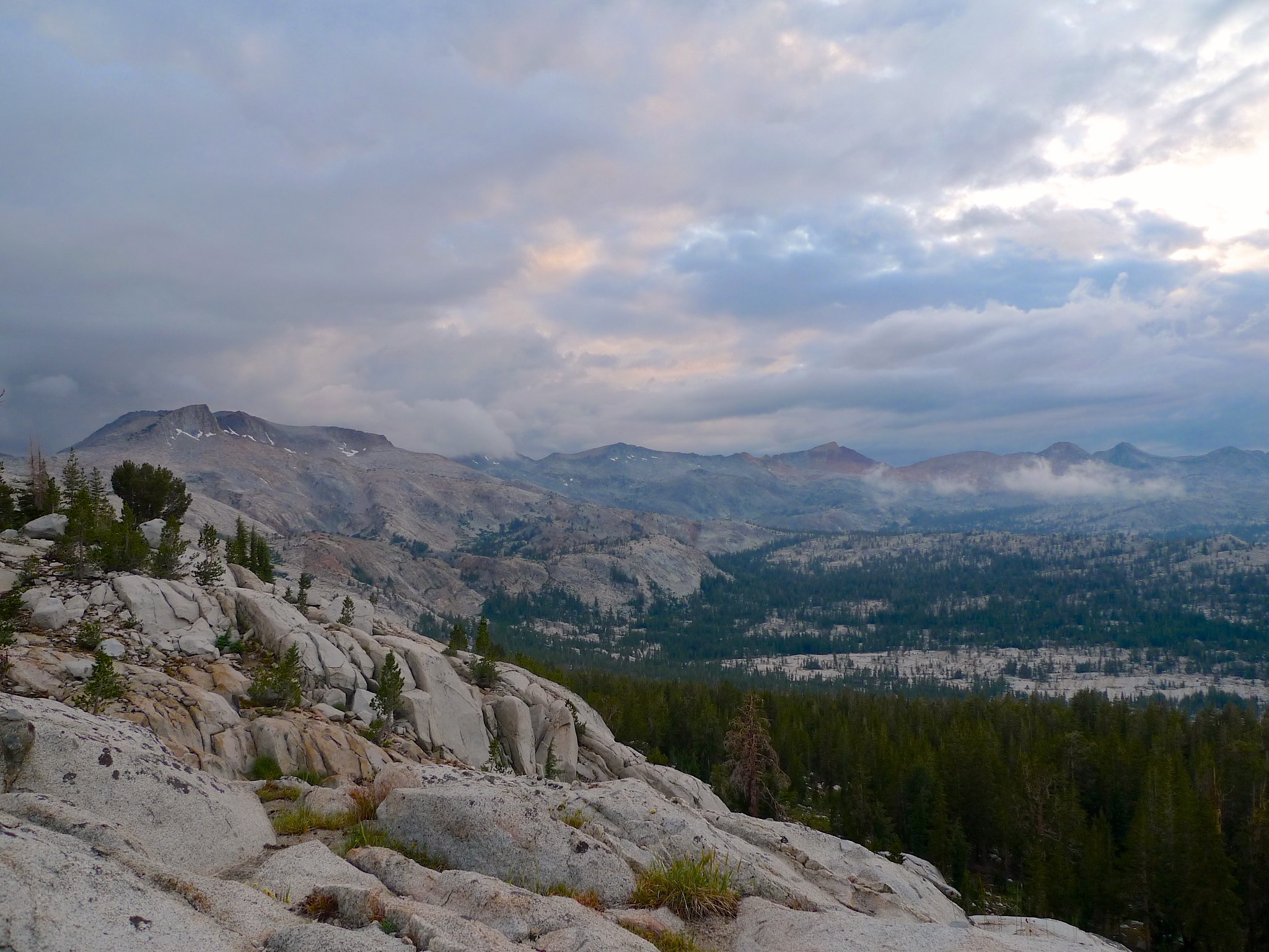
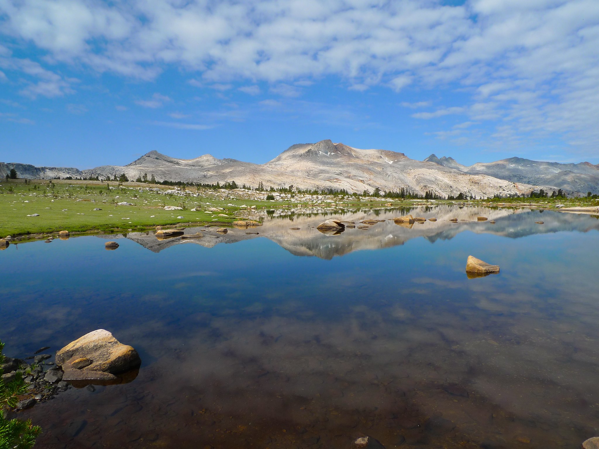
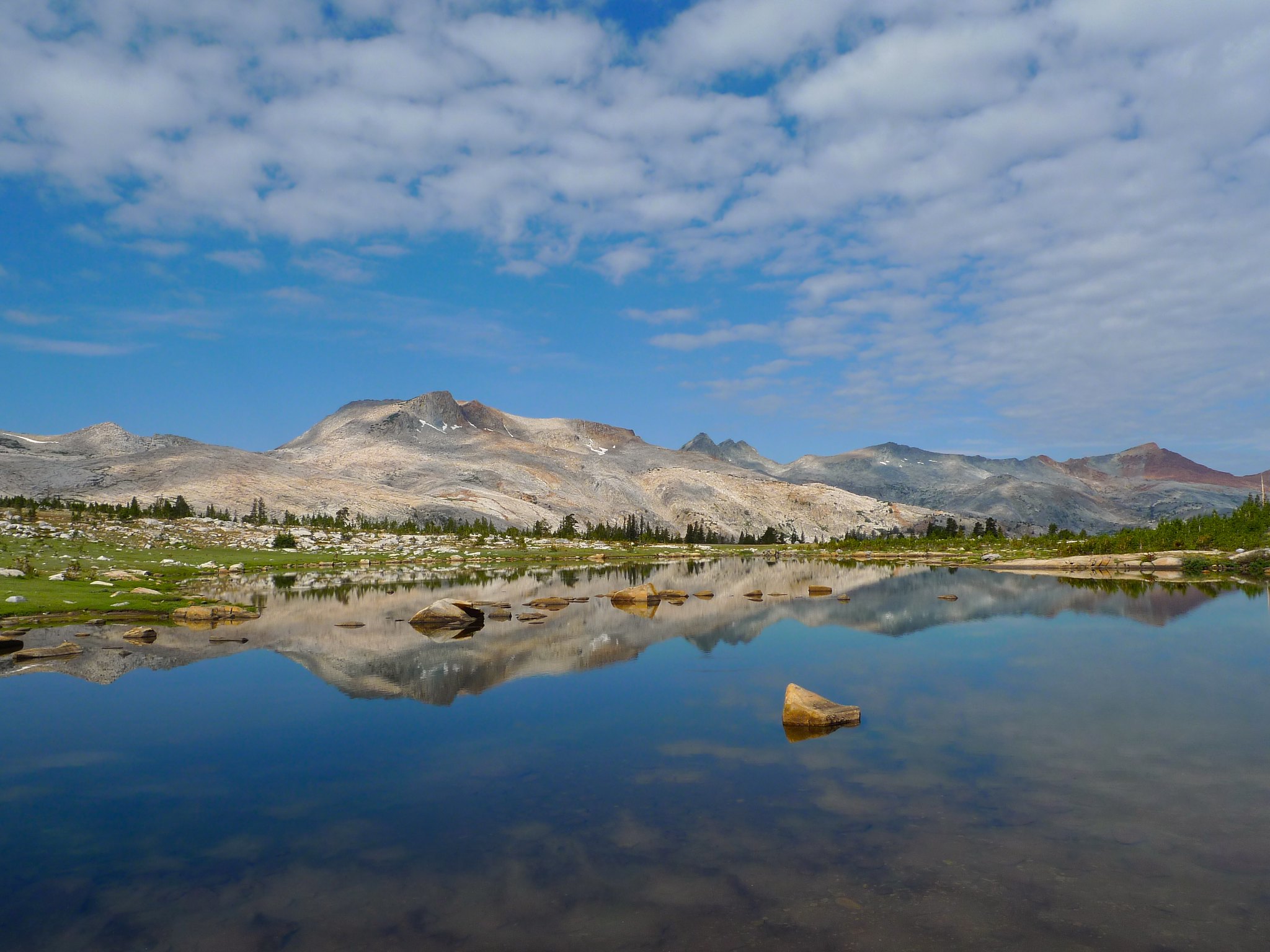
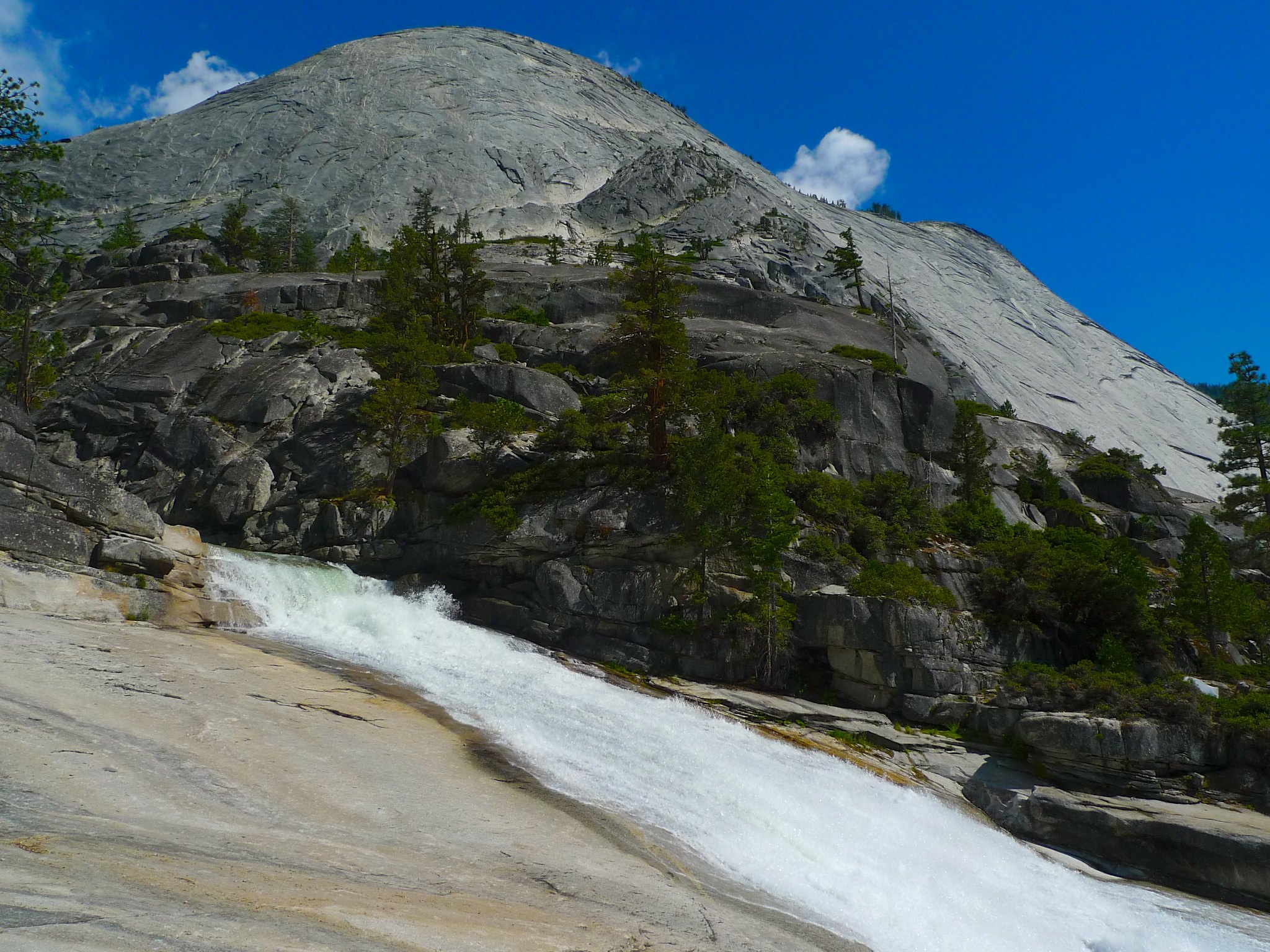
I was quite tired and the light was fading, so I planned to camp at the next water source I found. Many of the creeks were dry in this draught year, so I continued towards Ottoway Lakes. The red rocks of Red Peak came into view as I neared Ottoway Lakes outlet stream.
Upon finally reaching Ottoway Lakes outlet stream, I made camp, got water, bathed, and crashed. I knew I’d have to get up early the following day to beat the storms over Red Peak Pass. The forecast had the storms starting around 11am to noon, much earlier than normal, and the descent on the north side of Red Peak Pass is entirely exposed for miles—not a great spot to find oneself in a thunderstorm!
Day 2
Outlet Stream of Ottoway Lake to Lake 10,005 (west of Isberg Peak)
11 miles, +3200ft/-2500ft
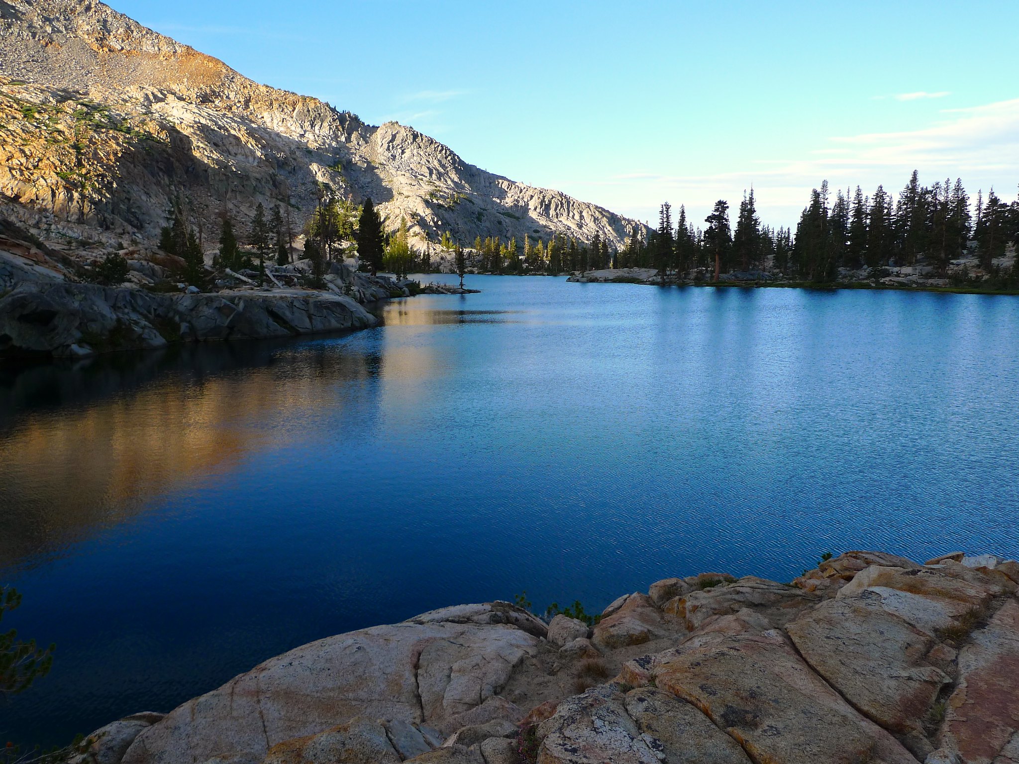
I woke around sunrise and broke camp quickly. By 6am I was making my way up the granite shelves towards Lower Ottoway Lake as the sun began to light up the ridges to its south.
I snapped a few shots at the lake as I made my way around its western and northern shore. I ran into one solo hiker in his pj’s at his camp who had been out for several days. He was surprised to seem me on the move so early, but when I told him about the expected early storms, he understood. He had been racing the storms yesterday down the pass, literally running to get to a sheltered area. He said he had 20 miles to cover this day and he was not expecting to make it!

The trail between Lower and Upper Ottoway Lakes is brutal—granite stairs and steep stretches built right into the rock. I would have done anything for some switchbacks instead of these stairs! But soon enough I found myself happily looking back down at Lower Ottoway Lake well below my feet.

And then I gained elevation above Upper Ottoway just as the sun was beginning to shine on its shoreline.
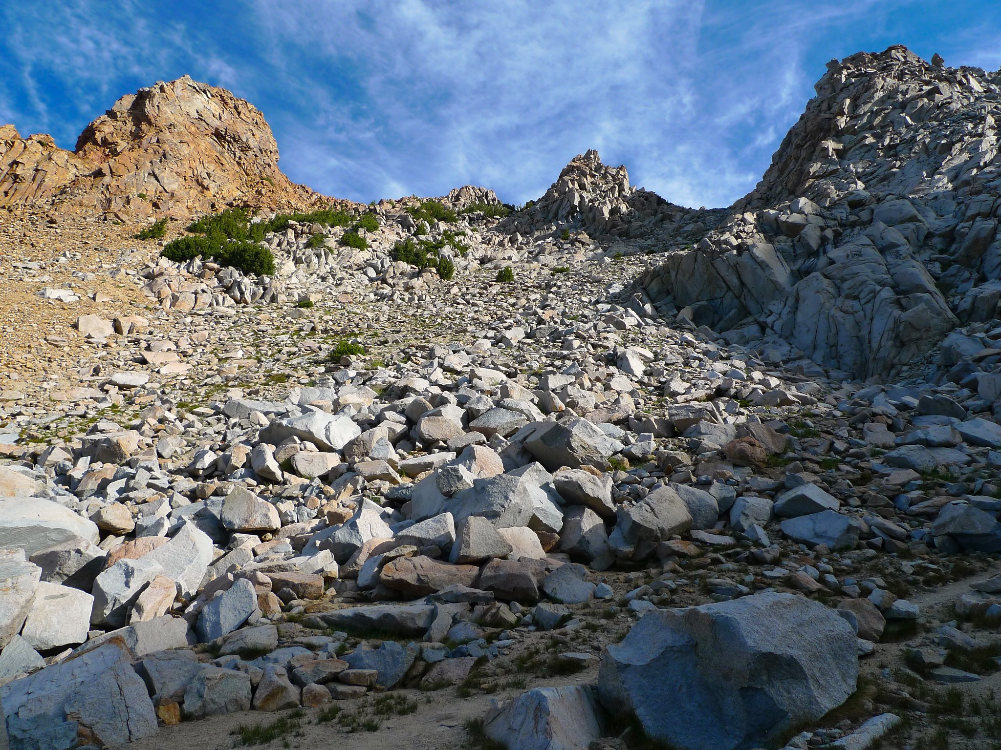
There were more stairs as I headed towards Red Peak Pass, but fortunately these would soon give way to some expertly constructed switchbacks.

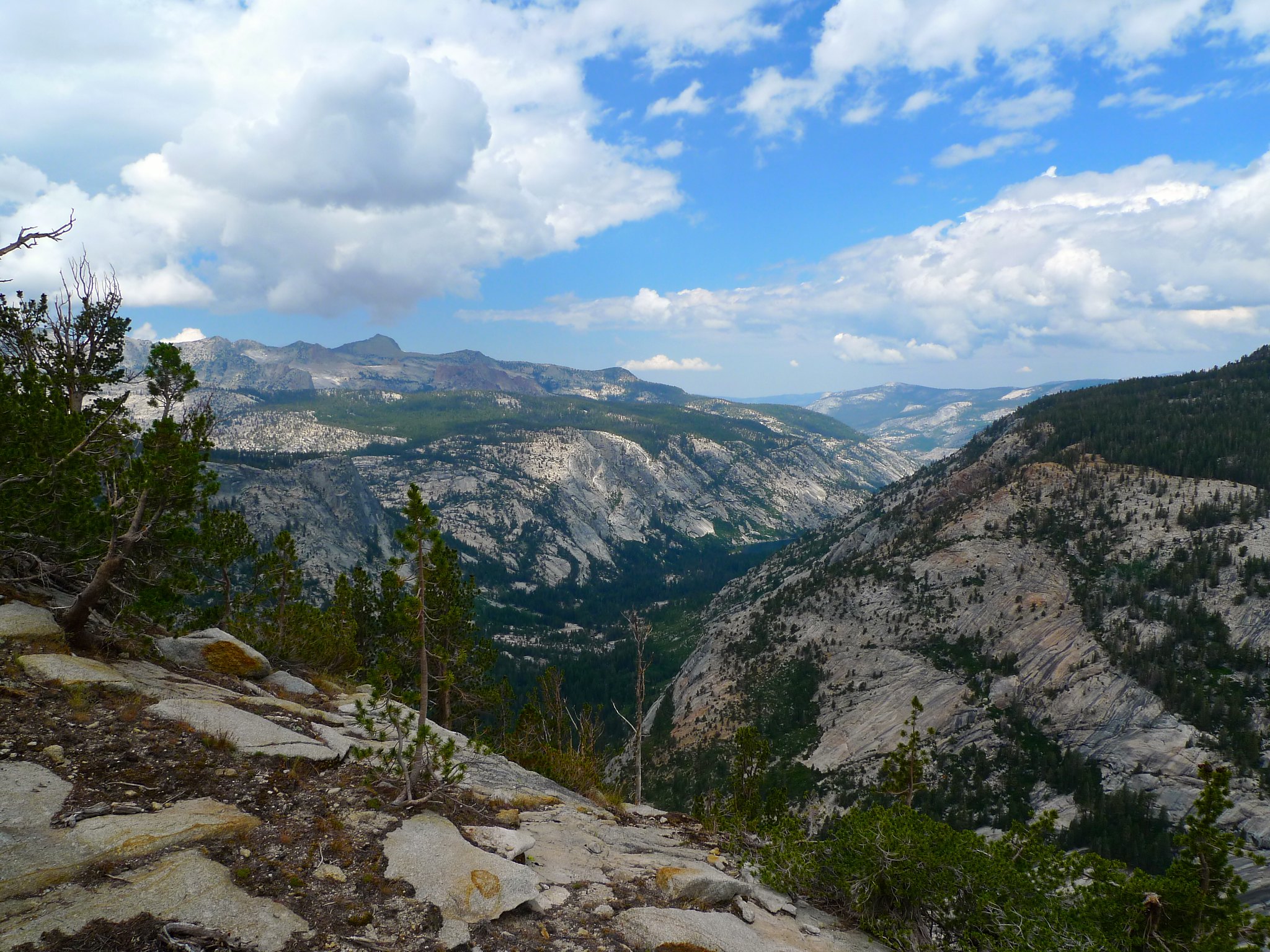
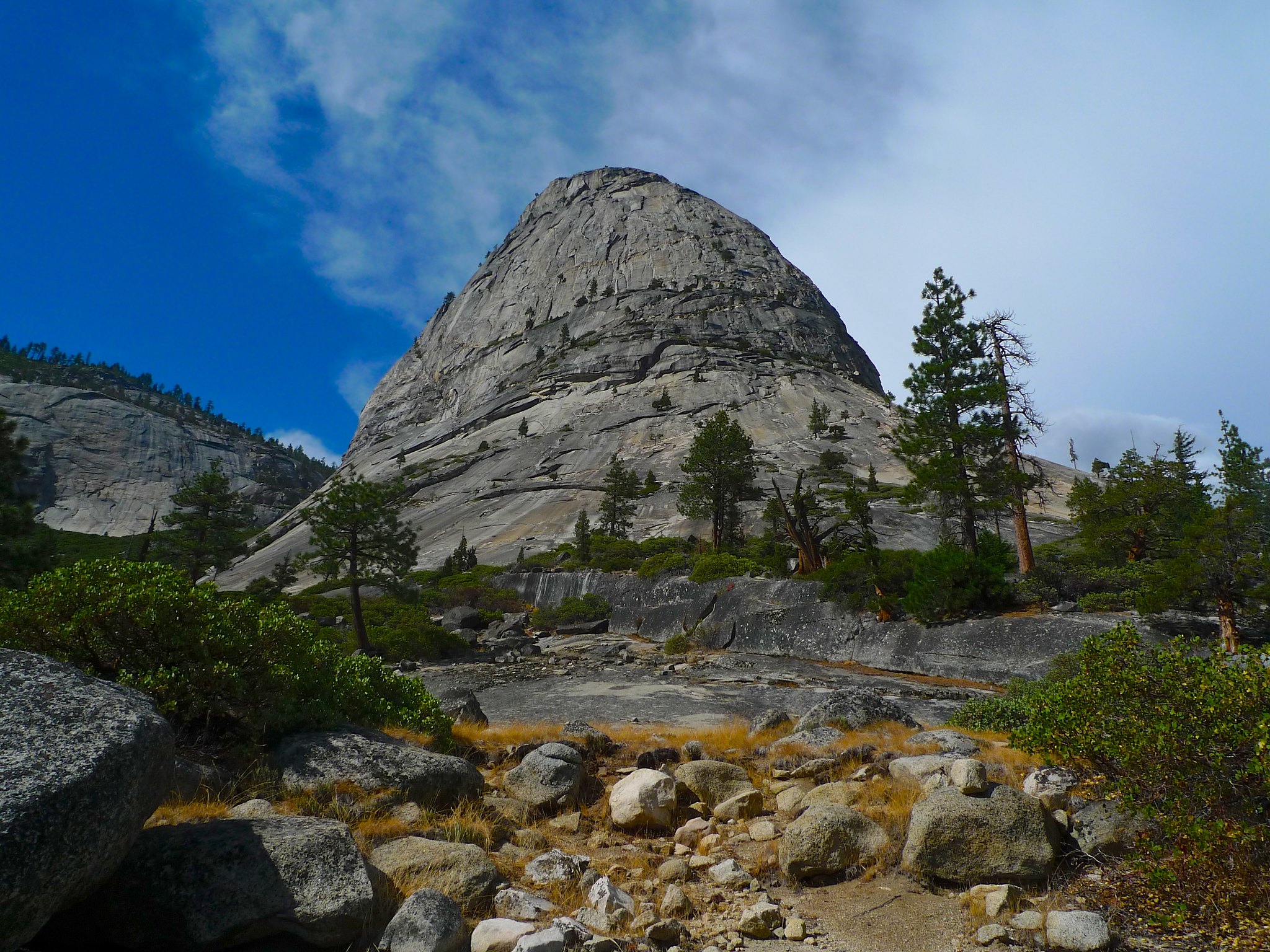
The trail heads up through a major talus field to the southeast of Red Peak. The pass itself is in the u-shaped dip of grey talus between peaks here. It’s impossible to see the trail from below—a testament to the expert construction of the switchbacks!
Once atop the pass at about 8:30am, I had a wonderful view of the rocky moonscape to the south…

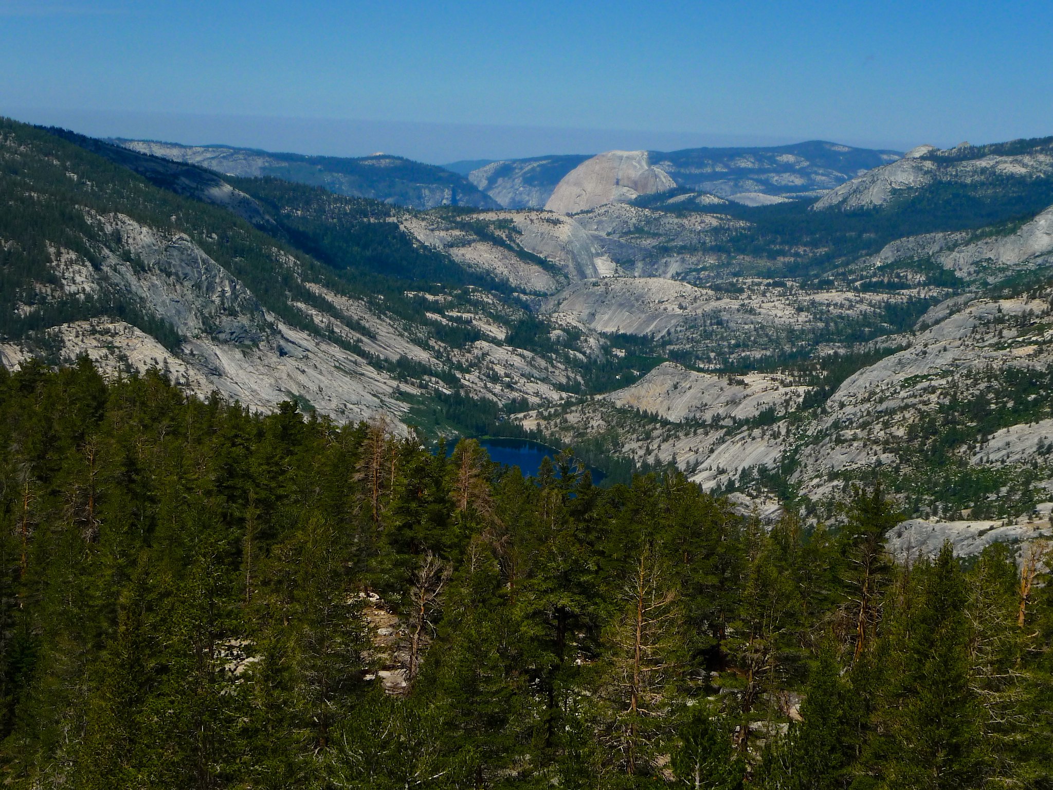
…and the sculpted granite below the Yosemite high country to the north and east.

I was thrilled and completely surprised to see the Minarets and Banner and Ritter from this side! I was not expecting that and it was really fun to see them clawing at the sky to the east.
I had heard that there was cell reception from Red Peak Pass and after an hour of breaks and puttering about the pass, I was sad to not have found it. I tried my phone one more time from a spot a few hundred yards north of the pass and was giddy with excitement to be able to call Patrick from the middle of this moonscape. It also put me at ease, as I’d not been able to get in touch with him since entering the Yosemite Valley the night before. I even took the chance to Instagram, of course ;)
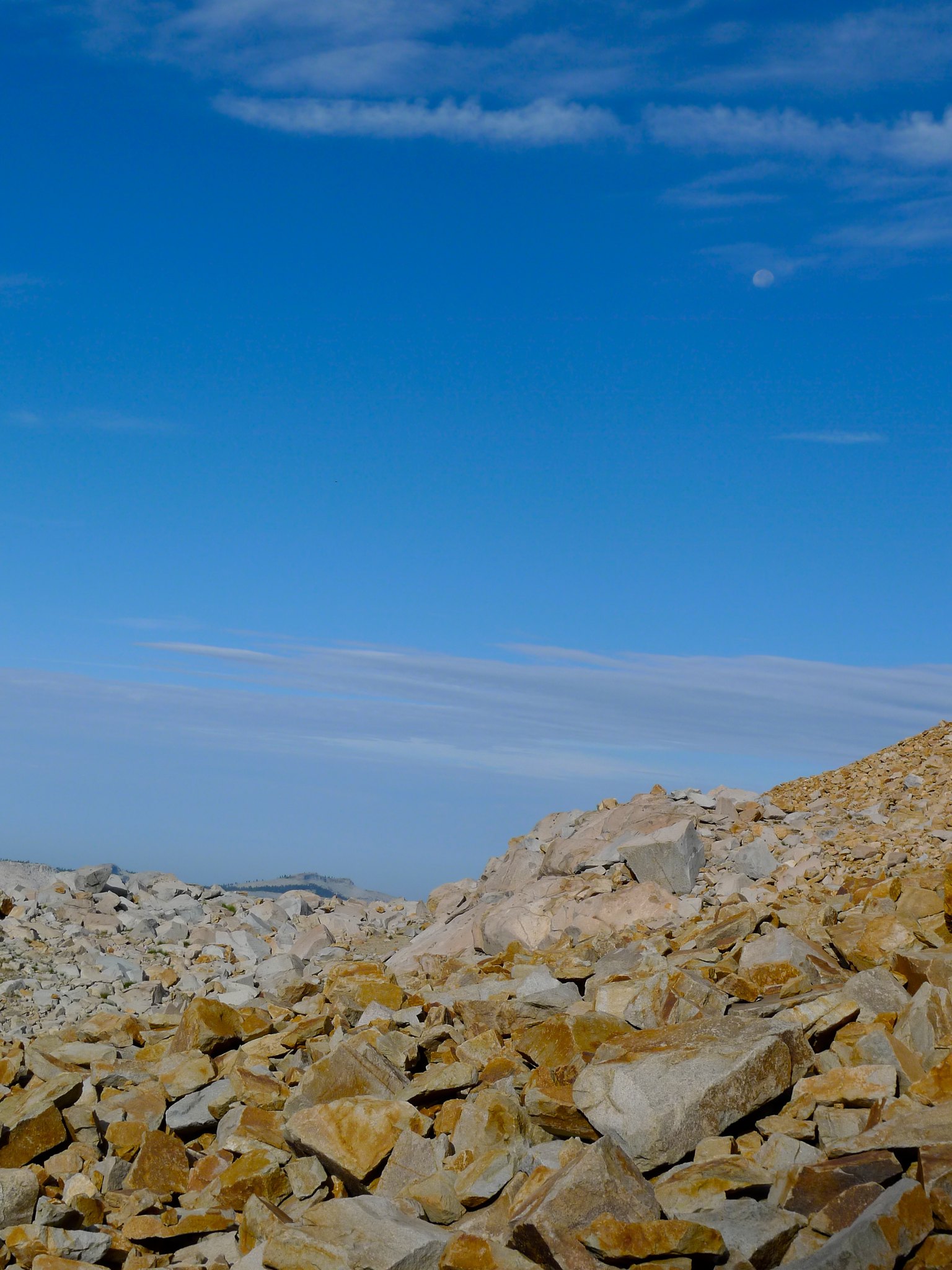
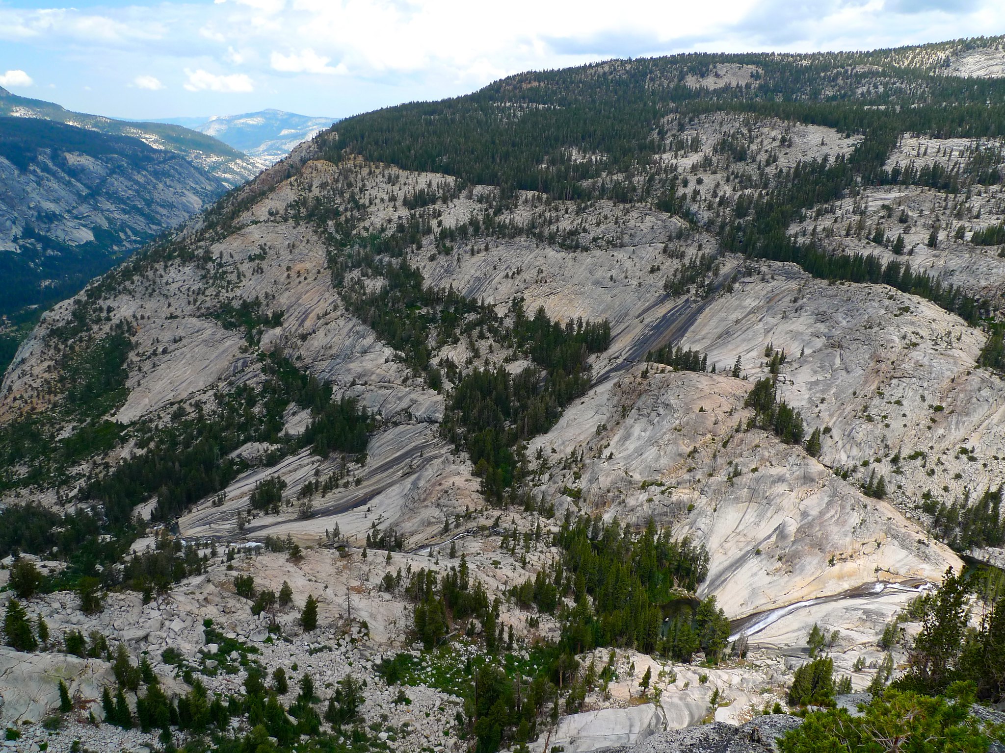
After spending far too much of my cell phone’s battery sharing my experience on Facebook, I finally turned the dang thing off and headed down the desolate talus with a view of the high country ahead of me the whole time.


The clouds were gathering ever more as I descended towards the drainage above Red Devil Lake.

And every time I looked back up at Red Peak Pass, I was very happy that I’d chosen to rise so early. Dark clouds started to loom over the pass around 10am and only got worse as the morning wore on.
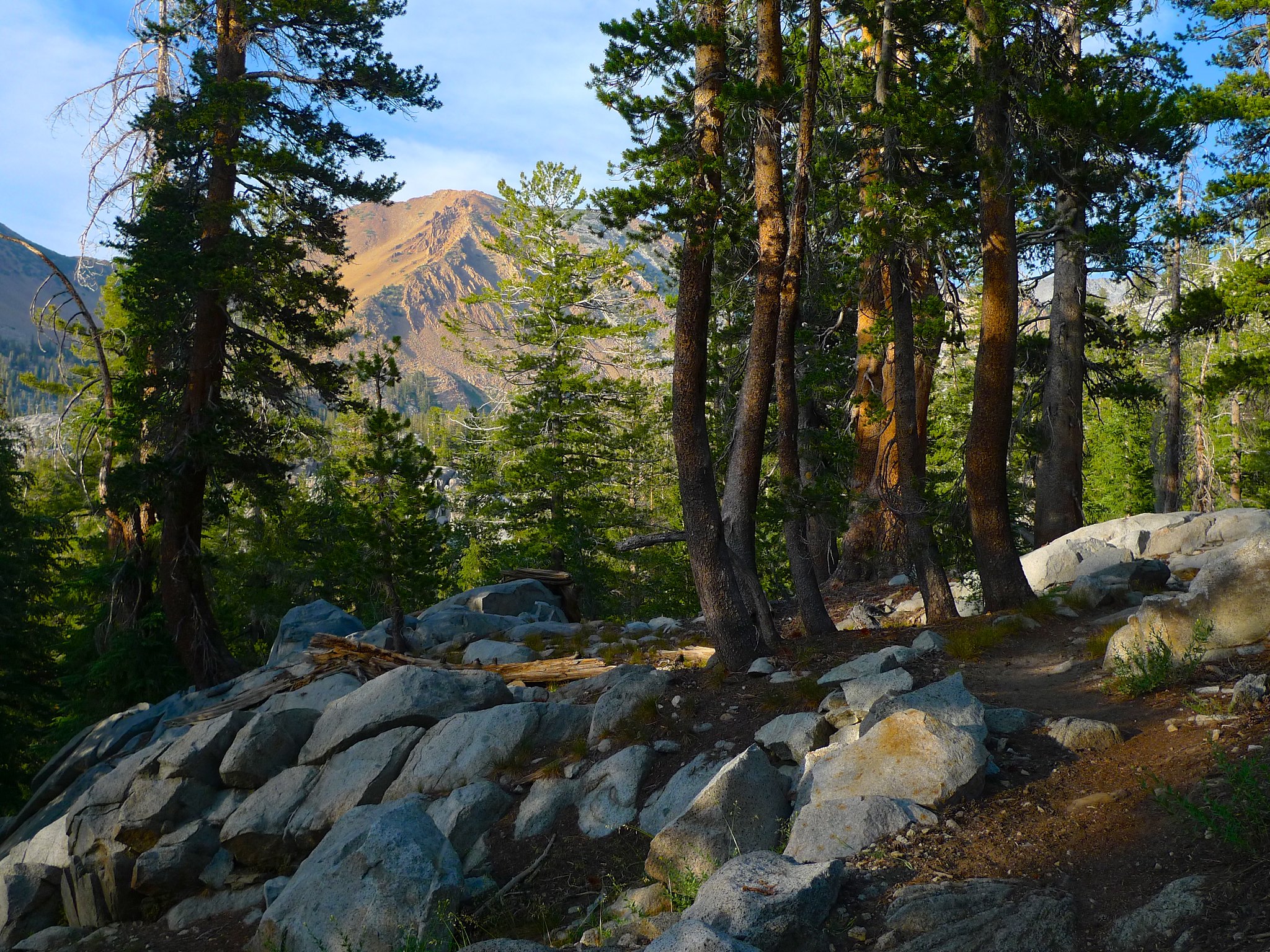
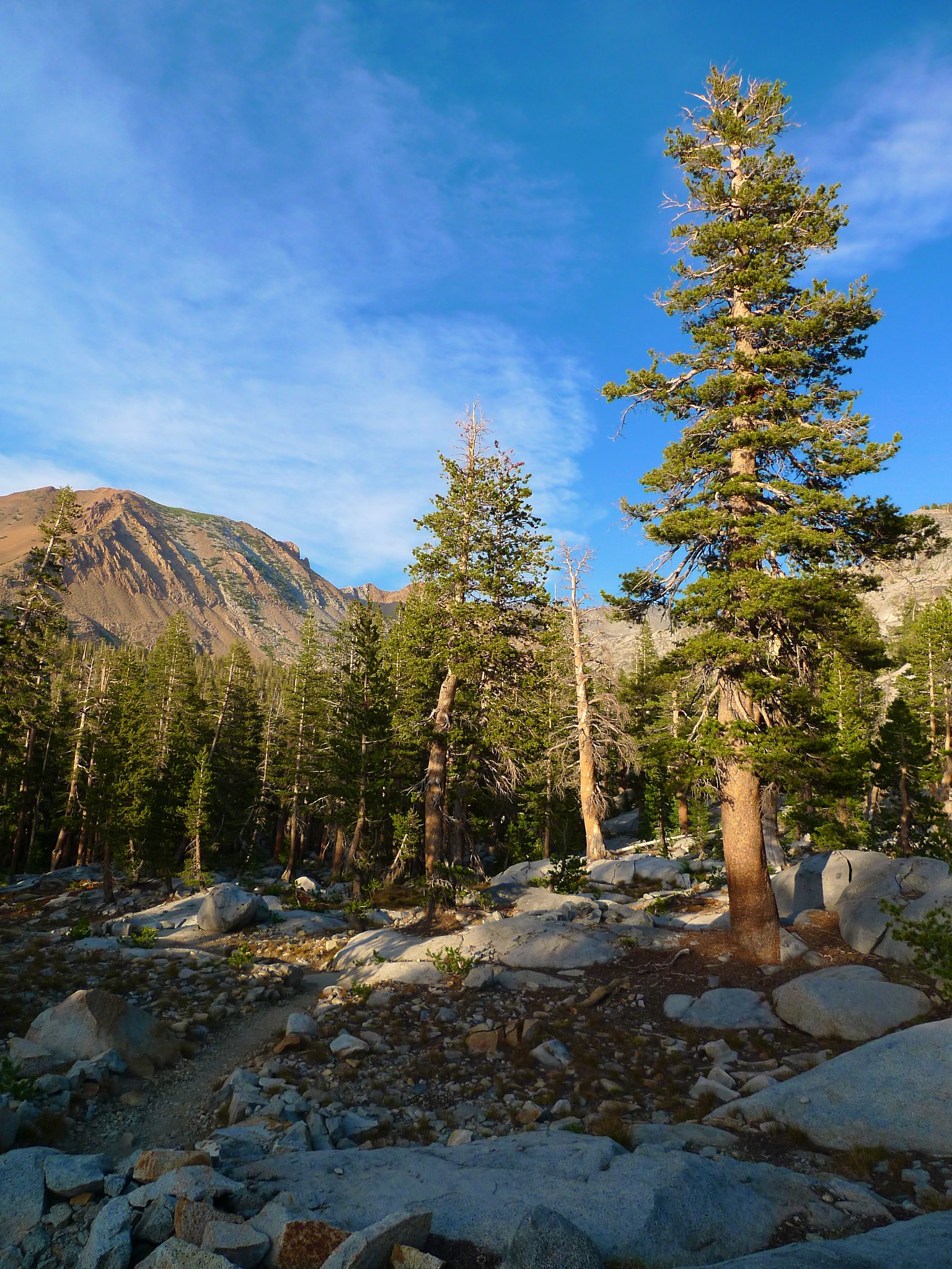
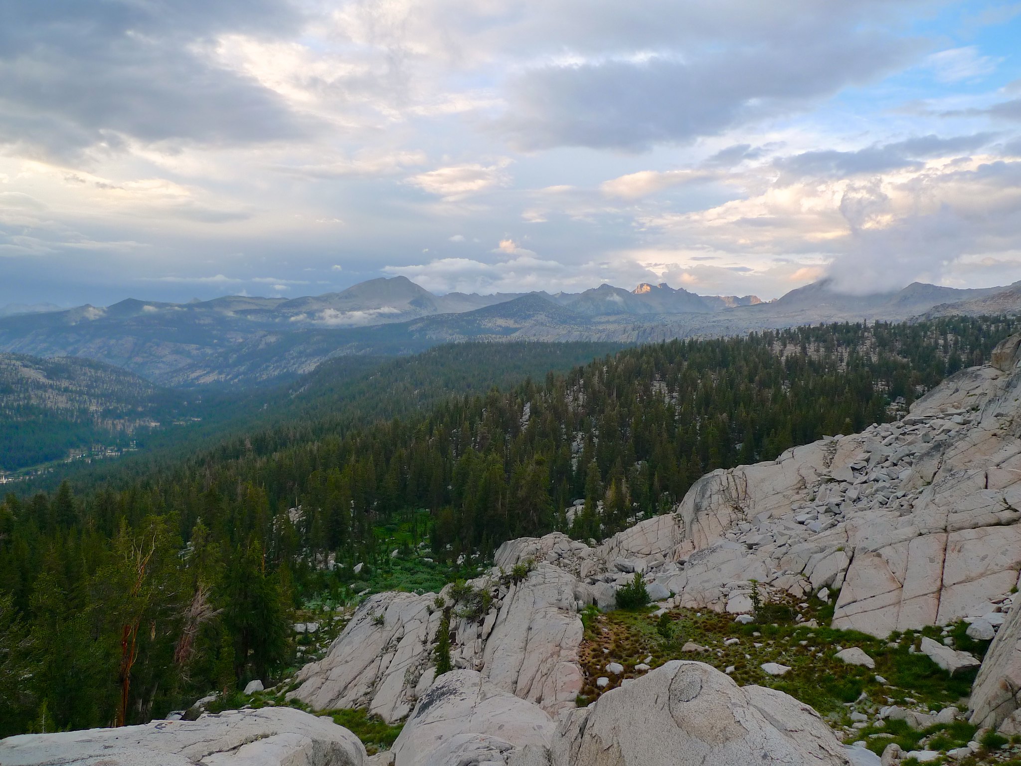
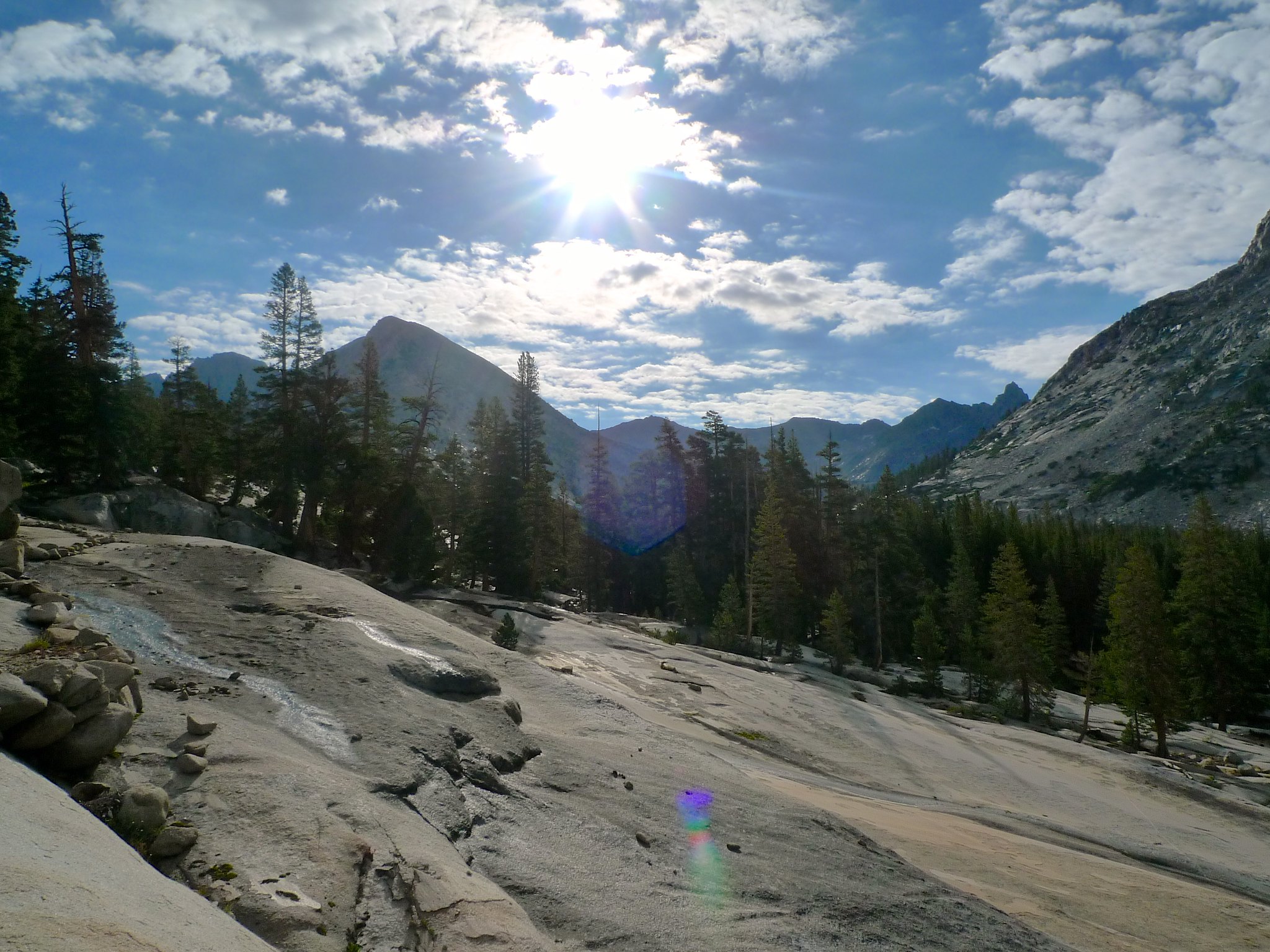
I didn’t mind, though, because the trail had me undulating up and down through sparse forests, tarns, and meadows of wildflowers, all with the Yosemite high country as a backdrop.

Around 1pm, the weather grew bad enough for me to seek shelter. I set up my tent and had lunch and a nap as the storm boomed overhead.
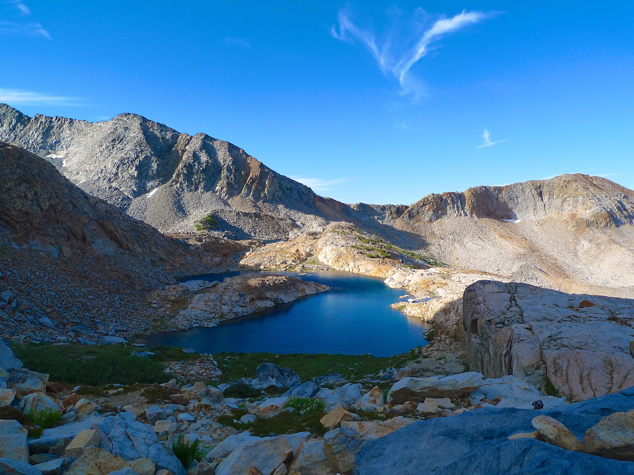
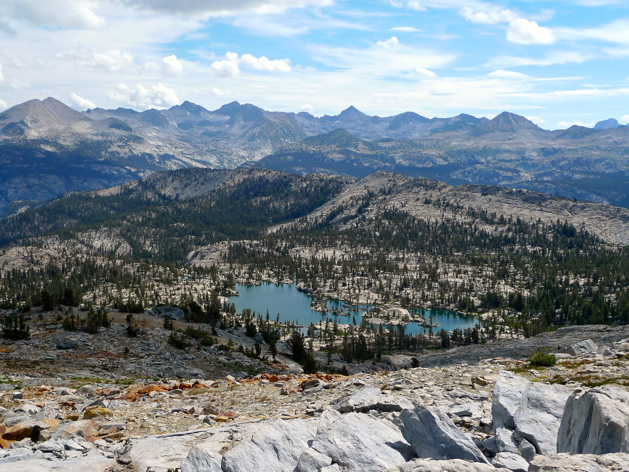
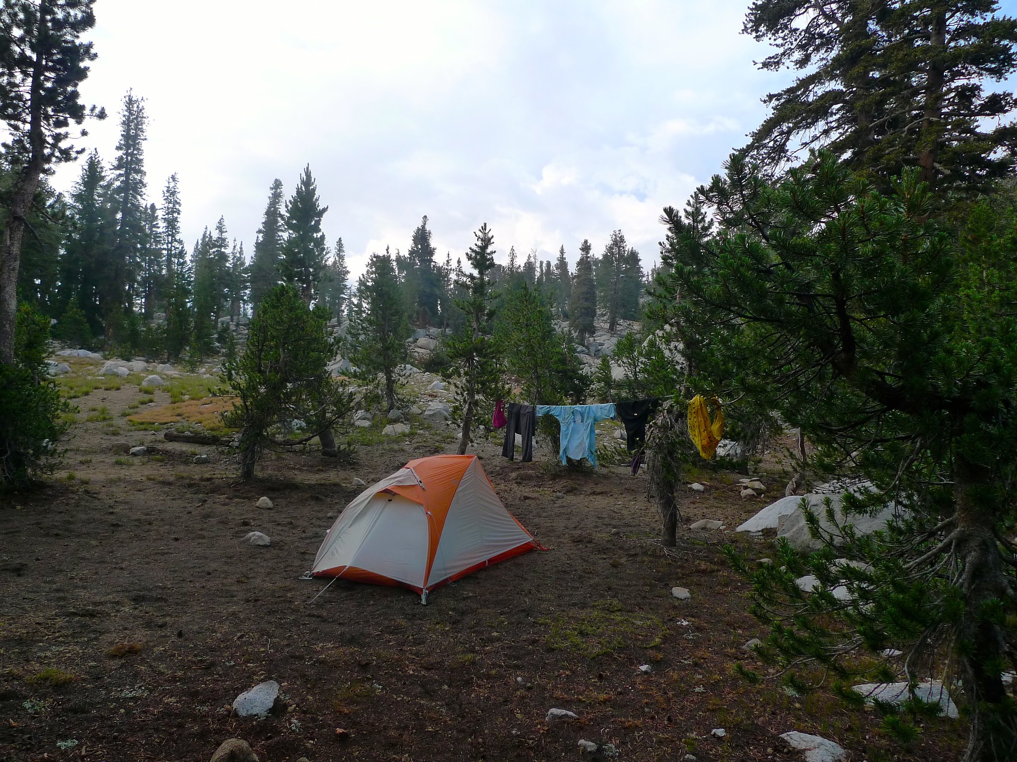
Most of the storm seemed to have run its course by 4pm, so I decided to continue the 500 more feet down to the Triple Peak Fork of the Merced and then up the opposite side of its canyon towards Isberg Pass; I planned to make camp at some off-trail lakes just west of the pass. As I ascended the east side of the canyon, I ran into the first people I’d seen since the solo hiker I’d come across in the morning. We were headed opposite ways on the same trail, so we exchanged beta on water sources and potential campsites before parting ways. I made my way up the final 700 feet of the day towards the high meadow and lakes west of Isberg Peak. The weather had held so far, but of course as soon as I reached the exposed ridge, the clouds began to weep and the mountains reflected booming thunder from all around. I was in a rush to find a sheltered spot—I was only 500 feet below the highest peaks in the area, on an exposed ridge with no shelter from trees. I skittered (as best one can with a 30 lb pack on!) east through sparse trees until I found some shelter amidst woods northwest of Lake 10,005. Ah, here was a camp! An established camp, even! I began to set up my tent as the clouds opened up, counting the time between flashes and booms. One one thousand, two one thousand… BOOM. As I was setting up my tent, I wiped the moisture from my glasses and noticed I was setting up in an established packer’s animal area. Should I look for another spot? FLASH one-oneth–BOOM GRUMBLE RUMBLE RUMBLE RUMBLE GRUMBLE… uh no I guess this will do!! Lightening was striking within half a mile; I needed shelter immediately. I scrambled to set up my tent in a flat area with minimal dung and crawled inside just as the full force of the thunderstorm opened up.
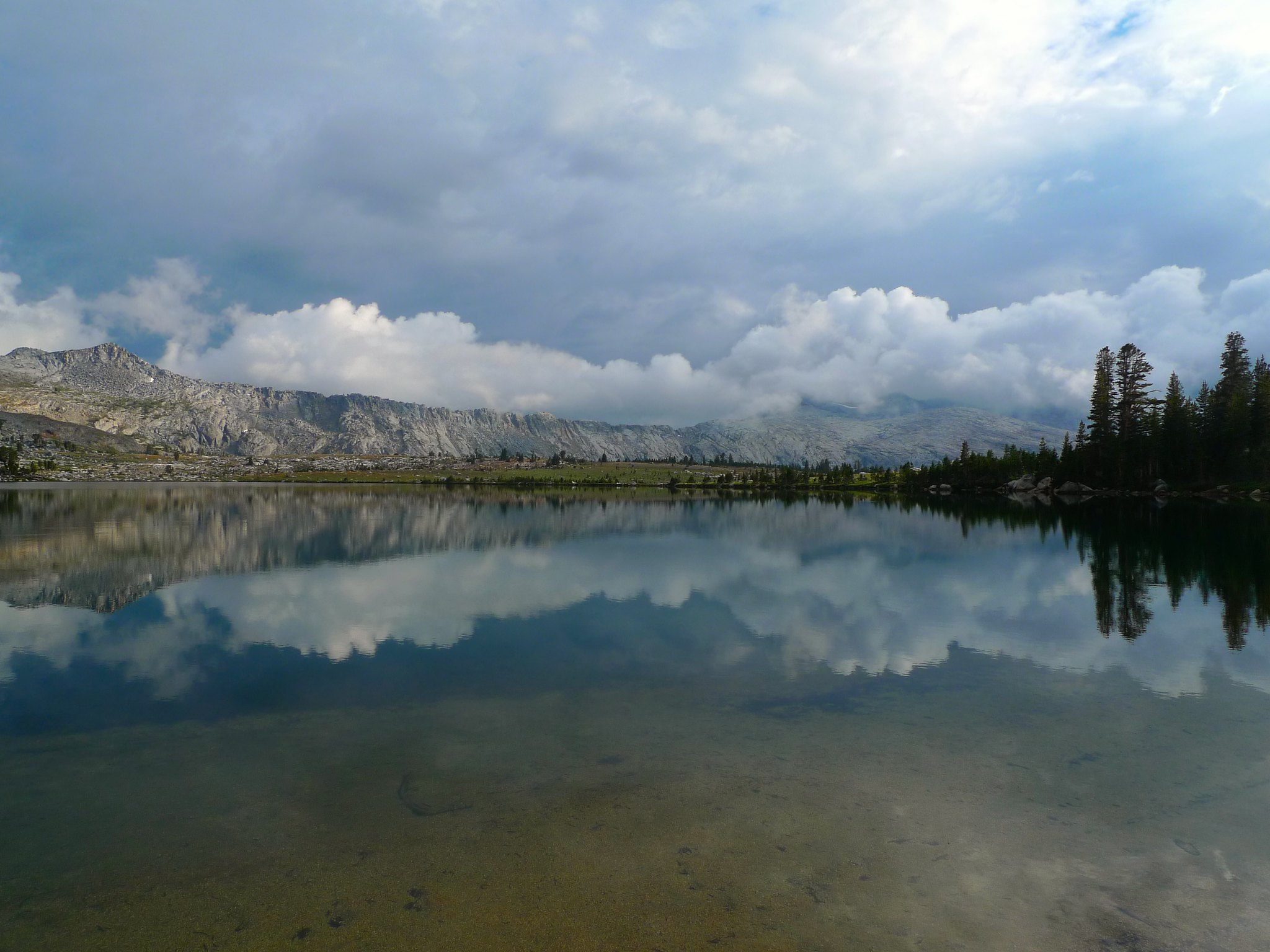
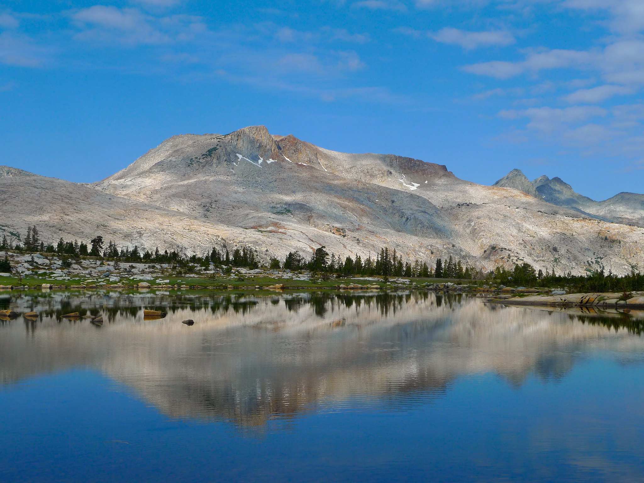
I was soaking wet, muddy, and camped in the midst of donkey dung. Good times! At least I’d packed my extra clothes and sleeping bag in dry sacks. I stripped and tried to hang my soggy clothes to “dry” (ha ha) inside my tent as I waited for the storm to pass. Around 7pm, the rain stopped and I ventured outside to a cloud of mosquitos. I needed water badly, so I sucked it up, plugged my nose from the stank of herbivore poo, and headed down to the lake. I was greeted with an incredibly gorgeous view while the mosquitos ate away at my legs through my long johns. This lake had a beach! If only it wasn’t lightning and swarming with blood-sucking mosquitos! Maybe I should return in late August…

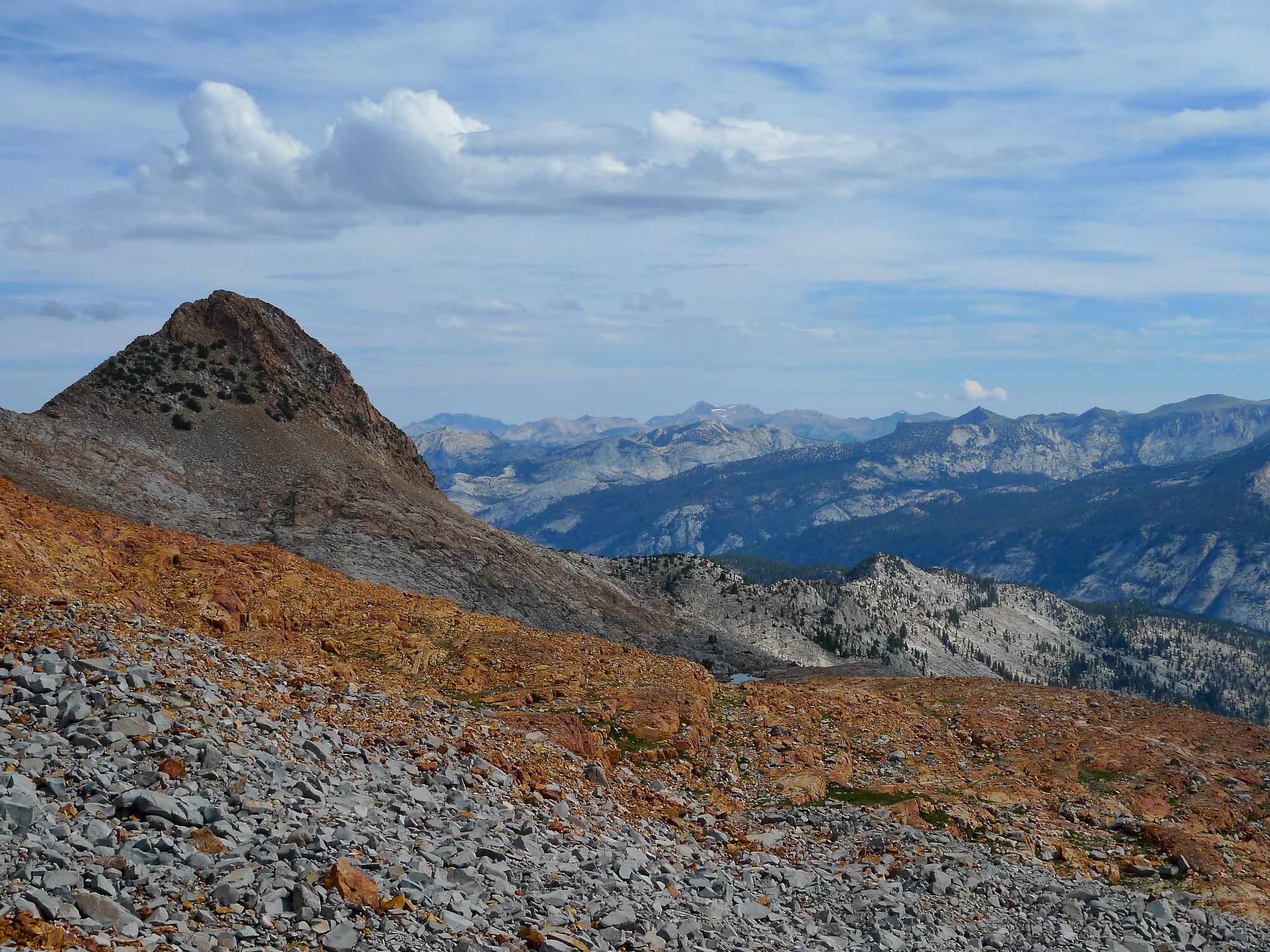
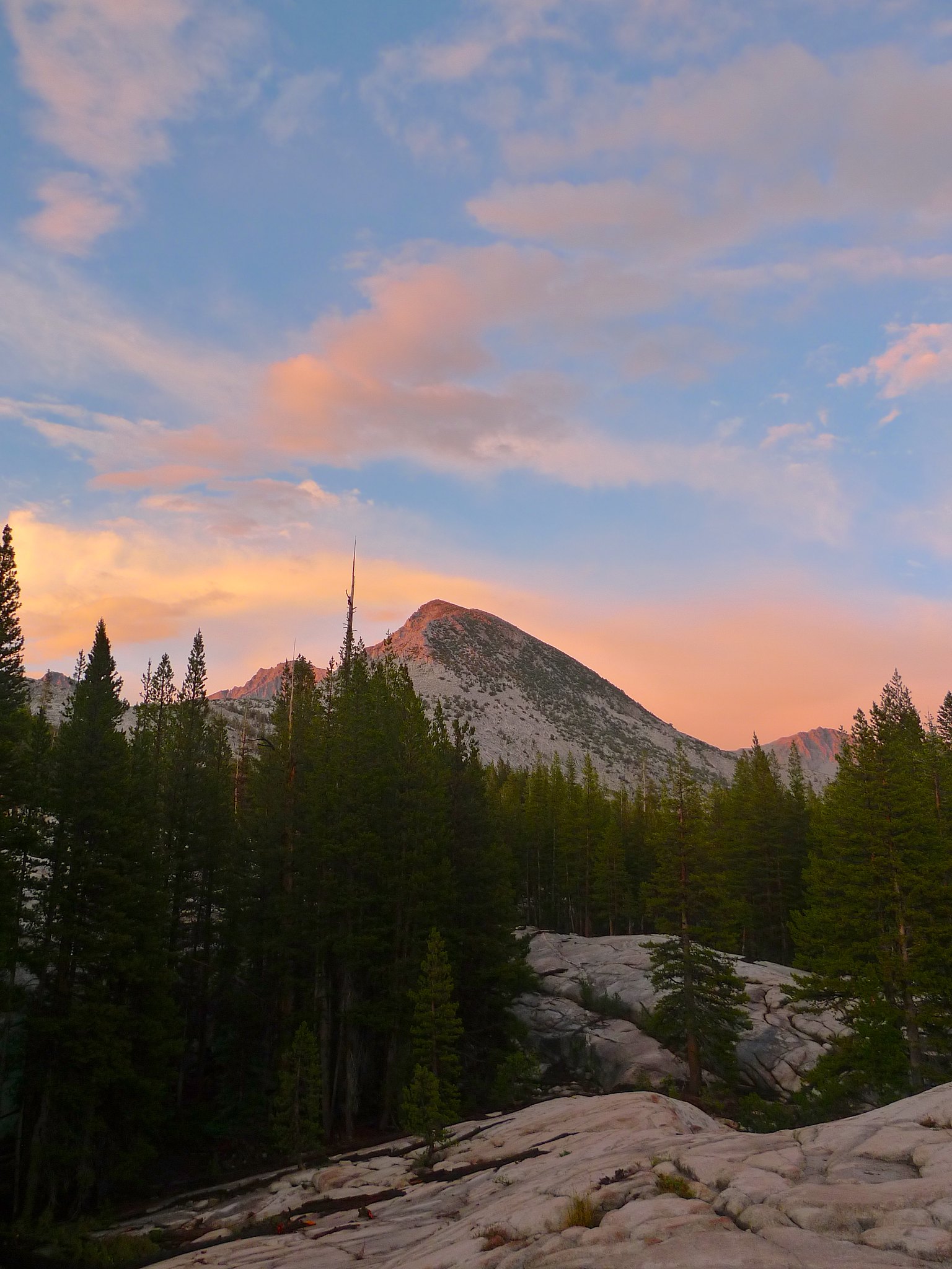
The rolling clouds and shifting storm made for a spectacular view to the south towards Isberg and Post Peak Passes.

But alas, the swarms of mosquitos proved more powerful than the scenery, and I made my way back towards The Crappiest Campsite™ where I strung up my clothes to dry.
I made myself some dinner (and became dinner myself to the thousands of mosquitos) before heading over to the exposed ridge area to check out the post- (well… midst- more on that later) storm view.
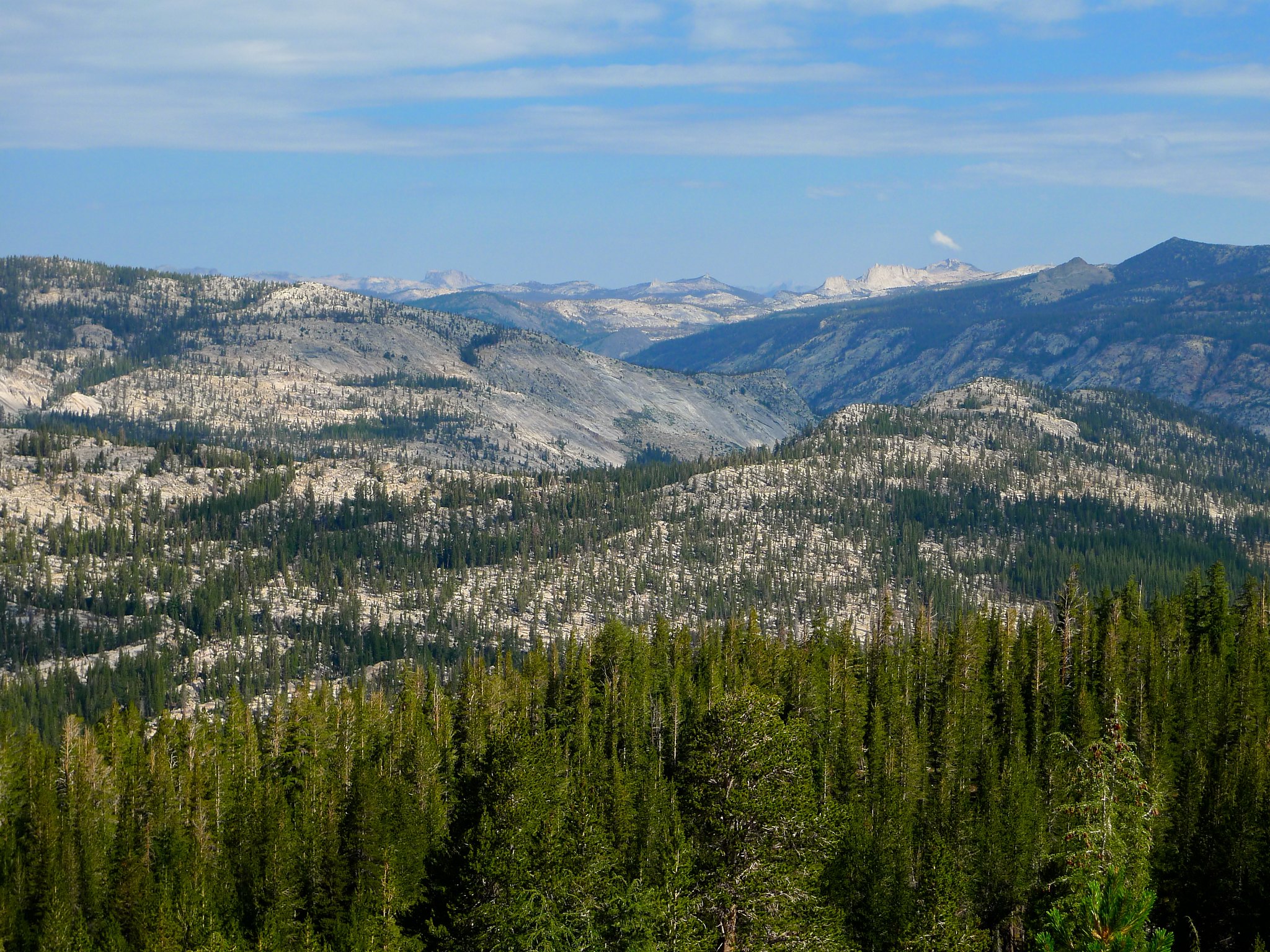
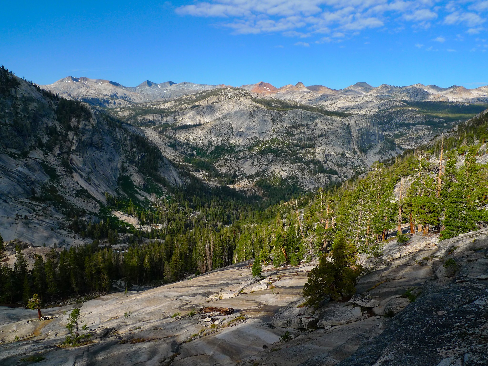
This view. It was unbelievable. I could see from Post Peak in the south and west towards the trail I’d taken from Red Peak all the way across the Clark Range and down the headwaters of the Merced River to Ansel Adams and other peaks of Yosemite’s high country to the northeast. It was absolutely spectacular.
I wanted badly to stay for the sunset, but thunder was sounding from the south and the storm was building again over Post Peak.
I made it back to my camp just in time to take down my still-soggy clothes from the line before the rain began to fall again. Ah, well. I shed my dung-caked boots and crawled into my sleeping bag, ready to spend the night worrying about the massive winds blowing down one of the many half-dead looking trees that could have crushed me during the night.
I love backpacking!
Day 3
Lake 10,005 to Lyell Fork of the Merced River
6 miles, +1000ft/-1900ft
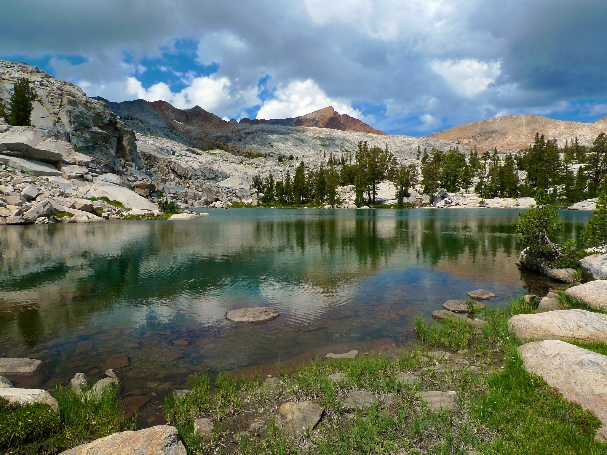
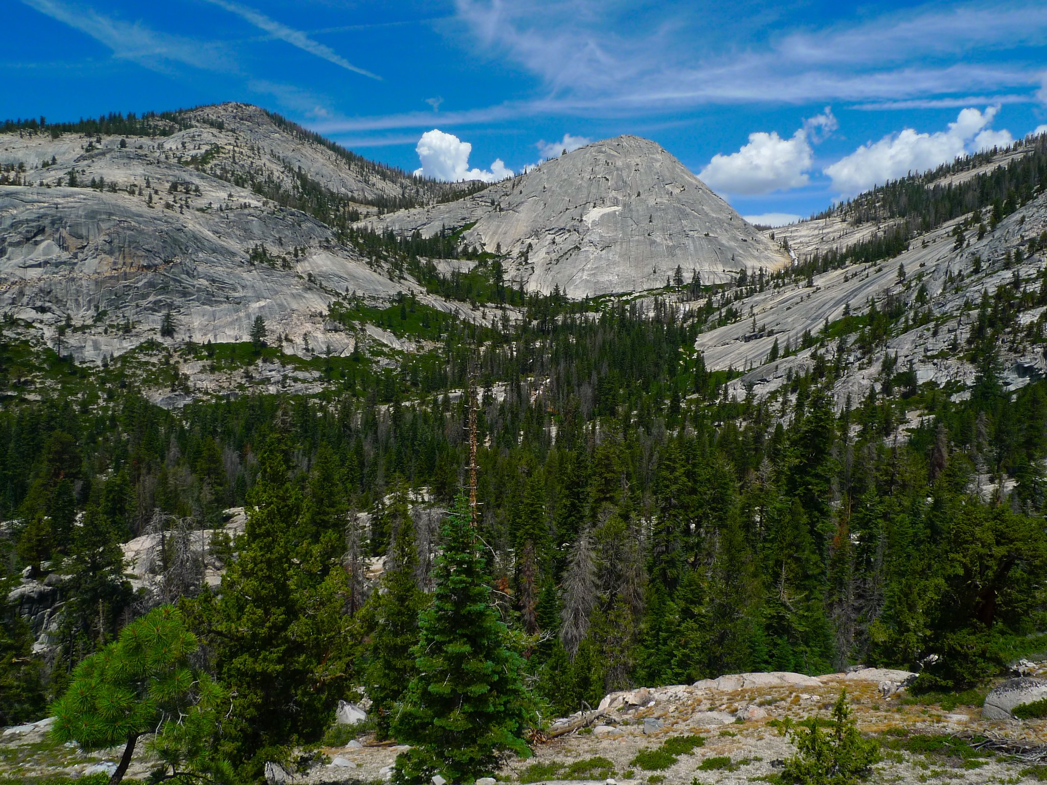
I was not excited to get up this day. I knew I’d need to spend time drying out my gear and cleaning the donkey and mule crap off of it. Around 7am, I finally dragged myself out of the tent and into the mosquito storm and set about hanging up my gear and wiping off the detritus accumulated in the last 12 hours. Around 9am, things were dry enough to pack up and get going. I headed south, out of my way, to have a look at the lakes and meadow in the morning light. This proved to be one of the most beautiful scenes of the entire trip as the cloud-filtered sunlight dappled the mountains all around me.
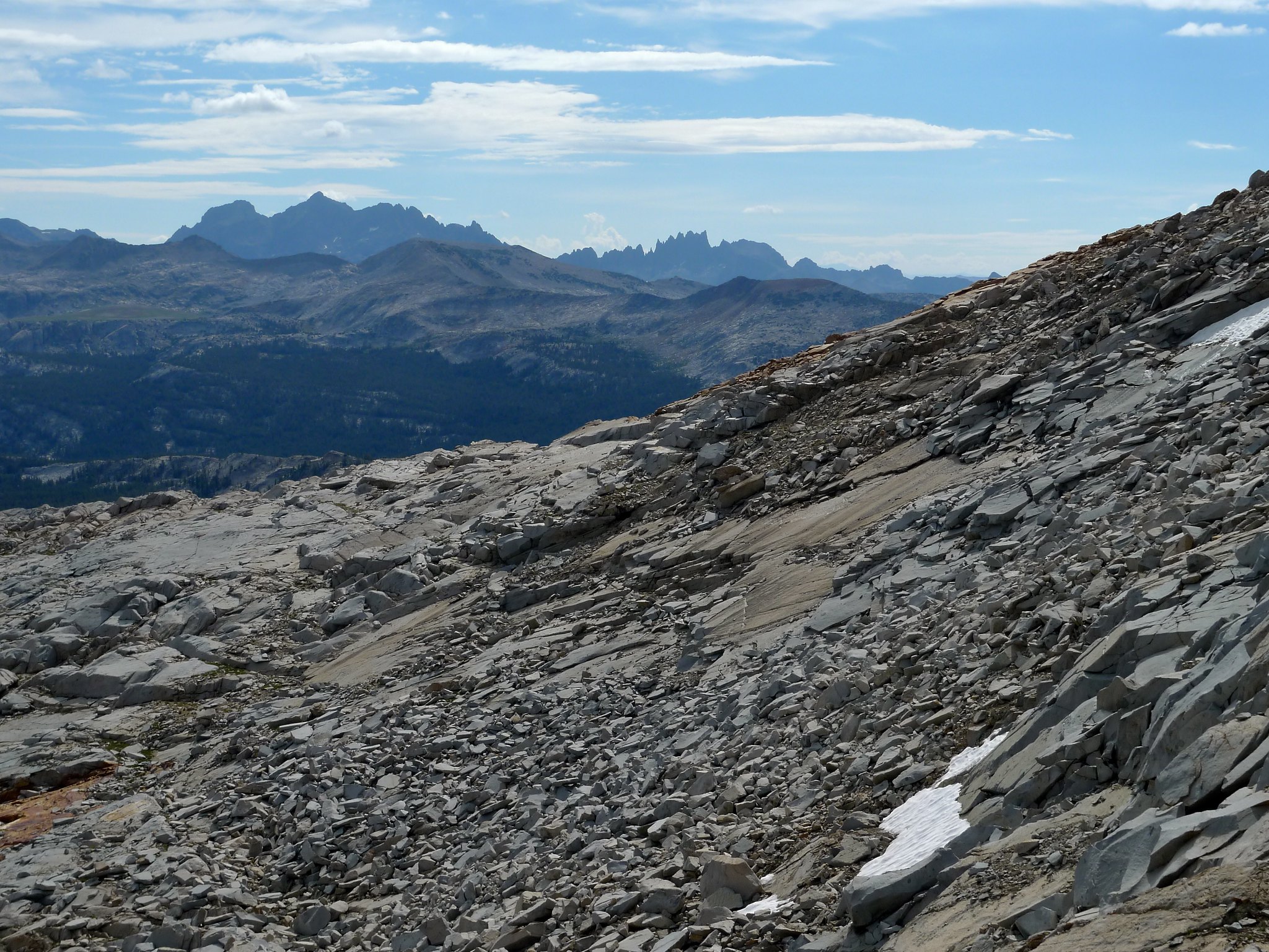
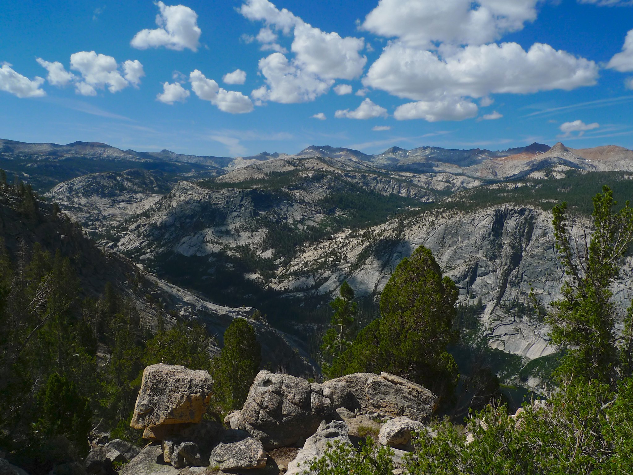
I headed northwest to rejoin the High Trail towards Vogelsang. The views across the headwater canyon of the Merced River were gorgeous before I descended into the forest.
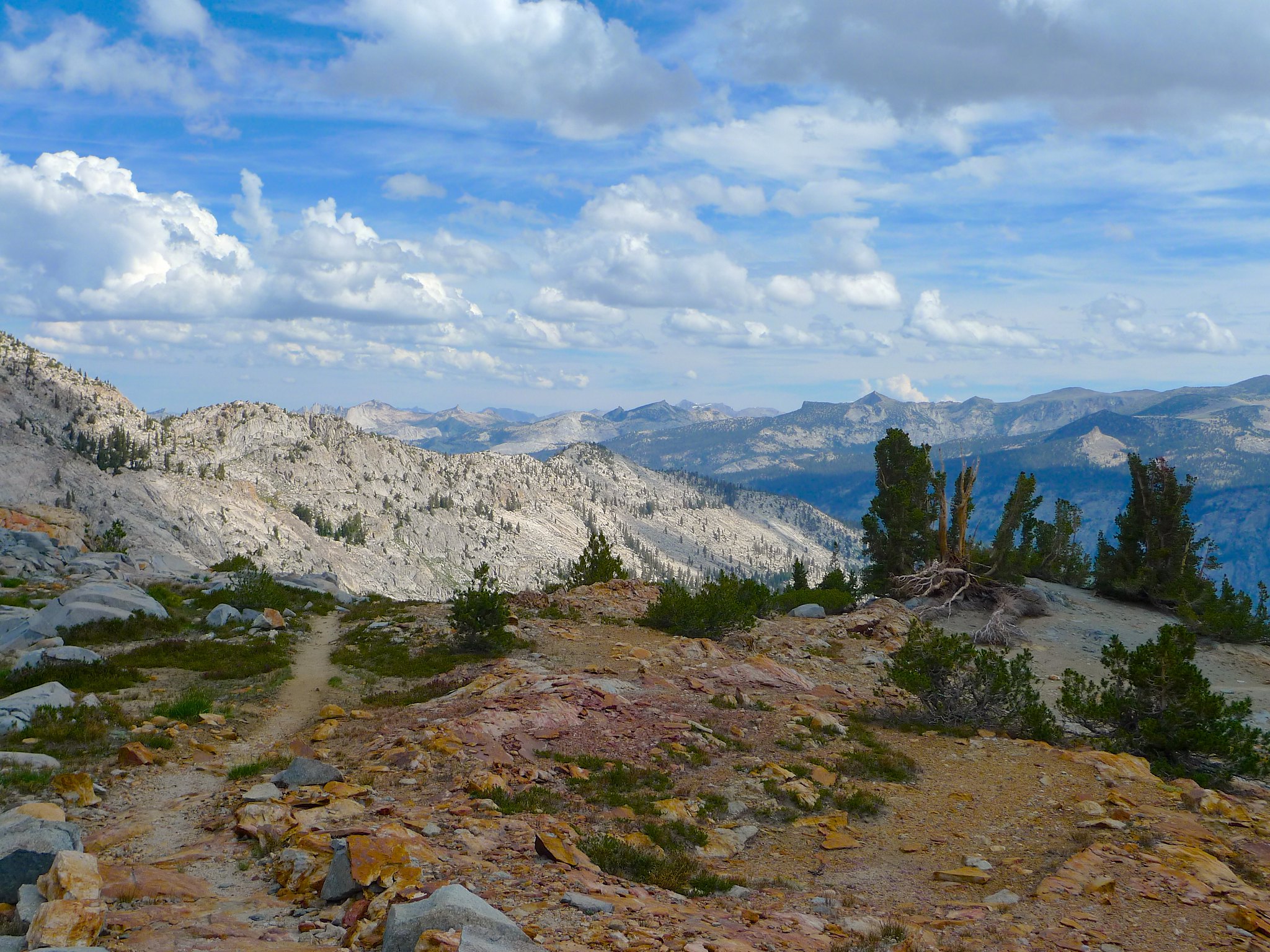
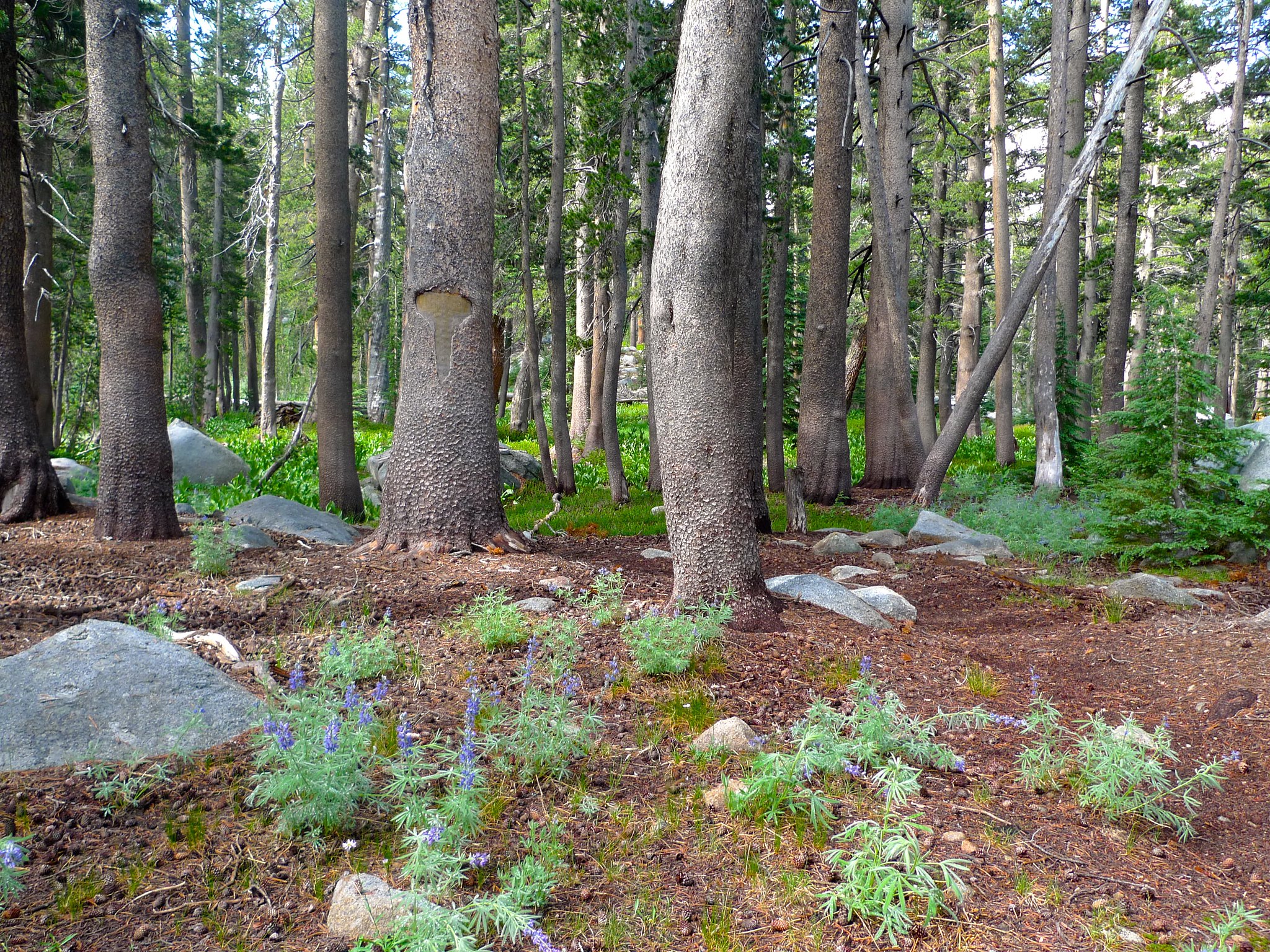
The five or so miles between my camp the Lyell Fork of the Merced River were heavily forested and I made quick progress. The High Trail between Isberg Pass and Vogelsang is infrequently used and quite ambiguous in spots. It is well-blazed, though, so as long as one keeps an eye out for the “T” cuts in the bark of the trees, it’s not hard to follow.
I arrived on the shelf south of the canyon of the Lyell Fork of the Merced River around noon. And guess what—more storms were brewing! The views up towards the high peaks of the Yosemite high country and down towards the canyon of the Merced were astounding… I wished to linger longer, but again I found myself racing for cover from the weather.

I raced down the insanely steep trail to seek cover in the canyon. After negotiating a not-so-easy crossing of the Lyell Fork, I began to look around for a spot to ride out the coming storm. Coming upon a burn area from an evidently very recent lightning strike did not give me too much comfort!
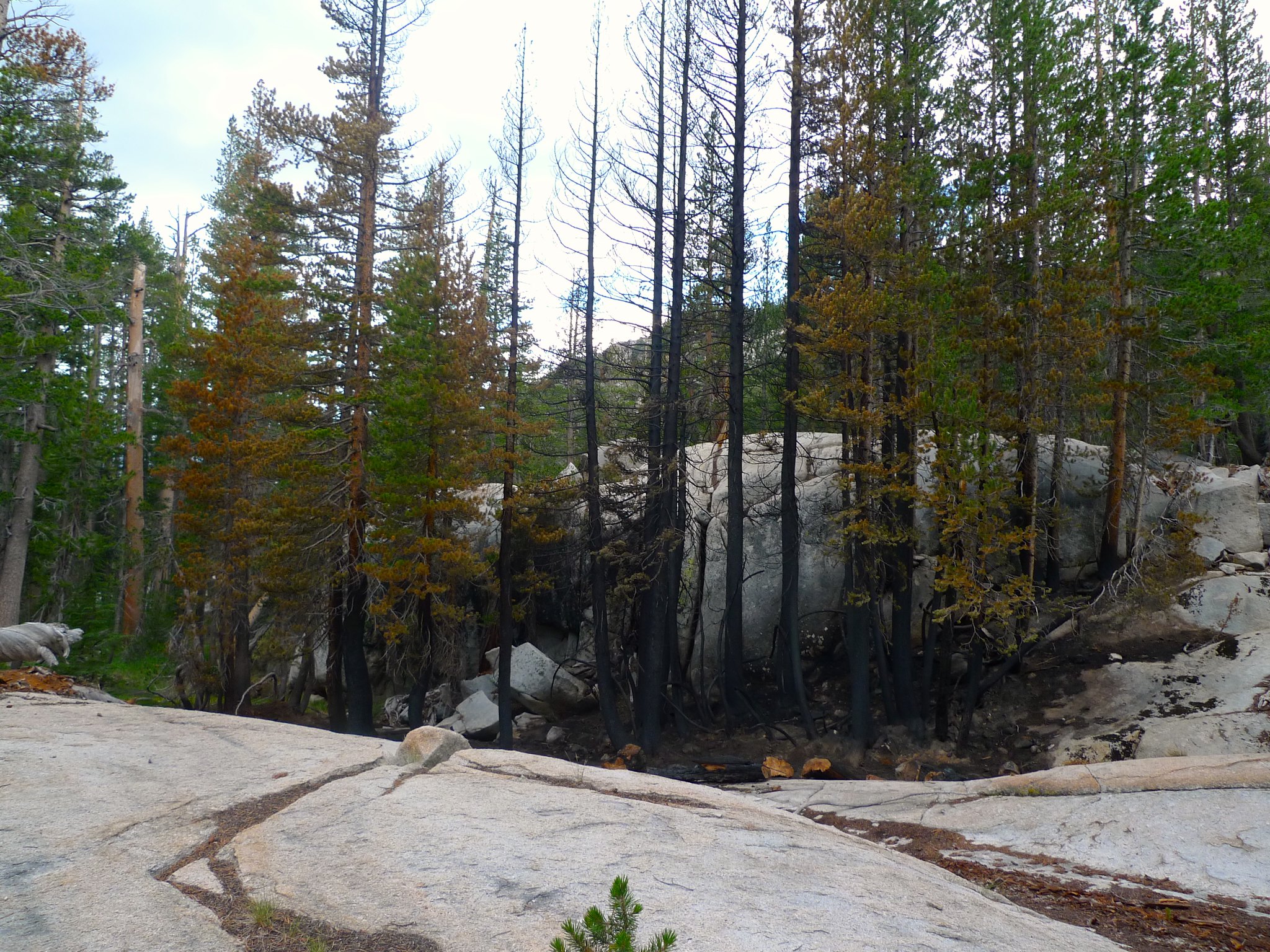
The scent of freshly-burned wood in my nose and copious trees downed about the area I was searching did not give me too much hope for safety, but the storm was approaching, so I chose what I thought was the best spot and set up camp. It rained for about an hour and then stopped. The storm didn’t seem like it was breaking, though, as thunder was still booming down the canyon from Lyell, Ansel Adams, and the other high peaks to my east. I decided to hold out a bit longer and I was glad I did! Around 3pm it began to storm violently, with sheets of rain pelting my tent and thunder echoing as it tumbled down the canyon. I could feel the vibrations of the thunder through my sleeping pad, as if it were booming bass from a passing car. It finally let up around 6:30pm. I had hoped to make it many miles farther this day, but it looked like I would be stuck in this canyon until morning.
After the rain, I made dinner and wandered about the canyon, looking for a good spot to watch the sunset. I didn’t find anything ideal, but it was nice enough.

Day 4
Lyell Fork of the Merced River to Little Yosemite Valley (east end)
15 miles, +1700ft/-4700ft
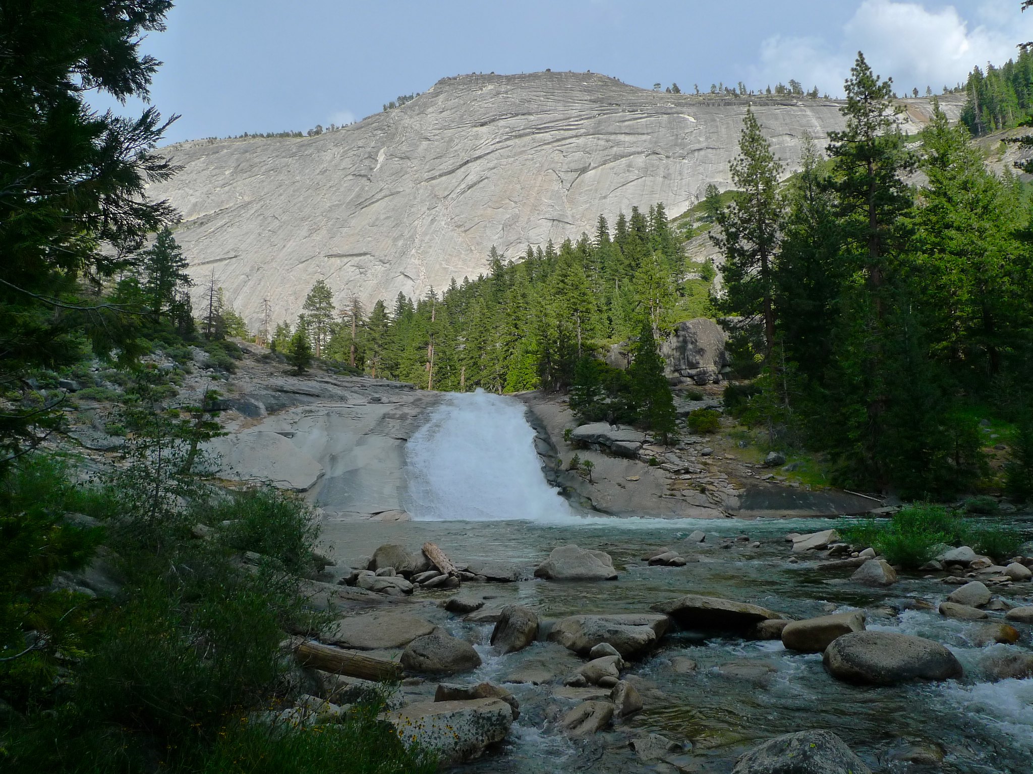
After packing up my soggy gear and eating breakfast, I set out on the trail around 8am. The climb north out of the Lyell Fork is tame compared with the descent from the day before, so I was happy to be hiking towards Vogelsang instead of towards Isberg. The views back up towards the high country to the east were lovely and made me sad that I hadn’t made it this far the day before so that I could have enjoyed them in the afternoon rather than the morning. I would not have wanted to be on this ridge during the previous afternoon’s storms, though, so I am glad I stayed down in the canyon.
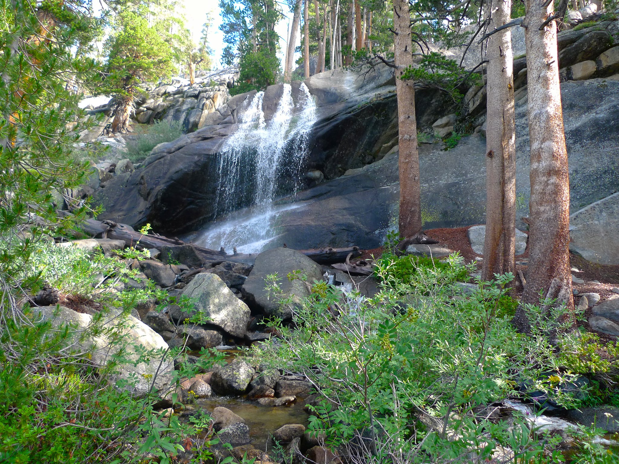
Soon I came across a spot that would have made a fantastic camp if the weather had been good. Perched on a ledge where the canyon of the Lyell Fork bends north to meet the canyon of the Merced, the camp had views up and down both canyons. And there was a gorgeous little waterfall just right there to boot. Next time!
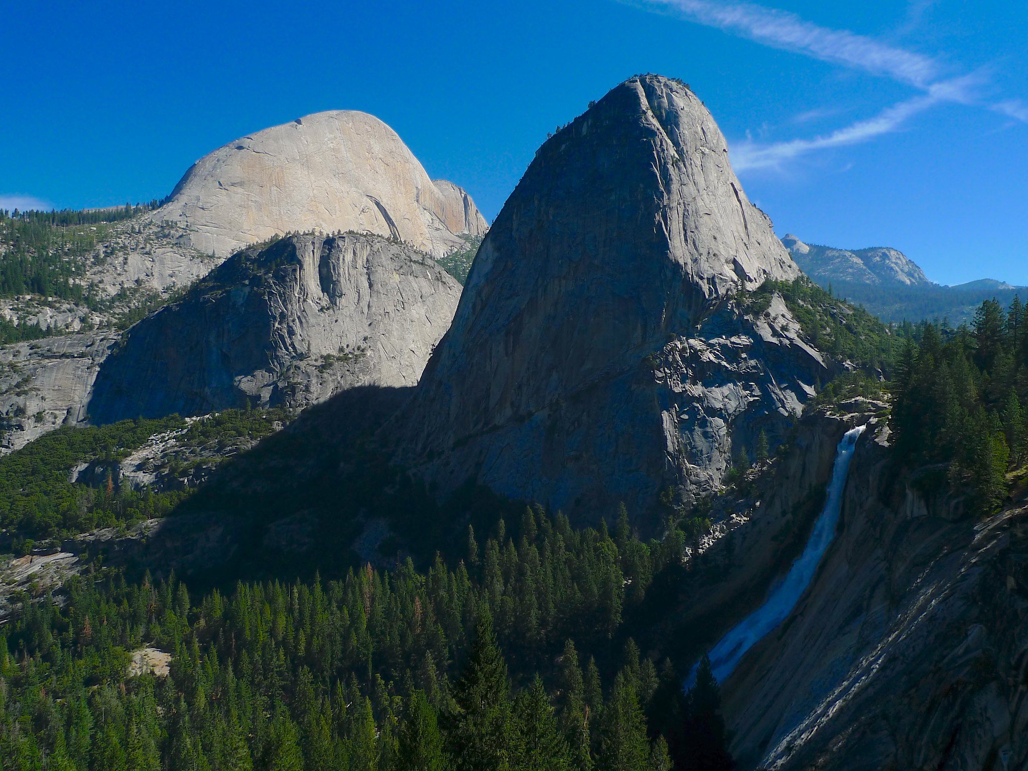
After turning this corner, the trail enters the woods again. There are peek-a-boo views out across the canyon and down towards Half Dome…

…and I left the trail several times to get wider views.
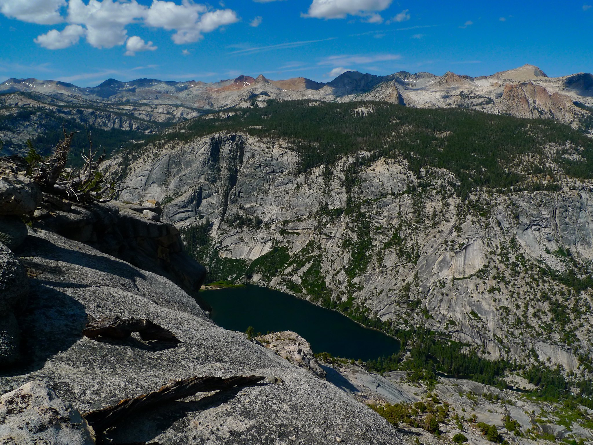
I wanted to get some views northeast to Vogelsang, so just before the trail began to descend, I stashed my pack and clambered a few hundred feet up a ridge. Unfortunately, a block of class 3+ rock blocked my view to the east and I didn’t have the energy to search around more for an easier route, so I contented myself with the expansive views in all directions but east.

I scrambled back down from the ridge, donned my pack, and headed down the trail towards Lewis Creek. Again, the steepness of the descent had me happy that I wasn’t climbing it! Soon I was down amidst the glacially carved domes that Yosemite is known for.

It was down, down, down all the way to the Merced High Sierra Camp, where I encountered the first people I’d seen since Tuesday. It was a bit surreal to walk into the camp. What is this… park benches?? People in swim suits? Bath-sheet sized towels?! DOORS??

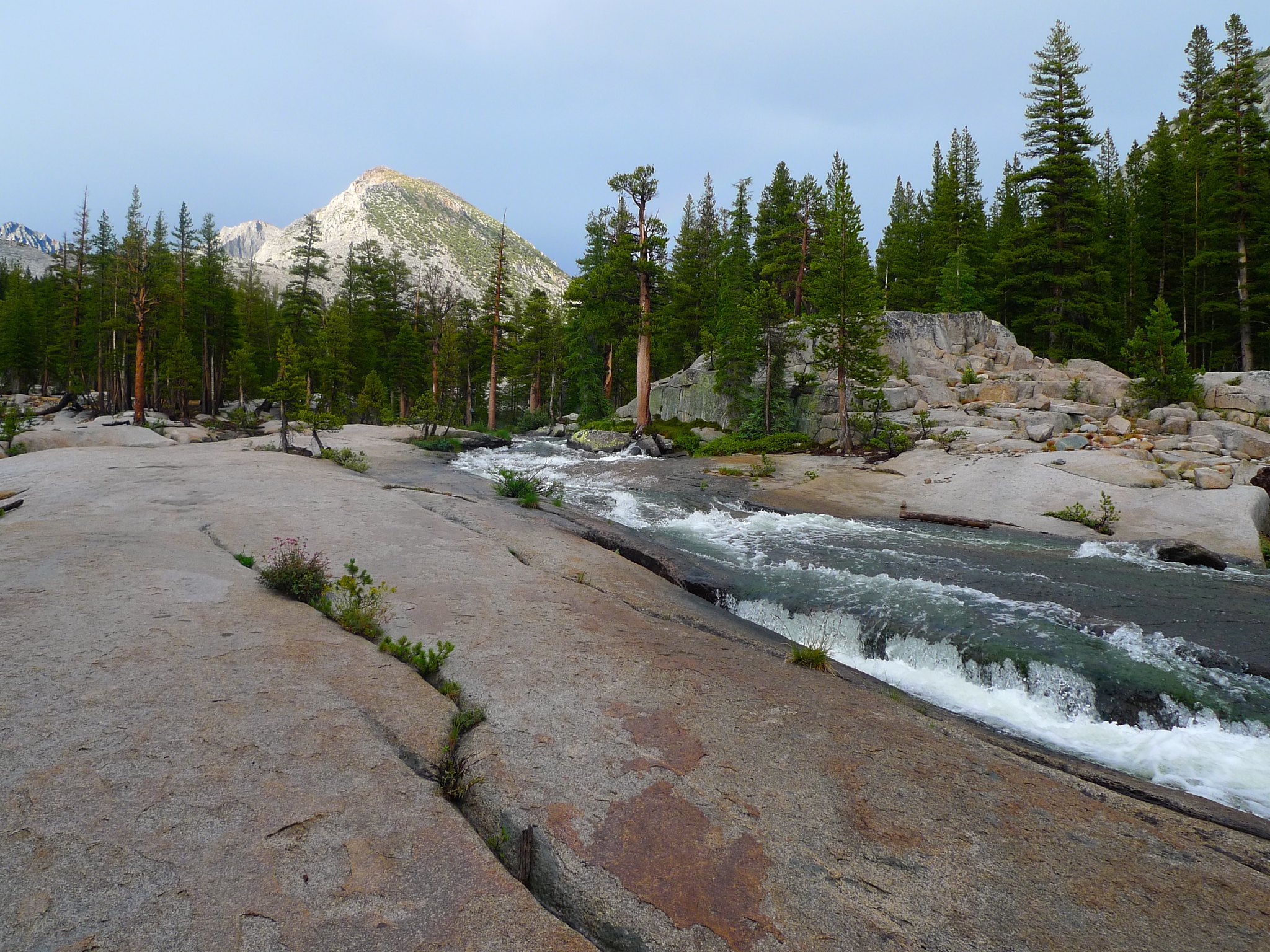
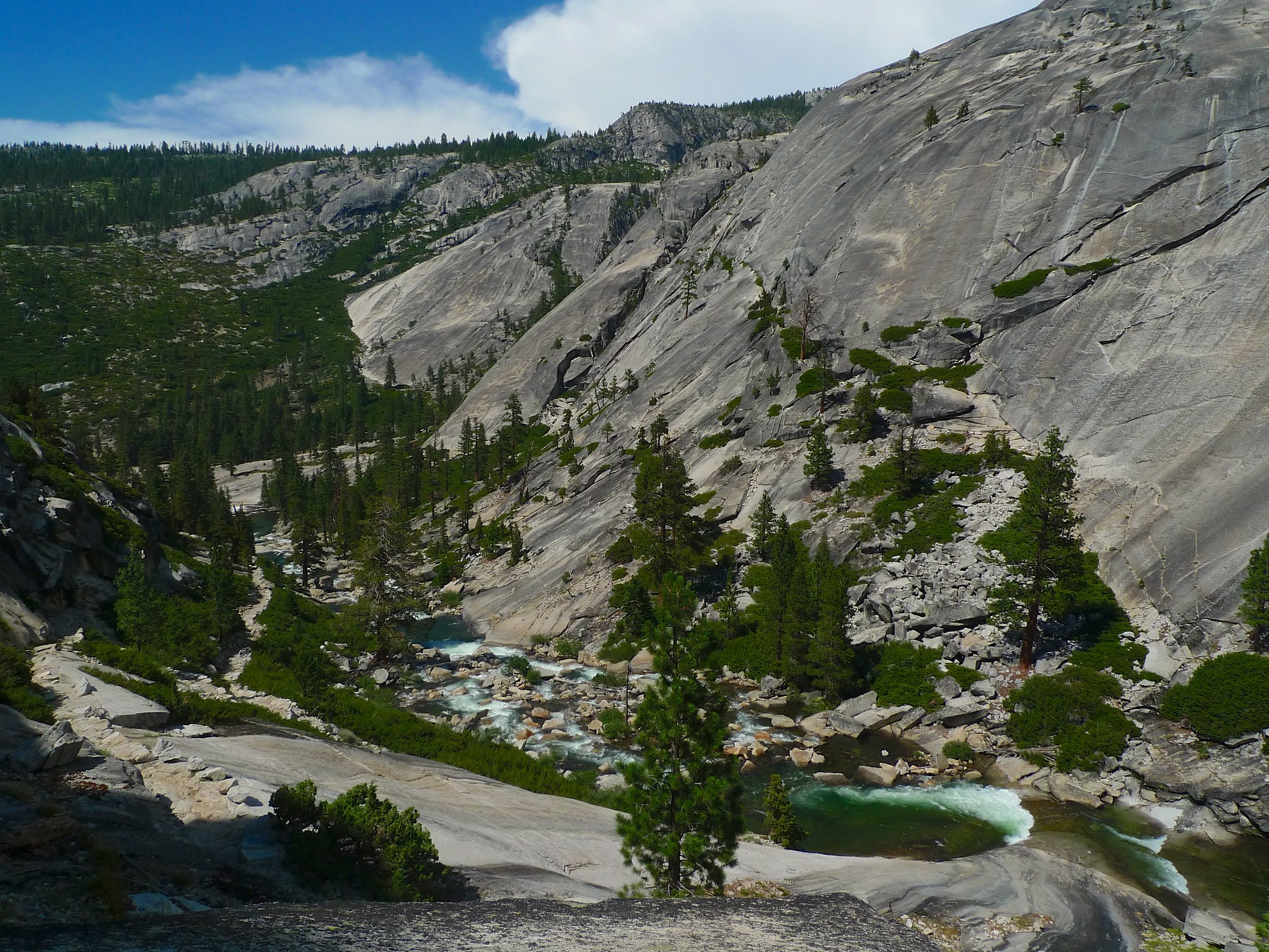
Here the trail follows the Merced River as meanders through meadows and slips across granite cascades. Another storm was brewing in the high country, so I kept the pace up hoping to find a nice spot to camp by the Bunnell Cascade.


Unfortunately, there were already a couple of groups camped around the Bunnell Cascade, so I continued on, hoping to find something before entering Little Yosemite Valley, since the camping there is exceptionally strict and limited to overused partially developed camps at the west end.
I found a clearly established camp area, complete with a fire ring and some pre-gathered wood, at the base of a cascade at the very eastern tip of Little Yosemite Valley. I wasn’t sure if it was a legal campsite, but it was definitely clearly very established and I didn’t think the impact of my camp there would be significant, especially since I wouldn’t be making use of the fire ring. I set up camp and bathed in a calm spot in the Merced before eating dinner and tucking in around 8pm.

Day 5
Little Yosemite Valley (east end) to Happy Isles
7 miles, +200ft/-2200ft
This would be a short day as I simply needed to hike back down to the valley. First, though, I had a monotonous and not especially pretty few miles to make across Little Yosemite Valley. The forest is recently burned and a bit dumpy.

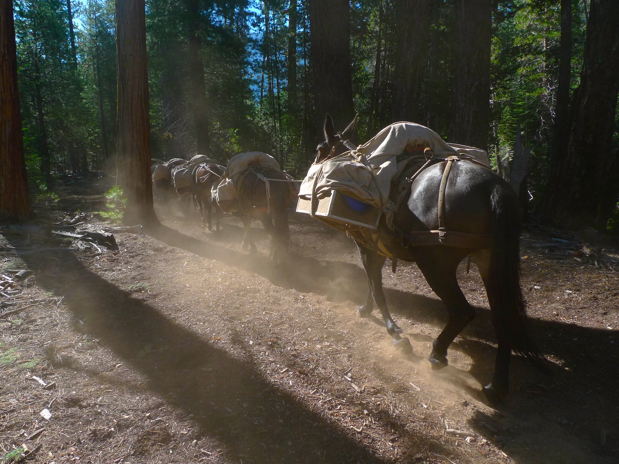
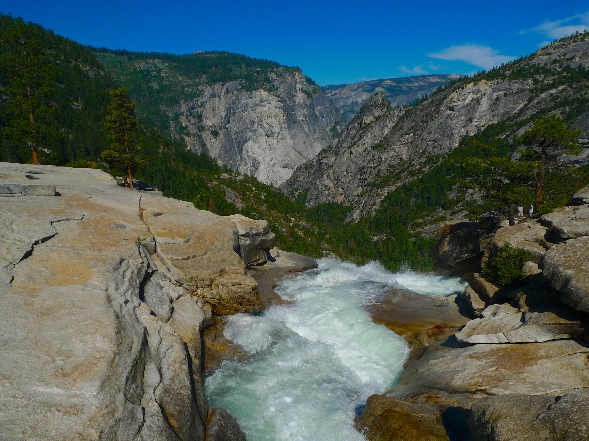
The trail is wide and dusty, trampled and destroyed by the pack trains that haul those park benches, towels, and the rest up to the High Sierra Camps. I passed three mule trains—each had a woman on a horse as the lead followed by five mules loaded up with hundreds of pounds of gear.
Before I knew it, I was at the top of Nevada Fall. I decided to take the John Muir Trail down to the valley because it’s much less steep, safer for a backpacker, and drastically less crowded.
The closer I got to the valley, the thicker the throngs of people became. Hundreds of people, all clean and in bright clothing. Snapping photos and yelling after children in dozens of languages. Well, I was back alright.
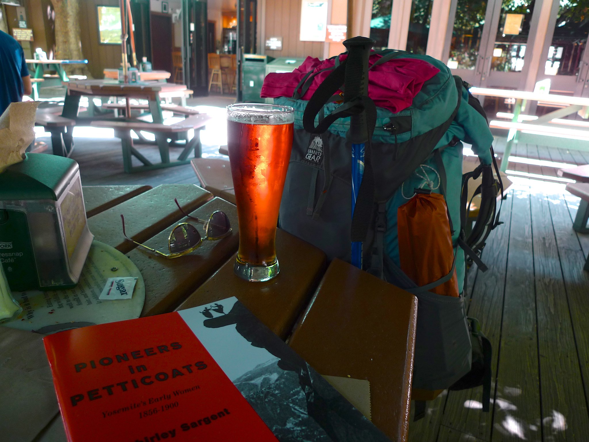
I headed over to Curry Village to wait for the 3:15pm YARTS. I rewarded myself with a beer when the bar opened at noon and then tried to fend off curious squirrels as I napped on the bus bench.
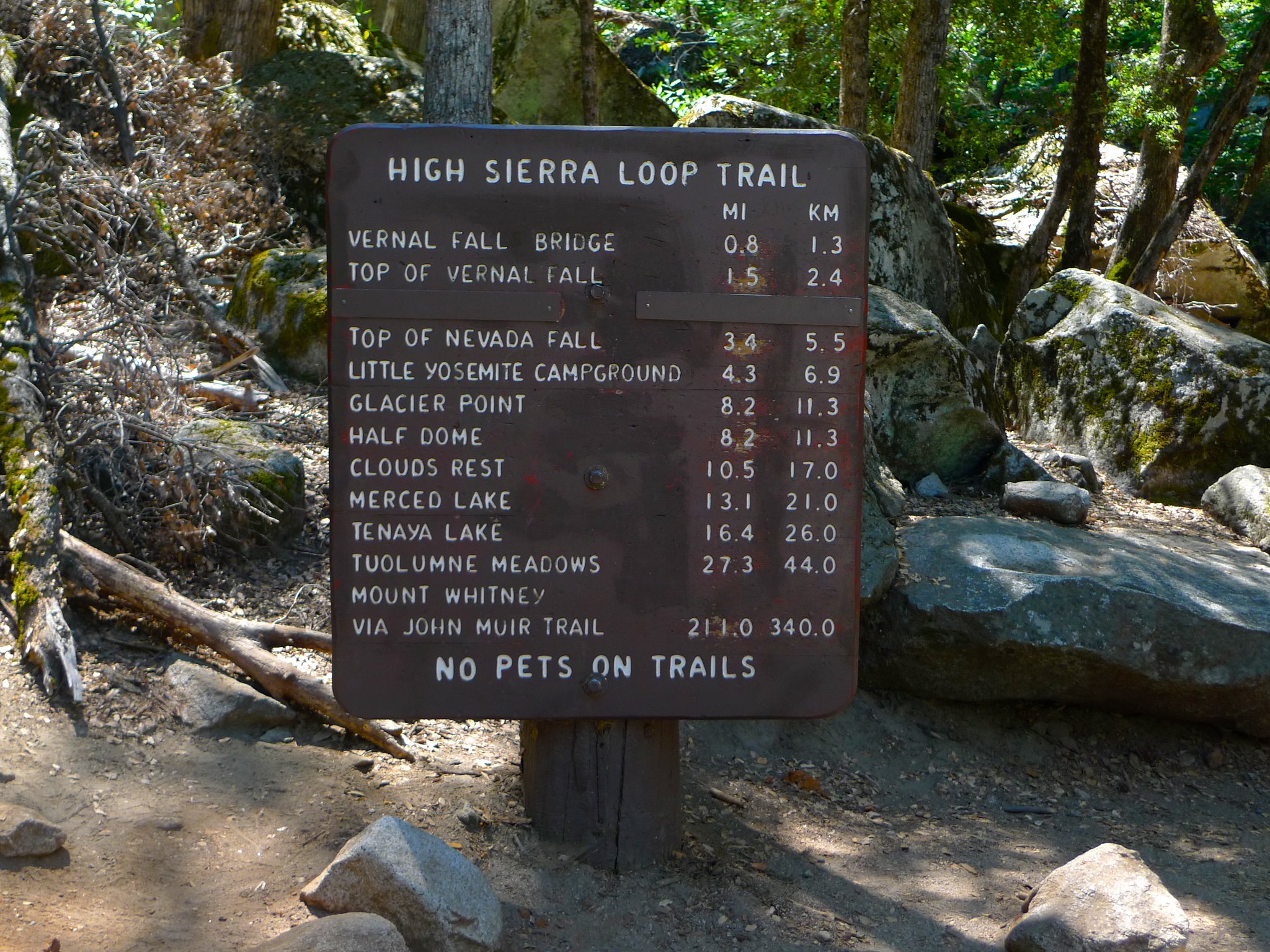
Want to do this trip yourself? You’ll need a permit from Yosemite National Park and you’ll probably want to pick up Tom Harrison’s Yosemite High Country map. The car shuttle can be made easier by using the Glacier Point Tour Bus as a shuttle.

What a great trip! I did Red Peak Pass recently but started outside of the park and didn’t encounter quite as many thunderstorms! https://adventuretramp.com/2019/10/01/red-peak-pass-celebratory-circuit/
What a great trip report! Sounds like a great time. Great photos too. I’m planning to do a similar trip in October (if the weather cooperates, which is probably about 80% in October). Except I’ll be hiking up the Merced River Gorge from Yosemite Valley and then up Triple Peak Fork, and then coming back along the high trail route same as you did.
I have a question for you – is there any good camping along the stretch just before you begin the steep descent into the Fletcher Creek drainage? I.e., the stretch where you tried to get some views of Vogelsang but had to content yourself with the awesome views in all the other directions — and got that great picture looking down the Merced River with Merced Lake down below you and the back of Half Dome off in the distance? My dream is to camp somewhere around there and be able to have that as my sunset view before bed. If you have any advice to offer about the potential for camping around that part of the trail, I’d very much appreciate hearing it.
Thanks again for sharing your experience.
It’s been a while since I was there. There are definitely flat spots aplenty, but I don’t know about water. That late in the season, I expect water will be an issue.